RHead6 Map
 |
5 |
01/01/9999 midnight |
3D |
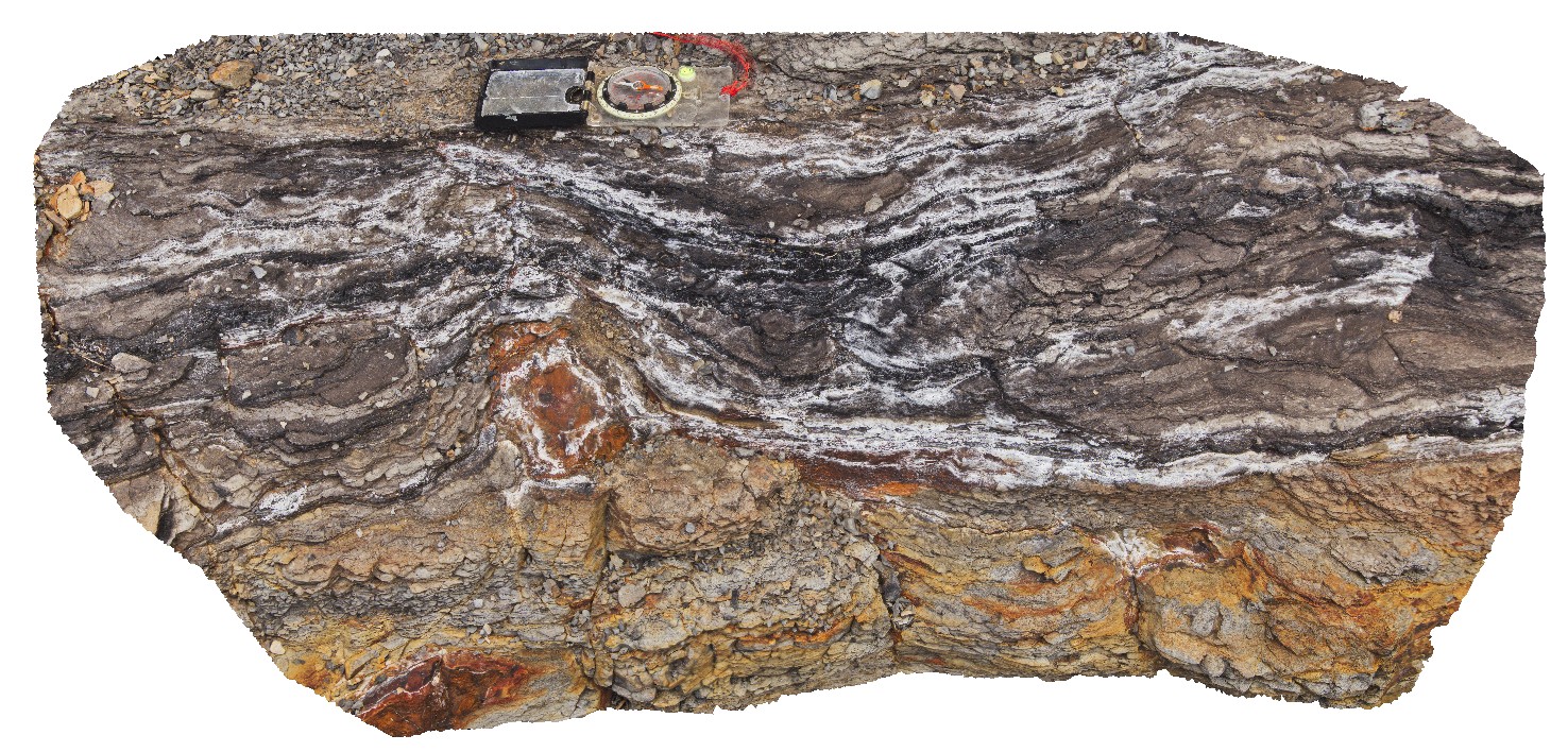
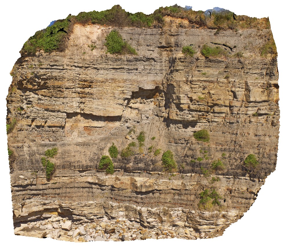
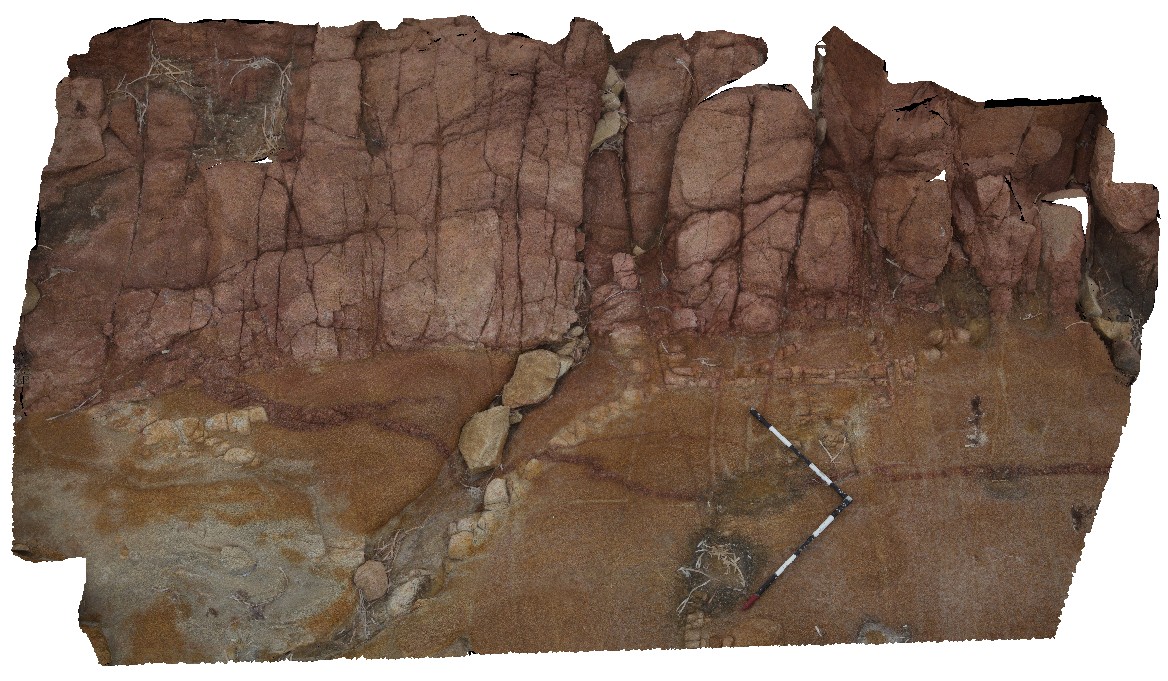
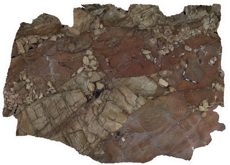
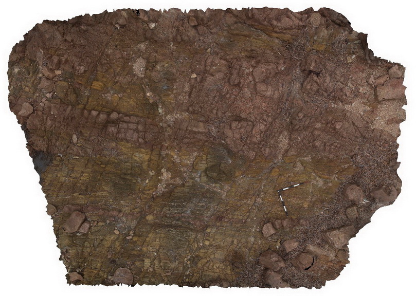
detailed view of floodplain sediments below the Victoria's Tunnel Coal Seam, with coaly stringers and a concretion that disrupts bedding. Redhead, N.S.W. |
0.00 |
-33.00335000000 |
151.72969000000 |
-9999.000 |
floodplain sediments, concretion, disrupted bedding, Victoria's Tunnel Coal Seam, sedimentology |
mudstone |
RHead7 Map
 |
5 |
01/01/9999 midnight |
3D |
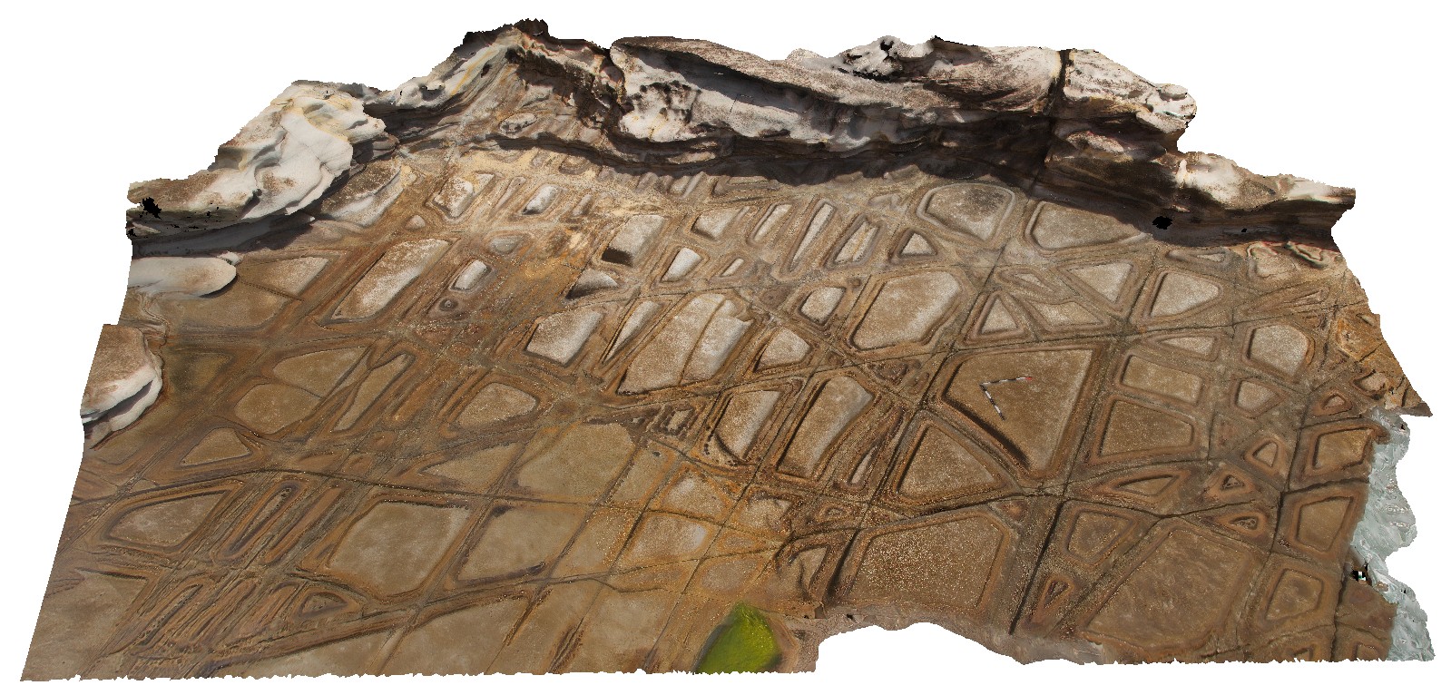
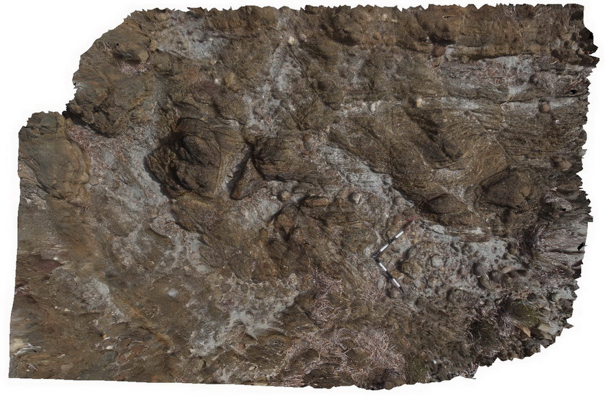
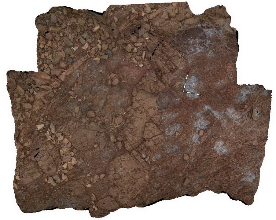
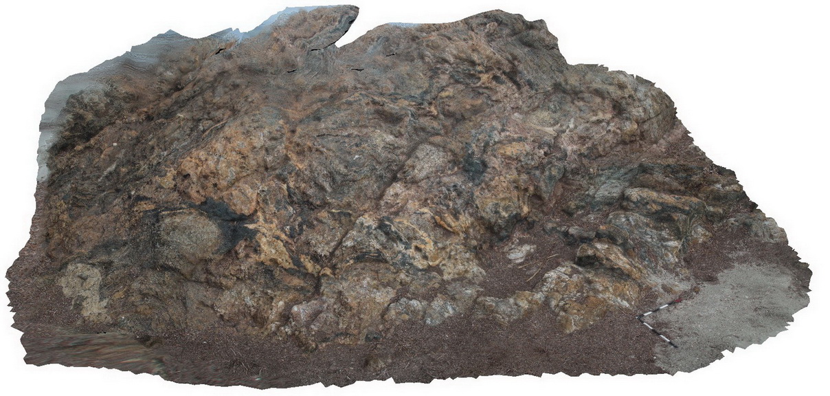
tessellated pavement in Nobbys Tuff, with concentric weathering along joints. Redhead, N.S.W. |
0.00 |
-33.00633000000 |
151.72972000000 |
-9999.000 |
joint, tessellated pavement, tuff |
tuff |
RHead8 Map
 |
5 |
01/01/9999 midnight |
3D |
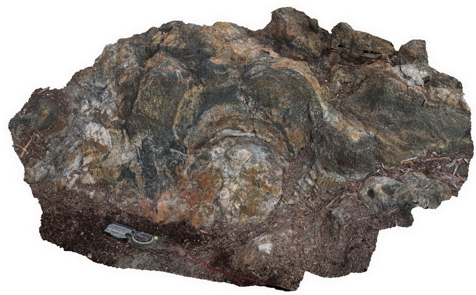
detail of tessellated pavement in Nobbys Tuff. Redhead, N.S.W. |
0.00 |
-33.00633000000 |
151.72971000000 |
-9999.000 |
tessellated pavement, tuff, jointing |
tuff |
RHead9 Map
 |
5 |
01/01/9999 midnight |
3D |
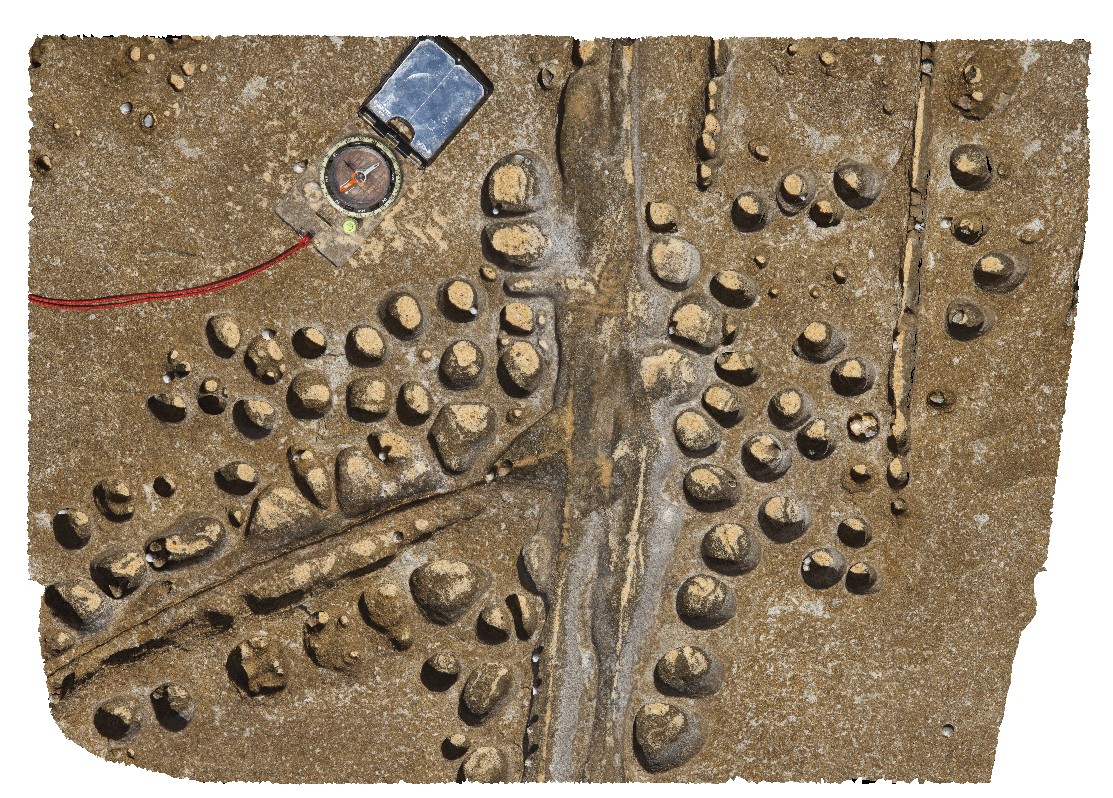
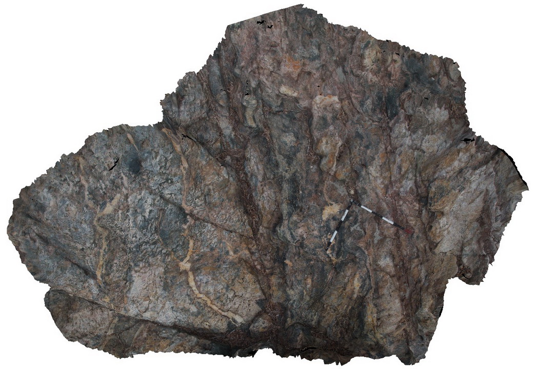
honeycomb weathering and jointing of Nobbys Tuff. Redhead, N.S.W. |
0.00 |
-33.00779000000 |
151.72920000000 |
-9999.000 |
honey comb weathering, weathering, jointing, tuff, Nobbys Tuff |
tuff |
RHeadUAV1 Map
 |
0 |
01/01/9999 midnight |
UAV |
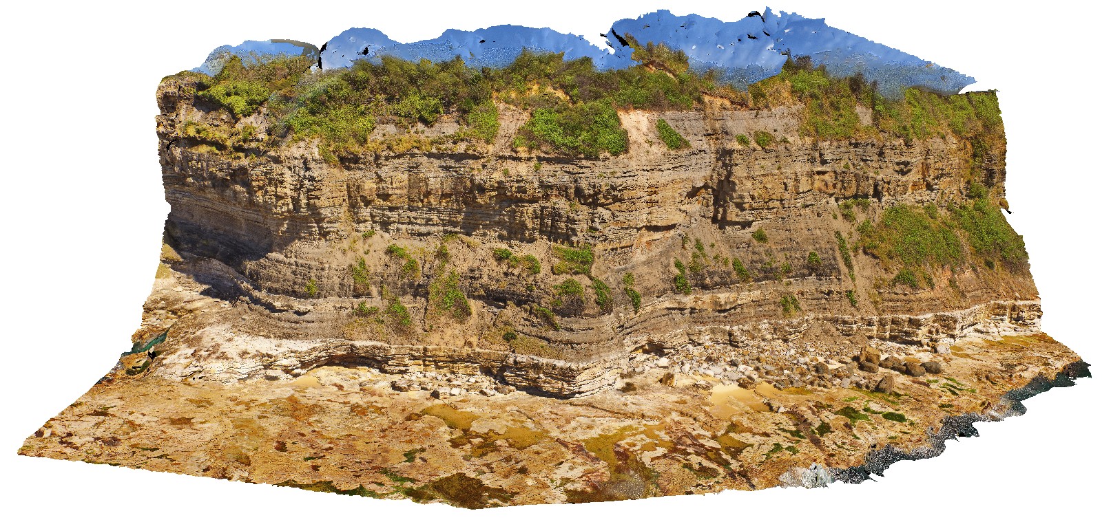
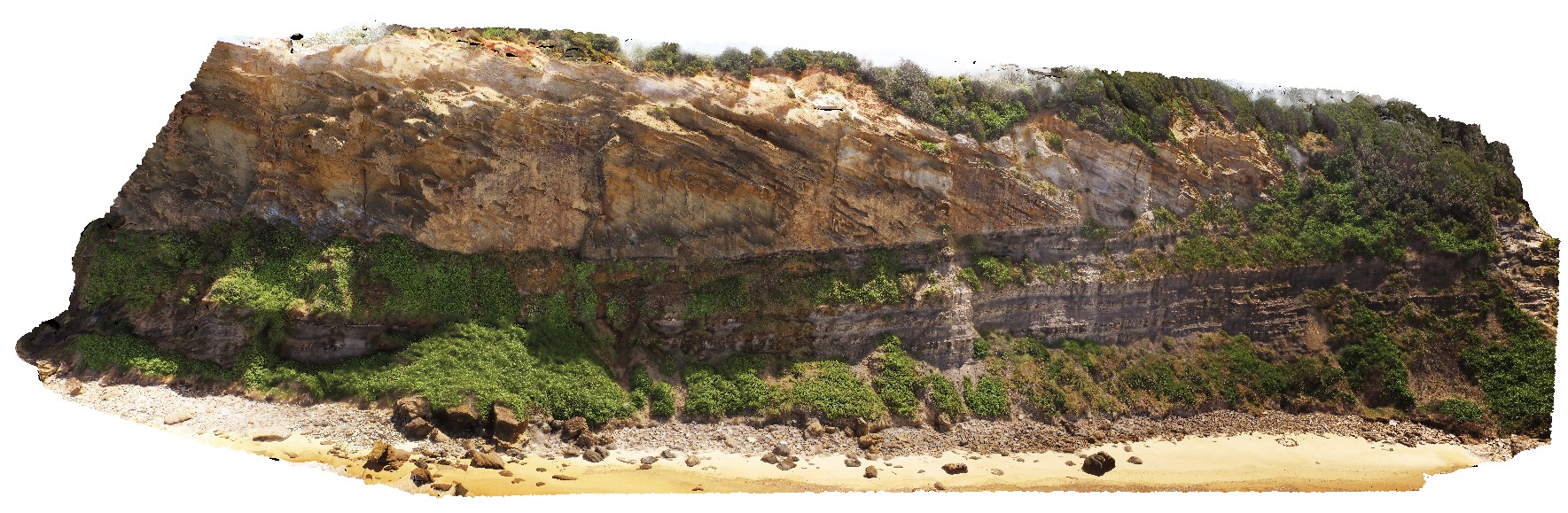
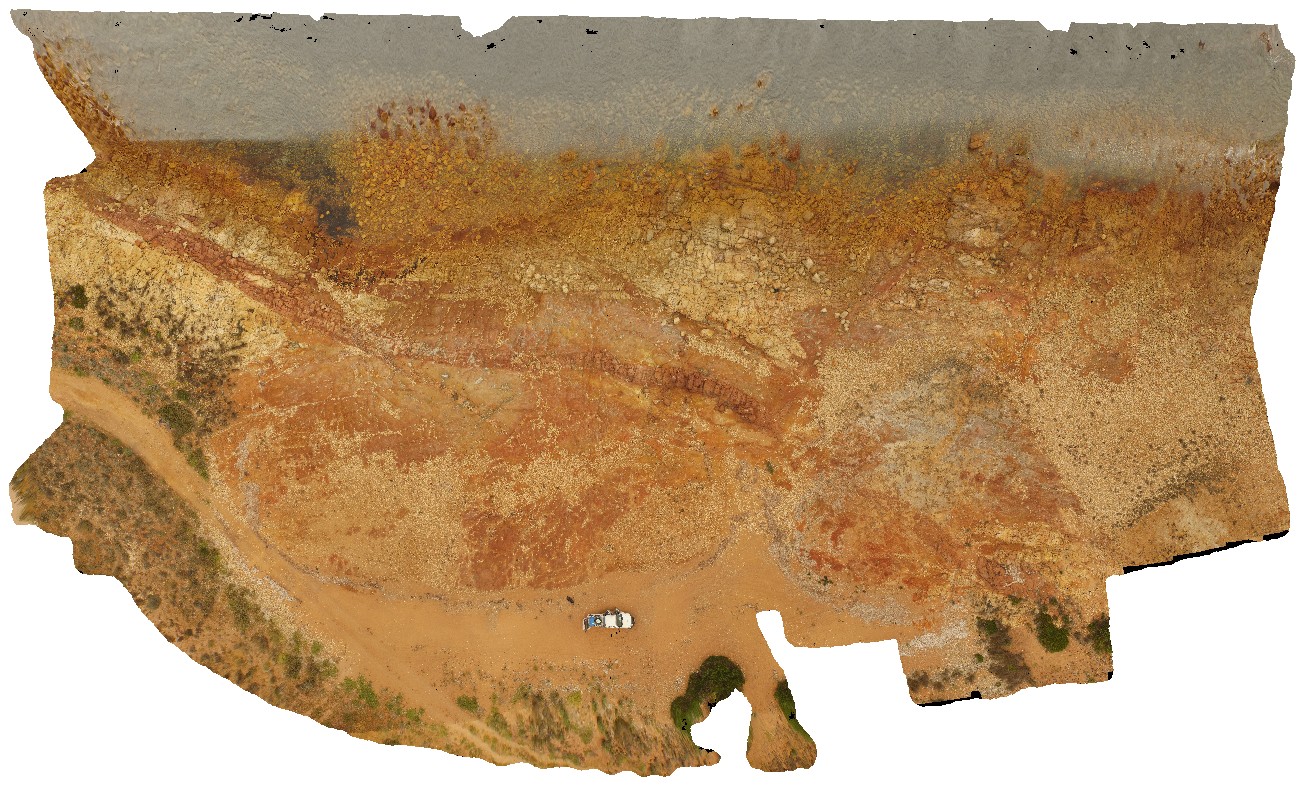
view of large cliff at Redhead, with Victoria's Tunnel Coal Seam, Nobbys Tuff and fluvial channel and floodplain sediments. Redhead, N.S.W. |
150.00 |
-33.00512000000 |
151.73041900000 |
37.800 |
fluvial sediments, floodplain sediments, sedimentology, Victoria's Tunnel Coal Seam, Nobbys Tuff |
sediments |
RHeadUAV2 Map
 |
0 |
01/01/9999 midnight |
UAV |
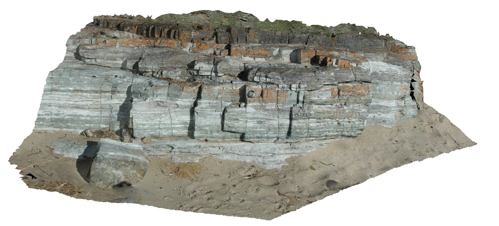
detailed view of cliff, showing channel and fluvial deposits, Nobbys Tuff and Victoria's Tunnel Coal Seam. Redhead, N.S.W. |
50.00 |
-33.00492300000 |
151.73019000000 |
22.600 |
fluvial sediments, channel sediments, Nobbys Tuff, Victoria's Tunnel Coal Seam, sedimentology |
sediments |
RHeadUAV3 Map
 |
20 |
01/01/9999 midnight |
UAV |
detail of bedforms in Nobbys Tuff showing wavy bedforms. Redhead, N.S.W. |
22.30 |
-33.00436700000 |
151.72998900000 |
9.000 |
wavy bedforms, tuff, sedimentology |
tuff |
RHeadUAV4 Map
 |
20 |
01/01/9999 midnight |
UAV |
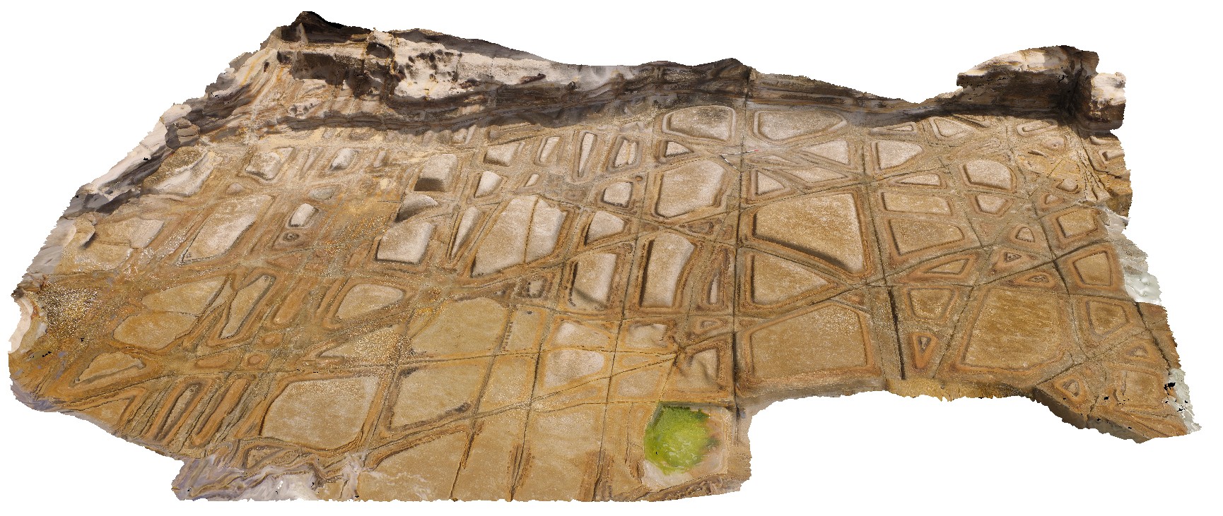
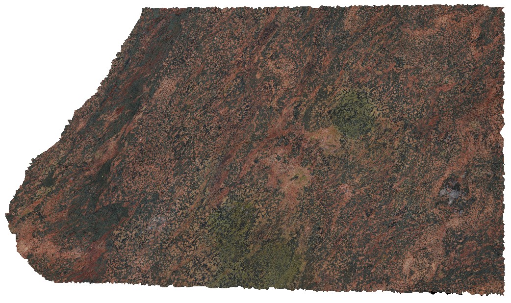
aerial view of tessellated pavement weathering pattern in Nobbys Tuff. Redhead, N.S.W. |
11.60 |
-33.00636200000 |
151.72970400000 |
4.000 |
weathering, tessellated pavement, jointing, Nobbys Tuff, Tuff |
tuff |
RHeadUAV5 Map
 |
20 |
01/01/9999 midnight |
UAV |
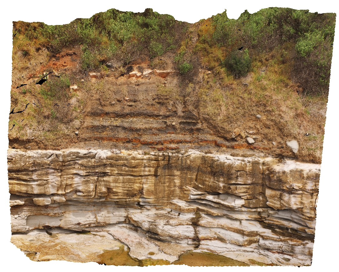
section view through Newcastle Coal Measures. View of cliff with Victoria's Tunnel Coal Seam, floodplain sediments and overlying conglomerate with steep cross bedding. Redhead, N.S.W. |
245.00 |
-33.01079900000 |
151.72764900000 |
29.000 |
conglomerate, cross bedding, coal seam, floodplain sediments, sedimentology |
sediments |
Riley1 Map
 |
0 |
10/20/2015 4:17 p.m. |
3D |
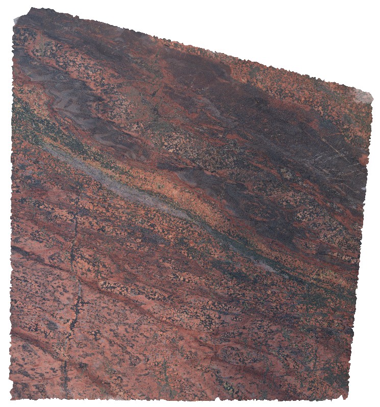
contact between tonalite and red granite dyke with possible leucogranite enclaves. Point Riley. |
4.00 |
-33.83583000000 |
137.60173000000 |
-9999.000 |
igneous contact, tonalite, leucogranite |
granite |
Riley10 Map
 |
0 |
10/20/2015 4:17 p.m. |
3D |
view of folded metasediments in exposed shore platform at Point Riley. |
5.00 |
-33.90408000000 |
137.62932000000 |
-9999.000 |
fold, metasediment, structure |
sediment |
Riley11 Map
 |
0 |
10/20/2015 4:18 p.m. |
3D |
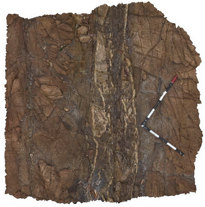
finely bedded, moderately folded metasediments, with moderately plunging fold hinge. Point Riley. |
1.50 |
-33.90409000000 |
137.67929000000 |
-9999.000 |
fold, fold hinge |
sediment |
Riley12 Map
 |
0 |
10/20/2015 4:18 p.m. |
3D |
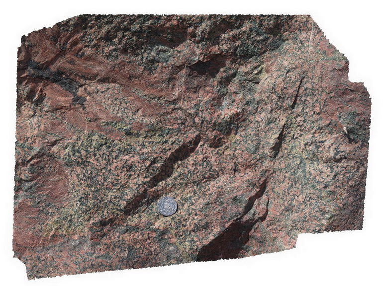
detail of metasomatism showing strong over printing alteration in large granite boulder at 'North Beach' sign. Point Riley. |
0.60 |
-33.90662000000 |
137.63478100000 |
-9999.000 |
alteration, granite |
granite |
Riley13 Map
 |
0 |
10/20/2015 4:19 p.m. |
3D |
detail of metasomatism, showing strong over printing with epidote and chalcopyrite alteration in large boulder at 'North Beach' sign. Point Riley. |
0.60 |
-33.90662000000 |
137.63478100000 |
-9999.000 |
metasomatism, epidote, chalcopyrite |
granite |
Riley14 Map
 |
0 |
10/20/2015 4:19 p.m. |
3D |
metasomatite, including epidote alteration in granite boulder in park at Walleroo. Walleroo. |
0.60 |
-33.92789900000 |
137.62472800000 |
-9999.000 |
metasomatism, epidote, granite |
granite |
Riley2 Map
 |
0 |
10/20/2015 4:21 p.m. |
3D |
leucogranite enveloped by foliated tonalite. Point Riley. |
4.20 |
-33.87575000000 |
137.60167000000 |
-9999.000 |
tonalite, leucogranite, dyke |
granite |
Riley3 Map
 |
0 |
10/20/2015 4:22 p.m. |
3D |
migmatised metasediments cut by tonalite dykes and quartz veins, Point Riley. |
5.00 |
-33.85767000000 |
137.61189000000 |
-9999.000 |
tonalite dyke, metasediments, igneous contact |
sediments, tonalite |
Riley4 Map
 |
0 |
10/20/2015 4:22 p.m. |
3D |
late hydrothermal / epithermal vein in tonalite, Point Riley. |
1.50 |
-33.88906000000 |
137.61319000000 |
-9999.000 |
tonalite, vein |
tonalite |
Riley5 Map
 |
0 |
10/20/2015 4:23 p.m. |
3D |
detail of late vein textures in tonalite, Point Riley. |
0.20 |
-33.88906000000 |
137.61319000000 |
-9999.000 |
hydrothermal vein, breccia |
tonalite |
Riley6 Map
 |
0 |
10/20/2015 4:23 p.m. |
3D |
metasediments intruded by numerous tonalite dykes, some of which are folded. The package has been cut by later faults. Point Riley. |
5.00 |
-33.88993000000 |
137.61420000000 |
-9999.000 |
metasediments, tonalite dyke, fault, fold, structure |
sediments, granite |
Riley7 Map
 |
0 |
10/20/2015 4:24 p.m. |
3D |
view of 'pudding rocks' / metasediments exposed on shoreline. Point Riley. |
6.00 |
-33.90218000000 |
137.62891000000 |
-9999.000 |
metasediments |
sediments |
Riley8 Map
 |
0 |
10/20/2015 4:24 p.m. |
3D |
detailed view of folding in metasediments, Point Riley. |
1.00 |
-33.90218000000 |
137.62891000000 |
-9999.000 |
metasediments, fold, structure |
sediments |
Riley9 Map
 |
0 |
10/20/2015 4:24 p.m. |
3D |
view of 'pudding rocks', metasediments, with cross cutting quartz veins. Point Riley. |
4.00 |
-33.90216000000 |
137.62889000000 |
-9999.000 |
metasediments, quartz veins |
sediments |
RileyUAV1 Map
 |
0 |
10/20/2015 4:25 p.m. |
UAV |
aerial view of granite shore exposure with intruding dykes. Point Riley. |
40.00 |
-33.87572300000 |
137.60184900000 |
-9999.000 |
granite, intrusive contact |
granite |
Roches1 Map
 |
5 |
03/16/2015 2:20 p.m. |
3D |
view of Jurassic dolerite intrusive contact with Permian siltstones. Siltstones have been hornfelsed. Roches Beach, Tasmania. |
10.00 |
-42.88390378000 |
147.50548658000 |
2.000 |
igneous intrusion, hornfels |
siltstone, dolerite |