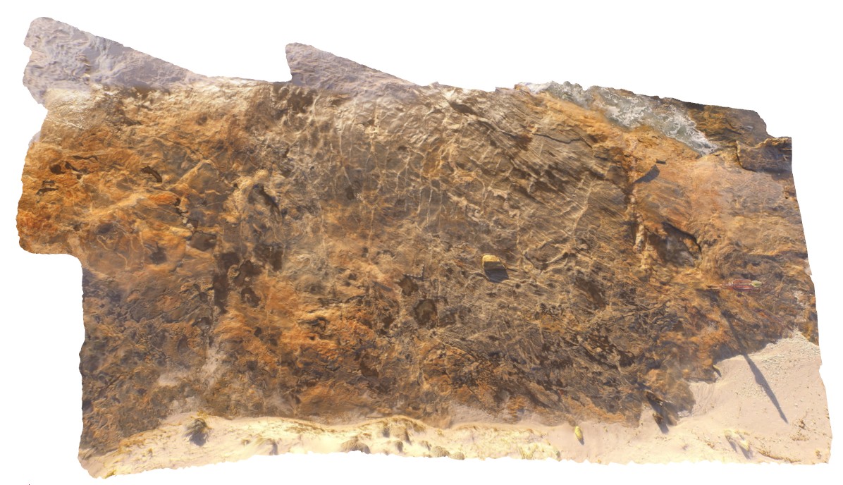
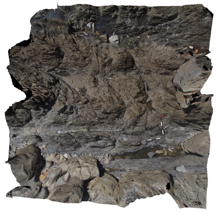
StarvationBayUAV1 Map
 |
0 |
01/01/9999 midnight |
UAV |
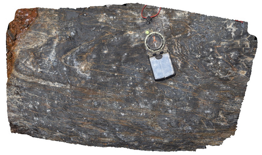
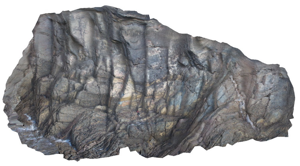
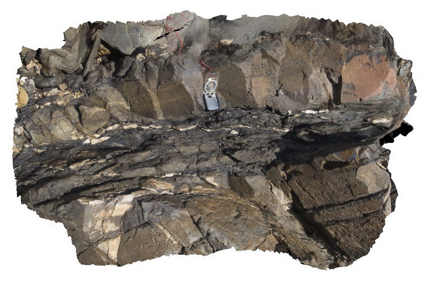
overall view of outcrop pavement, showing folded and sheared gneissic rocks. Starvation Bay, W.A. |
20.00 |
-33.92010800000 |
120.56163100000 |
5.100 |
gneiss, structure |
gneiss |
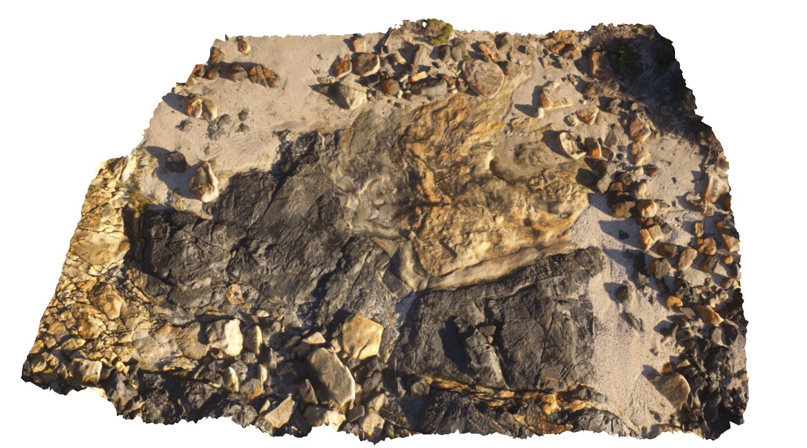
StarvationBayUAV2 Map
 |
0 |
01/01/9999 midnight |
UAV |
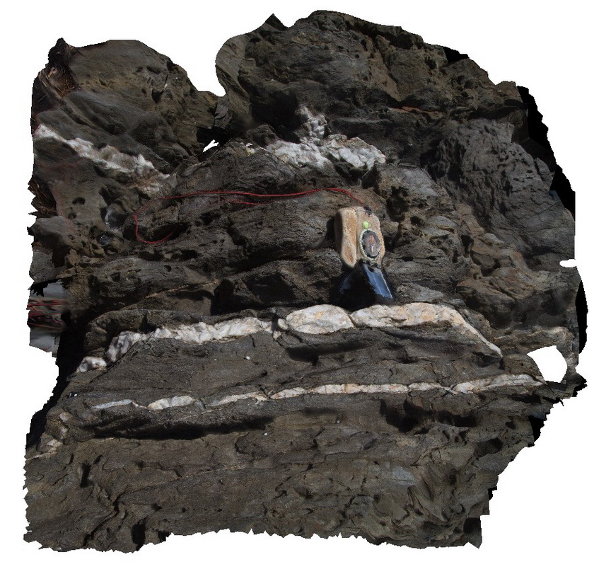
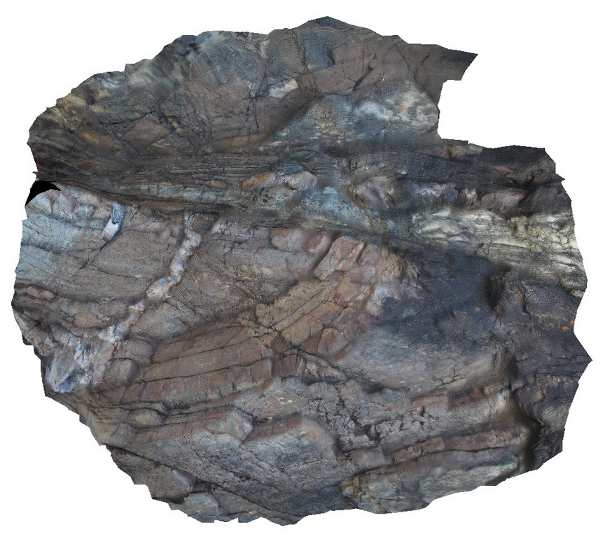
overall view of amphibole gneiss contact with gneiss. Starvation Bay, W.A. |
50.00 |
-33.92200700000 |
120.55943400000 |
34.400 |
contact, amphibolite, gneiss |
amphibolite |
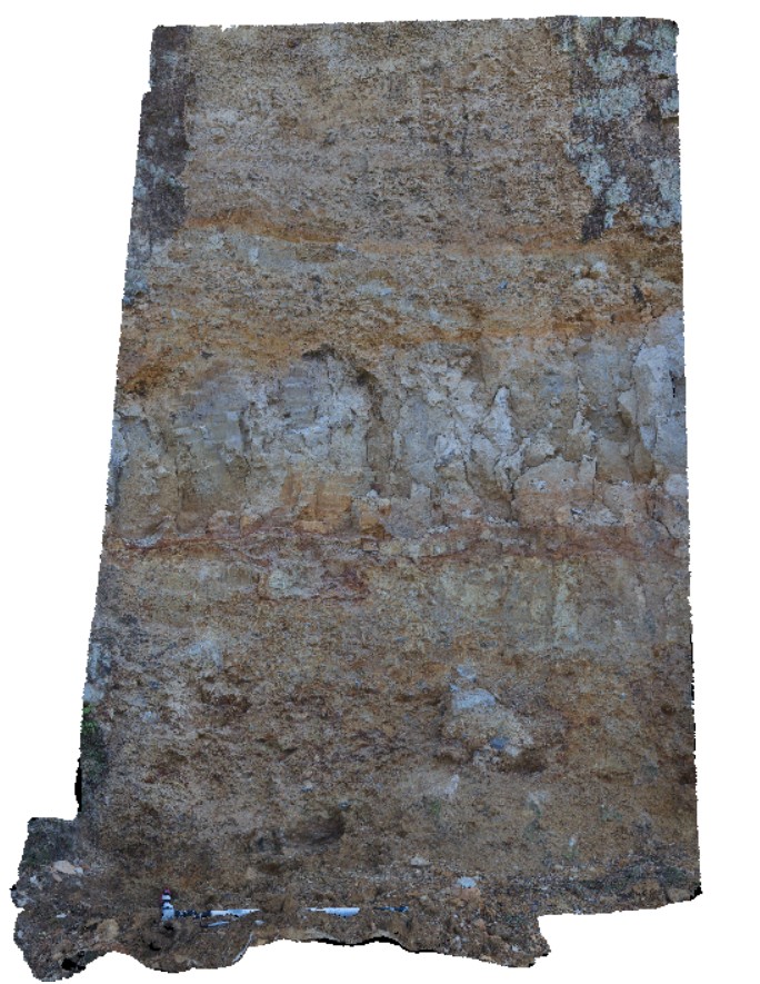
StarvationBayUAV3 Map
 |
0 |
01/01/9999 midnight |
UAV |
overall view of outcrop pavement, showing folded and sheared gneissic rocks. Starvation Bay, W.A. |
9.00 |
-33.92180700000 |
120.55943200000 |
5.500 |
amphibole gneiss, gneiss, geological contact |
amphibolite, gneiss |
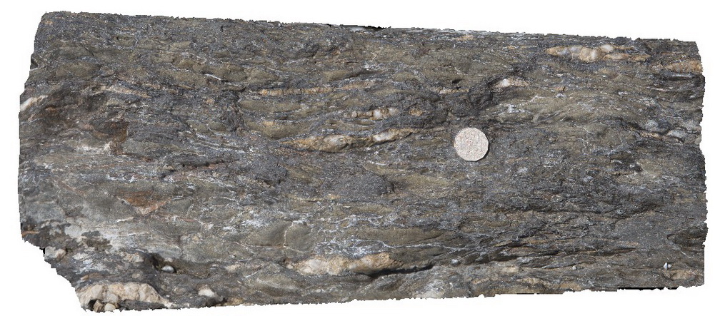
Stokes1 Map
 |
5 |
10/20/2015 3:54 p.m. |
3D |
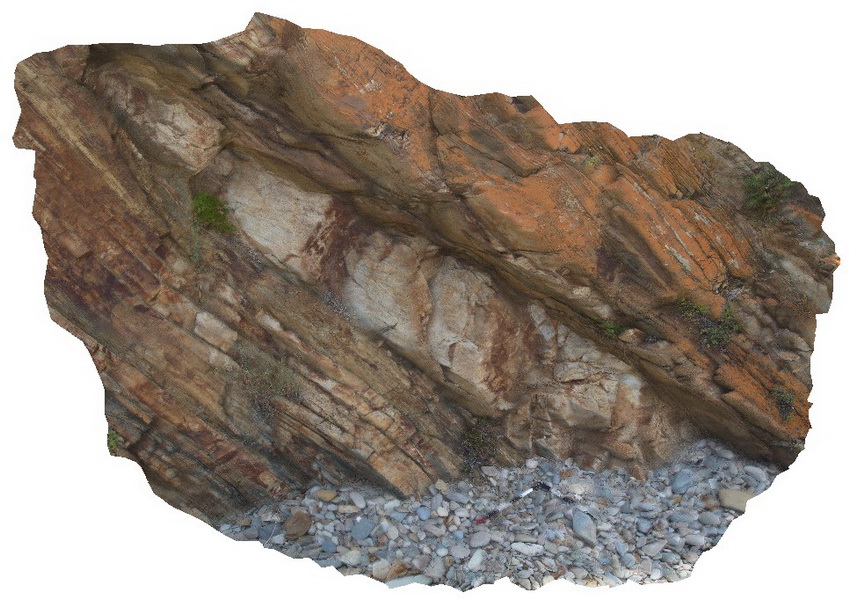
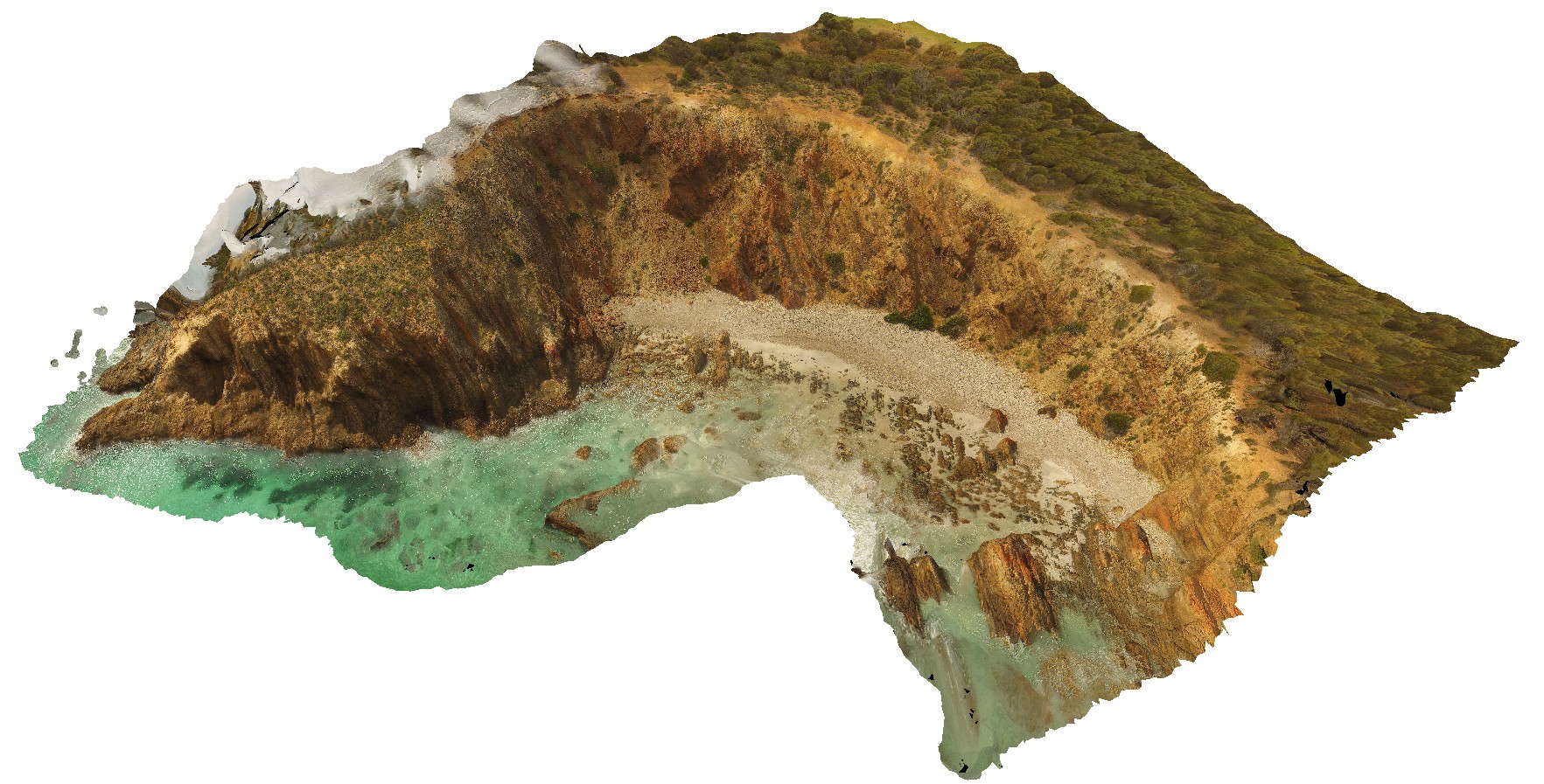
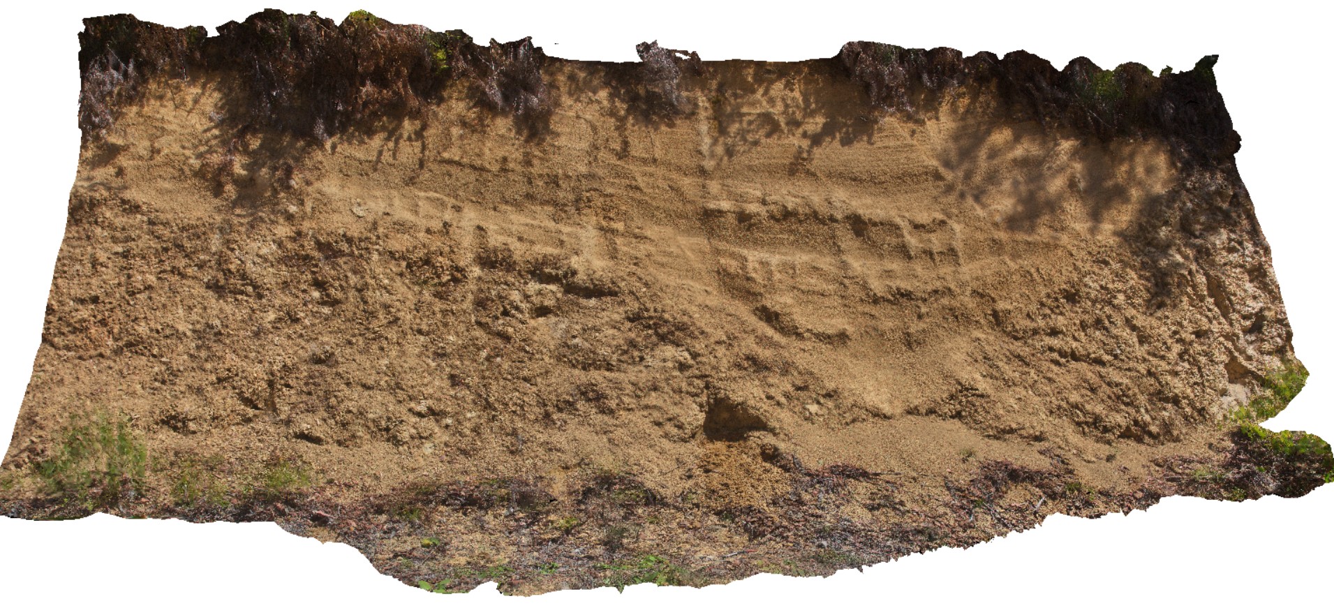
planar, convoluted and cross-bedding in the Stokes Bay Sandstone, Stokes Bay, Kangaroo Island. |
4.00 |
-35.62239000000 |
137.20599000000 |
-9999.000 |
cross-bedding, bedding, sedimentology |
sandstone |
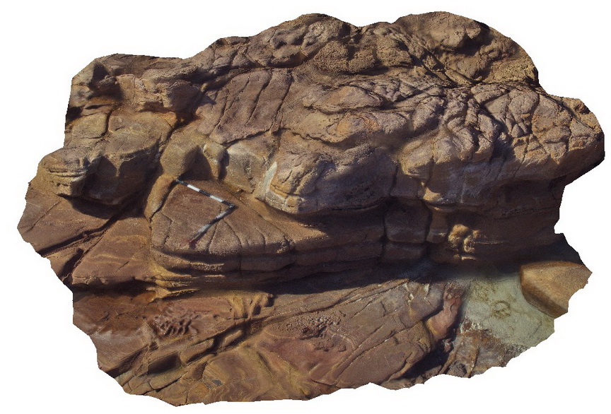
Stokes10 Map
 |
0 |
10/20/2015 3:54 p.m. |
3D |
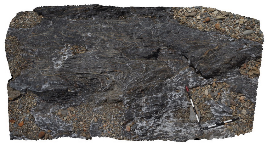
detail of faulted fold hinge in sandy layer of mudstone. Stratigraphy unknown. Snelling Beach, Kangaroo Island. |
0.30 |
-35.66827000000 |
137.06273000000 |
-9999.000 |
fold hinge, fault, structure |
mudstone |
Stokes11 Map
 |
0 |
10/20/2015 3:55 p.m. |
3D |
small scale faulting and folds in finely bedded mudstone and sandstone. Stratigraphy unknown. Snelling Beach, Kangaroo Island. |
0.30 |
-35.66823000000 |
137.06271000000 |
-9999.000 |
folding, faulting, structure, mudstone |
mudstone |
Stokes12 Map
 |
0 |
10/20/2015 3:55 p.m. |
3D |
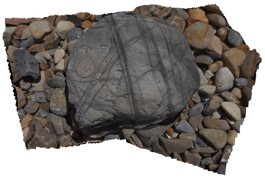
loose boulder with multiple shear bands in phyllite. Stratigraphy unknown. Snelling Beach, Kangaroo Island. |
0.00 |
-35.66823000000 |
137.06271000000 |
-9999.000 |
|
phyllite |
Stokes13 Map
 |
0 |
10/20/2015 3:55 p.m. |
3D |
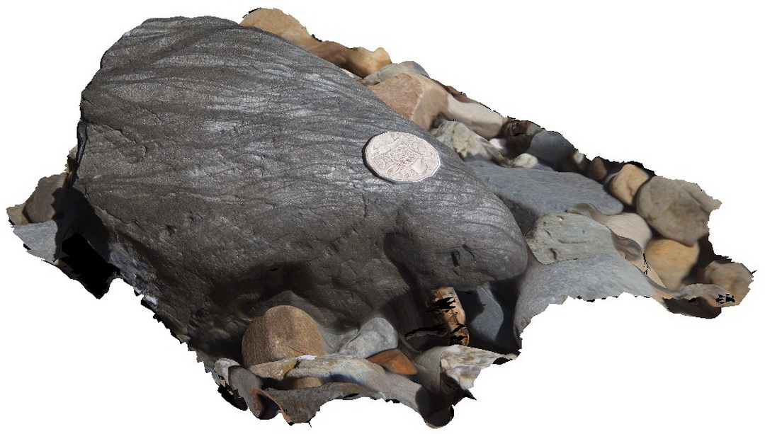
loose boulder with multiple shear bands in phyllite. Stratigraphy unknown. Snelling Beach, Kangaroo Island. |
0.45 |
-35.66823000000 |
137.06271000000 |
-9999.000 |
cross-cutting, shear zone, structure |
phyllite |
Stokes14 Map
 |
0 |
10/20/2015 3:56 p.m. |
3D |
boudinaged quartz veins in metasediment. Stratigraphy unknown. Snelling Beach, Kangaroo Island. |
0.50 |
-35.66864000000 |
137.06615000000 |
-9999.000 |
metasediment, boudinaged, structure |
sandstone |
Stokes15 Map
 |
0 |
10/20/2015 3:56 p.m. |
3D |
bedding parallel shear zone in meta sandstone. Stratigraphy unknown. Snelling Beach, Kangaroo Island. |
3.00 |
-35.66858000000 |
137.06801000000 |
-9999.000 |
metasediments, shear zone, bedding parallel shear |
sandstone |
Stokes16 Map
 |
0 |
10/20/2015 3:57 p.m. |
3D |
detail of bedding parallel shear structure in metasediment, with boudinaged quartz veins. Stratigraphy unknown. Snelling Beach, Kangaroo Island. |
0.60 |
-35.66858000000 |
137.06801000000 |
-9999.000 |
boudinage, shear zone, structure, metasediment |
siltstone |
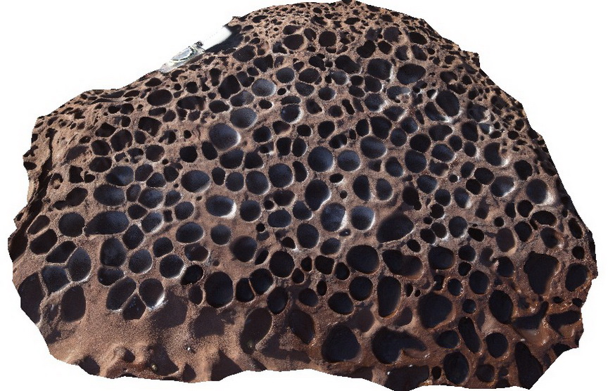
Stokes2 Map
 |
0 |
10/20/2015 3:57 p.m. |
3D |
honeycomb weathering in Stokes Bay Sandstone, Stokes Bay, Kangaroo Island. |
0.40 |
-35.62240000000 |
137.20584000000 |
-9999.000 |
honeycomb weathering, bedding, sedimentology |
sandstone |
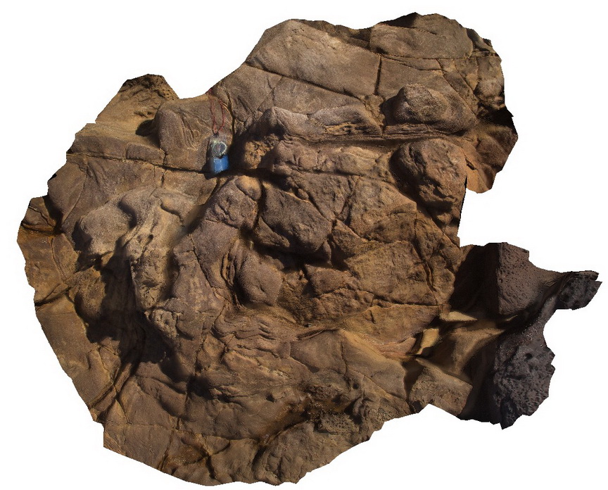
Stokes3 Map
 |
0 |
10/20/2015 3:58 p.m. |
3D |
convoluted bedding in Stokes Bay sandstone, Stokes Bay, Kangaroo Island. |
1.50 |
-35.62239000000 |
137.20601000000 |
-9999.000 |
convoluted bedding, sedimentology |
sandstone |
Stokes4 Map
 |
0 |
10/20/2015 3:58 p.m. |
3D |
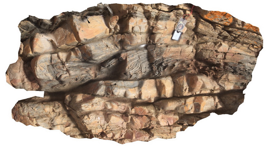
finely bedded sandstone, showing very open folding / kinks, with a faulted horizontal fold axis in steeply dipping beds. King George Bay, Kangaroo Island. |
11.00 |
-35.65411000000 |
137.11592000000 |
-9999.000 |
folding, faulting, structure, finely bedded |
sandstone |
Stokes5 Map
 |
0 |
10/20/2015 3:59 p.m. |
3D |
detail of small thrust fault, with drag folding in sandstone. King George Bay, Kangaroo Island. |
5.00 |
-35.65411000000 |
137.11592000000 |
-9999.000 |
thrust fault, structure, drag fold |
sandstone |
Stokes6 Map
 |
0 |
10/20/2015 3:59 p.m. |
3D |
moderately dipping beds showing sandstone channel with cross-beds and convoluted bedding in brecciated sandstone and siltstone. King George Bay, Kangaroo Island. |
5.00 |
-35.65446000000 |
137.11624000000 |
-9999.000 |
convoluted bedding, cross bedding, sedimentology |
sandstone |
Stokes7 Map
 |
0 |
10/20/2015 3:59 p.m. |
3D |
folding associated with bedding parallel thrusting or syndepositional movement. King George Bay, Kangaroo Island. |
2.00 |
-35.65480000000 |
137.11276000000 |
-9999.000 |
folding, bedding parallel thrusting |
sandstone |
Stokes8 Map
 |
0 |
10/20/2015 4 p.m. |
3D |
fault / shear zone in silty layer in metasediments. Stratigraphy unknown. Snelling Beach, Kangaroo Island. |
1.20 |
-35.66838000000 |
137.06142000000 |
-9999.000 |
fault, siltstone |
siltstone |
Stokes9 Map
 |
0 |
10/20/2015 4 p.m. |
3D |
intense ductile folding and deformation in mudstone unit with fine, silty layers. Stratigraphy unknown. Snelling Beach, Kangaroo Island. |
3.00 |
-35.66827000000 |
137.06273000000 |
-9999.000 |
ductile deformation, structure |
mudstone |
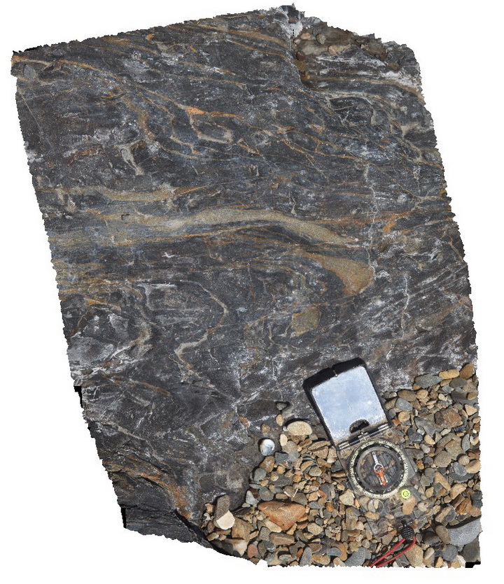
StokesUAV1 Map
 |
20 |
01/01/9999 midnight |
UAV |
aerial view of bedded sandstone, showing very open folding / kinks in steeply dipping beds. King George Bay, Kangaroo Island. |
200.00 |
-35.65456700000 |
137.11588900000 |
-9999.000 |
bedding, fold, kink fold, structure |
sandstone |
StyxRd1 Map
 |
0 |
02/23/2016 9:29 a.m. |
3D |
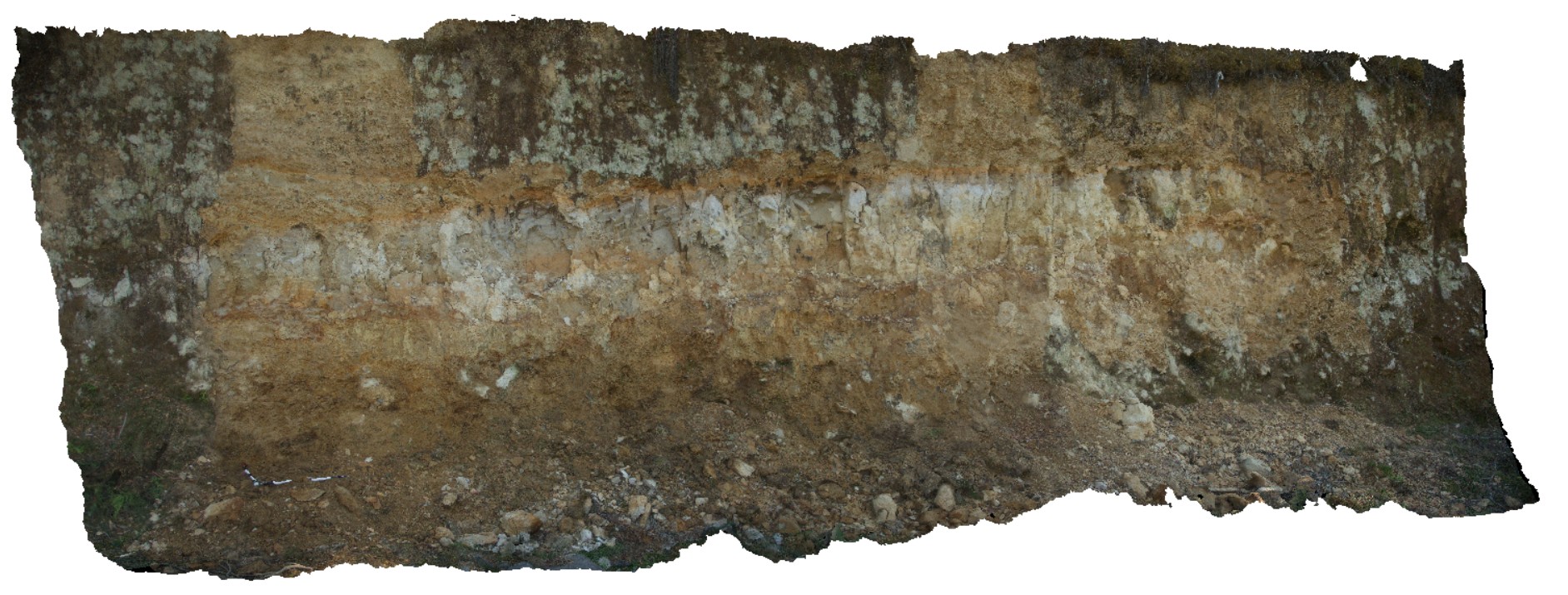
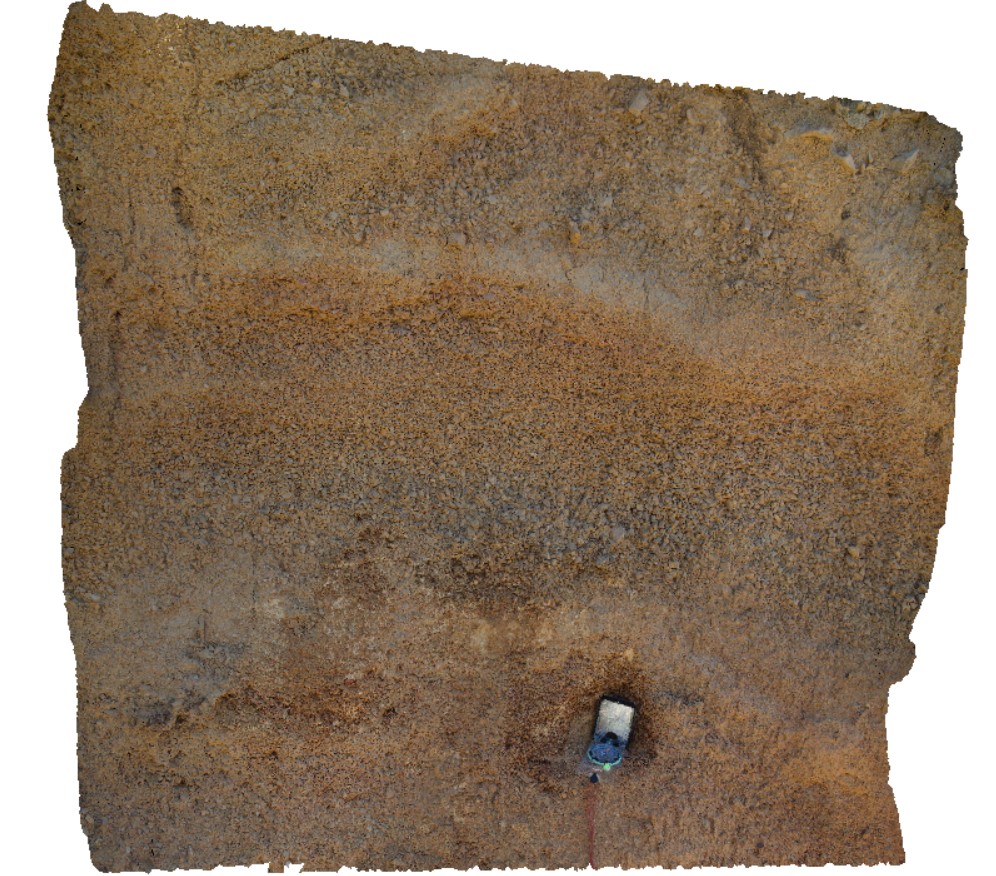
regolith profile, showing fine colluvial scree overlying silty-clay (aeolian), overlying coarser colluvial sediments. Styx road, Tasmania. |
7.00 |
-42.80639000000 |
146.59326000000 |
-9999.000 |
colluvium, scree |
scree |
StyxRd2 Map
 |
0 |
02/23/2016 9:29 a.m. |
3D |
detail of location StyxRd1, showing regolith profile; fine colluvial scree overlying silty-clay (aeolian), overlying coarser colluvial sediments. Styx road, Tasmania. |
2.50 |
-42.80639000000 |
146.59326000000 |
-9999.000 |
colluvium |
scree |
StyxRd3 Map
 |
0 |
02/23/2016 9:30 a.m. |
3D |
View of infilled paleogully. Fine scree, derived from Permian sandstone over Permian sandstone outcrop. Styx Road, Tasmania. |
0.00 |
-42.80680000000 |
146.59299000000 |
-9999.000 |
paleo horizons, paleo gully |
scree |
StyxRd4 Map
 |
0 |
02/23/2016 9:30 a.m. |
3D |
view of fine talus with clear rhythmic layering and graded bedding. Talus is monomict and derived from Permian siltstone. Styx road, Tasmania. |
0.60 |
-42.80716000000 |
146.59270000000 |
-9999.000 |
talus, graded bedding, rhythmic bedding |
talus |
SugarloafRock1 Map
 |
0 |
05/15/2016 noon |
3D |
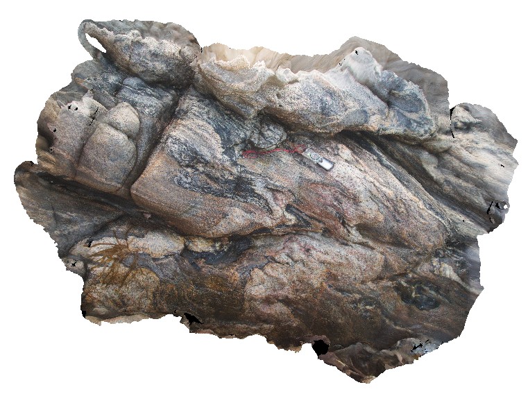
tightly folded, mixed gneiss and pegmatite. Sugarloaf Rock, Cape Naturaliste. W.A. This unit may also be known as Neoproterozoic granites 76645. |
2.00 |
-33.56073000000 |
115.00566000000 |
-9999.000 |
tight folding, metamorphics |
gneiss |