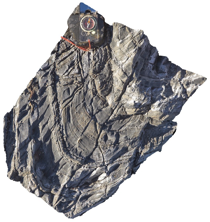
SugarloafRock2 Map
 |
0 |
05/15/2016 noon |
3D |
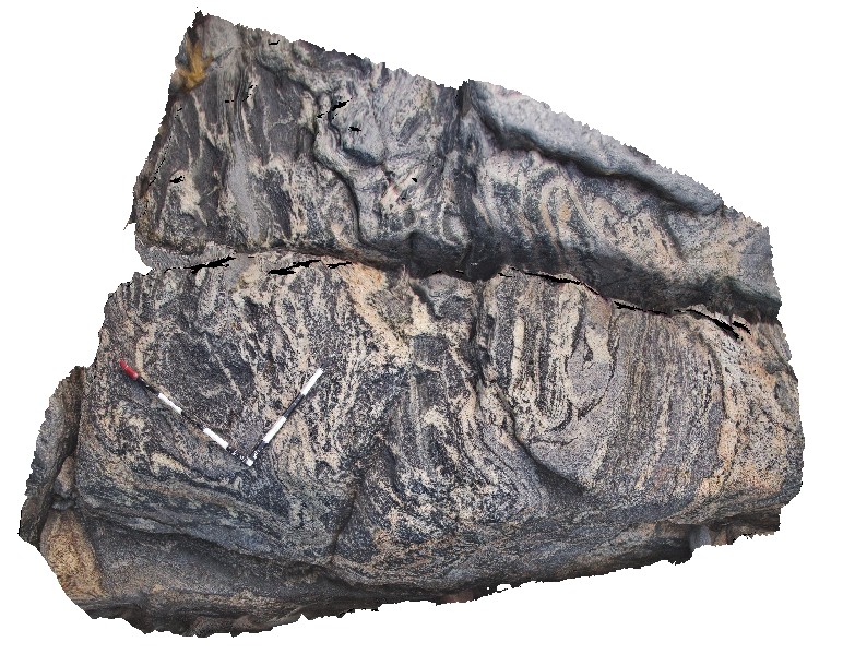
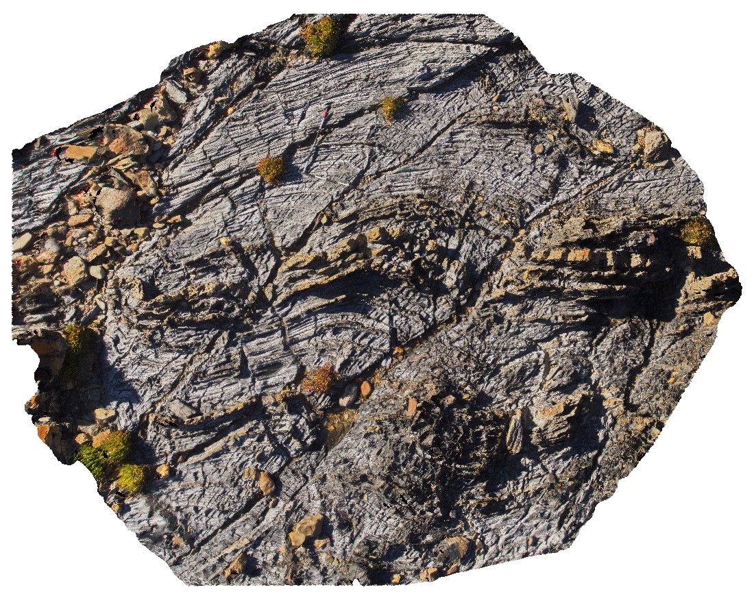
tightly folded grey granodiorite gneiss. Sugarloaf Rock, Cape Naturaliste. W.A. This unit may also be known as Neoproterozoic granites 76645. |
2.00 |
-33.56065000000 |
115.00563000000 |
-9999.000 |
tight folding, gneiss |
gneiss |
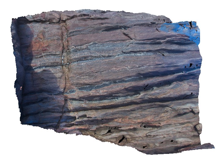
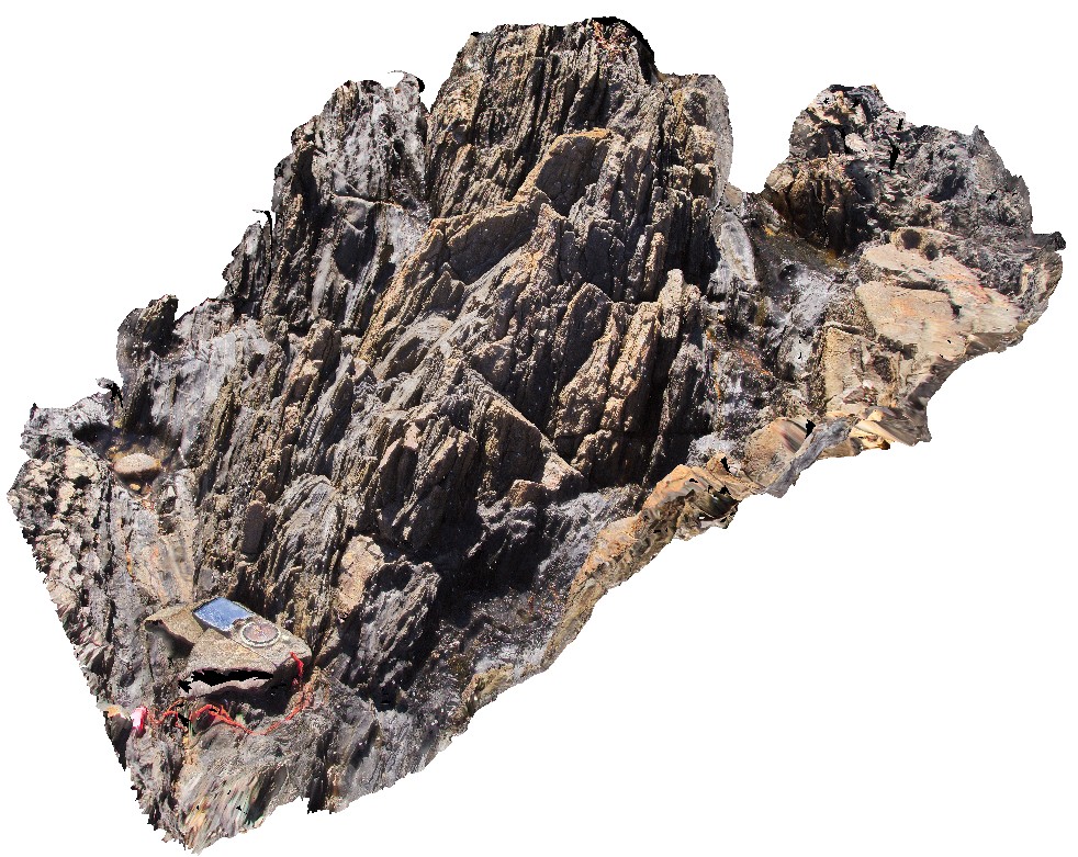
SugarloafRock3 Map
 |
0 |
05/15/2016 noon |
3D |
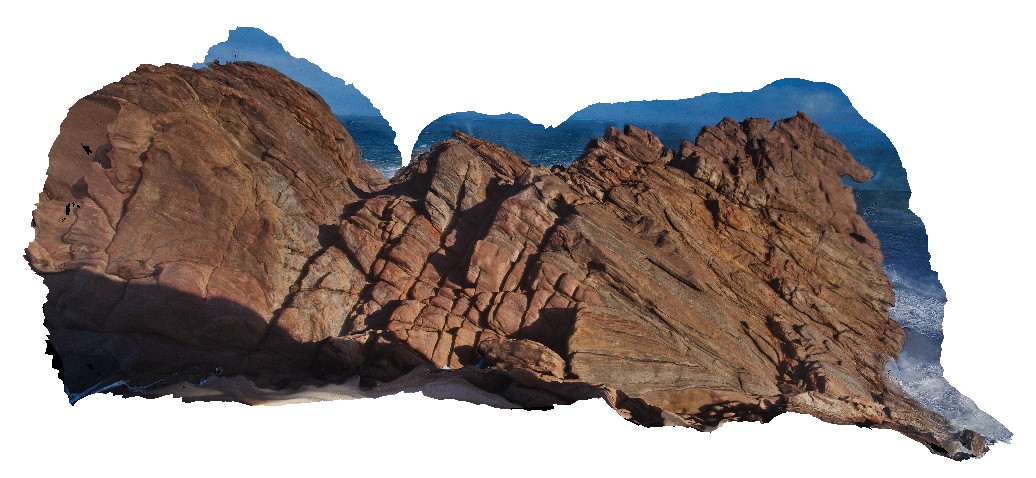
overview of large gneissic outcrop. Sugarloaf Rock, Cape Naturaliste. W.A. This unit may also be known as Neoproterozoic granites 76645. |
12.00 |
-33.56059000000 |
115.00500000000 |
-9999.000 |
gneiss |
gneiss |
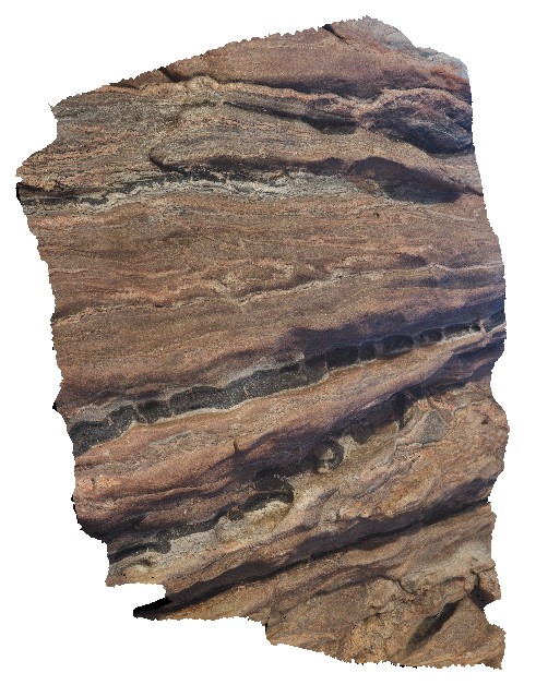
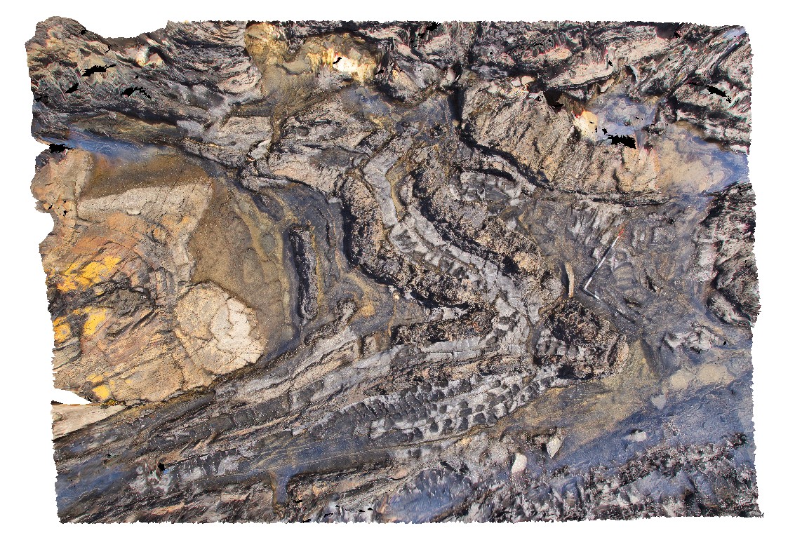
SugarloafRock4 Map
 |
0 |
05/15/2016 noon |
3D |
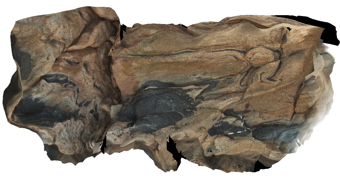
folded and boudinaged amphibolite layers in granitic gneiss. Pegmatite in boudin necks. Sugarloaf Rock, Cape Naturaliste. W.A. This unit may also be known as Neoproterozoic granites 76645. |
0.00 |
-33.56074000000 |
115.00518000000 |
-9999.000 |
boudinage, amphibolite, metamorphics |
gneiss |
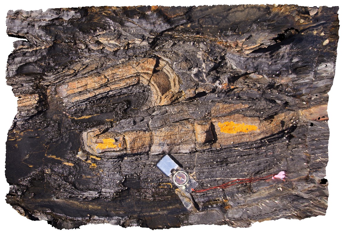
SugarloafRock5 Map
 |
0 |
05/15/2016 noon |
3D |
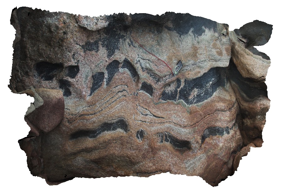
Detail of boudinaged amphibole layer in banded gneiss. Sugarloaf Rock, Cape Naturaliste. W.A. This unit may also be known as Neoproterozoic granites 76645. |
1.40 |
-33.56070000000 |
115.00522000000 |
-9999.000 |
boudinage, amphibole gneiss, structure |
gneiss |
SugarloafRock6 Map
 |
0 |
05/15/2016 noon |
3D |
steep cliff of folded gneiss and amphibolite. Sugarloaf Rock, Cape Naturaliste. W.A. This unit may also be known as Neoproterozoic granites 76645. |
7.00 |
-33.56067000000 |
115.00493000000 |
-9999.000 |
banded gneiss, amphibolite, fold, structure |
gneiss |
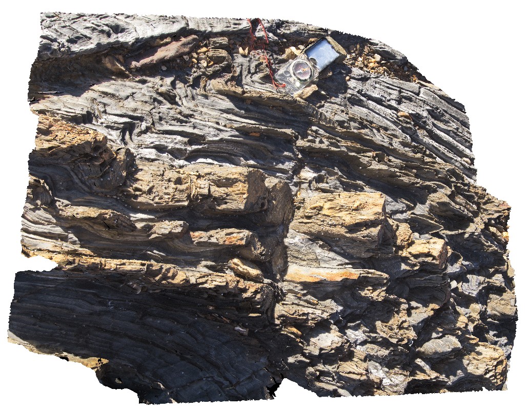
SugarloafRock6a Map
 |
10 |
01/01/9999 midnight |
3D |
folded and boudinaged amphibolite and leucosomes in banded granitic gneiss. Sugarloaf Rock, Cape Naturaliste. W.A. This unit may also be known as Neoproterozoic granites 76645. |
5.00 |
-33.56067000000 |
115.00493000000 |
-9999.000 |
boudinage, migmatite, pytigmatic fold |
gneiss |
SugarloafRock7 Map
 |
0 |
05/15/2016 noon |
3D |
folded and boudinaged amphibolite and leucosomes in banded granitic gneiss. Sugarloaf Rock, Cape Naturaliste. W.A. This unit may also be known as Neoproterozoic granites 76645. |
2.00 |
-33.56061000000 |
115.00500000000 |
-9999.000 |
boudinage, structure, fold, gneiss |
granitic gneiss |
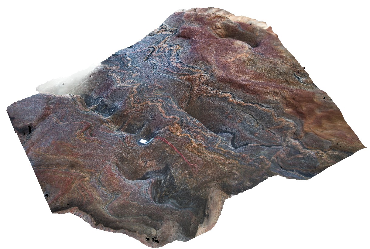
SulphurCreek1 Map
 |
5 |
03/16/2015 2:38 p.m. |
3D |
altered pillow basalts, with weathered pillow rims. Sulphur Creek, north Tas. |
3.50 |
-41.09074000000 |
146.01949000000 |
1.000 |
pillow basalt, pillow margin |
basalt |
SulphurCreek10 Map
 |
5 |
01/01/9999 midnight |
3D |
altered pillow basalts, showing individual pillows and quench rims. Sulphur Creek, north Tas. |
2.10 |
-41.09169000000 |
146.02086000000 |
1.000 |
pillow basalt, pillow, lava, volcanic |
basalt |
SulphurCreek11 Map
 |
5 |
01/01/9999 midnight |
3D |
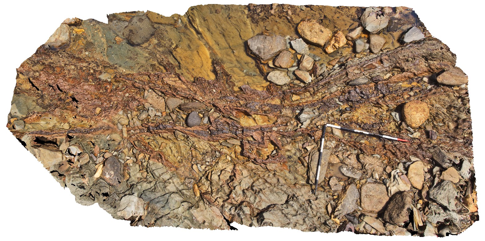
mineralised (Pyrite?) vein converting to iron oxides cutting deformed pillow basalts. Sulphur Creek, north Tas. |
4.00 |
-41.09169000000 |
146.02094000000 |
1.000 |
pillow basalt, vein, pyrite, iron oxide, alteration, deformation, structure |
basalt |
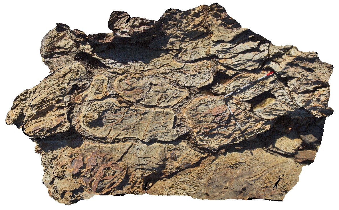
SulphurCreek12 Map
 |
5 |
01/01/9999 midnight |
3D |
folded quartz pebble conglomerate and quartzite beds. Sulphur Creek, north Tas. |
5.00 |
-41.09301664000 |
146.02858585000 |
1.000 |
conglomerate |
conglomerate |
SulphurCreek13 Map
 |
5 |
01/01/9999 midnight |
3D |
steeply dipping quartz cobble conglomerate and quartzite beds. Sulphur Creek, north Tas. |
5.00 |
-41.09291612000 |
146.02870559000 |
1.000 |
conglomerate, structure |
conglomerate |
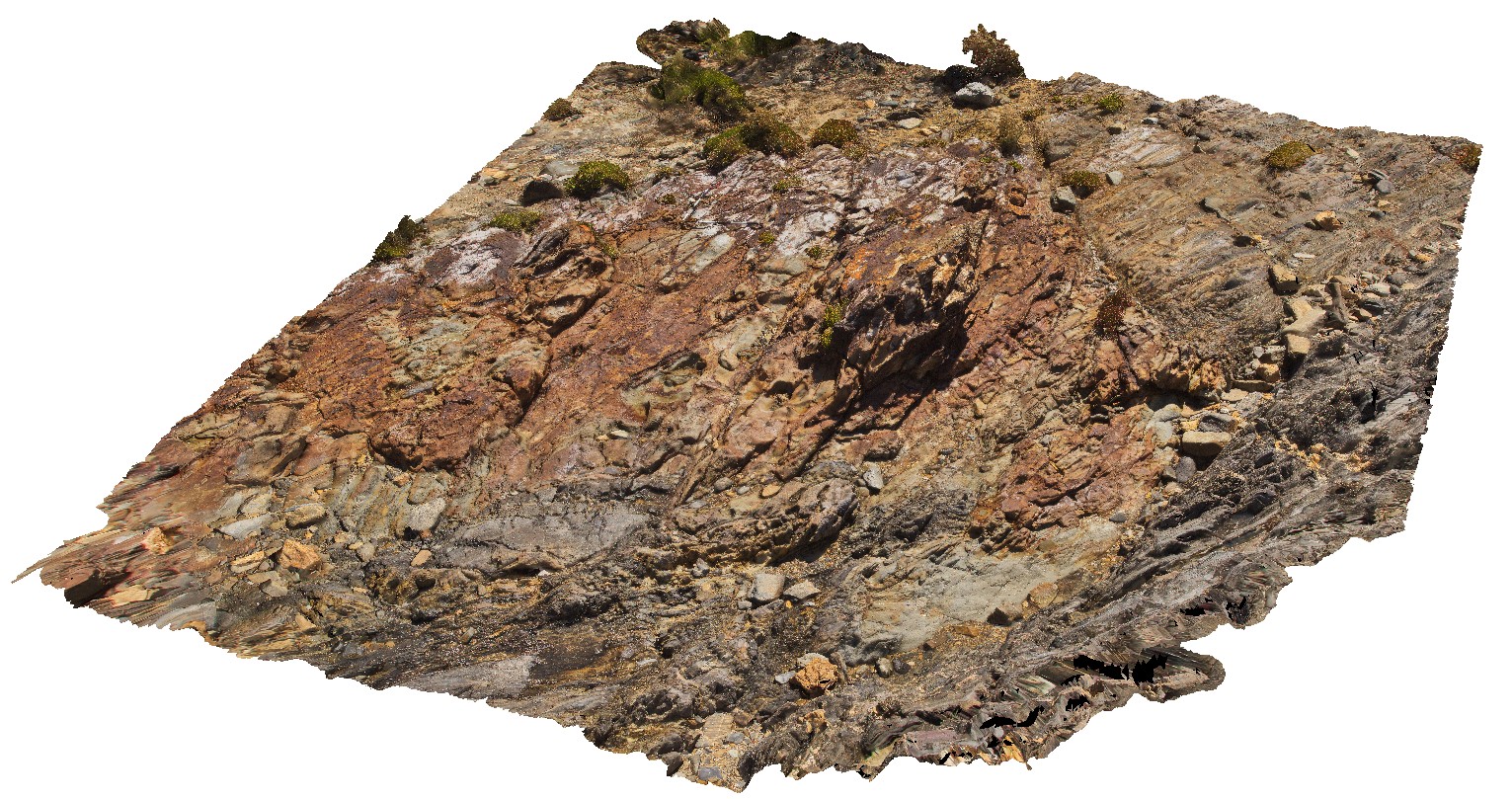
SulphurCreek2 Map
 |
5 |
03/16/2015 2:38 p.m. |
3D |
folds in thinly bedded mudstone and sandstones. Sulphur Creek, north Tas. |
6.00 |
-41.09081000000 |
146.07003000000 |
1.000 |
fold, tight fold, sedimentology |
mudstone |
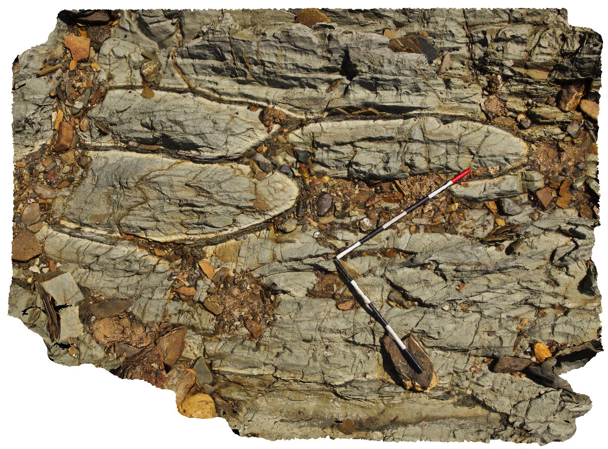
SulphurCreek3 Map
 |
5 |
01/01/9999 midnight |
3D |
detail of image SulphurCreek4, showing thin folded layers and folded and boudinaged sandstone layers. Sulphur Creek, north Tas. |
0.20 |
-41.09081000000 |
146.07003000000 |
1.000 |
boudinage, fold, structure |
mudstone |
SulphurCreek4 Map
 |
5 |
01/01/9999 midnight |
3D |
faulted contact between altered basalt and folded mudstone. Sulphur Creek, north Tas. |
4.00 |
-41.09097000000 |
146.02003000000 |
1.000 |
fault, contact, geological contact |
basalt, mudstone |
SulphurCreek5 Map
 |
5 |
01/01/9999 midnight |
3D |
steeply plunging fold hinge in mudstone with axial planar cleavage. Sulphur Creek, north Tas. |
0.55 |
-41.09159000000 |
146.02060000000 |
1.000 |
fold hinge, fold plunge, axial planar cleavage, cleavage, structure, fold |
mudstone |
SulphurCreek6 Map
 |
5 |
01/01/9999 midnight |
3D |
non-cylindrical folds in mudstone. Sulphur Creek, north Tas. |
5.00 |
-41.09169000000 |
146.02039000000 |
1.000 |
non-cylindrical fold, fold, structure |
mudstone |
SulphurCreek7 Map
 |
5 |
01/01/9999 midnight |
3D |
faulted, plunging parasitic fold in sandstone layer. Sulphur Creek, north Tas. |
1.00 |
-41.09143000000 |
146.02013000000 |
1.000 |
fault, parasitic fold, fold, fold plunge, structure |
sandstone |
SulphurCreek8 Map
 |
5 |
01/01/9999 midnight |
3D |
refolded tight to isoclinal fold hinge in thinly bedded sandstones and mudstones. Sulphur Creek, north Tas. |
1.40 |
-41.09142000000 |
146.02008000000 |
1.000 |
refolded fold, fold, tight fold, isoclinal fold, fold hinge |
sandstone |
SulphurCreek9 Map
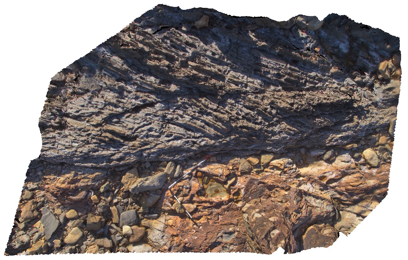
 |
5 |
01/01/9999 midnight |
3D |
faulted contact between metasediments and altered basalt. Sulphur Creek, north Tas. |
11.70 |
-41.09114000000 |
146.01987000000 |
1.000 |
faulted contact, geological contact, basalt, structure |
basalt, metasediments |
SulphurCreekFSP1 Map
 |
5 |
01/01/9999 midnight |
FSP |
folded metasediments, with stringer and stockwork veining. Sulphur Creek, north Tas. |
250.00 |
-41.09081000000 |
146.07003000000 |
1.000 |
stockwork veining, metasediments |
metasediments |
SulphurCreekFSP2 Map
 |
5 |
01/01/9999 midnight |
FSP |
out crop of folded interbedded sandstones and mudstones. Sulphur Creek, north Tas. |
500.00 |
-41.09081000000 |
146.07003000000 |
1.000 |
fold, metasediments, structure |
metasediment |
SulphurCreekFSP3 Map
 |
5 |
01/01/9999 midnight |
FSP |
view of thinly layered mudstones with kink bands. Sulphur Creek, north Tas. |
500.00 |
-41.09081000000 |
146.07003000000 |
1.000 |
kink band, fold, structure |
mudstone |
SulphurCreekFSP4 Map
 |
5 |
01/01/9999 midnight |
FSP |
beach exposure of truncated folding in bedded sandstones and mudstones. Sulphur Creek, north Tas. |
500.00 |
-41.09097000000 |
146.02003000000 |
1.000 |
fault, fold, structure, metasediments |
metasediments |
SulphurCreekFSP5 Map
 |
5 |
01/01/9999 midnight |
FSP |
shore exposure of faulted contact between basalt and folded sediments. Sulphur Creek, north Tas. |
500.00 |
-41.09097000000 |
146.02003000000 |
1.000 |
fault, contact, metasediments, structure |
mudstone, basalt |