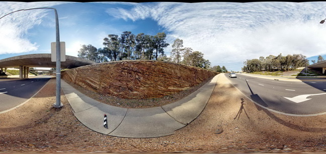
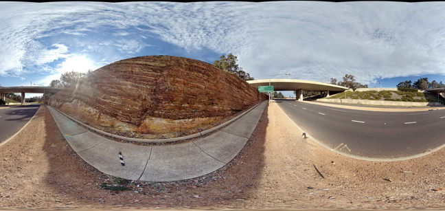
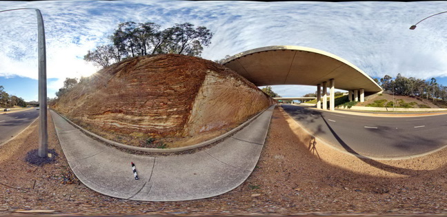
CanberraFSP1 Map
 |
5 |
06/17/2015 10:22 a.m. |
FSP |
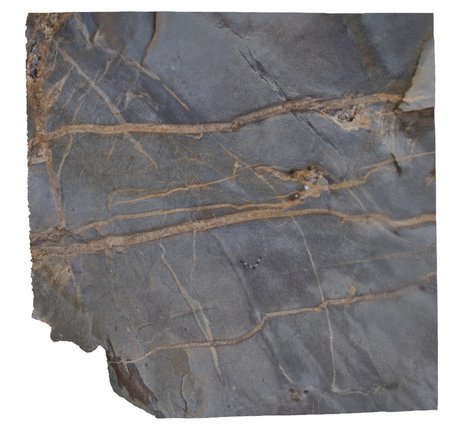
Open folds and faults in Silurian sandstone and mudstone of the Camp Hill Sandstone. A.C.T. |
50.00 |
-35.30497000000 |
149.12817000000 |
580.000 |
folds, faults, structure |
sandstone |
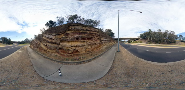
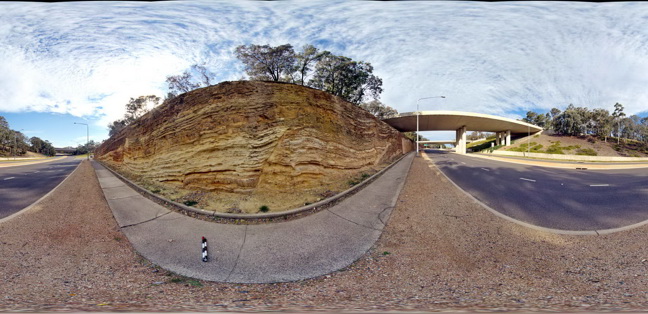
CanberraFSP10 Map
 |
5 |
09/04/2015 9:28 a.m. |
FSP |
Open folds and faults in Silurian sandstone and mudstone of the Camp Hill Sandstone. A.C.T. |
50.00 |
-35.30414000000 |
149.12650000000 |
580.000 |
folds, faults, structure, sedimentology |
sandstone |
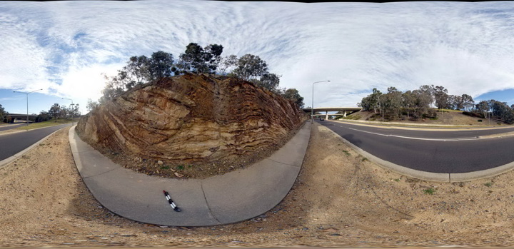
CanberraFSP11 Map
 |
5 |
09/04/2015 9:28 a.m. |
FSP |
Open folds and faults in Silurian sandstone and mudstone of the Camp Hill Sandstone. A.C.T. |
50.00 |
-35.30400000000 |
149.12634000000 |
580.000 |
folds, faults, structure, sedimentology |
sandstone |
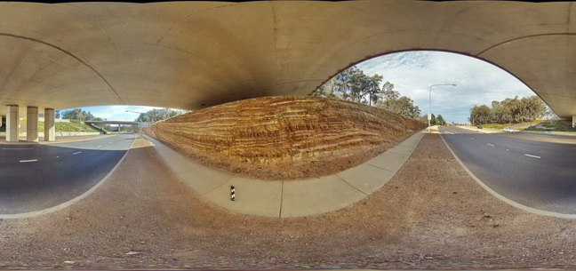
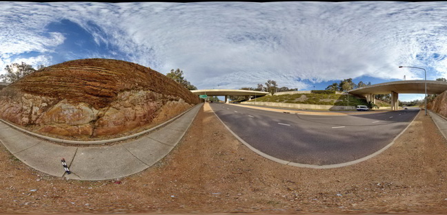
CanberraFSP2 Map
 |
5 |
09/03/2015 1:19 p.m. |
FSP |
Open folds and faults in Silurian sandstone and mudstone of the Camp Hill Sandstone. A.C.T. |
50.00 |
-35.30493000000 |
149.12813000000 |
580.000 |
folds, faults, structure, sedimentology |
sandstone |
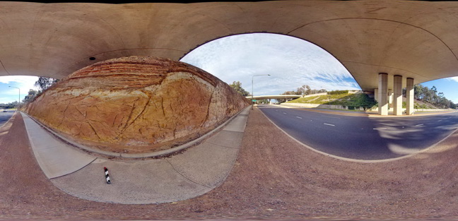
CanberraFSP3 Map
 |
5 |
06/17/2015 10:24 a.m. |
FSP |
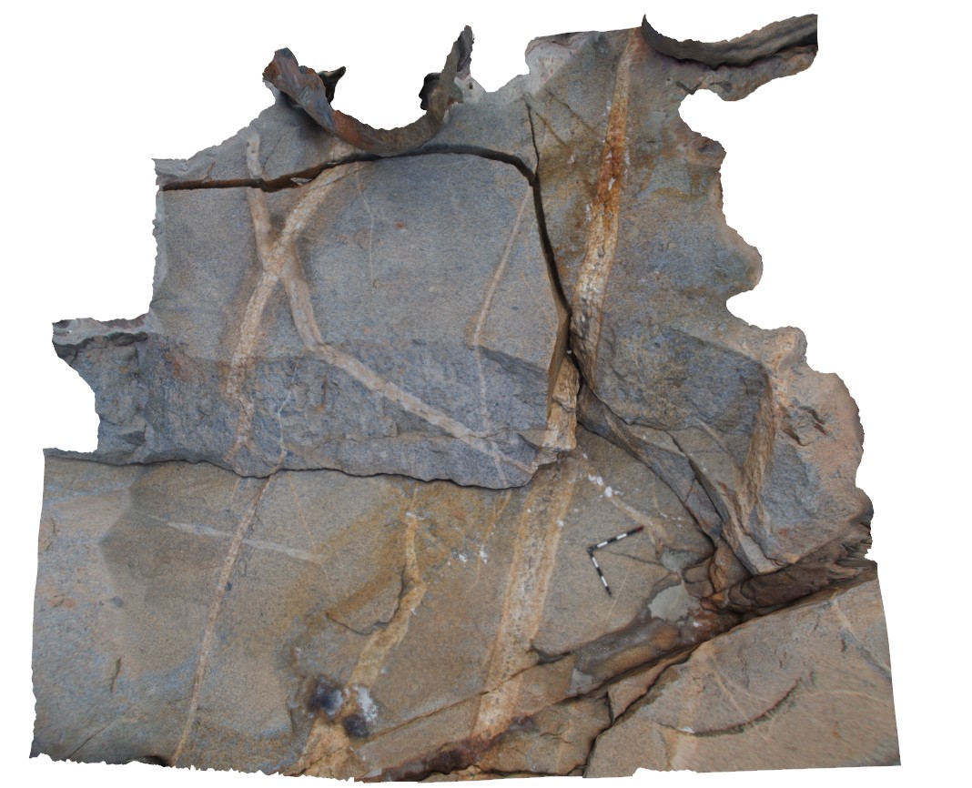
Open folds and faults in Silurian sandstone and mudstone of the Camp Hill Sandstone unconformably overlying Silurian State Circle Shale. A.C.T. |
50.00 |
-35.30463000000 |
149.12769000000 |
580.000 |
folds, faults, structure, unconformity, sedimentology |
sandstone, shale |
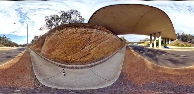
CanberraFSP4 Map
 |
5 |
06/17/2015 10:25 a.m. |
FSP |
Open folds and faults in Silurian sandstone and mudstone of the Camp Hill Sandstone unconformably overlying Silurian State Circle Shale. A.C.T. |
50.00 |
-35.30456000000 |
149.12755000000 |
580.000 |
folds, faults, unconformity, sedimentology, structure |
sandstone, shale |
CanberraFSP5 Map
 |
5 |
09/03/2015 1:20 p.m. |
FSP |
Open folds and faults in Silurian sandstone and mudstone of the Camp Hill Sandstone unconformably overlying Silurian State Circle Shale which contains disaggregated rafts of sandstone. A.C.T. |
50.00 |
-35.30453000000 |
149.12744000000 |
580.000 |
structure, sedimentology, folds, faults, angular unconformity |
sandstone |
CanberraFSP6 Map
 |
5 |
09/03/2015 1:20 p.m. |
FSP |
Open folds and faults in Silurian sandstone and mudstone of the Camp Hill Sandstone unconformably overlying Silurian State Circle Shale which contains disaggregated rafts of sandstone. A.C.T. |
50.00 |
-35.30445000000 |
149.12733000000 |
580.000 |
folds, faults, structure, sedimentology |
sandstone, shale |
CanberraFSP7 Map
 |
5 |
09/03/2015 1:20 p.m. |
FSP |
Open folds and faults in Silurian sandstone and mudstone of the Camp Hill Sandstone unconformably overlying tightly folded Silurian State Circle Shale. A.C.T. |
50.00 |
-35.30431000000 |
149.12711000000 |
580.000 |
folds, faults, structure, angular unconformity |
sandstone, shale |
CanberraFSP8 Map
 |
5 |
09/03/2015 1:20 p.m. |
FSP |
Open folds and faults in Silurian sandstone and mudstone of the Camp Hill Sandstone unconformably overlying tightly folded Silurian State Circle Shale. A.C.T. |
50.00 |
-35.30430000000 |
149.12703000000 |
580.000 |
|
sandstone, shale |
CanberraFSP9 Map
 |
5 |
09/03/2015 1:20 p.m. |
FSP |
Open folds and faults in Silurian sandstone and mudstone of the Camp Hill Sandstone unconformably overlying tightly folded Silurian State Circle Shale. A.C.T. |
50.00 |
-35.30420000000 |
149.12686000000 |
580.000 |
folds, faults, structure, angular unconformity, sedimentology |
sandstone, shale |
CanberraGiga1 Map
 |
1 |
06/17/2015 10:27 a.m. |
GIGA |
— |
0.00 |
-35.30408000000 |
149.12651000000 |
-9999.000 |
|
|
CanberraGiga2 Map
 |
0 |
06/17/2015 10:29 a.m. |
GIGA |
— |
0.00 |
-35.30408000000 |
149.12651000000 |
-9999.000 |
|
|
CanberraGiga3 Map
 |
1 |
06/17/2015 10:30 a.m. |
GIGA |
— |
0.00 |
-35.30408000000 |
149.12651000000 |
-9999.000 |
|
|
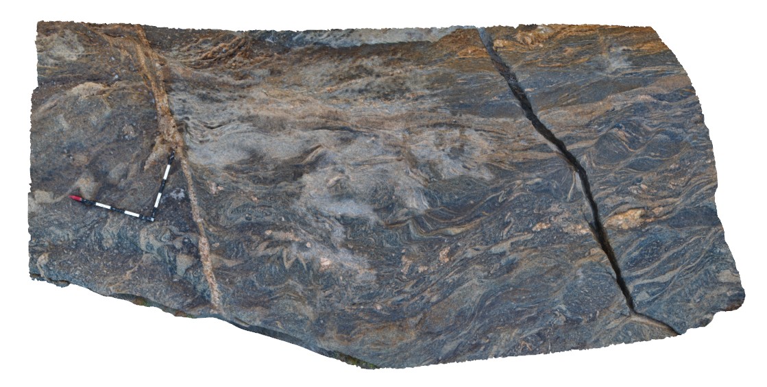
CapeArid1 Map
 |
0 |
06/05/2016 10:33 a.m. |
3D |
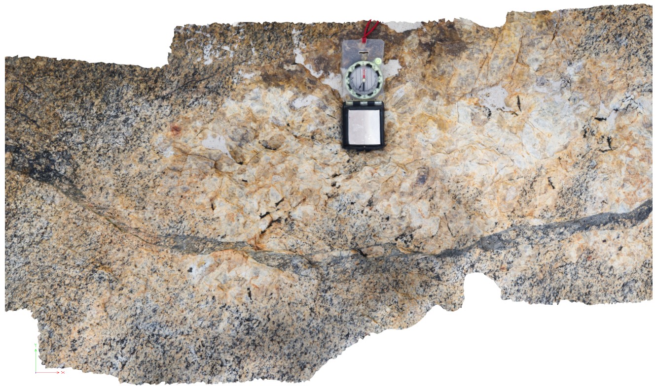
folded and sheared granitic fine layering in gneiss? With leucosomes. Cape Arid, W.A. |
3.60 |
-33.93373000000 |
123.32534000000 |
-9999.000 |
gneiss, leucosomes |
gneiss |
CapeArid10 Map
 |
0 |
06/05/2016 10:35 a.m. |
3D |
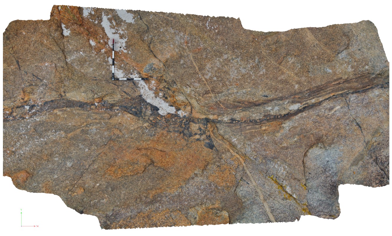
detailed view of shear zone in site CapeArid9, showing shear zone and cross cutting leucocratic zone, crosscut by late stage pegmatite dyke. Cape Arid, W.A. |
1.00 |
-33.90596000000 |
123.35376000000 |
-9999.000 |
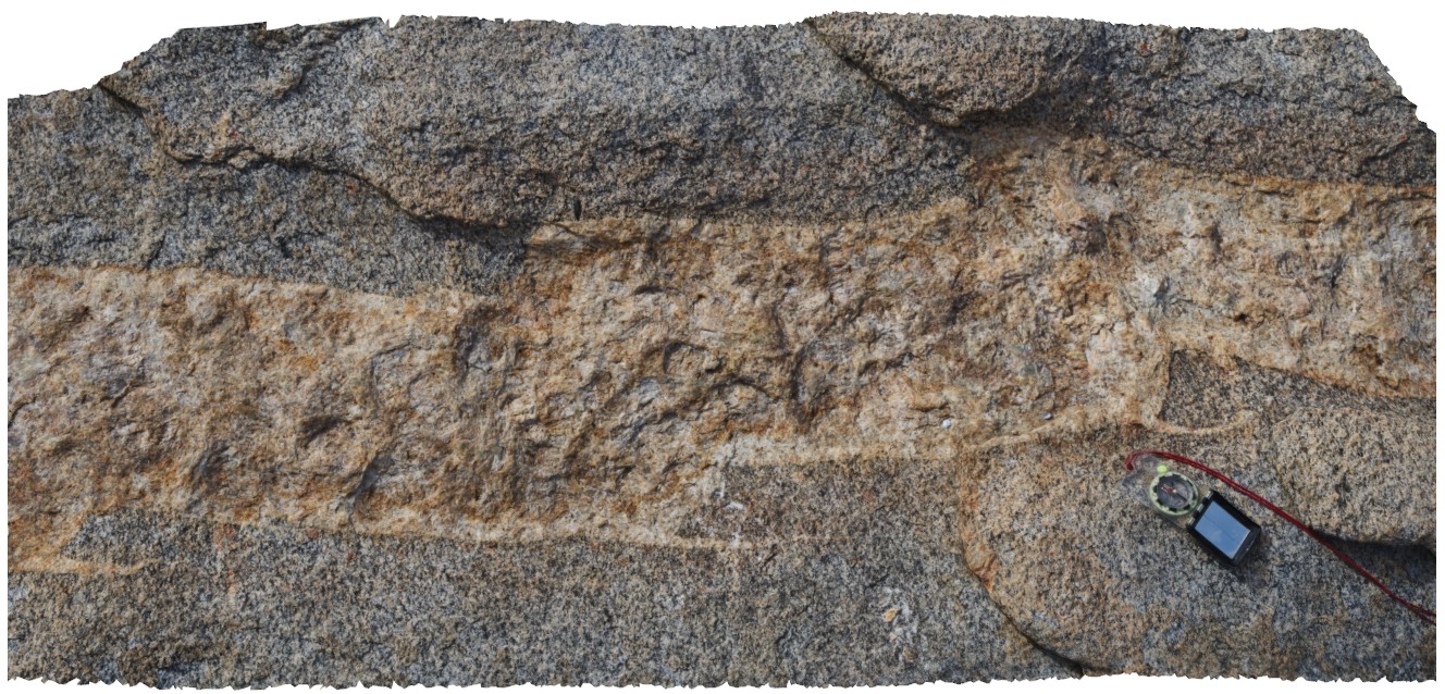
shear zone, leucocratic zone |
gneiss |
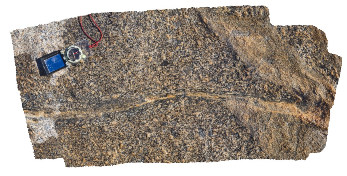
CapeArid11 Map
 |
0 |
06/05/2016 10:35 a.m. |
3D |
pegmatite dykes and leucosomes in granitic gneiss, Cape Arid. W.A. |
20.00 |
-33.87421000000 |
123.00494000000 |
-9999.000 |
pegmatite dyke, leucosome |
gneiss |
CapeArid12 Map
 |
0 |
06/05/2016 10:36 a.m. |
3D |
view of small-scale step-overs / faults in pegmatite dyke, Cape Arid. W.A. |
1.60 |
-33.87414000000 |
123.00493000000 |
-9999.000 |
fault, pegmatite dyke |
pegmatite |
CapeArid13 Map
 |
0 |
06/05/2016 10:36 a.m. |
3D |
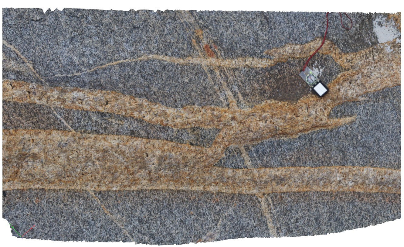
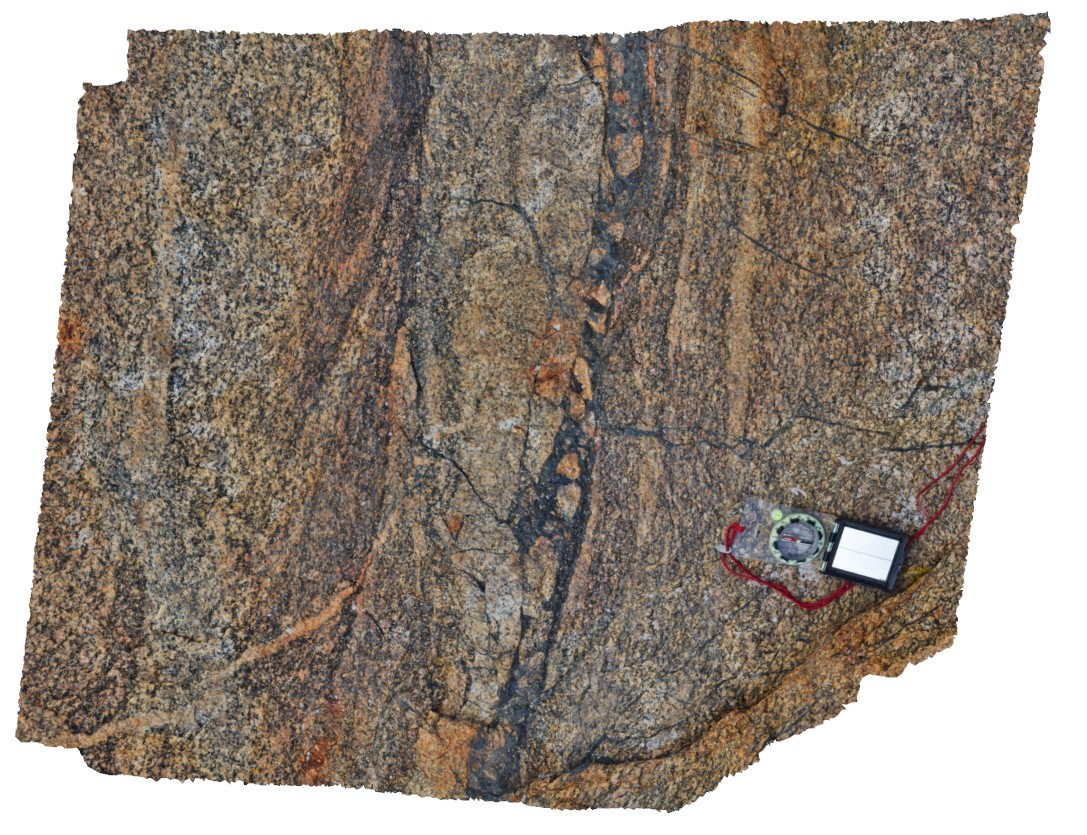
view of cross-cutting relationship between pegmatite dykes in gneiss. Selvage alteration apparent in dykes close to contact with wall rock. Cape Arid, W.A. |
2.00 |
-33.87418000000 |
123.00500000000 |
-9999.000 |
gneiss, pegmatite dyke, cross cutting relationship |
gneiss, pegmatite |
CapeArid14 Map
 |
0 |
06/05/2016 10:36 a.m. |
3D |
view of cross-cutting relationship between pegmatite dykes in gneiss. Dykes can be seen cutting at several orientations relative to each other. Cape Arid, W.A. |
6.00 |
-33.87402000000 |
123.00484000000 |
-9999.000 |
cross cutting relationships, pegmatite dyke |
pegmatite, gneiss |
CapeArid15 Map
 |
0 |
06/05/2016 10:36 a.m. |
3D |
late stage anastomosing shear / vein, cutting off other shear/ gneiss fabrics. Cape Arid, W.A. |
1.00 |
-33.87357000000 |
123.00552000000 |
-9999.000 |
shear, vein |
gneiss |
CapeArid16 Map
 |
0 |
06/05/2016 10:37 a.m. |
3D |
view of late-stage breccia vein with shearing on vein margins. Vein cuts and offsets other veins. Cape Arid, W.A. |
5.00 |
-33.87234000000 |
123.00432000000 |
-9999.000 |
shear, breccia vein, structure |
gneiss |
CapeArid17 Map
 |
0 |
06/05/2016 10:37 a.m. |
3D |
detail of breccia vein from site CapeArid16, showing breccia clasts in black groundmass and shear fabrics. Cape Arid, W.A. |
0.90 |
-33.87235000000 |
123.00436000000 |
-9999.000 |
breccia vein, shear, structure |
gneiss |
CapeArid2 Map
 |
0 |
06/05/2016 10:33 a.m. |
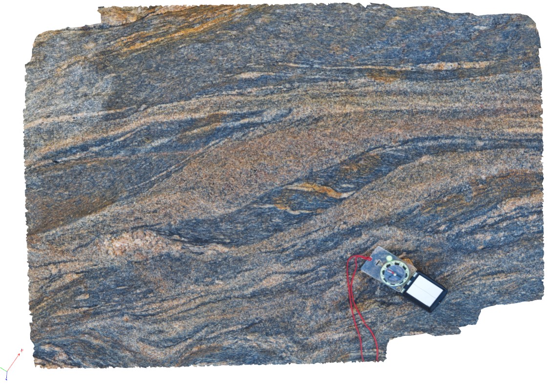
3D |
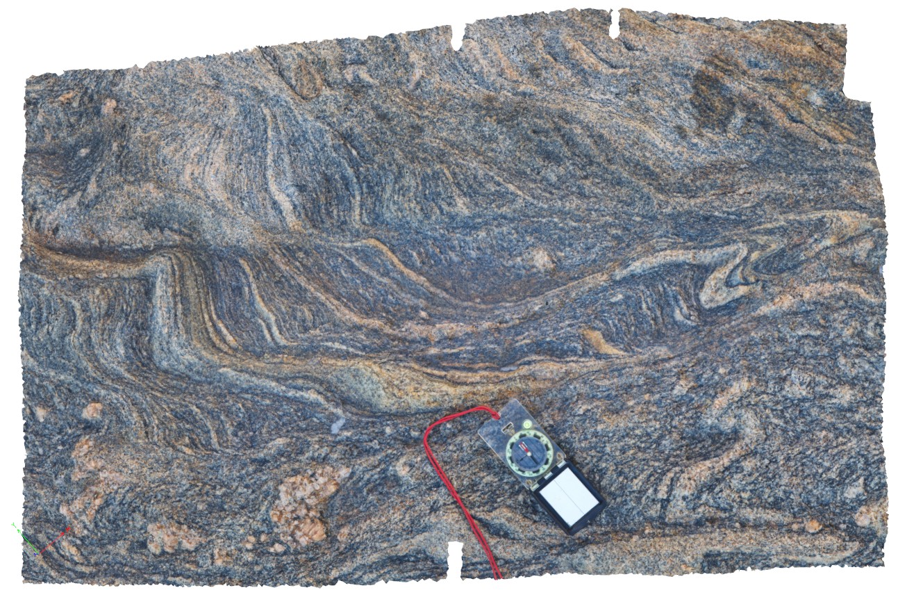
detail of fine banding, folding and shearing in gneiss from site CapeArid1. Cape Arid, W.A. |
1.00 |
-33.93373000000 |
123.32534000000 |
-9999.000 |
gneiss, fold, shear |
gneiss |
CapeArid3 Map
 |
0 |
06/05/2016 10:33 a.m. |
3D |
sheared gneissic layering with leucosomes in shear zones. Cape Arid, W.A. |
0.80 |
-33.93375000000 |
123.32533000000 |
-9999.000 |
shear zone, leucosome, gneissic layering |
gneiss |