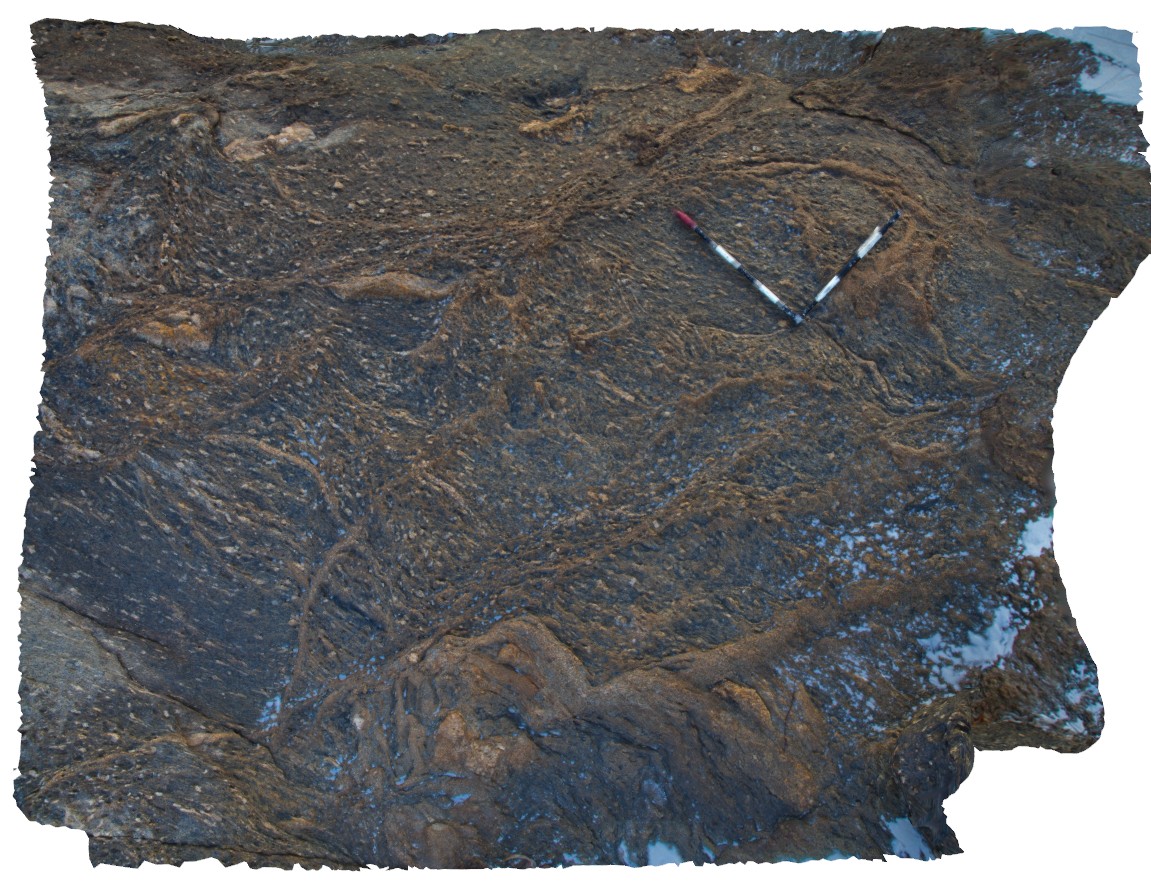
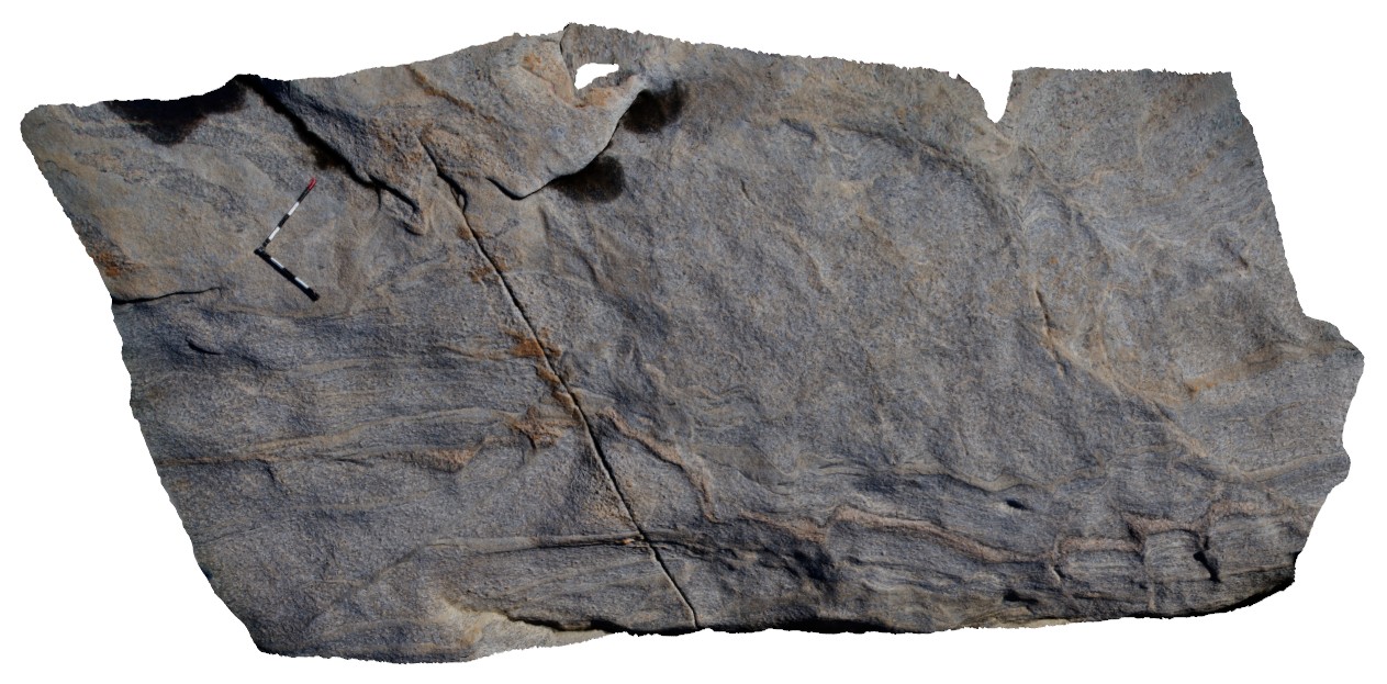
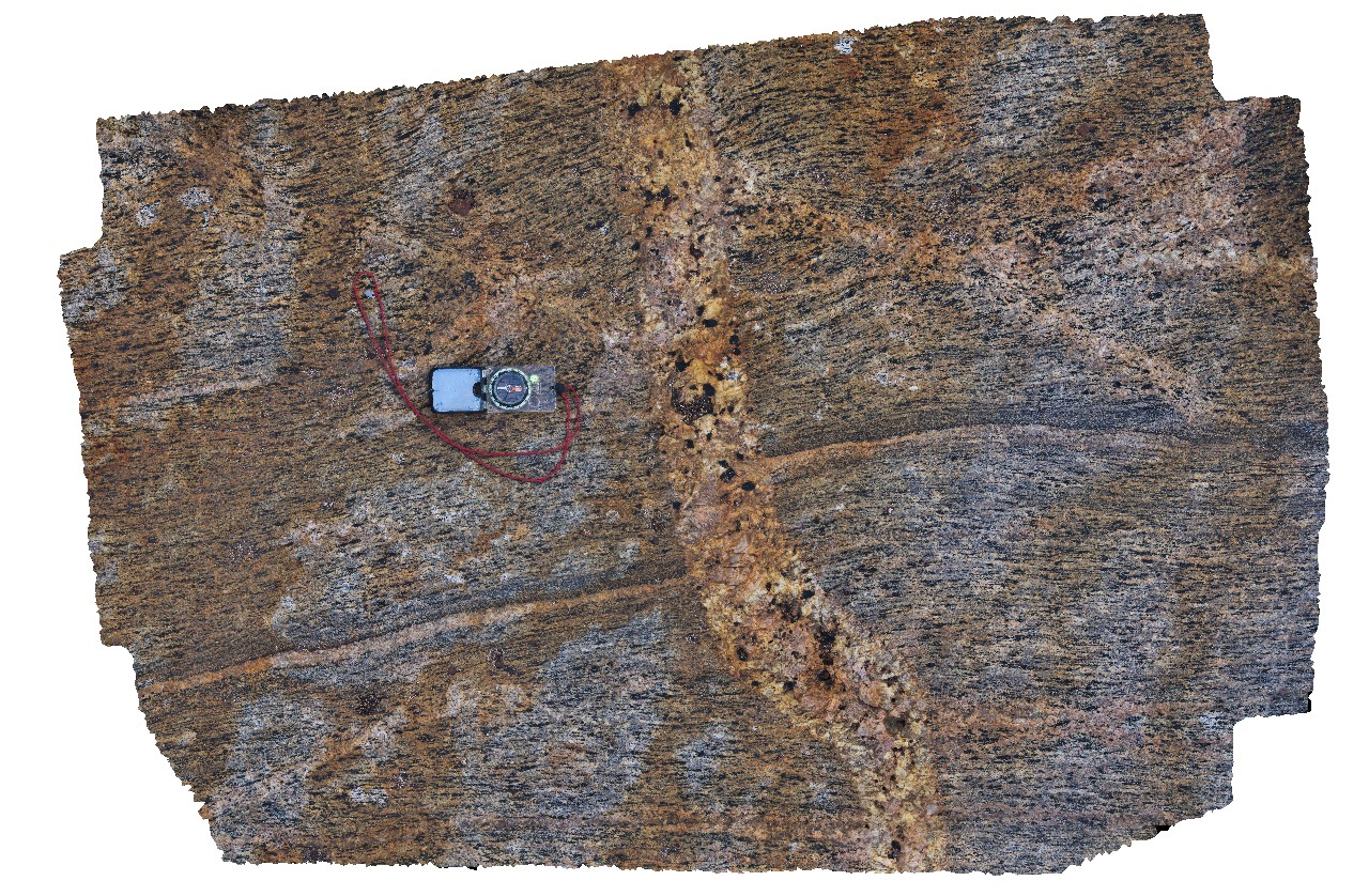
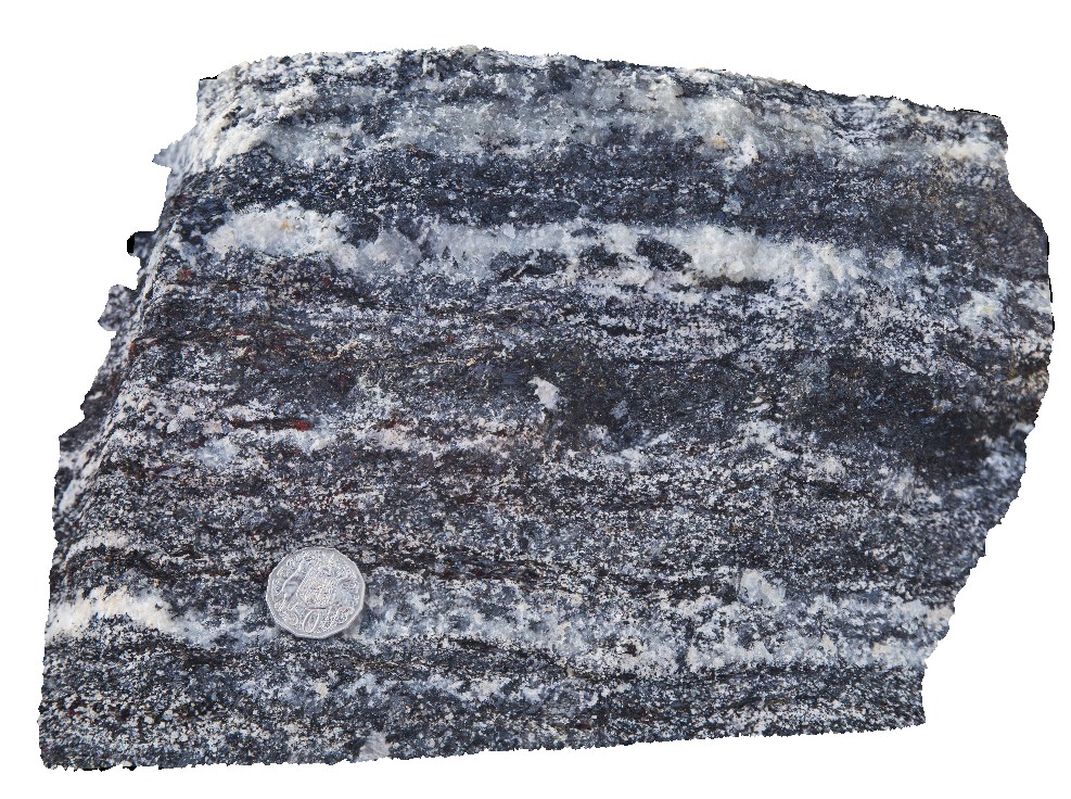
CapeArid4 Map
 |
0 |
06/05/2016 10:33 a.m. |
3D |
sheared augen gneiss with leucosomes in shear zone, Cape Arid, W.A. |
3.20 |
-33.93375000000 |
123.32542000000 |
-9999.000 |
leucosomes, augen gneiss, shear zone |
gneiss |
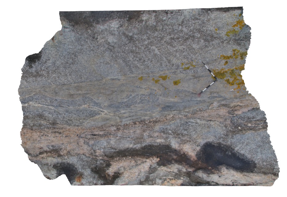
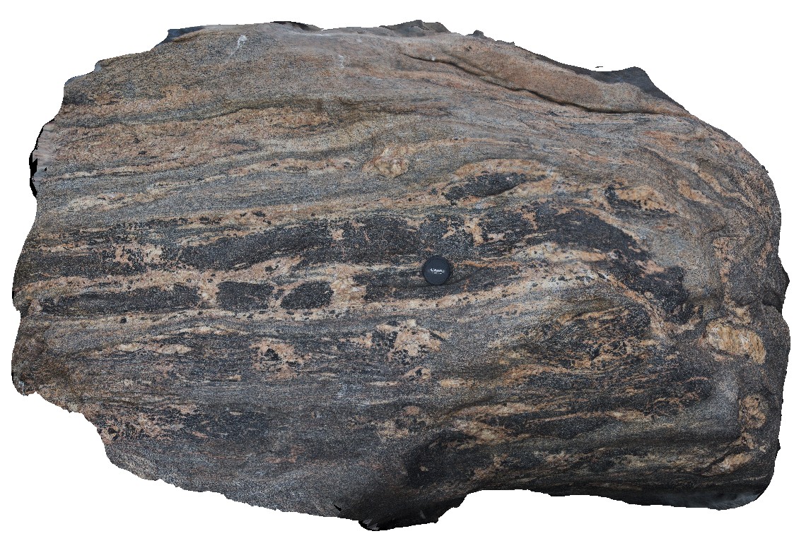
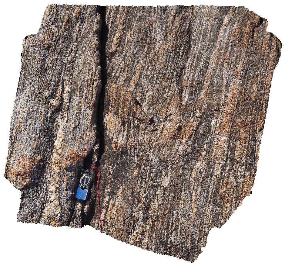
CapeArid5 Map
 |
0 |
06/05/2016 10:34 a.m. |
3D |
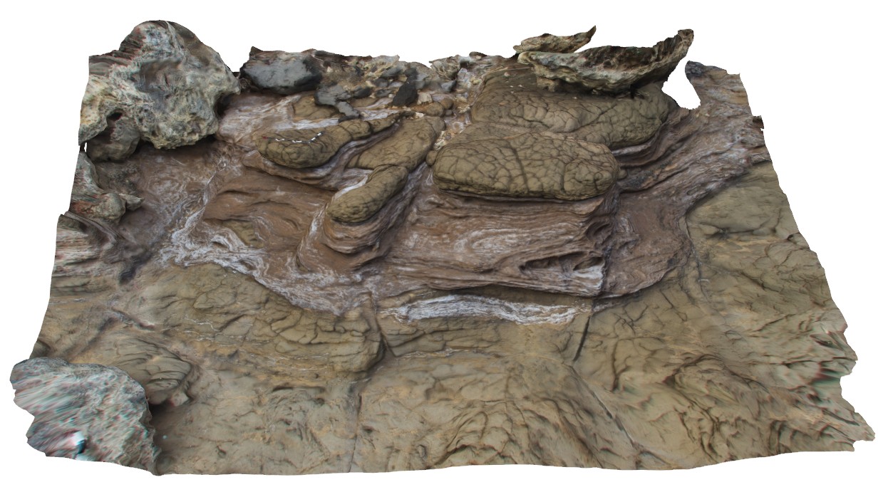
view of disharmonic folds in gneissic rocks, Cape Arid, W.A. Use in conjunction with image CapeAridUAV1. |
4.50 |
-33.90518000000 |
123.35397000000 |
-9999.000 |
disharmonic folds, gneiss |
gneiss |
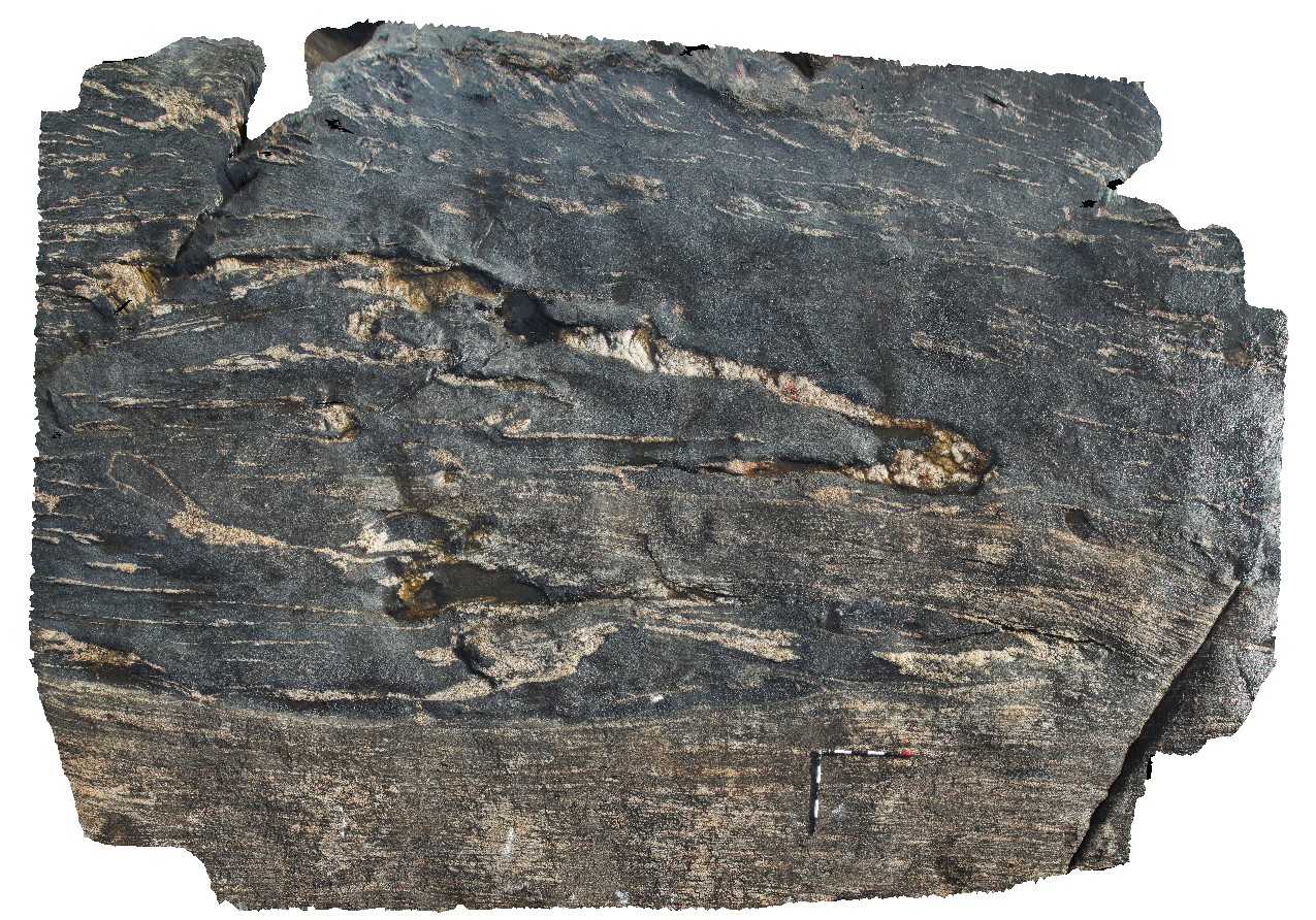
CapeArid6 Map
 |
0 |
06/05/2016 10:34 a.m. |
3D |
folded and sheared mafic enclave and leucosomes in gneiss. Cape Arid, W.A. Use image in conjunction with CapeAridVAV1. |
5.50 |
-33.90528000000 |
123.35400000000 |
-9999.000 |
mafic gneiss, shear zone, leucosome |
gneiss |
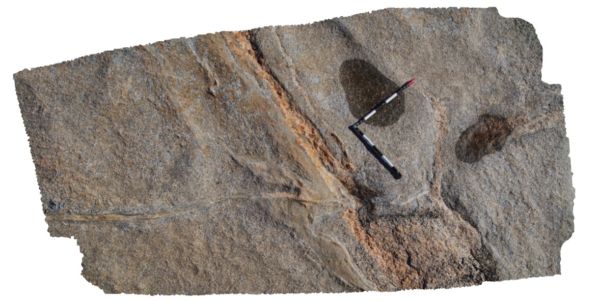
CapeArid7 Map
 |
0 |
06/05/2016 10:34 a.m. |
3D |
mafic enclave, sheared and cut by late stage pegmatite vein. Cape Arid, W.A. |
0.00 |
-33.90616000000 |
123.35374000000 |
-9999.000 |
mafic gneiss, pegmatite vein, shear |
gneiss |
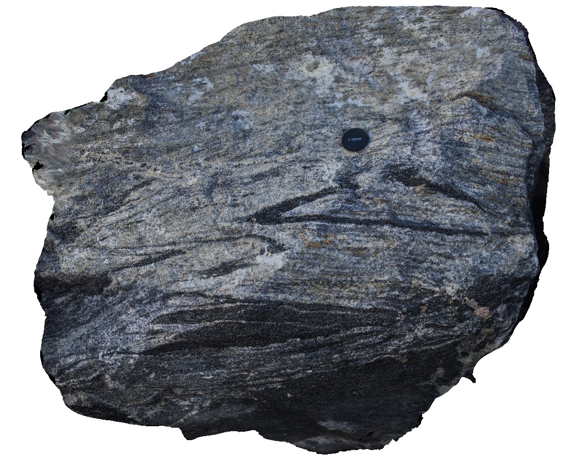
CapeArid8 Map
 |
0 |
06/05/2016 10:34 a.m. |
3D |
folded and sheared gneissic layering and leucosomes. Cape Arid. W.A. |
0.00 |
-33.90670000000 |
123.35329000000 |
-9999.000 |
shear, fold, leucosomes, gneissic layering |
gneiss |
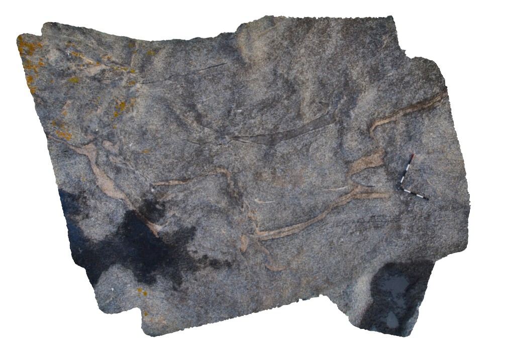
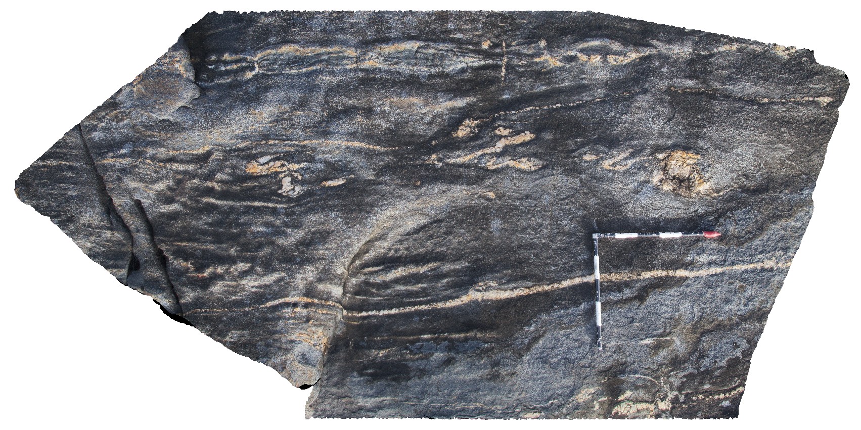
CapeArid9 Map
 |
0 |
06/05/2016 10:35 a.m. |
3D |
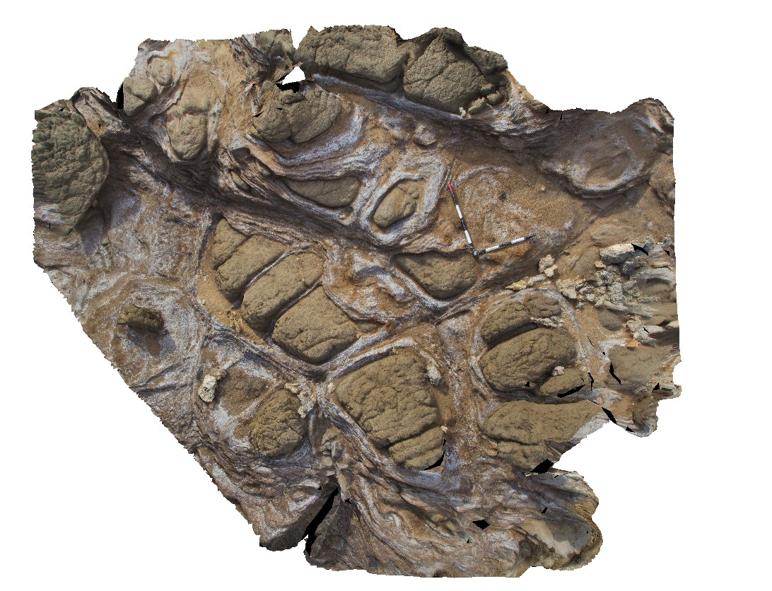
shear zone and cross cutting leucocratic zone, crosscut by late stage pegmatite dyke. Cape Arid, W.A. |
3.00 |
-33.90596000000 |
123.35376000000 |
-9999.000 |
shear zone, leucocratic zone, pegmatite dyke |
gneiss |
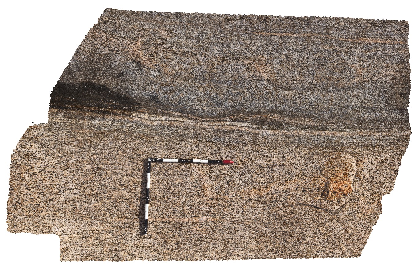
CapeAridUAV1 Map
 |
0 |
06/05/2016 10:37 a.m. |
UAV |
aerial view of gneissic rocks with thick compositional layering and shears. Cape Arid, W.A. |
0.00 |
-33.90596000000 |
123.35376000000 |
-9999.000 |
gneiss, shear, compositional layering |
gneiss |
CapeAridUAV2 Map
 |
20 |
01/01/9999 midnight |
UAV |
aerial view of folded pegmatite and gneissic layers. Cape Arid, W.A. |
200.00 |
-33.90626600000 |
123.35366500000 |
5.800 |
pegmatite, gneiss |
gneiss, pegmatite |
CapeAridUAV3 Map
 |
0 |
01/01/9999 midnight |
UAV |
aerial view of folded and sheared gneissic layering and leucosomes, Cape Arid. W.A. |
8.00 |
-33.90668000000 |
123.35332000000 |
-9999.000 |
fold, shear |
gneiss |
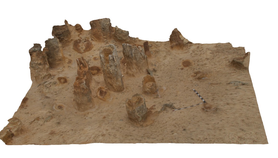
CapeBridgewater1 Map
 |
0 |
06/05/2016 10:37 a.m. |
3D |
view of column-like solution tubes in calcareous aeolian sands. Cape Bridgewater, Vic. |
3.00 |
-38.38243000000 |
141.37041000000 |
-9999.000 |
solution tubes, aeolian sand |
aeolian sand |
CapeBridgewater2 Map
 |
0 |
06/05/2016 10:38 a.m. |
3D |
view of solution tubes in aeolian sand. Cape Bridgewater, Vic. |
3.20 |
-38.38239000000 |
141.37033500000 |
-9999.000 |
solution tubes, aeolian sand |
aeolian sand |
CapeBridgewater3 Map
 |
0 |
06/05/2016 10:38 a.m. |
3D |
view of solution tubes in cross bedded aeolian sand. Cape Bridgewater, Vic. |
4.20 |
-38.38137000000 |
141.36914000000 |
-9999.000 |
solution tubes, cross bedding, aeolian sandstone |
sandstone |
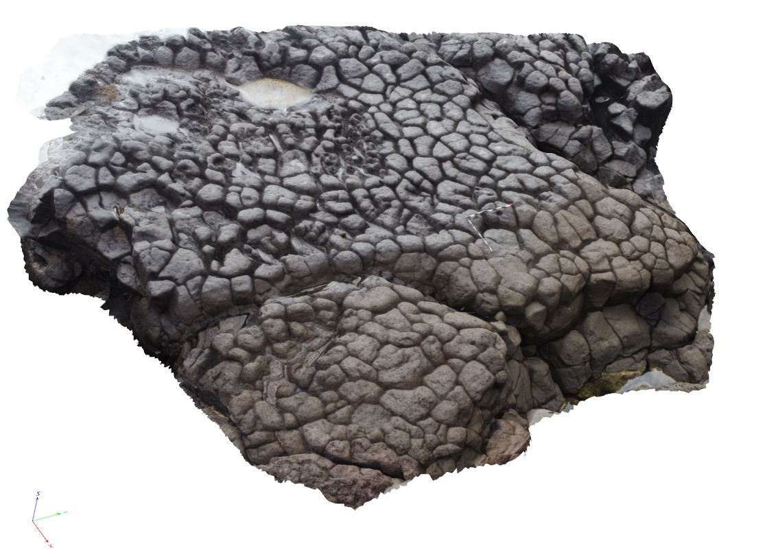
CapeBridgewater4 Map
 |
0 |
06/05/2016 10:38 a.m. |
3D |
view down and into the top of a columnar jointed vesicular basalt flow, Cape Bridgewater, Vic. |
5.00 |
-38.37889000000 |
141.36603000000 |
-9999.000 |
columnar basalt, igneous textures, basalt flow top |
basalt |
CapeBridgewater5 Map
 |
0 |
06/05/2016 10:39 a.m. |
3D |
unconformity (nonconformity) between basalt and overlying tufa. Tufa has large blocks of embedded basalt. Cape Bridgewater, Vic. |
5.50 |
-38.37716000000 |
141.36572000000 |
-9999.000 |
Tufa, basalt, nonconformity |
basalt, Tufa |
CapeBridgewater6 Map
 |
0 |
06/05/2016 10:39 a.m. |
3D |
unconformity (nonconformity) between basalt and overlying tufa, with view of embedded basalt blocks. Cape Bridgewater, Vic. |
4.50 |
-38.37700000000 |
141.36563000000 |
-9999.000 |
tufa, basalt block, igneous textures, nonconformity |
basalt, tufa |
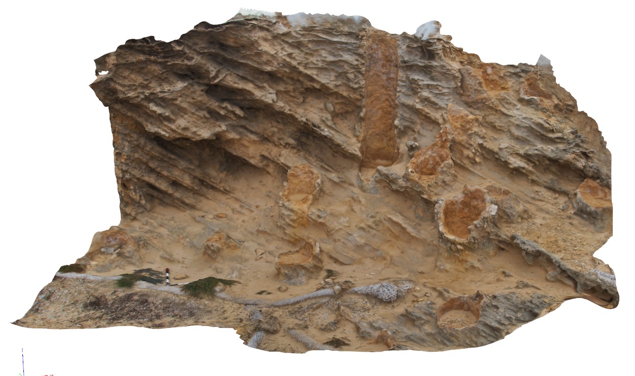
CapeBridgewater7 Map
 |
0 |
06/05/2016 10:39 a.m. |
3D |
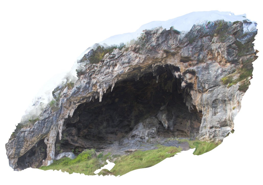
view of cave in Pleistocene, cross-bedded, calcareous sandstone? Cape Bridgewater, Vic. |
15.00 |
-38.31846000000 |
141.40782000000 |
-9999.000 |
cave, calcareous sandstone |
sandstone |
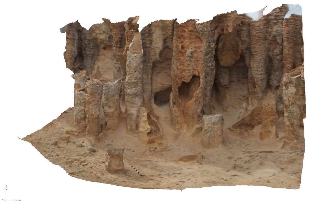
CapeBridgewater8 Map
 |
0 |
06/05/2016 10:39 a.m. |
3D |
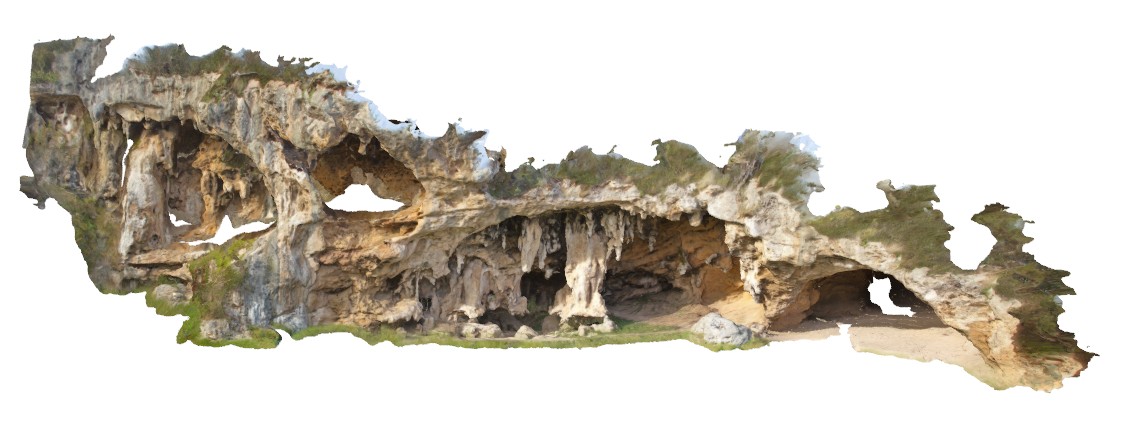
view of cave complex in Pleistocene, cross-bedded, calcareous sandstone?, with stalactites and stalagmites. Cape Bridgewater, Vic. |
18.00 |
-38.31902000000 |
141.40817000000 |
-9999.000 |
cave, calcareous sandstone, stalactites, stalagmites |
sandstone |
CapeLeeuwin1 Map
 |
0 |
05/14/2016 noon |
3D |
granitic gneiss cut by pegmatite dyke. Cape Leeuwin, W.A. |
1.50 |
-34.37218000000 |
115.13711000000 |
-9999.000 |
banded gneiss, pegmatite dyke |
gneiss, pegmatite |
CapeLeeuwin10 Map
 |
0 |
05/15/2016 noon |
3D |
folded and disaggregated early pegmatite leucosomes in amphibolite. Cape Leeuwin, W.A. |
3.00 |
-34.36848000000 |
115.15424000000 |
-9999.000 |
fold, leucosome, amphibolite, structure |
amphibolite |
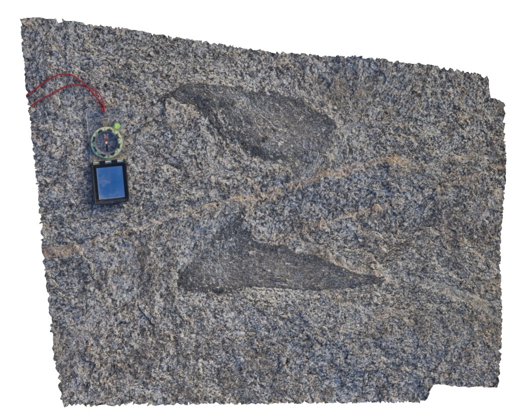
CapeLeeuwin11 Map
 |
0 |
05/15/2016 noon |
3D |
boulder of folded gneiss and amphibolite with boudinaged amphibolite. Cape Leeuwin, W.A. |
1.00 |
-34.36802000000 |
115.15259000000 |
-9999.000 |
boudinage, structure |
amphibolite |
CapeLeeuwin12 Map
 |
0 |
05/15/2016 noon |
3D |
tightly folded biotite-rich layers in gneiss boulder in sea break wall. Cape Leeuwin, W.A. |
1.00 |
-34.36501000000 |
115.16736000000 |
-9999.000 |
fold, structure, gneiss |
amphibole gneiss |
CapeLeeuwin13 Map
 |
0 |
05/15/2016 noon |
3D |
detail of biotite-hornblende rich layers in gneiss boulder on sea break wall. Also present are blebs and stringers of sulphide, possibly Cpy. Cape Leeuwin, W.A. |
0.40 |
-34.35521000000 |
115.16705000000 |
-9999.000 |
hornblende gneiss, metamorphic, sulphide |
gneiss |
CapeLeeuwin2 Map
 |
0 |
05/14/2016 noon |
3D |
banded granitic gneiss, with boudinaged gneissic layering. Cape Leeuwin, W.A. |
2.50 |
-34.37584000000 |
115.13730000000 |
-9999.000 |
banded gneiss, boudinage, structure |
gneiss |
CapeLeeuwin3 Map
 |
0 |
05/14/2016 noon |
3D |
Tightly folded contact between mafic and felsic gneiss, Cape Leeuwin, W.A. |
6.50 |
-34.35695000000 |
115.12878000000 |
-9999.000 |
geological contact, gneiss, fold |
gneiss |
CapeLeeuwin4 Map
 |
0 |
05/14/2016 noon |
3D |
tightly / isoclinal folded leucosomes in coarsely banded gneiss. Cape Leeuwin, W.A. |
1.30 |
-34.35671000000 |
115.12875000000 |
-9999.000 |
isoclinal fold, leucosome, banded gneiss |
gneiss |