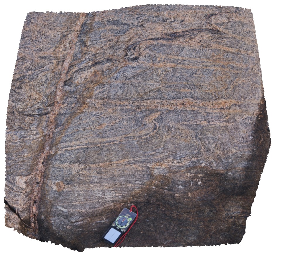
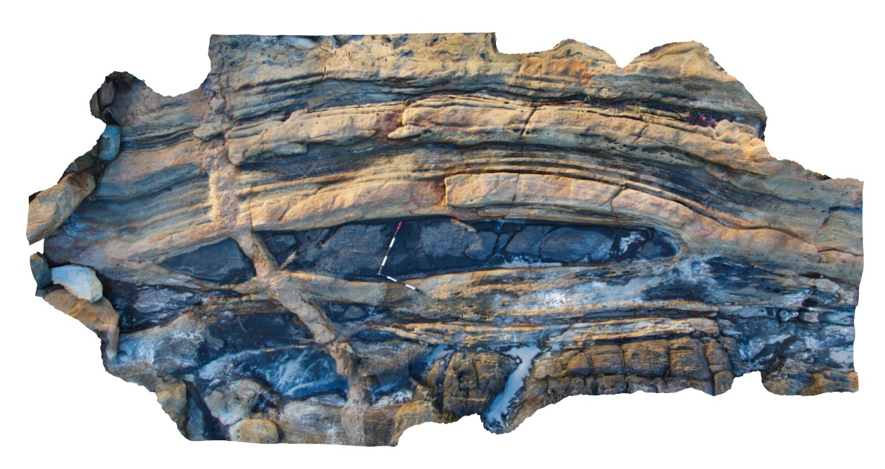
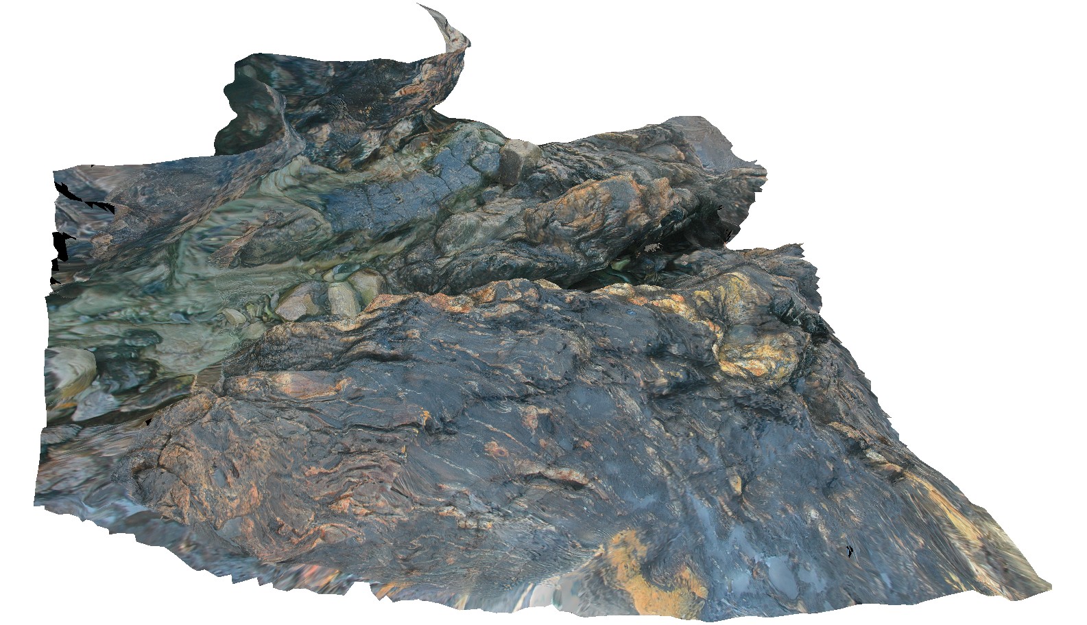
CapeLeeuwin5 Map
 |
0 |
05/14/2016 noon |
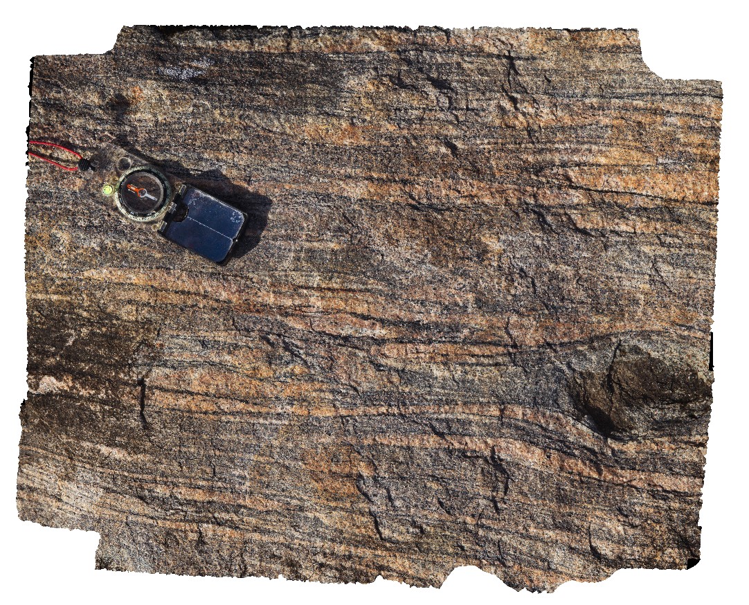
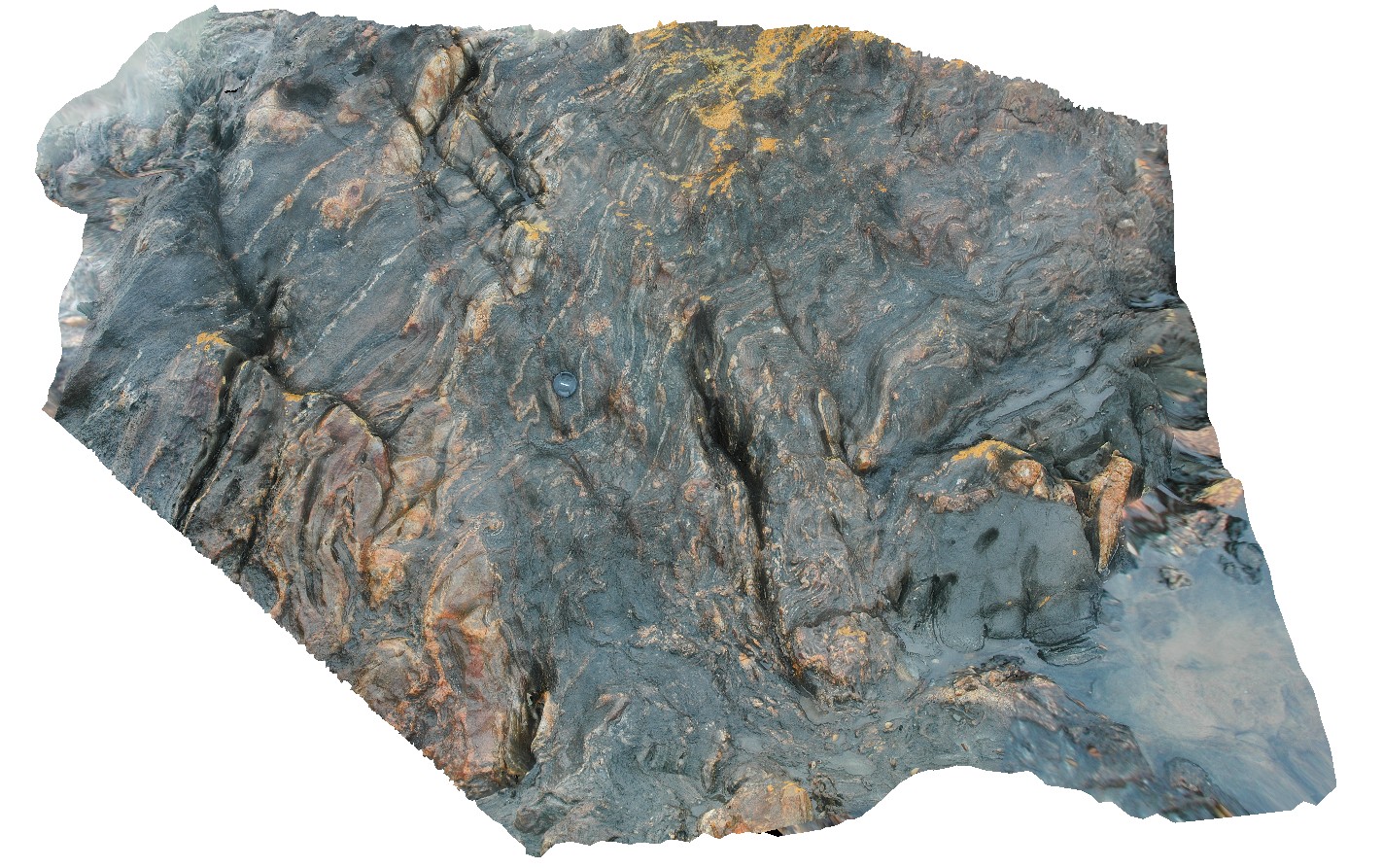
3D |
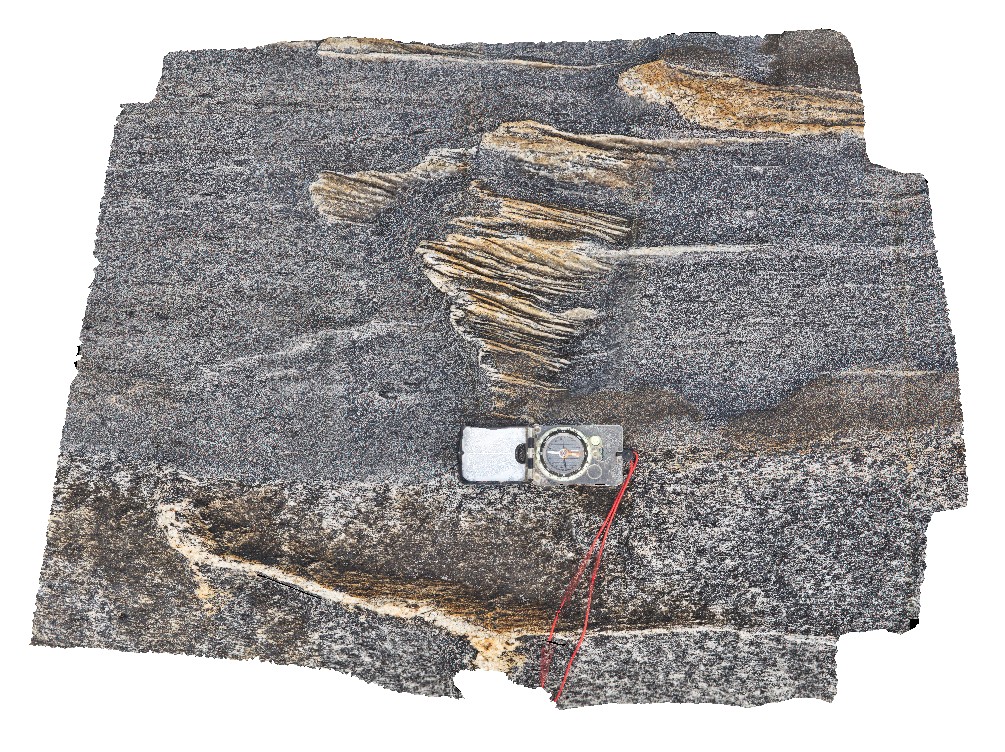
detailed view of isoclinal folded leucosomes in coarsely banded gneiss. Cape Leeuwin, W.A. |
0.80 |
-34.35674000000 |
115.12876000000 |
-9999.000 |
isoclinal fold, leucosome, gneiss, structure |
gneiss |
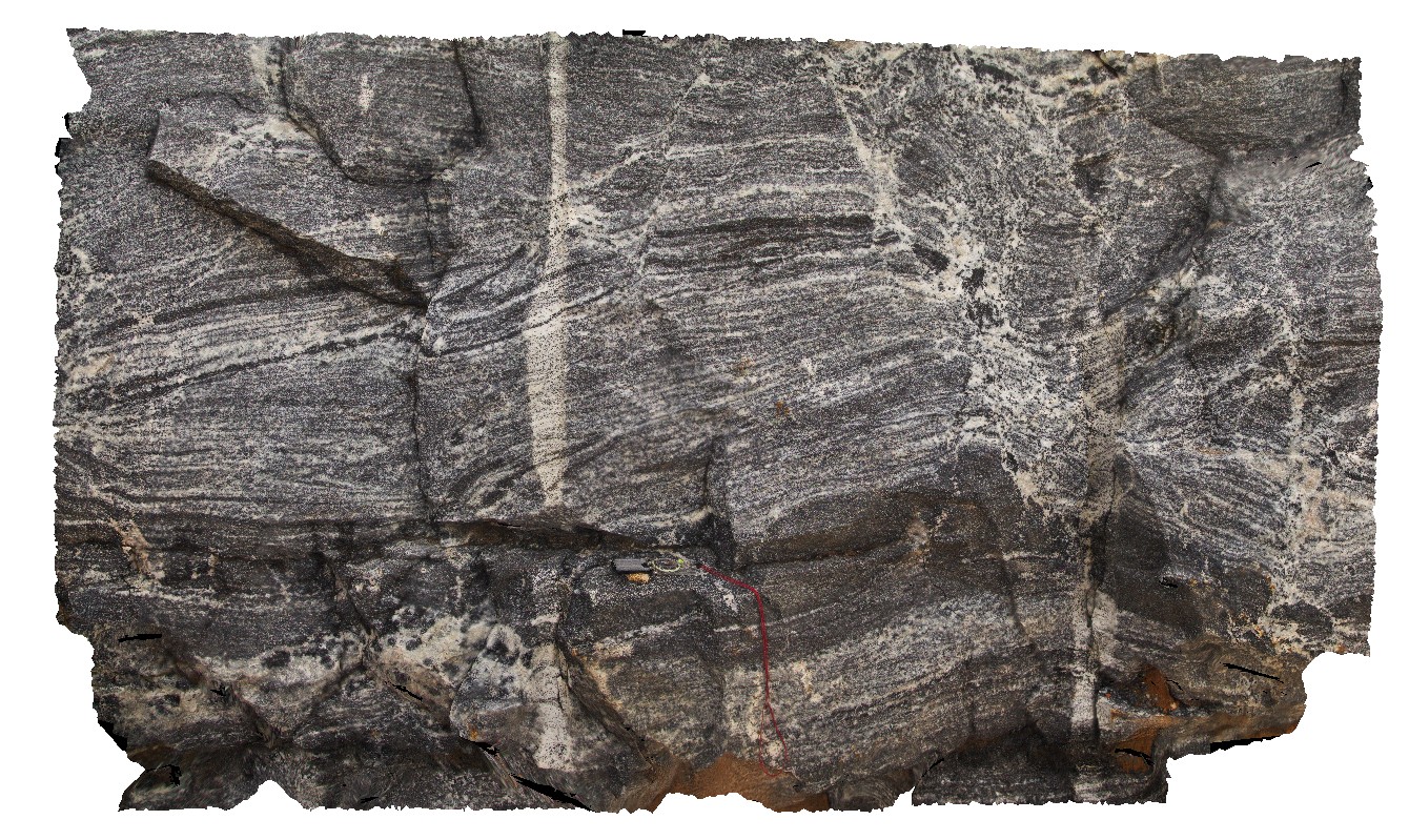
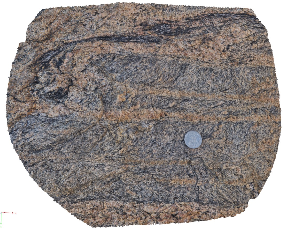
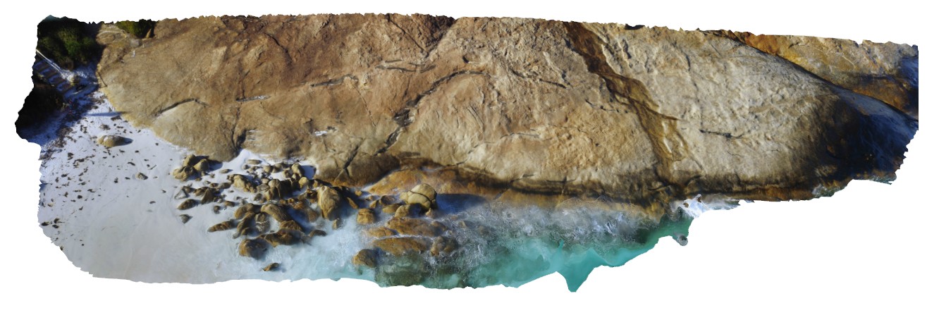
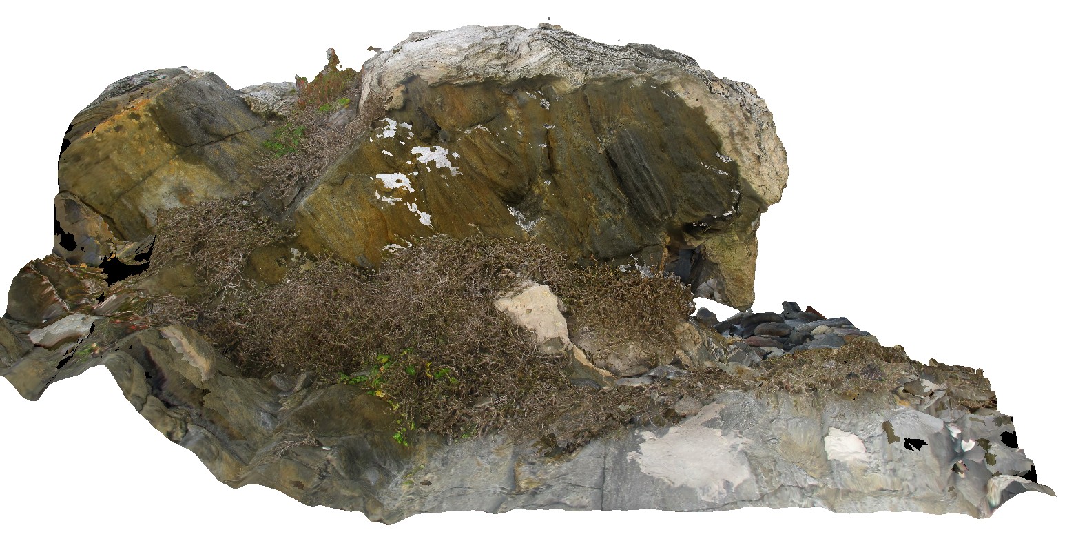
CapeLeeuwin6 Map
 |
0 |
05/14/2016 noon |
3D |
unconformity between gneiss and overlying Quaternary aeolian, bedded beach? Deposits. Cape Leeuwin, W.A. |
24.00 |
-34.35586000000 |
115.12827000000 |
-9999.000 |
geological unconformity, aeolian deposit, gneiss |
gneiss, limestone |
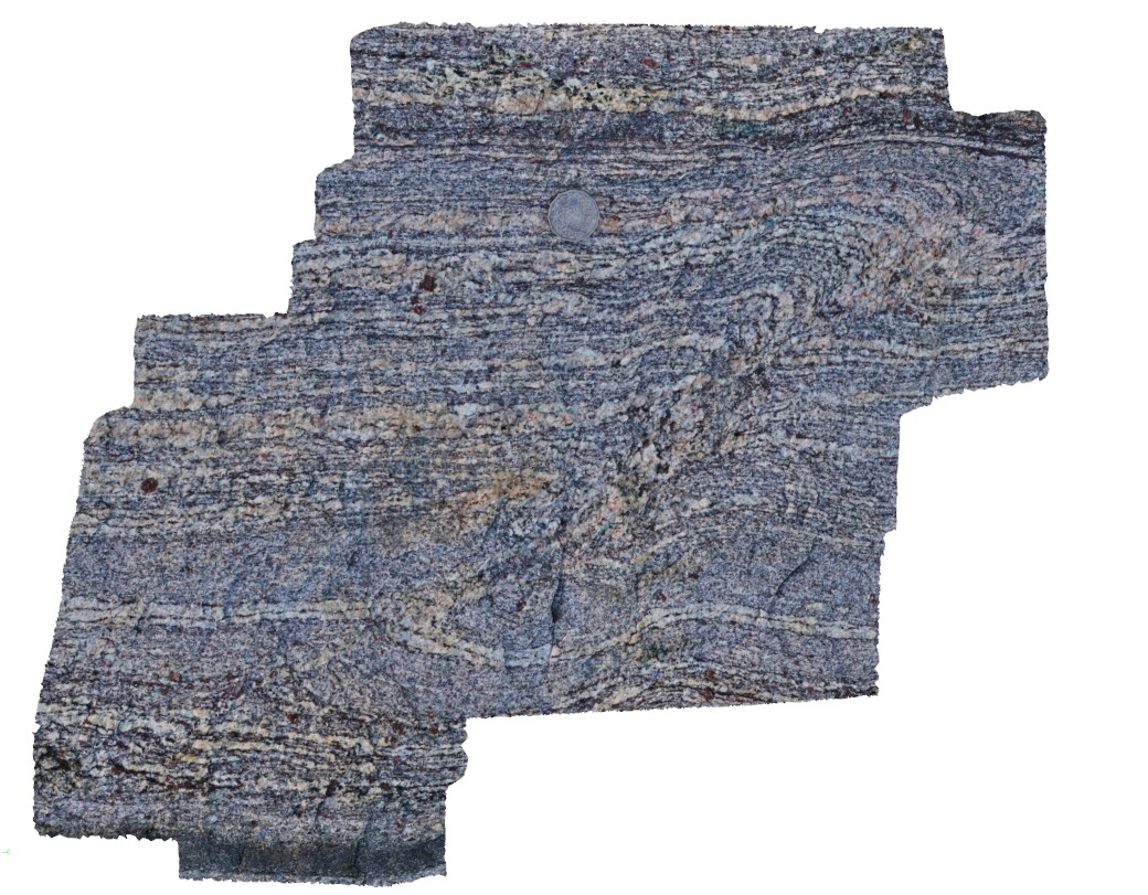
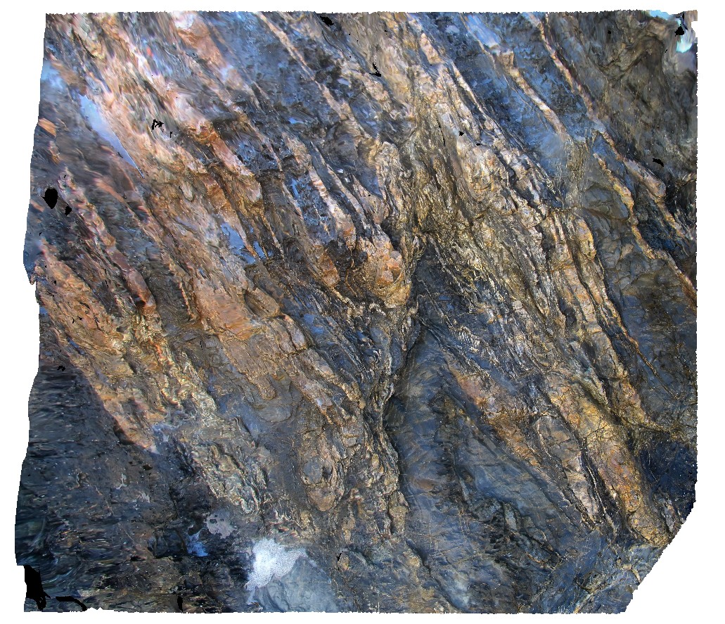
CapeLeeuwin7 Map
 |
0 |
05/14/2016 noon |
3D |
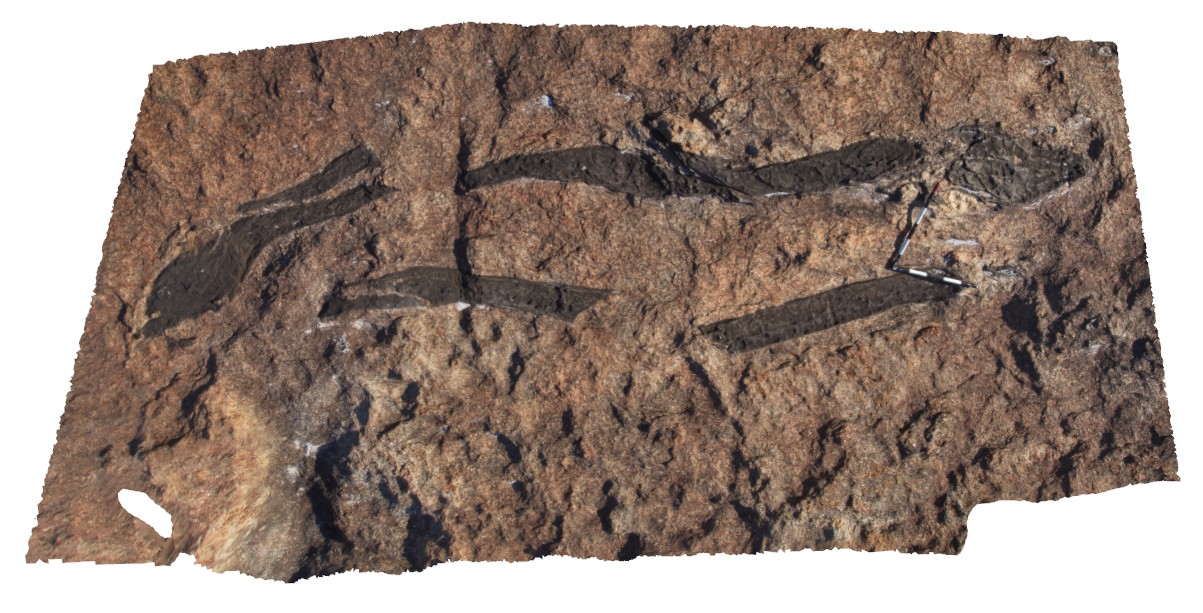
folded Biotite gneiss cut by quartz-biotite 'vein' network. Cape Leeuwin, W.A. |
2.00 |
-34.35340000000 |
115.16620000000 |
-9999.000 |
biotite gneiss, metamorphic |
gneiss |
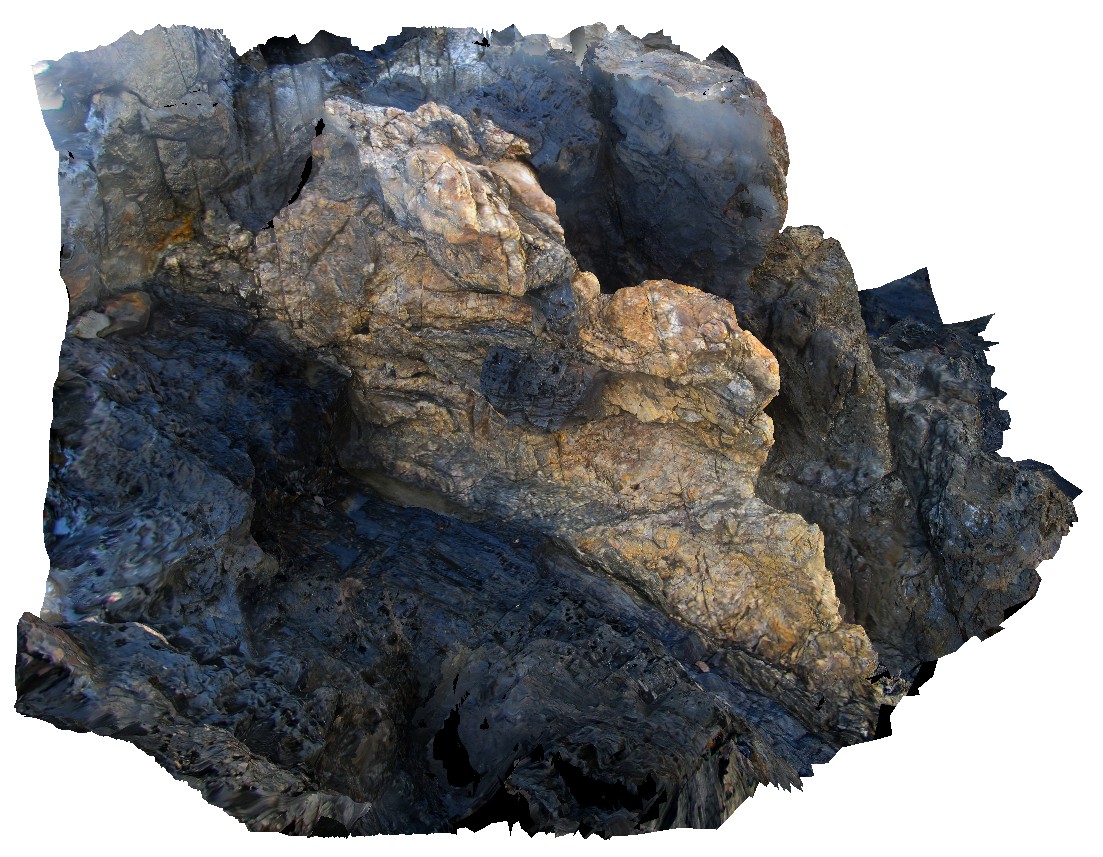
CapeLeeuwin8 Map
 |
0 |
05/15/2016 noon |
3D |
boudinaged pegmatite body in granitic gneiss. Cape Leeuwin, W.A. |
3.00 |
-34.36815000000 |
115.15273000000 |
-9999.000 |
boudinage, pegmatite, structure |
granitic gneiss |
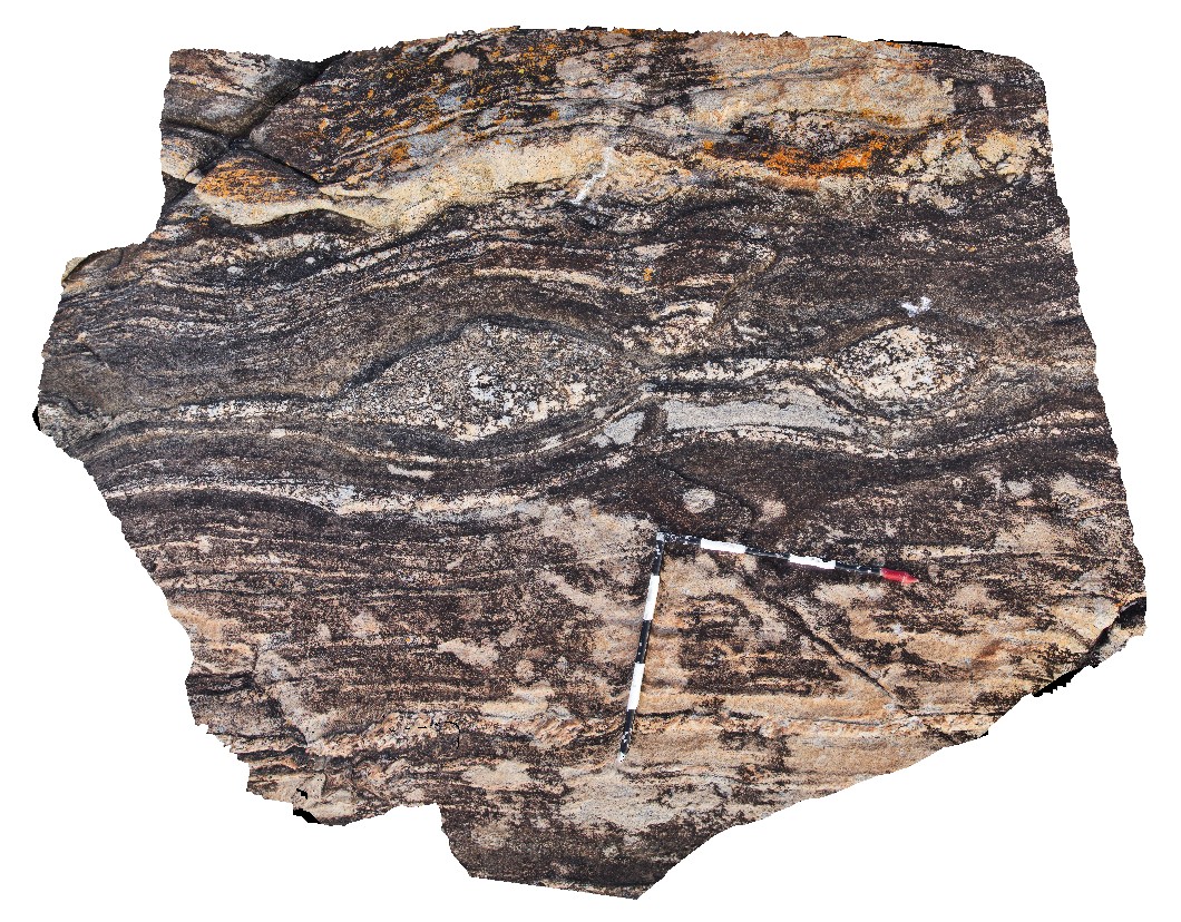
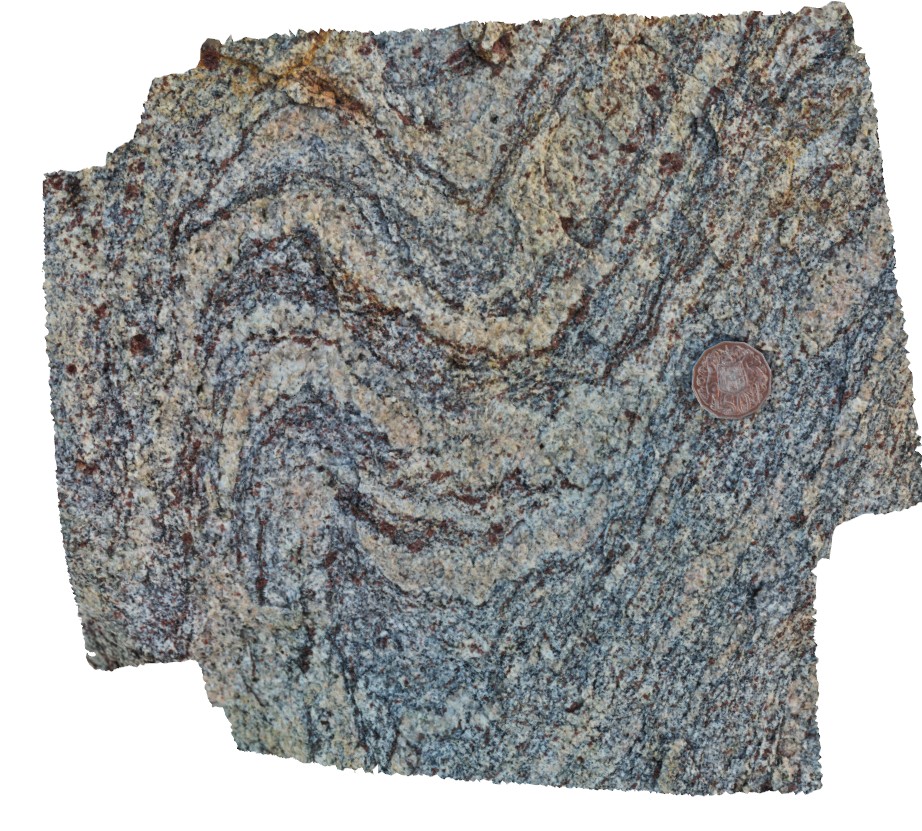
CapeLeeuwin9 Map
 |
0 |
05/15/2016 noon |
3D |
ptygmatic folding of quartz leucosome vein in 'amphibolite'. Lineation highlighted by amphibole orientation. Cape Leeuwin, W.A. |
0.90 |
-34.36853000000 |
115.15380000000 |
-9999.000 |
ptygmatic folding, leucosome, amphibole lineation |
gneiss |
CapeLeGrande1 Map
 |
0 |
06/05/2016 10:39 a.m. |
3D |
isoclinal folded amphibolite layer in granitic gneiss. Cape Le Grande. W.A |
3.60 |
-34.00407000000 |
122.16869000000 |
-9999.000 |
amphibolite enclave, gneiss |
gneiss |
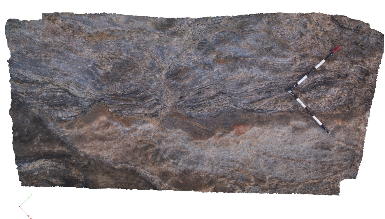
CapeLeGrande2 Map
 |
0 |
06/05/2016 10:39 a.m. |
3D |
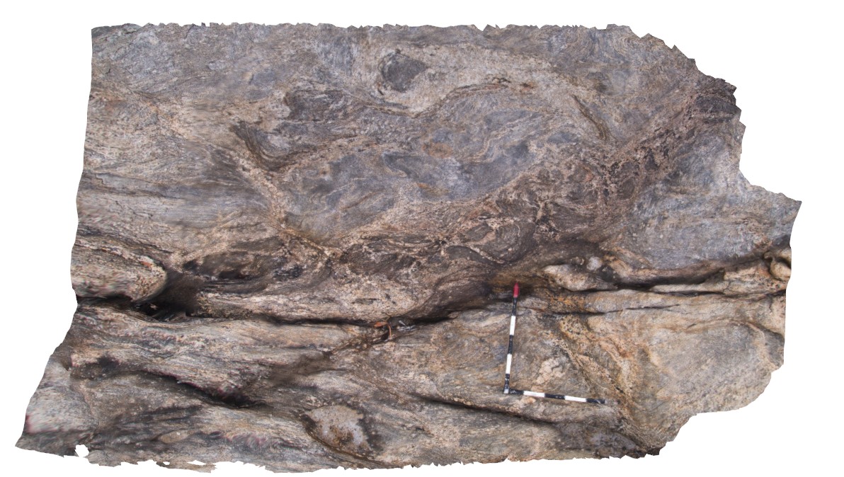
complex folding of gneissic layering and leucosomes in gneiss. Cape Le Grande, south coast W.A. |
3.30 |
-34.00437000000 |
122.16872000000 |
-9999.000 |
folding, leucosome, gneiss, structure |
gneiss |
CapeLeGrande3 Map
 |
0 |
06/05/2016 10:40 a.m. |
3D |
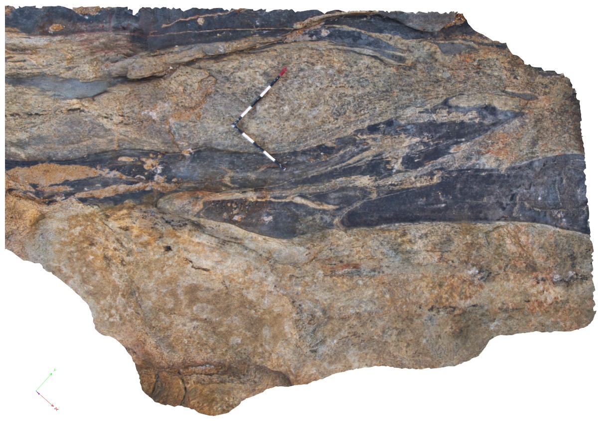
disaggregated mafic dyke in banded gneiss with cross cutting late shear and pegmatite vein. Cape Le Grande, south coast W.A. |
2.70 |
-34.00446000000 |
122.16902000000 |
-9999.000 |
mafic dyke, shear, structure |
gneiss, mafic |
CapeLeGrande4 Map
 |
0 |
06/05/2016 10:40 a.m. |
3D |
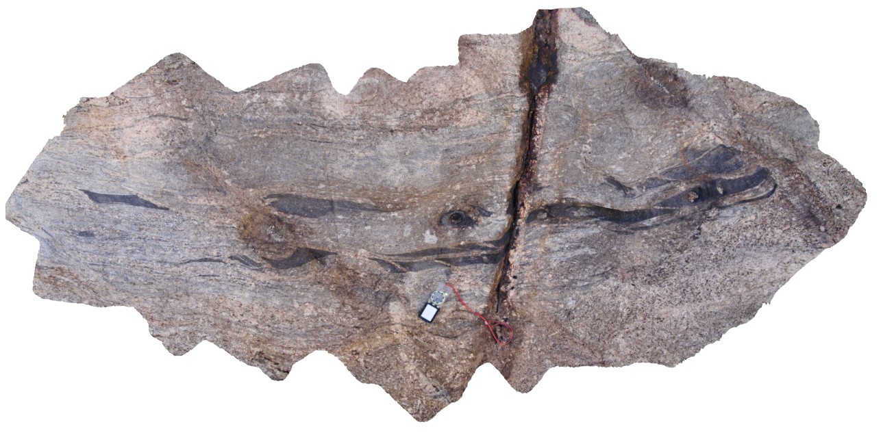
view of gneiss, exhibiting 2 generations of folded leucosomes and shearing with cross cutting pegmatite dyke. Cape Le Grande, south coast, W.A. |
0.80 |
-34.00441000000 |
122.16897000000 |
-9999.000 |
leucosome, multiple deformation events, shear, structure |
gneiss |
CapeLeGrande5 Map
 |
0 |
06/05/2016 10:40 a.m. |
3D |
detail of site CapeLeGrande4, showing shear fabrics and leucosomes. Cape Le Grande, south coast W.A. |
0.45 |
-34.00441000000 |
122.16897000000 |
-9999.000 |
shear fabric, leucosome, structure |
gneiss |
CapeLeGrande6 Map
 |
0 |
06/05/2016 10:41 a.m. |
3D |
view of boudinaged gneissic layering. Cape Le Grande, south coast W.A. |
3.00 |
-34.00442000000 |
122.16874000000 |
-9999.000 |
boudinage, gneiss, structure |
gneiss |
CapeLeGrande7 Map
 |
0 |
06/10/2016 12:46 p.m. |
3D |
view of disaggregated / boudinaged? mafic dyke in gneiss. Cape Le Grande, south coast W.A. |
5.00 |
-34.00386000000 |
122.16887000000 |
-9999.000 |
disaggregated, structure |
gneiss, mafic |
CapeLeGrande8 Map
 |
0 |
06/06/2016 2:59 p.m. |
3D |
view of disaggregated dykes in gneiss. Cape Le Grande, south coast W.A. |
5.00 |
-34.00378000000 |
122.16901000000 |
-9999.000 |
disaggregated, structure |
gneiss, mafic |
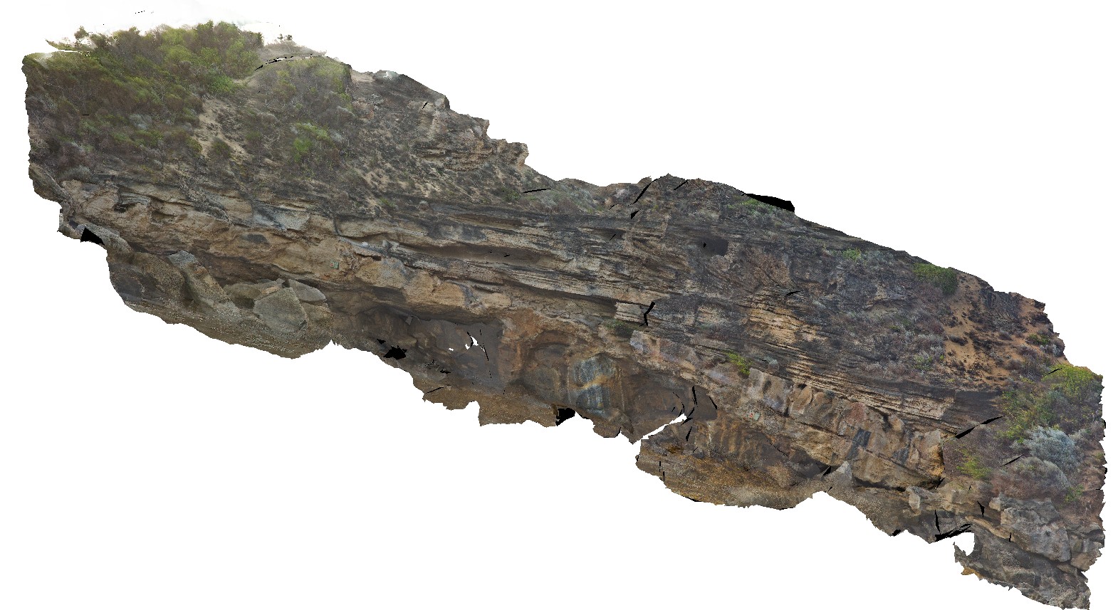
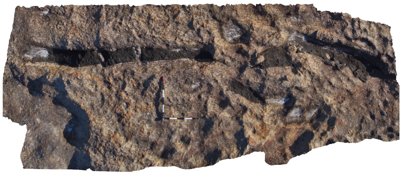
CapeLeGrandeFSP1 Map
 |
0 |
06/05/2016 10:42 a.m. |
FSP |
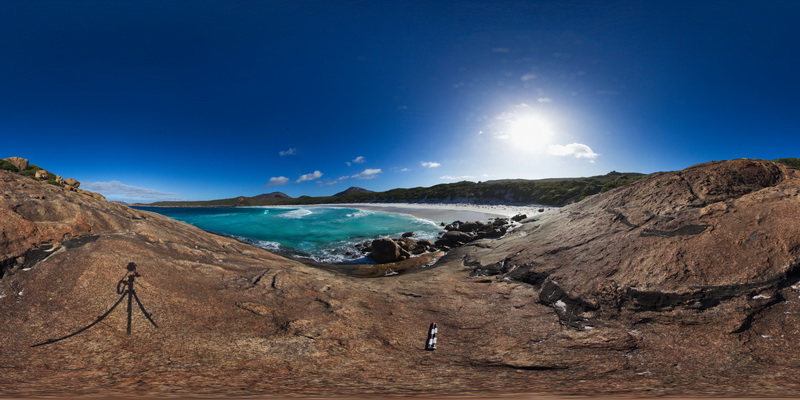
shoreline exposure, showing disaggregated mafic dykes in gneiss and surrounding coast. Cape Le Grande, south coast W.A. |
1000.00 |
-34.00378000000 |
122.16893000000 |
-9999.000 |
disaggregated, structure |
gneiss, mafic |
CapeLeGrandeFSP2 Map
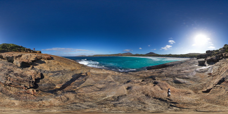 |
0 |
06/05/2016 10:42 a.m. |
FSP |
shoreline exposure, showing disaggregated mafic dykes in gneiss and surrounding coast. Cape Le Grande, south coast W.A. |
1000.00 |
-34.00409000000 |
122.16869000000 |
-9999.000 |
disaggregated mafic dyke, structure |
gneiss, mafic |
CapeLeGrandeFSP3 Map
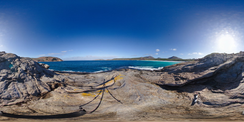 |
0 |
06/05/2016 10:42 a.m. |
FSP |
shoreline exposure, showing layered gneiss and surrounding coast. Cape Le Grande, south coast W.A. |
1000.00 |
-34.00441000000 |
122.16879000000 |
-9999.000 |
gneiss |
gneiss |
CapeLeGrandeUAV1 Map
 |
0 |
01/01/9999 midnight |
UAV |
aerial view of disaggregated mafic dykes in gneiss, Cape Le Grande. South coast W.A. |
100.00 |
-34.00378000000 |
122.16901000000 |
-9999.000 |
disaggregated mafic dyke, gneiss |
gneiss, mafic |
CapeRiche1 Map
 |
0 |
06/05/2016 10:44 a.m. |
3D |
garnet-bearing, banded gneiss with small cross cutting shear. Cape Riche, W.A. |
0.60 |
-34.59777000000 |
118.75500000000 |
-9999.000 |
garnet gneiss, shear, structure |
garnet gneiss |
CapeRiche2 Map
 |
0 |
06/05/2016 10:44 a.m. |
3D |
folded layers in garnet-bearing gneiss, Cape Riche, W.A. |
0.35 |
-34.59782000000 |
118.75497000000 |
-9999.000 |
garnet gneiss, fold, metamorphic, structure |
garnet gneiss |
CapeRiche3 Map
 |
0 |
06/05/2016 10:45 a.m. |
3D |
large mafic boudins cut by late pegmatite dyke, Cape Riche, W.A. |
6.50 |
-34.59695000000 |
118.75183000000 |
-9999.000 |
boudinage, pegmatite dyke, structure |
gneiss |
CapeWickham1 Map
 |
5 |
04/22/2016 9:57 a.m. |
3D |
complex folding in metasediments and felsic dyke. Cape Wickham, King Island. Tasmania. |
2.00 |
-39.59208286000 |
143.92775993000 |
2.000 |
fold, structure |
metasediments |
CapeWickham10 Map
 |
5 |
04/28/2016 10:01 a.m. |
3D |
steeply dipping quartzites / metasediments with unconformably overlying limestone. Cape Wickham, King Island. Tasmania. |
2.00 |
-39.59223806000 |
143.92780547000 |
2.000 |
unconformity, contact |
quartzite, limestone |
CapeWickham12 Map
 |
5 |
04/28/2016 9:44 a.m. |
3D |
folded and faulted metasediments of the Surprise Bay Formation. Cape Wickham, King Island. Tasmania. |
1.00 |
-39.71335720000 |
143.84641330000 |
2.000 |
fold, structure, fault |
metasediments |
CapeWickham13 Map
 |
5 |
04/28/2016 9:36 a.m. |
3D |
sub-vertically dipping metasediments with stratiform felsic dyke. Package has been folded. Cape Wickham, King Island. Tasmania. |
2.00 |
-39.71343221000 |
143.84648864000 |
2.000 |
fold, structure, metasediment |
metasediment, felsic |
CapeWickham3 Map
 |
5 |
04/22/2016 10:15 a.m. |
3D |
polydeformed metasediments with migmatite bands? Cape Wickham, King Island. Tasmania. |
1.00 |
-39.59218250000 |
143.92804483000 |
2.000 |
deformation, migmatite, metasediments |
metasediments |