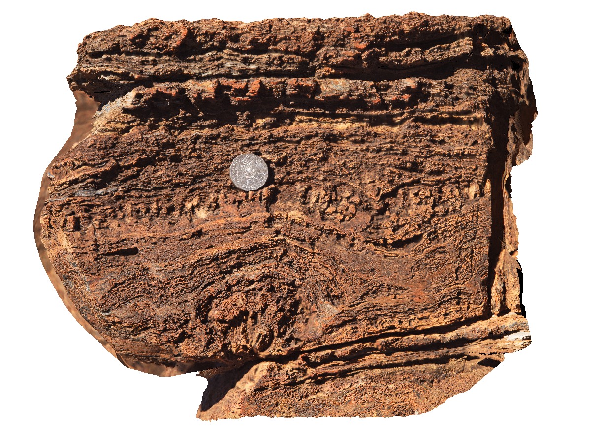
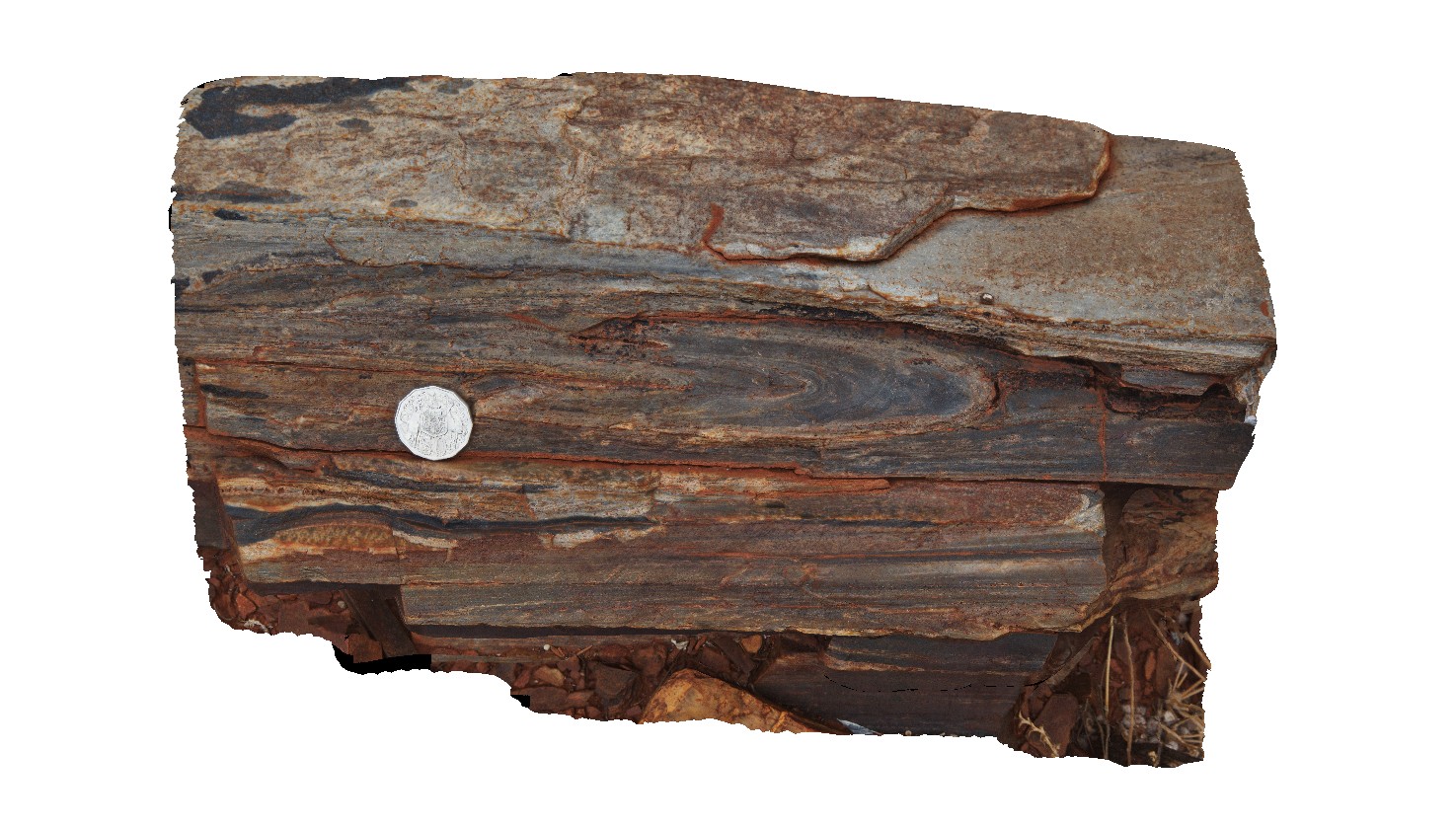
Chichester4 Map
 |
0 |
05/31/2016 noon |
3D |
stromatolite and algal mat layering in Carbonate. Outcrop near the Great Northern Highway, Cooletha Hill, W.A. |
0.40 |
-22.00111000000 |
118.82693000000 |
-9999.000 |
carbonate, algal mat, stromatolite, sedimentology |
carbonate |
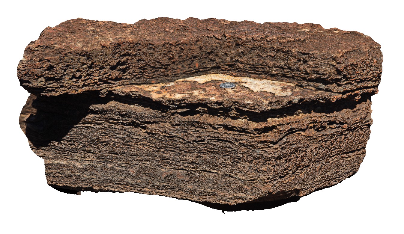
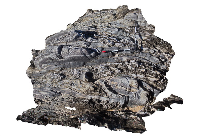
Chichester5 Map
 |
0 |
05/31/2016 noon |
3D |
block with small stromatolites and crinkly algal mat layers in Carbonate. Outcrop near the Great Northern Highway, Cooletha Hill, W.A. |
0.60 |
-22.00115000000 |
118.82701000000 |
-9999.000 |
stromatolite, algal mat, carbonate, sedimentology |
carbonate |
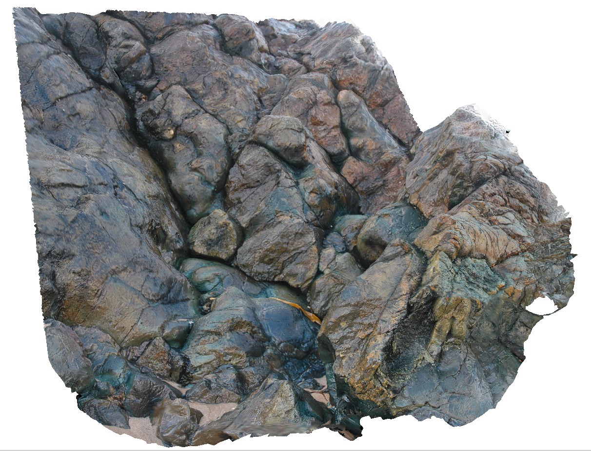
CityofMelbourneBay1 Map
 |
5 |
04/28/2016 10:32 a.m. |
3D |
3 dimensional view of view of pillow basalt package. City of Melbourne Bay, King Island. Tasmania. |
1.00 |
-40.01287733000 |
144.11669452000 |
-9999.000 |
|
basalt |
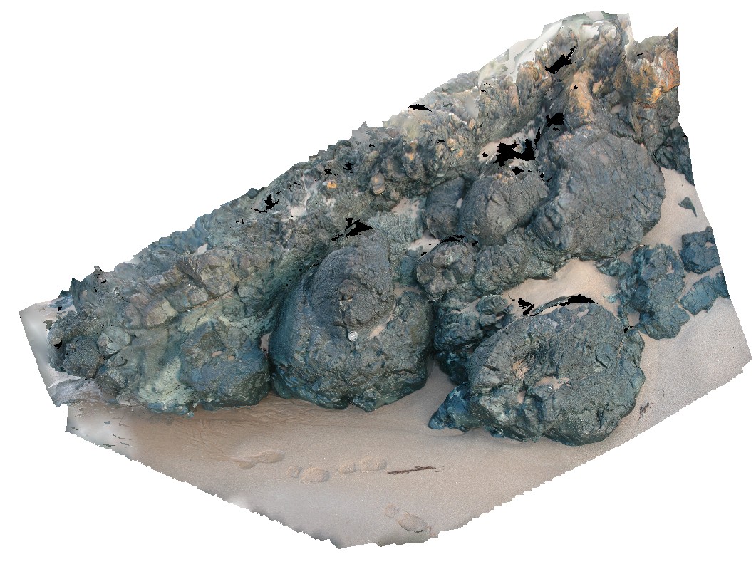
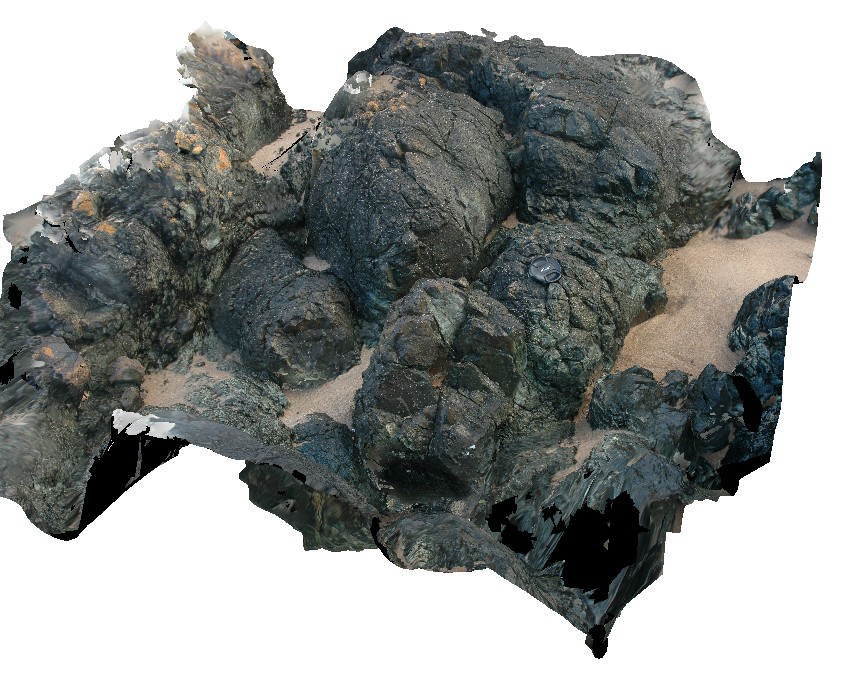
CityofMelbourneBay2 Map
 |
5 |
03/16/2015 2:25 p.m. |
3D |
outcrop of pillow basalt, showing radiating columnar cooling joints in pillows. City of Melbourne Bay, King Island. Tasmania. |
4.00 |
-40.01288513000 |
144.11669537000 |
2.000 |
pillow basalt, cooling joints, volcanics |
basalt |
CityofMelbourneBay3 Map
 |
5 |
03/16/2015 2:25 p.m. |
3D |
outcrop of pillow basalt, showing radiating columnar cooling joints in pillows. City of Melbourne Bay, King Island. Tasmania. |
2.00 |
-40.01288968000 |
144.11668562000 |
2.000 |
pillow basalt, columnar cooling joints |
basalt |
CityofMelbourneBay4 Map
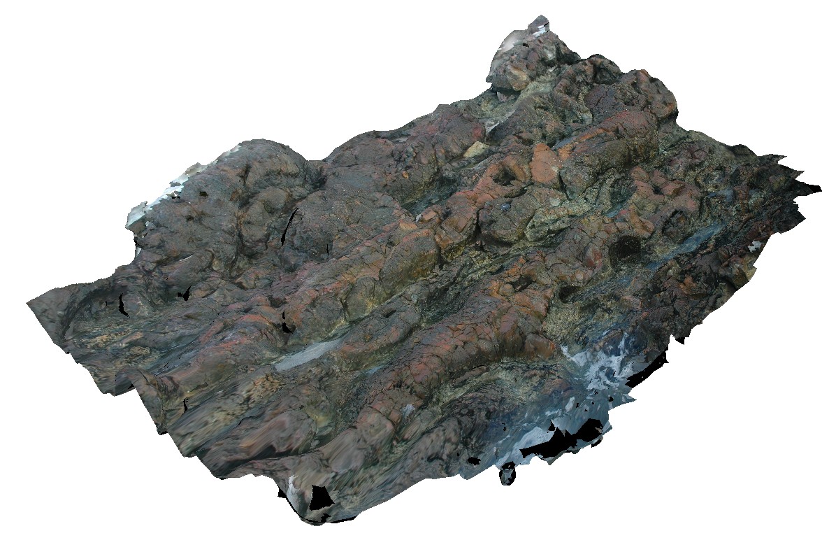 |
5 |
03/16/2015 2:25 p.m. |
3D |
package of basaltic pillow lavas and thin flows with inter-flow sediments. City of Melbourne Bay, King Island. Tasmania. |
2.00 |
-40.01289812000 |
144.11667629000 |
1.000 |
pillow lava, flow, basalt, inter-pillow sediments, volcanology |
basalt |
CityofMelbourneBay5 Map
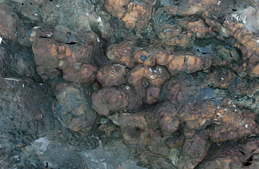 |
5 |
03/16/2015 2:25 p.m. |
3D |
package of basaltic pillow lava with some inter-pillow sediments. City of Melbourne Bay, King Island. Tasmania. |
2.00 |
-40.01291699000 |
144.11668860000 |
2.000 |
basalt, pillow lava, inter-pillow sediments, volcanology |
basalt |
CityofMelbourneBay6 Map
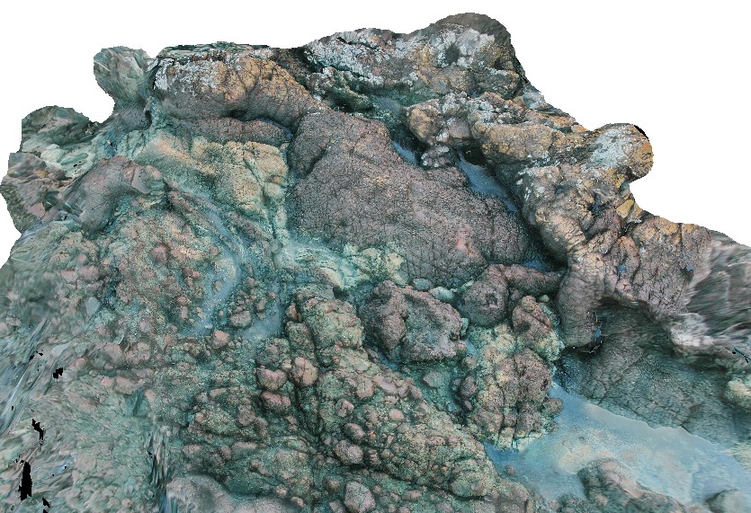 |
5 |
04/25/2015 11:38 a.m. |
3D |
basaltic volcanic package, showing flows and pillows, inter pillow / flow sediments and possible breccia flow? City of Melbourne Bay, King Island. Tasmania. |
3.00 |
-40.01292543000 |
144.11667927000 |
1.000 |
lava flow, sediments, volcanology |
basalt |
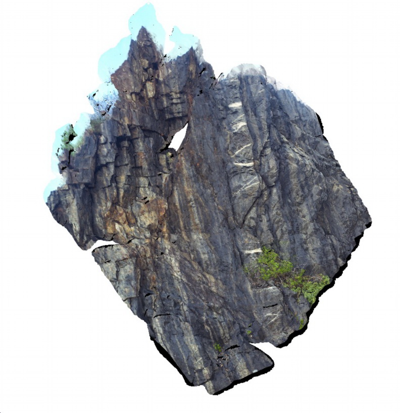
Cobra1 Map
 |
0 |
05/27/2016 noon |
3D |
boudinaged 'bedding' in silicified siltstone of the Discovery Formation in the Edmund Group. Cobra-Dairy Creek, Wanna Road Junction, W.A. |
2.00 |
-24.20047000000 |
116.44970000000 |
-9999.000 |
boudinage, sediments |
siltstone |
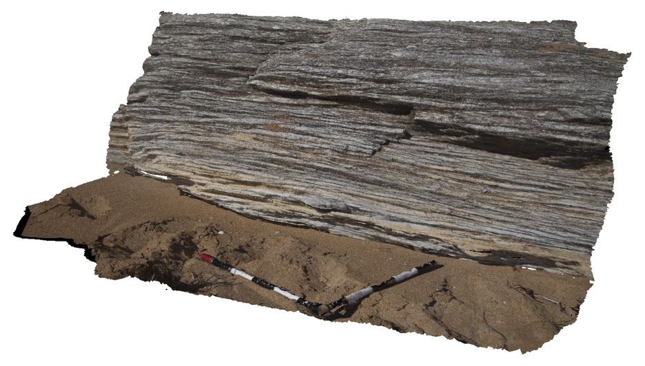
Cobra2 Map
 |
0 |
05/27/2016 noon |
3D |
outcrop of steeply 'dipping', finely banded, silicified siltstone. Cobra-Dairy Creek, Wanna Road Junction, W.A. |
3.00 |
-24.20045000000 |
116.44955000000 |
-9999.000 |
siltstone, steeply dipping, fold, structure |
siltstone |
Cobra3 Map
 |
0 |
05/27/2016 noon |
3D |
3D view of outcrop of sub-vertical bedding with micro folds, cleavage and lineations on cleavage surface. Cobra-Dairy Creek, Wanna Road Junction, W.A. |
1.00 |
-24.20044000000 |
116.44952000000 |
-9999.000 |
cleavage, lineation, structure, fold |
siltstone |
Cobra4 Map
 |
0 |
05/27/2016 noon |
3D |
detailed view of micro folds, cleavage and lineations on cleavage surface. Cobra-Dairy Creek, Wanna Road Junction, W.A. |
0.40 |
-24.20044000000 |
116.44952000000 |
-9999.000 |
lineation, fold, cleavage, structure |
siltstone |
Cobra5 Map
 |
0 |
05/27/2016 noon |
3D |
Isoclinal fold in loose block of silicified siltstone. Cobra-Dairy Creek, Wanna Road Junction, W.A. |
0.45 |
-24.20044000000 |
116.44952000000 |
-9999.000 |
isoclinal fold, fold, structure |
siltstone |
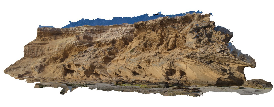
Coffin1 Map
 |
20 |
10/29/2015 8:55 a.m. |
3D |
beach exposure showing cross-bedded calcareous sand and calcarenite? Point Avoid. S.A. |
10.00 |
-34.68882700000 |
135.32904100000 |
-9999.000 |
cross-bedding, calcareous sand, calcarenite |
calcarenite |
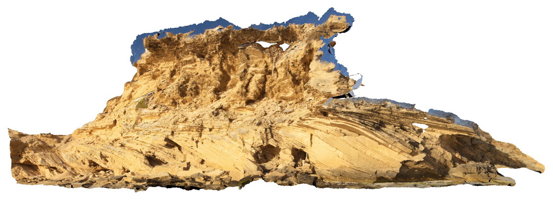
Coffin2 Map
 |
0 |
10/29/2015 8:56 a.m. |
3D |
beach exposure showing cross-bedded calcareous sand and calcarenite? Point Avoid. S.A. |
20.00 |
-34.68882700000 |
135.32904100000 |
-9999.000 |
cross-bedded, calcareous sand, calcarenite |
calcarenite |
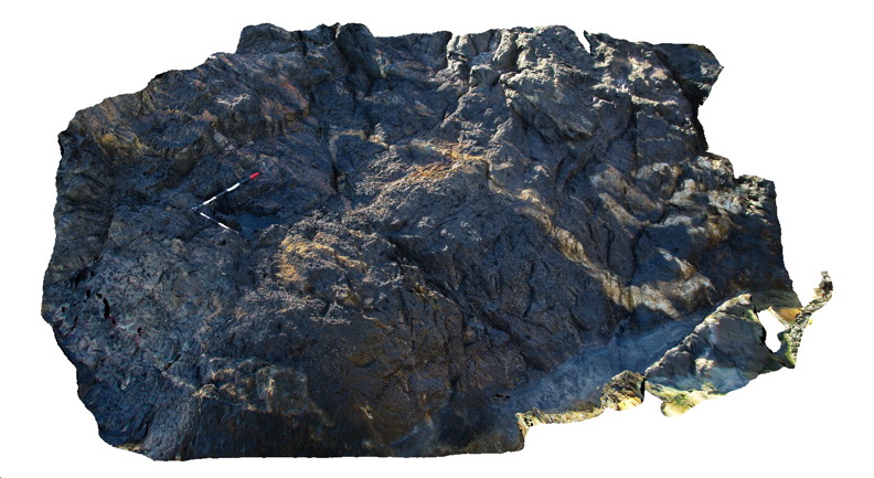
Coffs1 Map
 |
5 |
07/08/2015 10:27 a.m. |
3D |
Folded and faulted metasediments - Mutton bird Island - Carboniferous Coffs Harbour Association. Coffs Harbour, N.S.W. |
4.00 |
-30.30574000000 |
153.14870000000 |
1.000 |
metasediments, folds, faults, structure |
metasediments |
Coffs2 Map
 |
1 |
07/08/2015 10:28 a.m. |
3D |
Quartz veins in steeply dipping metasediments of the Carboniferous Brooklana Beds. Coffs Harbour, N.S.W. |
9.00 |
-30.31222000000 |
153.14862000000 |
8.000 |
metasediments, quartz vein, structure |
metasediments |
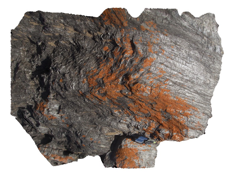
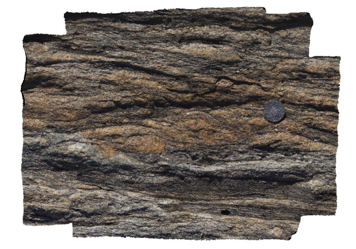
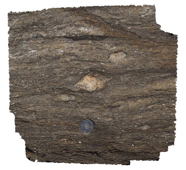
Coles1 Map
 |
0 |
11/06/2015 9:21 a.m. |
3D |
muscovite-andalusite schist with crenulations, Coles Point. S.A. |
1.50 |
-34.38033000000 |
135.36440000000 |
-9999.000 |
crenulations, schist |
schist |
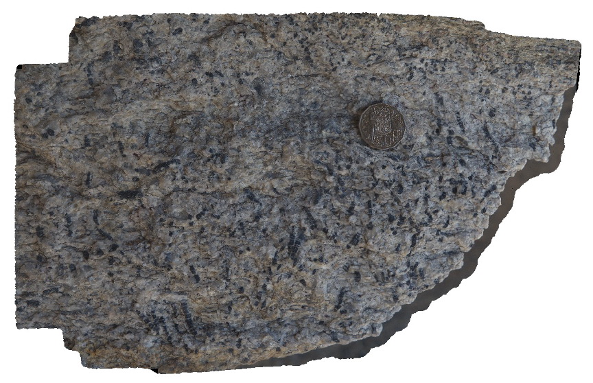
Coles2 Map
 |
0 |
11/06/2015 8:29 a.m. |
3D |
andalusite porphyroblast. Coles Point. S.A. |
0.25 |
-34.38047000000 |
135.36452000000 |
-9999.000 |
andalusite, porphyroblast, metamorphic |
gneiss |
Coles3 Map
 |
0 |
11/06/2015 8:30 a.m. |
3D |
crenulated schist, Coles Point. S.A. |
2.00 |
-34.38032000000 |
135.36450000000 |
-9999.000 |
schist, crenulations |
schist |
Coles4 Map
 |
0 |
11/06/2015 8:30 a.m. |
3D |
S-C texture in sheared granite gneiss. Coles Point. S.A. |
0.30 |
-34.37899000000 |
135.36273000000 |
-9999.000 |
S-C fabric, metamorphic, granite gneiss |
gneiss |
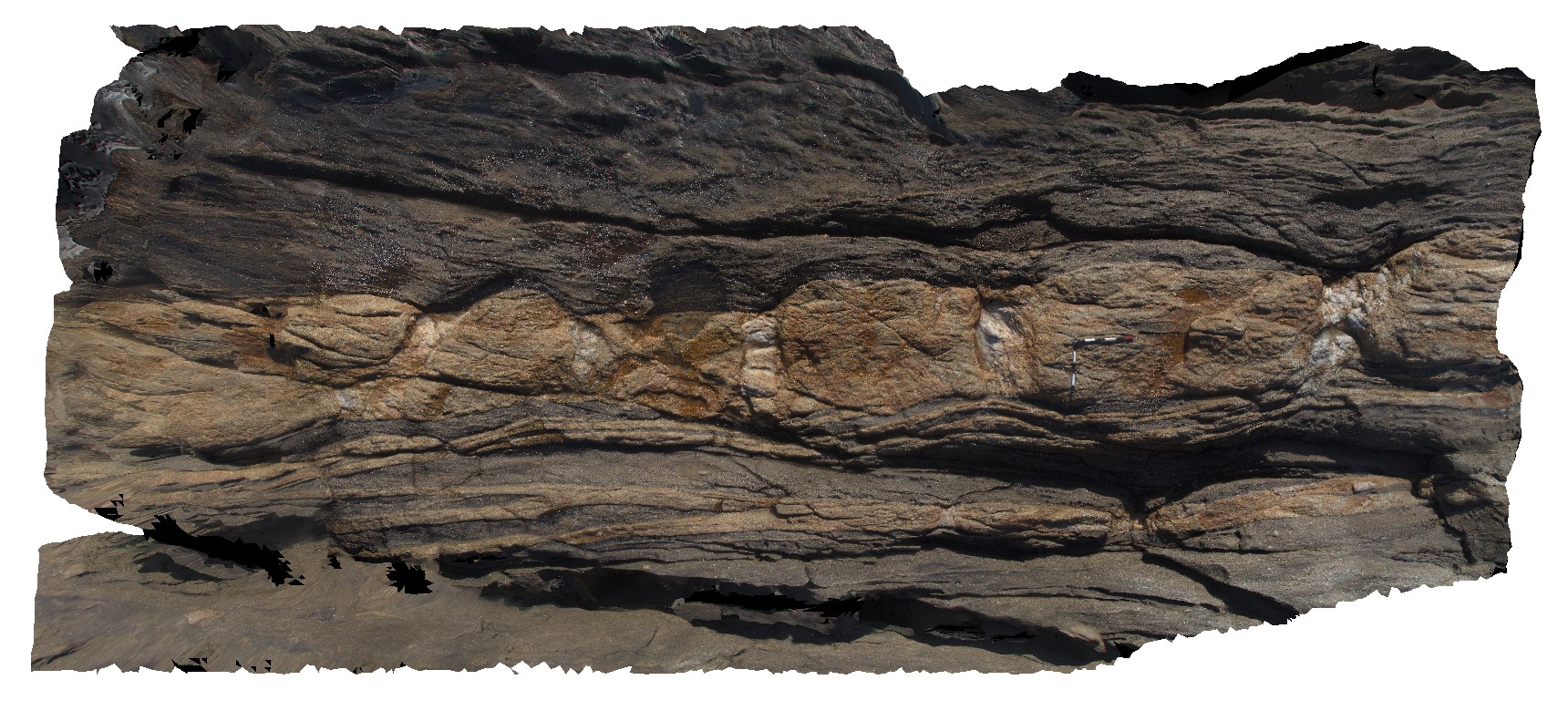
Coles5 Map
 |
0 |
11/06/2015 9:27 a.m. |
3D |
boudinaged aplite dyke with quartz boudin necks. Coles Point. S.A. |
9.00 |
-34.37894000000 |
135.36267000000 |
-9999.000 |
boudinage, gneiss, metamorphic |
gneiss |
Coles6 Map
 |
0 |
11/06/2015 9:28 a.m. |
3D |
porphyroblast in sheared gneiss. Coles Point. S.A. |
0.20 |
-34.37892000000 |
135.36269000000 |
-9999.000 |
porphyroblast, gneiss, metamorphic |
gneiss |
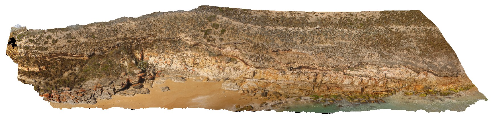
ColesUAV1 Map
 |
0 |
10/20/2015 4:34 p.m. |
UAV |
contact between schist, quartzite and the overlying limestone. Coles Point. S.A. |
300.00 |
-34.38084800000 |
135.36448700000 |
-9999.000 |
geological contact, unconformity, quartzite |
quartzite, schist, sand |
Conran1 Map
 |
5 |
07/21/2015 2:07 p.m. |
3D |
Tight / isoclinal folds and quartz veins in Ordovician Pinnak Sandstone. Cape Conran, Vic. |
3.00 |
-37.79979000000 |
148.74274000000 |
1.000 |
isoclinal fold, turbidite, structure |
turbidite |