CapeWickham4 Map
 |
5 |
03/16/2015 2:24 p.m. |
3D |
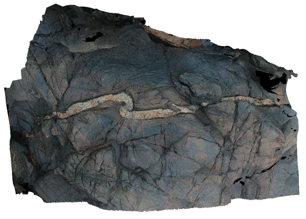
folded mafic intrusion? With cross cutting felsic dyke. Cape Wickham, King Island. Tasmania. |
2.00 |
-39.59227327000 |
143.92778293000 |
2.000 |
mafic dyke, felsic dyke, deformation, folding, structure |
dolerite, felsic |
CapeWickham5 Map
 |
5 |
04/22/2016 12:27 p.m. |
3D |
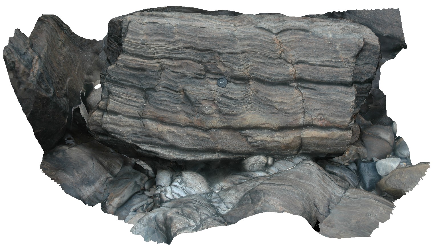
thinly bedded quartzites with folding. Cape Wickham, King Island. Tasmania. |
1.00 |
-39.59226336000 |
143.92808021000 |
2.000 |
fold, structure, quartzite |
quartzite |
CapeWickham6 Map
 |
5 |
04/28/2016 9:10 a.m. |
3D |
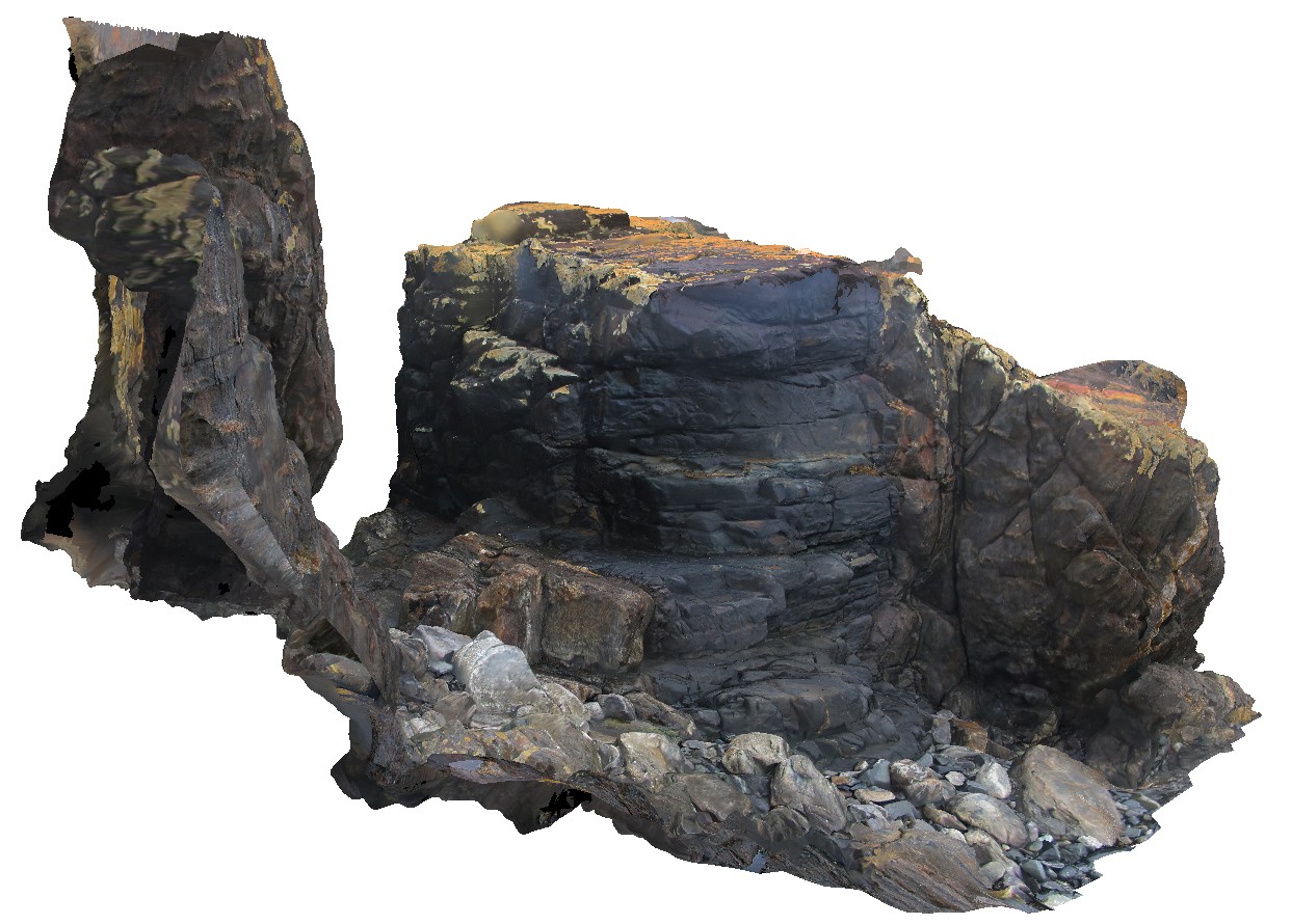
intrusive contact between sub vertically dipping metasediments of the Surprise Bay Formation and a dolerite dyke. Cape Wickham, King Island. Tasmania. |
5.00 |
-39.59209477000 |
143.92795761000 |
5.000 |
dip, intrusive contact, contact, structure |
|
CapeWickham7 Map
 |
5 |
04/22/2016 12:08 p.m. |
3D |
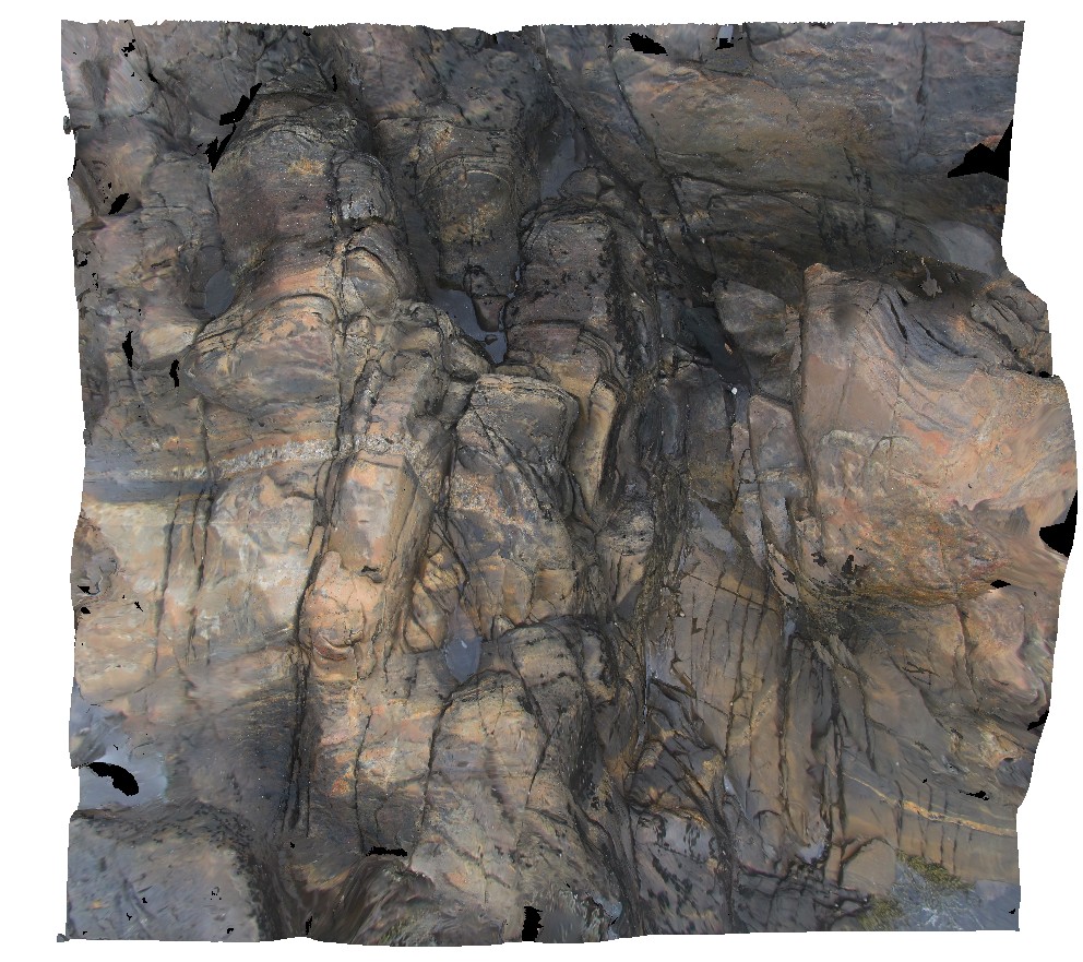
folded and deformed metasediments with crosscutting felsic dykelets. Cape Wickham, King Island. Tasmania. |
2.00 |
-39.59224014000 |
143.92801576000 |
2.000 |
fold, deformation, structure, felsic dyke |
|
CapeWickham8 Map
 |
5 |
04/22/2016 12:22 p.m. |
3D |
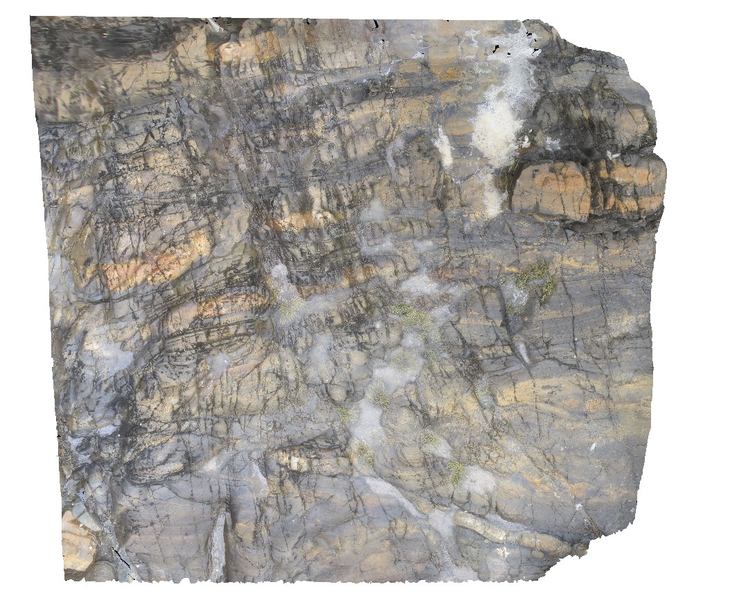
view of bedded, quartzite dominant metasediments. Cape Wickham, King Island. Tasmania. |
0.00 |
-39.59224515000 |
143.92791342000 |
0.500 |
metasediments |
|
CapeWickham9 Map
 |
5 |
04/25/2015 11:52 a.m. |
3D |
steeply plunging fold hinge in quartzite and pelites. Cape Wickham, King Island. Tasmania. |
0.00 |
-39.59211212000 |
143.92782848000 |
2.000 |
fold hinge, fold, structure, metamorphic |
quartzite |
Carnot1 Map
 |
0 |
10/29/2015 9:38 a.m. |
3D |
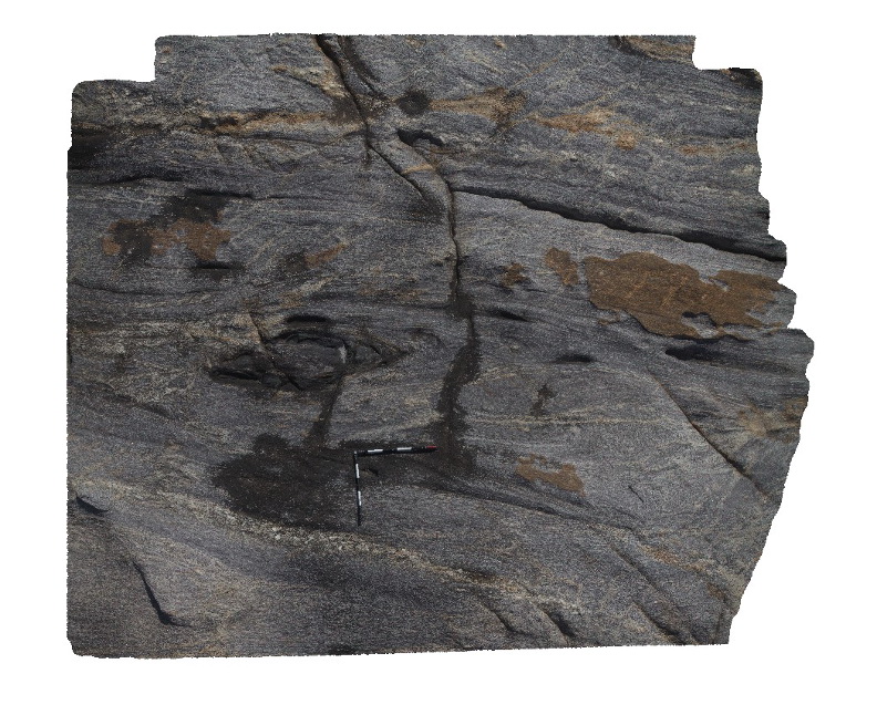
shear zone and mafic banding in Carnot Gneiss, Cape Carnot. S.A. |
4.50 |
-34.94354000000 |
135.62024000000 |
-9999.000 |
gneiss, banding, shear zone |
gneiss |
Carnot10 Map
 |
20 |
10/29/2015 9:46 a.m. |
3D |
Aerial view, looking back toward Cape Carnot, showing banded gneiss / shear zone. Cape Carnot. S.A. |
50.00 |
-34.94329600000 |
135.61994200000 |
-9999.000 |
gneiss, shear zone |
gneiss |
Carnot11 Map
 |
0 |
10/29/2015 9:47 a.m. |
3D |
Unconformity showing Tertiary sands of the Semaphore Sand Member, overlying Carnot Gneiss. Cape Carnot. S.A. |
20.00 |
-34.94001000000 |
135.62035000000 |
-9999.000 |
unconformity, gneiss |
gneiss, sand |
Carnot12 Map
 |
0 |
10/29/2015 9:48 a.m. |
3D |
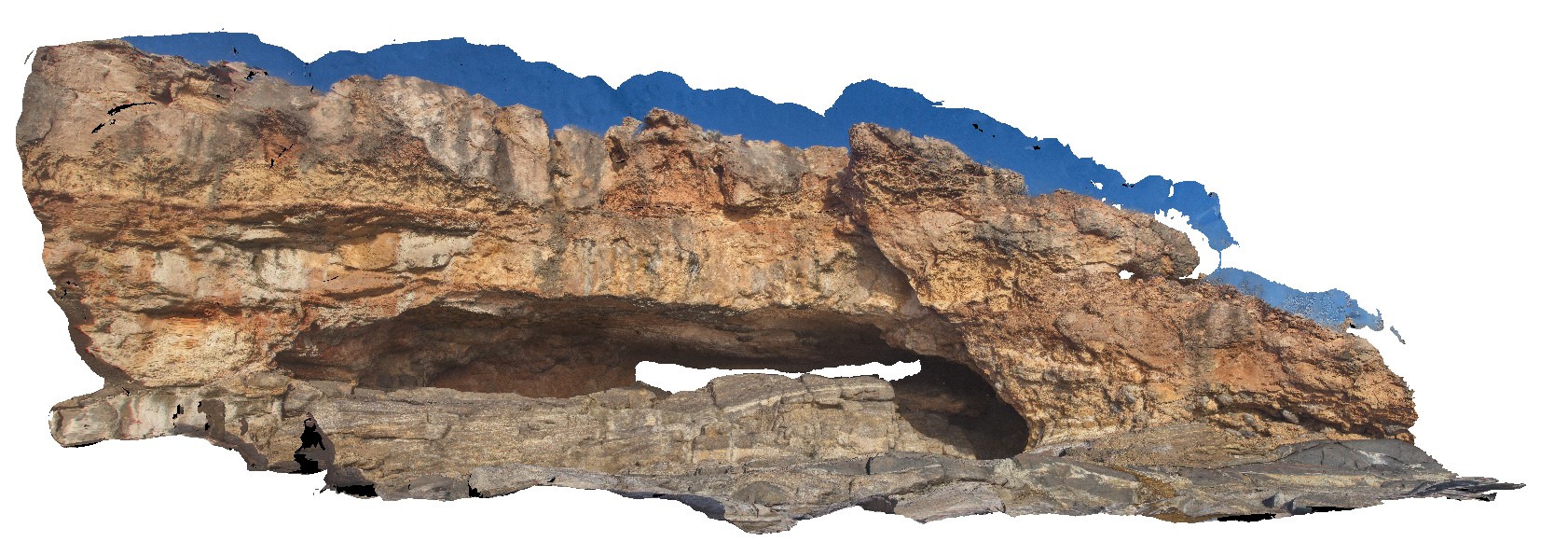
coastal exposure, showing unconformity between Tertiary sands and underlying gneiss. Cape Carnot. S.A. |
10.00 |
-34.93957000000 |
135.62047000000 |
-9999.000 |
unconformity, tertiary sands, gneiss |
gneiss, sand |
Carnot13 Map
 |
0 |
10/29/2015 9:48 a.m. |
3D |
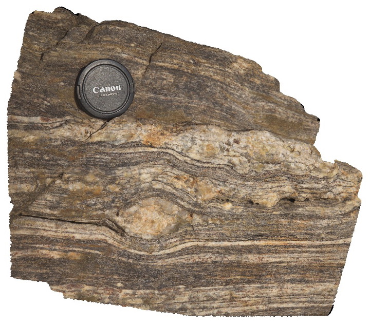
detail of large winged porphyroblast in banded gneiss, Cape Carnot. S.A. |
0.30 |
-34.93957000000 |
135.62047000000 |
-9999.000 |
porphyroblast, gneiss |
gneiss |
Carnot2 Map
 |
0 |
10/29/2015 9:39 a.m. |
3D |
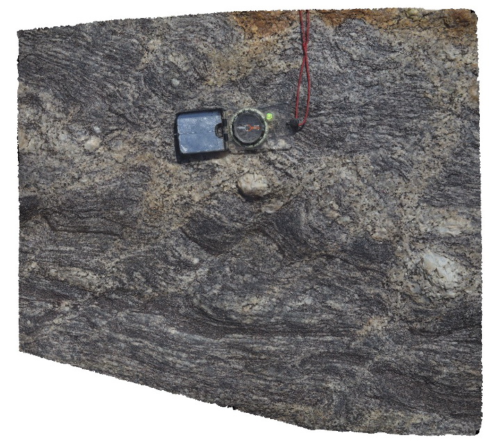
cross cutting small shears disrupting foliation in gneiss, Cape Carnot. S.A. |
0.40 |
-34.94352000000 |
135.62024000000 |
-9999.000 |
shearing, gneiss |
gneiss |
Carnot3 Map
 |
0 |
10/29/2015 9:39 a.m. |
3D |
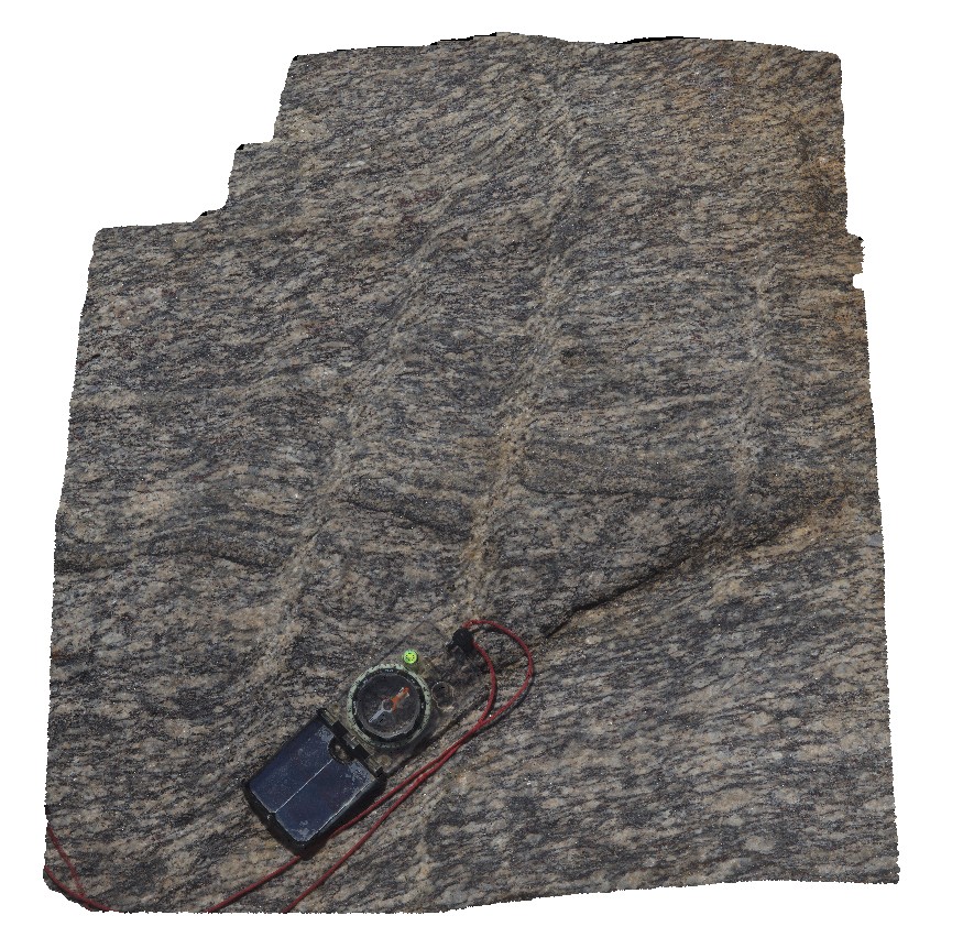
small shears disrupting layering and foliation in gneiss, Cape Carnot. S.A. |
0.40 |
-34.94358000000 |
135.62056000000 |
-9999.000 |
gneiss, foliation, shearing |
gneiss |
Carnot4 Map
 |
20 |
10/29/2015 9:40 a.m. |
3D |
Overview of coast outcrop exposure, showing unconformity with older gneiss and Holocene sediments, Cape Carnot. S.A. |
200.00 |
-34.94264900000 |
135.62080600000 |
-9999.000 |
unconformity, gneiss, sand |
gneiss, sand |
Carnot5 Map
 |
0 |
10/29/2015 9:41 a.m. |
3D |
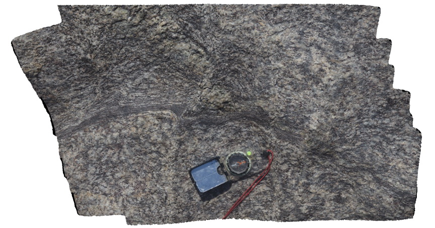
view of early shear in gneiss, cut by later shearing. Cape Carnot. S.A. |
0.50 |
-34.94352000000 |
135.62071000000 |
-9999.000 |
gneiss, shearing, structure |
gneiss |
Carnot6 Map
 |
0 |
10/29/2015 9:43 a.m. |
3D |
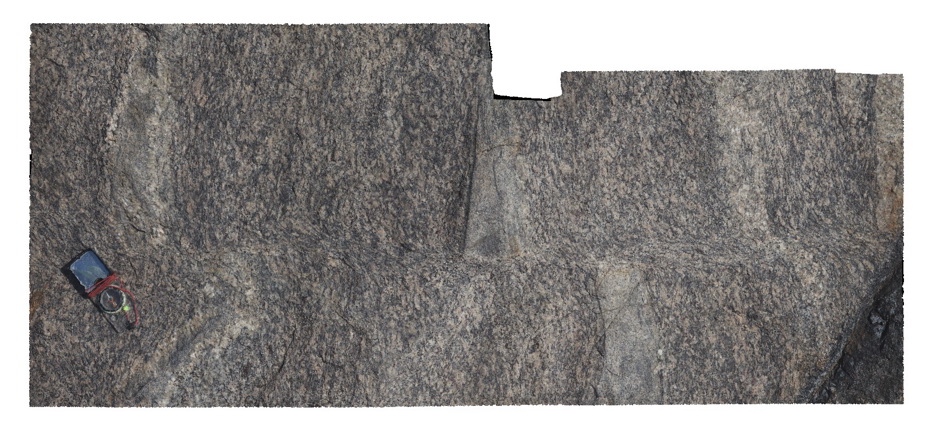
view of shear zone cutting and offsetting foliation in banded gneiss, Cape Carnot. S.A. |
1.20 |
-34.94372000000 |
135.62036000000 |
-9999.000 |
shear zone, gneiss, foliation |
gneiss |
Carnot7 Map
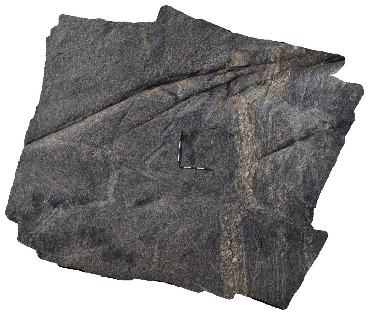 |
0 |
10/29/2015 9:44 a.m. |
3D |
folded pegmatites, foliation and shear zones in gneiss. Cape Carnot. S.A. |
4.00 |
-34.94376000000 |
135.62025000000 |
-9999.000 |
foliation, shear zone, structure, pegmatite, gneiss |
gneiss |
Carnot8 Map
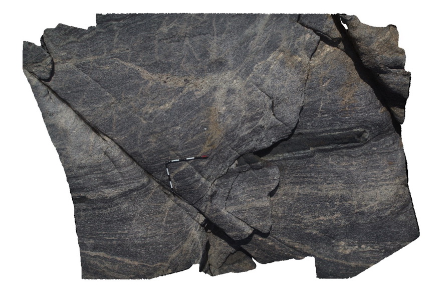 |
0 |
10/29/2015 9:44 a.m. |
3D |
Mafic dyke boudin in shear zone. Carnot Gneiss, Cape Carnot. S.A. |
3.50 |
-34.94372000000 |
135.63012000000 |
-9999.000 |
boudin, shear zone, gneiss |
gneiss |
Carnot9 Map
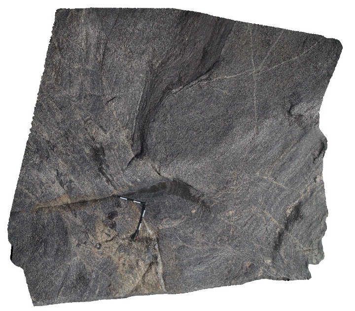 |
0 |
10/29/2015 9:45 a.m. |
3D |
Mafic dyke hosted in gneiss, cut by shear zone, Cape Carnot. S.A. |
4.00 |
-34.94376000000 |
135.62013000000 |
-9999.000 |
shear zone, gneiss, dyke |
gneiss |
CarnotFSP1 Map
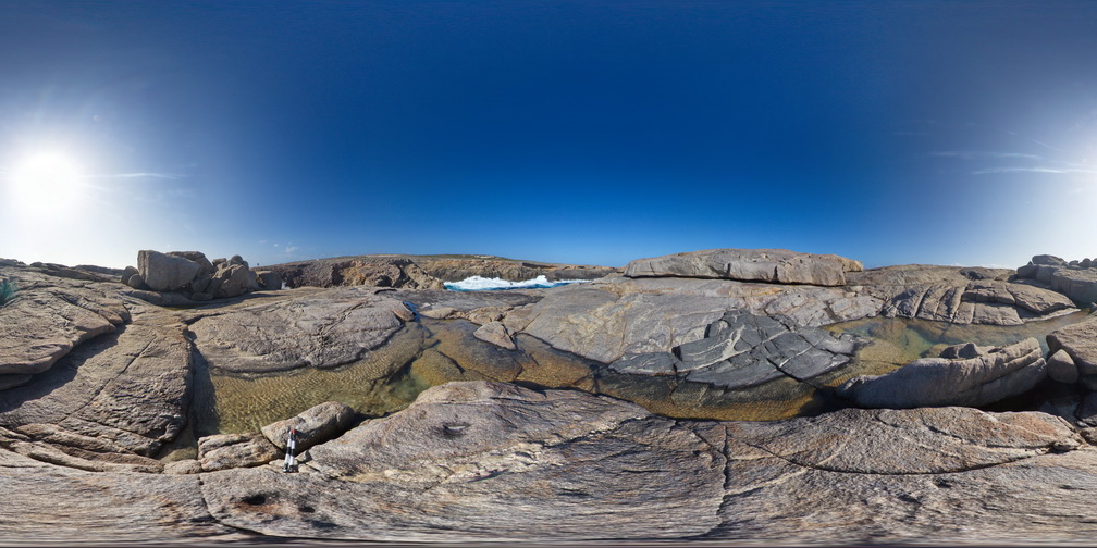 |
0 |
10/28/2015 12:22 p.m. |
FSP |
shore exposure, showing folded and deformed mafic dyke in gneiss, Cape Carnot. S.A. |
1000.00 |
-34.94358000000 |
135.62029000000 |
-9999.000 |
dyke, gneiss, structure |
gneiss |
CarnotFSP2 Map
 |
0 |
10/28/2015 12:23 p.m. |
FSP |
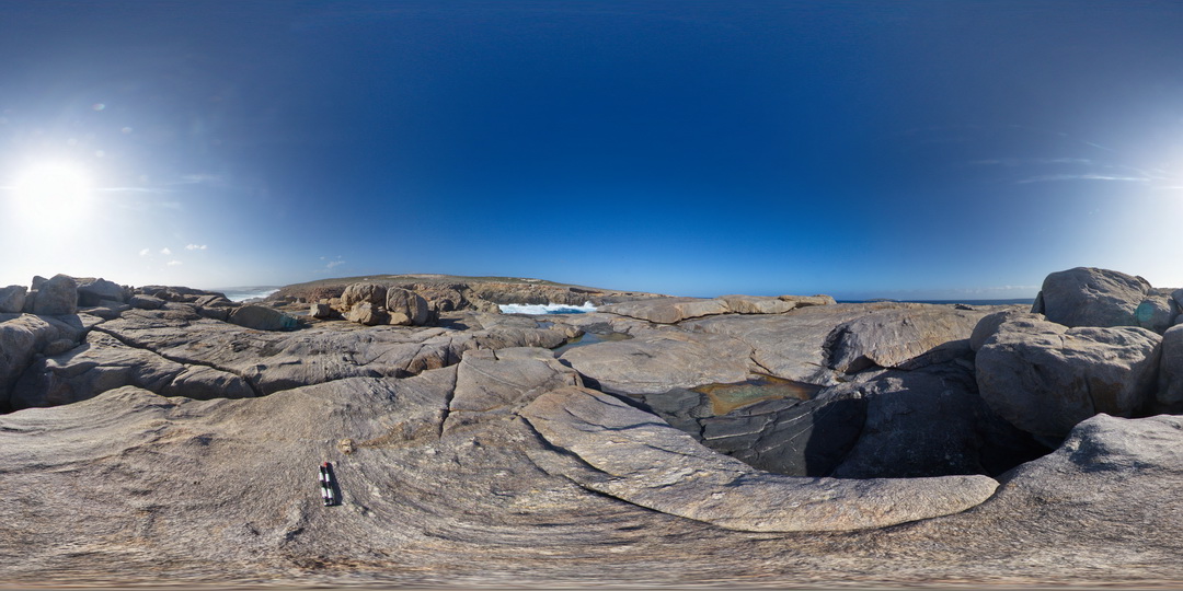
shoreline exposure, showing gneiss, disrupted mafic dyke and deformed pegmatite dyke. Ages of intruding mafic dyke and pegmatites are unknown. Cape Carnot. S.A. |
1000.00 |
-34.94363000000 |
135.62029000000 |
-9999.000 |
pegmatite, mafic dyke, gneiss, structure |
gneiss |
CarnotFSP3 Map
 |
0 |
10/28/2015 12:23 p.m. |
FSP |
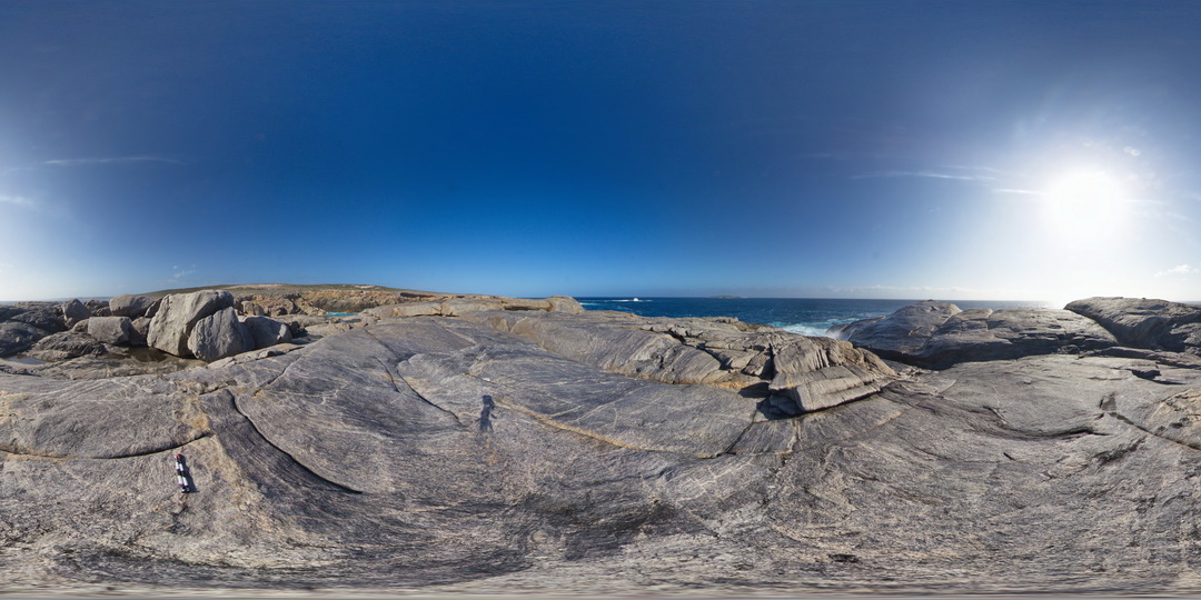
shoreline exposure showing banded gneiss and shear zone disrupted mafic dyke. Cape Carnot. S.A. |
1000.00 |
-34.94378000000 |
135.62018000000 |
-9999.000 |
shear zone, mafic dyke, gneiss |
gneiss |
CarnotFSP4 Map
 |
0 |
10/28/2015 12:23 p.m. |
FSP |
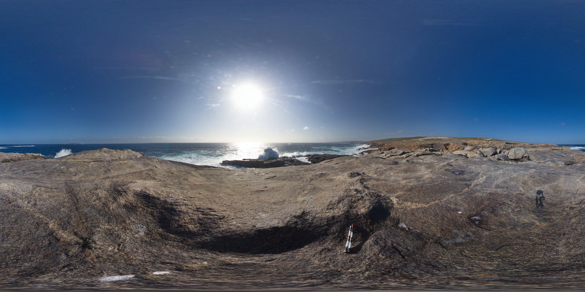
shoreline exposure of Carnot Gneiss, Cape Carnot. S.A. |
1000.00 |
-34.94370000000 |
135.61977000000 |
-9999.000 |
gneiss |
gneiss |
CarnotFSP5 Map
 |
0 |
10/28/2015 12:23 p.m. |
FSP |
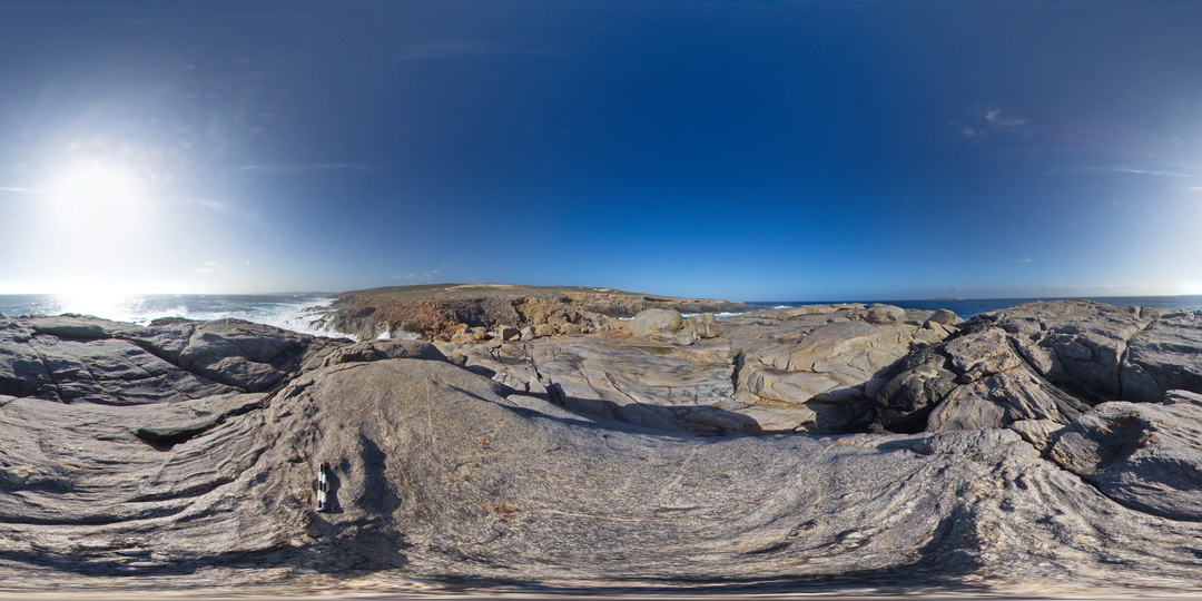
shoreline exposure, with deformed pegmatite intruding gneiss, Cape Carnot. S.A. |
1000.00 |
-34.94335000000 |
135.62010000000 |
-9999.000 |
pegmatite, gneiss, structure |
gneiss |
CarnotFSP6 Map
 |
0 |
10/28/2015 12:23 p.m. |
FSP |
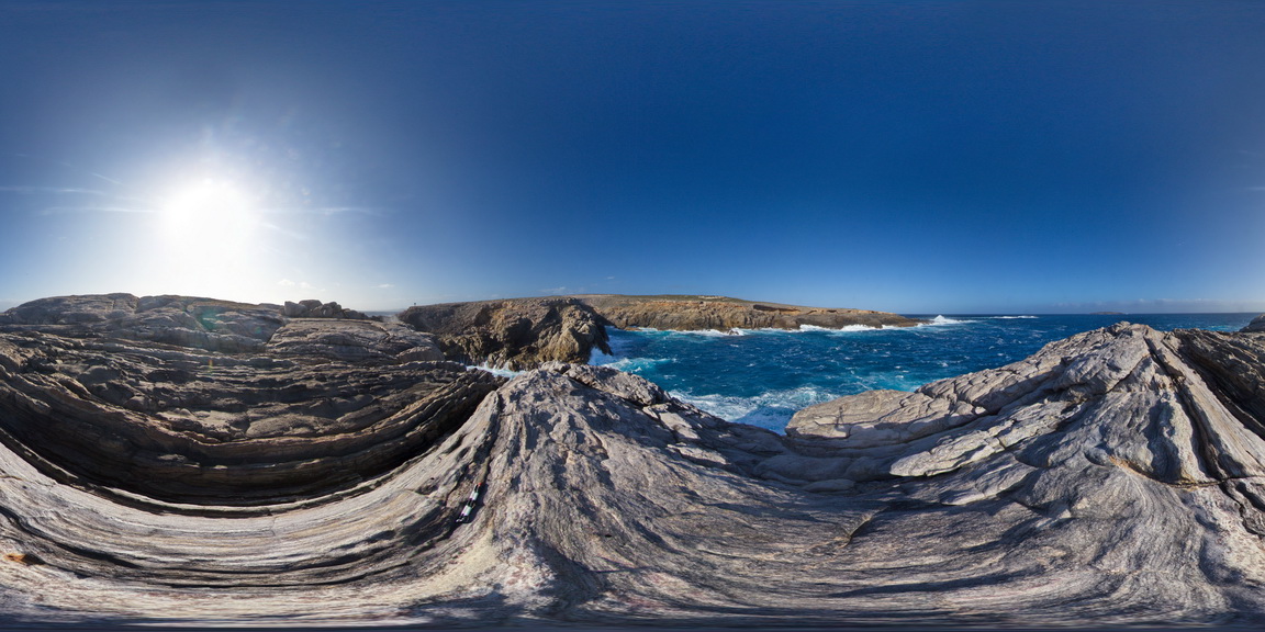
shoreline exposure, showing garnet porphyroblast in banded gneiss. Cape Carnot. S.A. |
1000.00 |
-34.94283000000 |
135.62138000000 |
-9999.000 |
garnet porphyroblast, gneiss |
gneiss |


