Conran1 Map
 |
5 |
07/21/2015 2:07 p.m. |
3D terrestrial photogrammetric model |
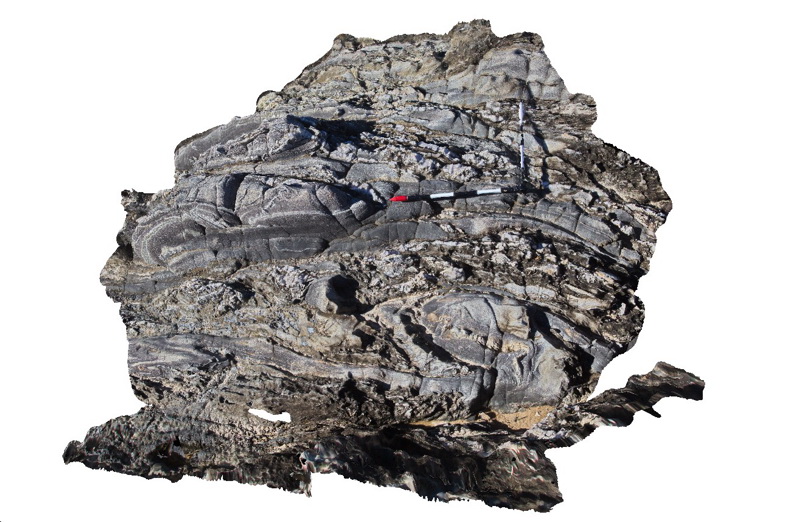
Tight / isoclinal folds and quartz veins in Ordovician Pinnak Sandstone. Cape Conran, Vic. |
3.00 |
-37.79979000000 |
148.74274000000 |
1.000 |
isoclinal fold, turbidite, structure |
turbidite |
Conran10 Map
 |
5 |
07/18/2015 3:17 p.m. |
3D terrestrial photogrammetric model |
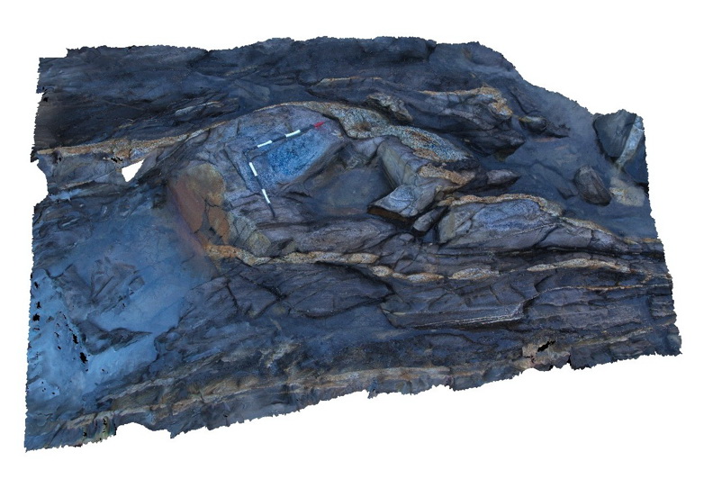
Folded granitic dyke from the Cape Conran Granite - dyke has been boudinaged and faulted. Dyke intrudes turbiditic metasediments of the Ordovician Pinnak Sandstone. Cape Conran, Vic. |
4.00 |
-37.80813000000 |
148.73351000000 |
1.000 |
granite, dyke, fold, fault, boudin, igneous, structure |
turbidite, granite |
Conran11 Map
 |
5 |
07/18/2015 3:18 p.m. |
3D terrestrial photogrammetric model |
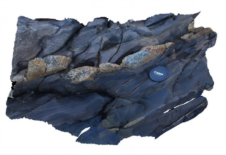
Detail of the boudinaged granitic dyke shown in Conran10. Dyke intrudes turbiditic metasediments of the Ordovician Pinnak Sandstone. Cape Conran, Vic. |
0.50 |
-37.80813000000 |
148.73351000000 |
1.000 |
granite, dyke, fault, boudin, igneous, structure |
turbidite, granite |
Conran12 Map
 |
5 |
07/18/2015 3:19 p.m. |
3D terrestrial photogrammetric model |
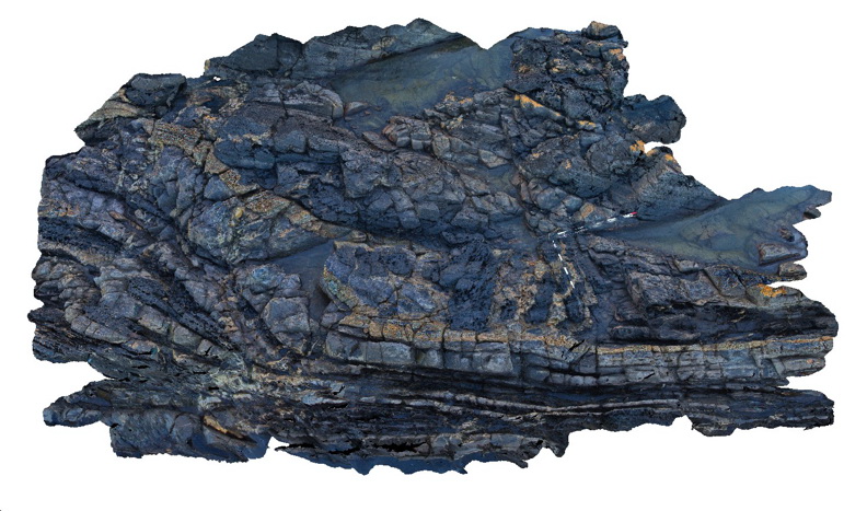
folded granitic dyke from the Cape Conran granite intruding contact metamorphosed turbiditic metasediments of the Ordovician Pinnak Sandstone. Cape Conran, Vic. |
8.00 |
-37.80805000000 |
148.73363000000 |
1.000 |
turbidite, fold, granite, dyke, igneous, structure |
turbidite, granite |
Conran13 Map
 |
1 |
08/04/2015 10:03 a.m. |
3D terrestrial photogrammetric model |
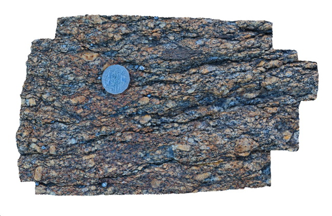
Porphyritic granite from the margin of the Cape Conran Granite with well defined shear fabric. Cape Conran, Vic. |
0.30 |
-37.80811100000 |
148.73338000000 |
1.000 |
granite, shear, s-c fabric, igneous, structure |
granite |
Conran14 Map
 |
5 |
07/18/2015 3:21 p.m. |
3D terrestrial photogrammetric model |
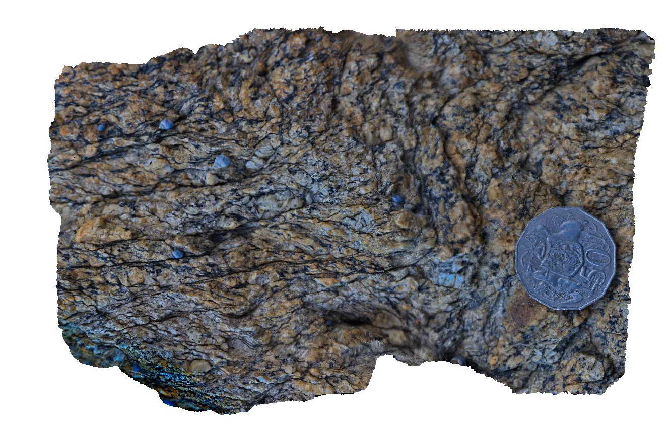
Shear textures in granite on the margin of the Cape Conran Granite. Cape Conran, Vic. |
0.20 |
-37.80819000000 |
148.73337000000 |
1.000 |
granite, shear, s-c fabric, structure, igneous |
granite |
Conran15 Map
 |
5 |
08/04/2015 10:26 a.m. |
3D terrestrial photogrammetric model |
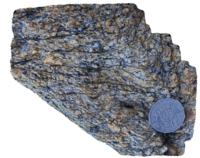
s-c texture in equigranular granite on the margin of the Cape Conran Granite. Cape Conran, Vic. |
0.20 |
-37.80819000000 |
148.73337000000 |
1.000 |
granite, shear, s-s fabric, structure, igneous |
granite |
Conran16 Map
 |
5 |
08/04/2015 10:35 a.m. |
3D terrestrial photogrammetric model |
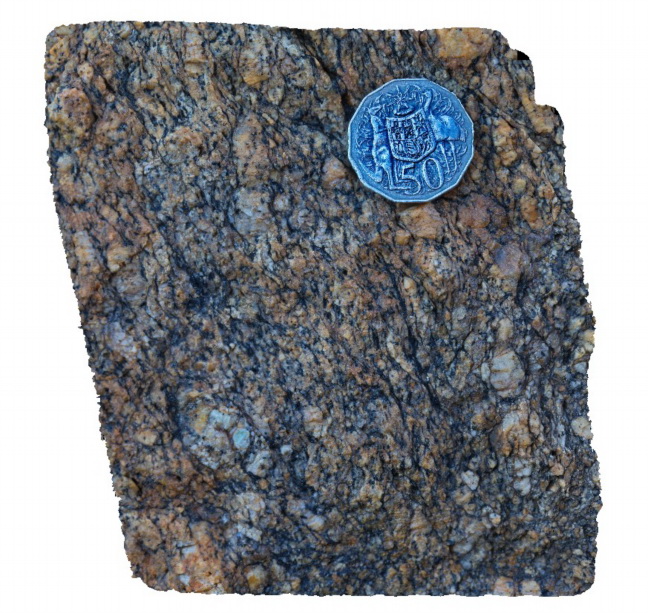
s-c fabric in Cape Conran Granite. Cape Conran, Vic. |
0.20 |
-37.80819000000 |
148.73337000000 |
1.000 |
granite, shear, s-c fabric, igneous, structure |
granite |
Conran16b Map
 |
5 |
07/18/2015 3:23 p.m. |
3D terrestrial photogrammetric model |
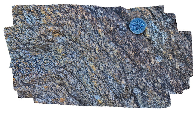
Shear textures (s-c fabric) in Cape Conran Granite. Shear fabric appears to have been folded? Cape Conran, Vic. |
0.30 |
-37.80819000000 |
148.73337000000 |
1.000 |
granite, shear, s-c fabric, structure |
granite |
Conran17 Map
 |
5 |
07/18/2015 3:25 p.m. |
3D terrestrial photogrammetric model |
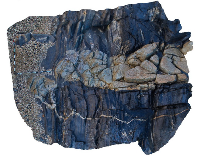
Granitic dykes from the Cape Conran Granite intruding contact metamorphosed turbiditic metasediments of the Ordovician Pinnak Sandstone. Cape Conran, Vic. |
5.00 |
-37.80782000000 |
148.73389000000 |
1.000 |
turbidite, granite, dyke, igneous, structure |
turbidite, Granite |
Conran2 Map
 |
5 |
07/18/2015 3:08 p.m. |
3D terrestrial photogrammetric model |
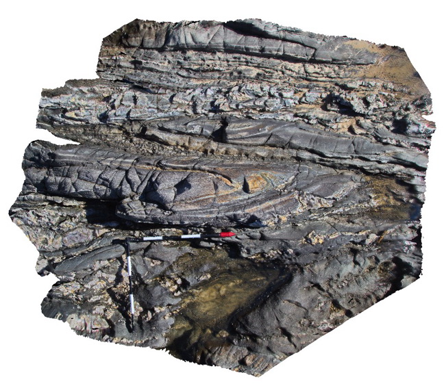
isoclinal fold hinge in Ordovician Pinnak Sandstone turbidites. Cape Conran, Vic. |
2.00 |
-37.80032000000 |
148.74261000000 |
1.000 |
isoclinal fold, structure |
turbidite |
Conran3 Map
 |
5 |
07/18/2015 3:09 p.m. |
3D terrestrial photogrammetric model |
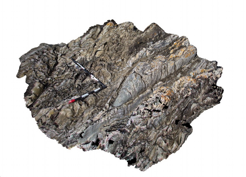
Gently plunging tight to isoclinal fold in turbiditic metasediments of the Ordovician Pinnak Sandstone. Cape Conran, Vic. |
2.00 |
-37.80042000000 |
148.74257000000 |
1.000 |
isoclinal fold, turbidite, structure |
turbidite |
Conran4 Map
 |
5 |
07/18/2015 3:10 p.m. |
3D terrestrial photogrammetric model |
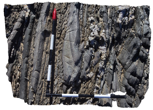
Disrupted isoclinal fold hinge in turbiditic metasediments of the Ordovician Pinnak Sandstone. Axial planar cleavage is well developed in the hinge of the fold. Cape Conran, Vic. |
0.90 |
-37.80046000000 |
148.74255000000 |
-9999.000 |
turbidite, isoclinal fold, cleavage, structure |
turbidite |
Conran5 Map
 |
5 |
07/18/2015 3:11 p.m. |
3D terrestrial photogrammetric model |
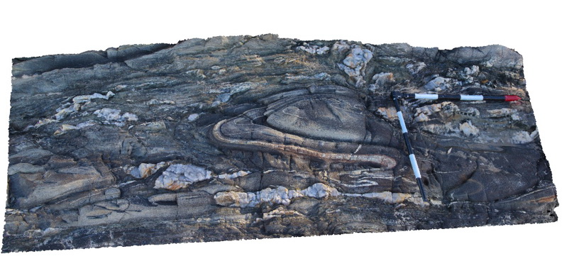
Tight fold in turbiditic metasediments of the Ordovician Pinnak Sandstone. Cape Conran, Vic. |
2.00 |
-37.80064000000 |
148.74240000000 |
1.000 |
turbidite, fold, structure |
turbidite |
Conran6 Map
 |
5 |
07/18/2015 3:12 p.m. |
3D terrestrial photogrammetric model |
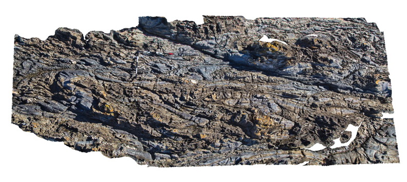
Folded and faulted turbiditic metasediments of the Ordovician Pinnak Sandstone. Cape Conran, Vic. |
5.00 |
-37.80084000000 |
148.74246000000 |
1.000 |
turbidite, fold, fault, structure |
turbidite |
Conran7 Map
 |
5 |
07/18/2015 3:14 p.m. |
3D terrestrial photogrammetric model |
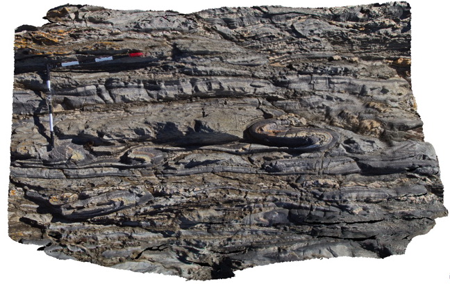
Tight parasitic folds in turbiditic metasediments of the Ordovician Pinnak Sandstone. Cape Conran, Vic. |
2.00 |
-37.80100000000 |
148.74242000000 |
1.000 |
parasitic fold, turbidite, structure |
turbidite |
Conran8 Map
 |
5 |
07/18/2015 3:15 p.m. |
3D terrestrial photogrammetric model |
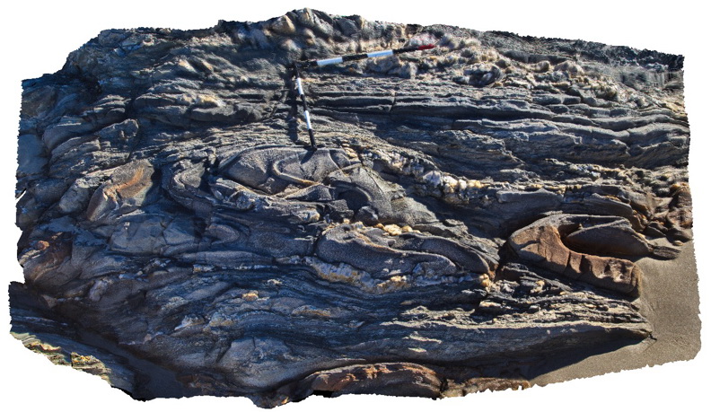
Multiple folds within turbiditic metasediments of the Ordovician Pinnak Sandstone. Cape Conran, Vic. |
3.00 |
-37.80087000000 |
148.74232000000 |
1.000 |
turbidite, fold, structure |
turbidite |
Conran9 Map
 |
5 |
07/18/2015 3:16 p.m. |
3D terrestrial photogrammetric model |
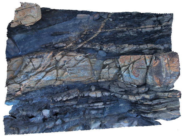
Granitic dyke from the Silurian Cape Conran Granite intruding Ordovician Pinnak Sandstone and cut by late stage thin aplite dykes. Cape Conran, Vic. |
8.00 |
-37.80816000000 |
148.73344000000 |
1.000 |
granite, dyke, turbidite, aplite, igneous, structure |
turbidite, granite, aplite |
ConranFSP1 Map
 |
5 |
09/02/2015 1:33 p.m. |
Full Spherical Panorama |
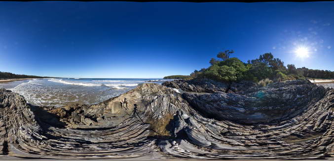
tightly folded turbiditic metasediments of the Ordovician Pinnak Sandstone. Cape Conran, Vic. |
50.00 |
-37.80028000000 |
148.74263000000 |
1.000 |
turbidite, fold, structure, sedimentology |
turbidite |
ConranFSP2 Map
 |
5 |
09/02/2015 1:33 p.m. |
Full Spherical Panorama |
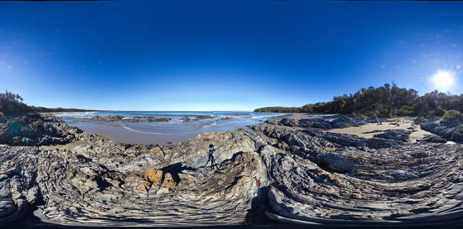
Folded and faulted turbiditic metasediments of the Ordovician Pinnak Sandstone. Cape Conran, Vic. |
50.00 |
-37.80036000000 |
148.74254000000 |
1.000 |
turbidite, fold, structure, sedimentology |
turbidite |
ConranFSP3 Map
 |
5 |
09/02/2015 1:33 p.m. |
Full Spherical Panorama |
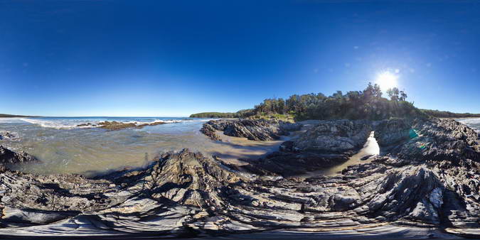
Folded and faulted turbiditic metasediments of the Ordovician Pinnak Sandstone. Cape Conran, Vic. |
50.00 |
-37.80047000000 |
148.74257000000 |
1.000 |
turbidite, fold, structure, sedimentology |
turbidite |
ConranFSP4 Map
 |
5 |
09/02/2015 1:36 p.m. |
Full Spherical Panorama |
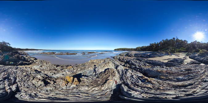
Folded and faulted turbiditic metasediments of the Ordovician Pinnak Sandstone. Cape Conran, Vic. |
50.00 |
-37.80087000000 |
148.74246000000 |
1.000 |
turbidite, fold, structure, sedimentology |
turbidite |
Copley1 Map
 |
5 |
01/01/9999 midnight |
3D terrestrial photogrammetric model |
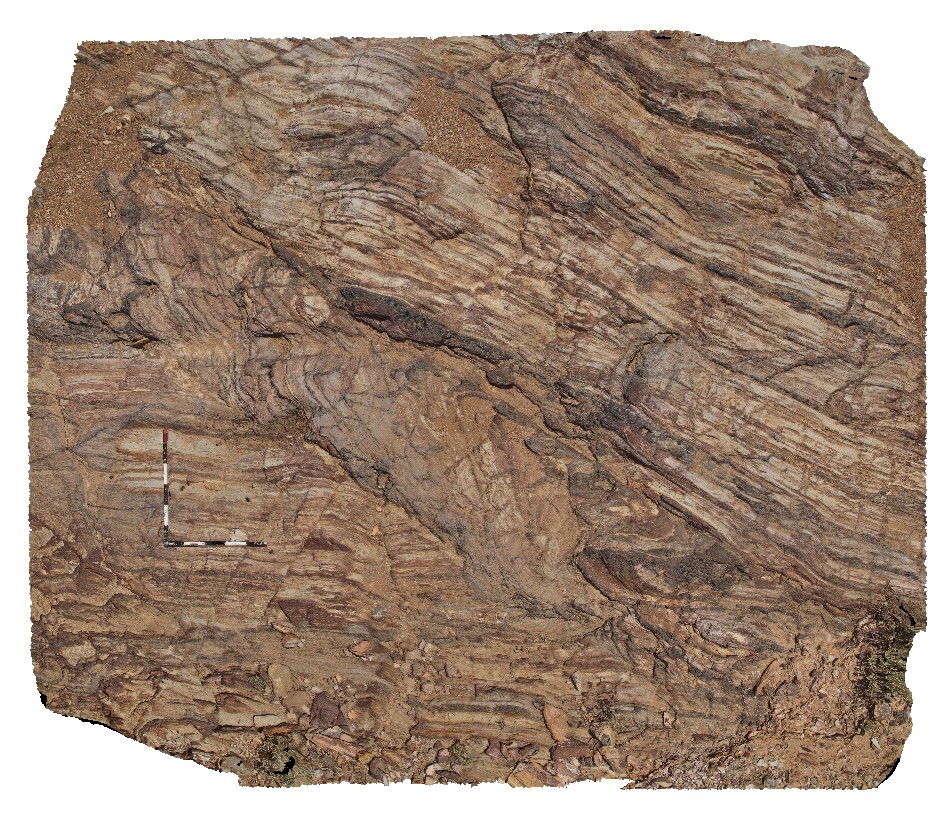
fault zone in thinly layered, fine-grained sandstone and siltstone with hematite veins in Adelaidean metasediments. Copley, S.A. |
6.50 |
-30.52473000000 |
138.53651000000 |
309.000 |
Adelaidean, fault zone, metasediments, metamorphic |
metasediments |
Copley2 Map
 |
5 |
01/01/9999 midnight |
3D terrestrial photogrammetric model |
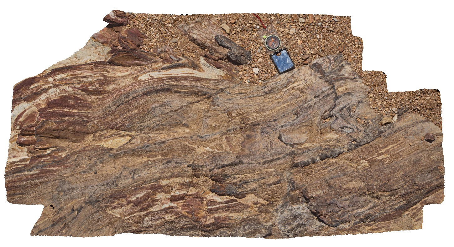
detailed view of fold and fault zone in thinly bedded sandstone and siltstone in Adelaidean metasediments. Copley, S.A. |
1.40 |
-30.52472000000 |
138.53644000000 |
309.000 |
Adelaidean, fault, fold, structure, metasediments |
metasediments |
Copley3 Map
 |
5 |
01/01/9999 midnight |
3D terrestrial photogrammetric model |
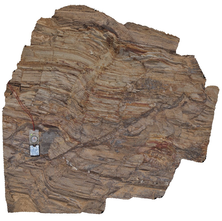
iron oxide infilled fault breccia with kink-bands in Adelaidean metasediments. Copley, S.A. |
1.40 |
-30.52467000000 |
138.53604000000 |
-9999.000 |
fault, structure, kink band, metasediment, Adelaidean |
metasediments |
 AusGeol.org