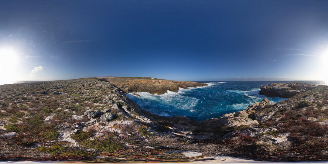
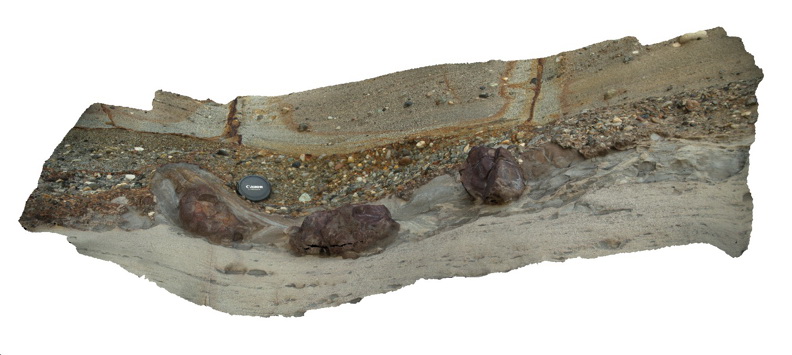
CarnotFSP7 Map
 |
0 |
10/28/2015 12:23 p.m. |
FSP |
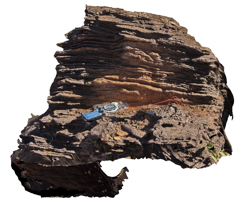
view of Cape Carnot, showing gneiss outcrop and geological unconformity with overlying Tertiary sand. Cape Carnot. S.A. |
1000.00 |
-34.94281800000 |
135.62137400000 |
-9999.000 |
unconformity, gneiss, sand |
gneiss, sand |
CattleCreek1 Map
 |
0 |
06/13/2016 noon |
3D |
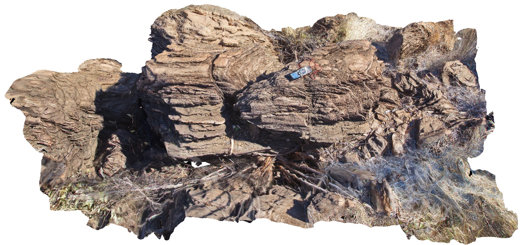
harmonic and disharmonic folds in psammitic and pelitic beds. Cattle Creek, Purnululu National Park road. W.A. |
0.80 |
-17.42998000000 |
128.08949000000 |
-9999.000 |
harmonic folds, disharmonic folds, structure, pelite, psammite |
psammite |
CattleCreek2 Map
 |
0 |
06/13/2016 noon |
3D |
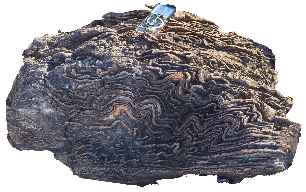
parasitic folds and fold hinge in psammitic and pelitic beds. Cattle Creek, Purnululu National Park road. W.A. |
2.50 |
-17.42995000000 |
128.08943000000 |
-9999.000 |
parasitic fold, fold, structure, psammite, pelite |
pelite |
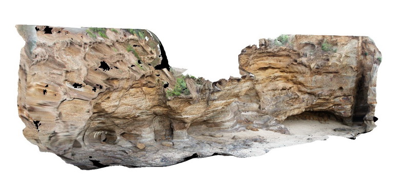
CattleCreek3 Map
 |
0 |
06/13/2016 noon |
3D |
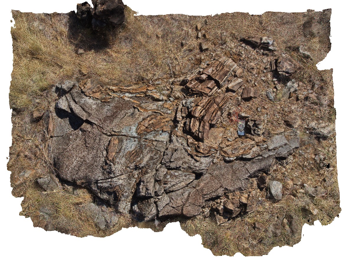
contact between folded pelite and granite. Folded pelite xenoliths occur within the granite. Cattle Creek, Purnululu National Park road. W.A. |
3.00 |
-17.42932000000 |
128.08986000000 |
-9999.000 |
intrusive contact, folded pelite, granite |
pelite, granite |
CattleCreek4 Map
 |
0 |
06/13/2016 noon |
3D |
parasitic folds in pelitic and psammite beds. Cattle Creek, Purnululu National Park road. W.A. |
1.20 |
-17.43000000000 |
128.08939000000 |
-9999.000 |
pelite, psammite, open fold, fold hinge |
pelite |
CavesBch1 Map
 |
5 |
07/08/2015 10:21 a.m. |
3D |
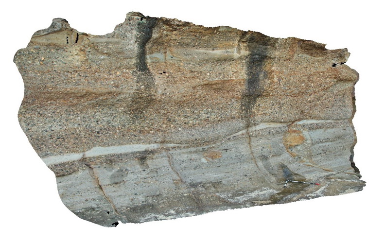
Fluvial sandstone and conglomerate of the Permian Boolaroo Formation. Caves Beach, N.S.W. |
8.00 |
-33.11150000000 |
151.64642000000 |
2.000 |
sandstone, conglomerate, fluvial, sedimentology |
sandstone, conglomerate |
CavesBch2 Map
 |
5 |
07/08/2015 10:22 a.m. |
3D |
Detail of polymictic conglomerate and sandstone shown in CavesBch1 - Boolaroo Formation. Caves Beach, N.S.W. |
0.50 |
-33.11150000000 |
151.64642000000 |
2.000 |
sandstone, conglomerate, fluvial, sedimentology, polymictic |
sandstone, conglomerate |
CavesBch3 Map
 |
5 |
07/08/2015 10:23 a.m. |
3D |
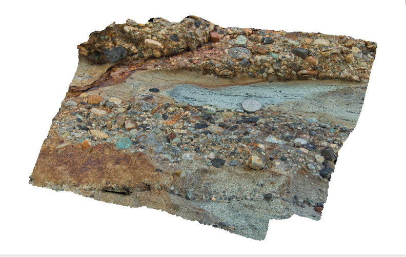
Fe-rich Carbonate? Concretions in medium sandstone layers in a fluvial sequence of sandstone and conglomerate. Caves Beach, N.S.W. |
4.00 |
-33.11278000000 |
151.64615000000 |
2.000 |
sandstone, conglomerate, fluvial, sedimentology, concretions |
sandstone, conglomerate |
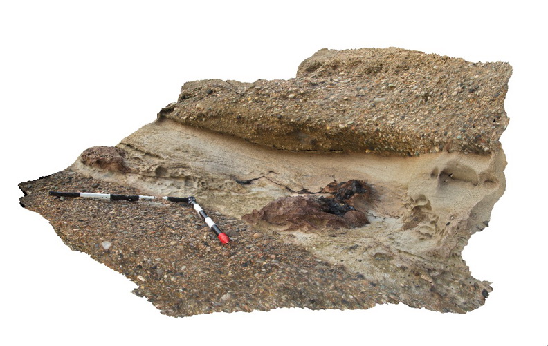
CavesBch4 Map
 |
5 |
07/08/2015 10:24 a.m. |
3D |
Details of concretions and mudstone rip-up clasts in sandstone and conglomerate of the Permian Boolaroo Formation. Caves Beach, N.S.W. |
1.20 |
-33.11150000000 |
151.64642000000 |
2.000 |
sandstone, conglomerate, concretion, fluvial, sedimentology, rip-up clasts |
sandstone, conglomerate |
CavesBch5 Map
 |
5 |
07/08/2015 10:25 a.m. |
3D |
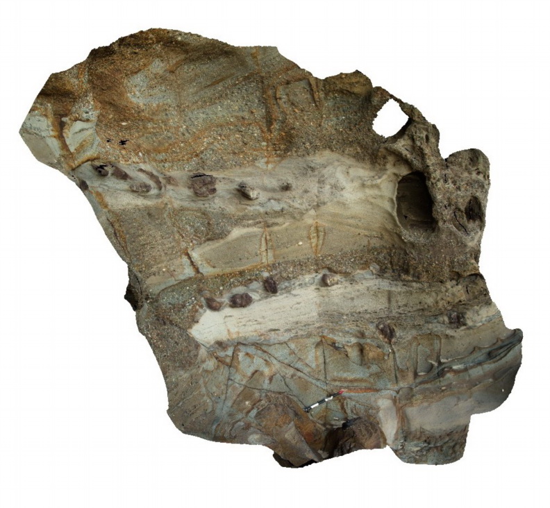
overall view of fluvial sedimentology in the Permian Boolaroo Formation with overlapping sandstone and pebble conglomerate lenses. Sea caves developed in the sandstone. Caves Beach, N.S.W. |
25.00 |
-33.11150000000 |
151.64642000000 |
1.000 |
sandstone, conglomerate, fluvial, sedimentology, sea caves, geomorphology |
sandstone, conglomerate |
CavesBch6 Map
 |
5 |
07/08/2015 10:26 a.m. |
3D |
petrified/coalified log in sandstone layer within the Permian Boolaroo Formation. Log is not in growth position. Caves Beach, N.S.W. |
1.50 |
-33.11258000000 |
151.64641000000 |
1.000 |
petrified log, coalified log, sandstone, conglomerate, fluvial, sedimentology, palaeontology |
sandstone, conglomerate |
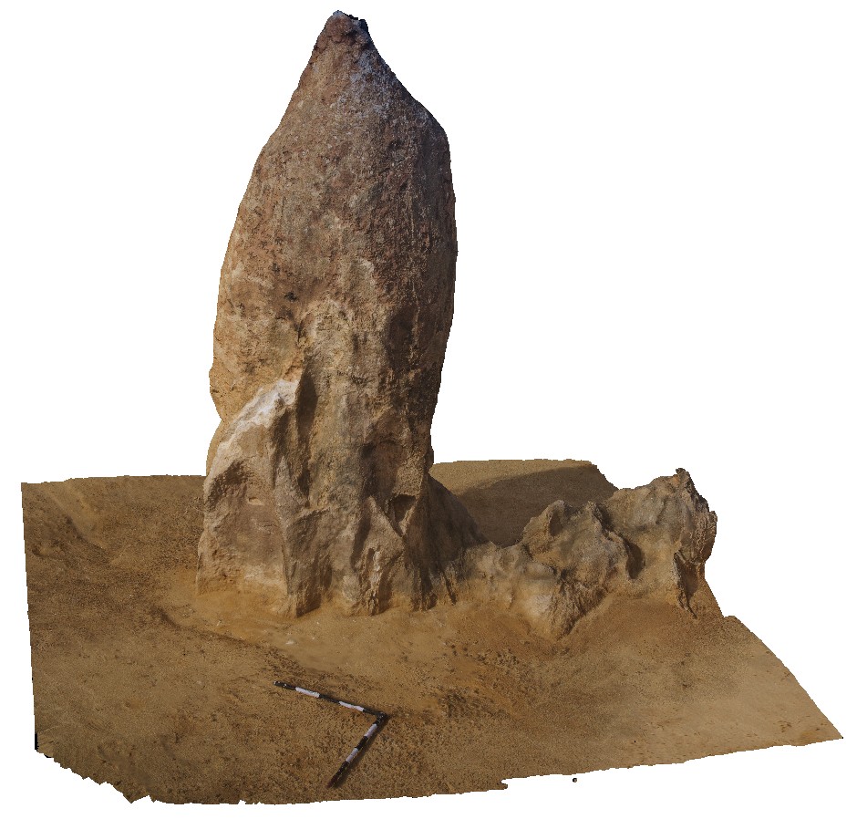
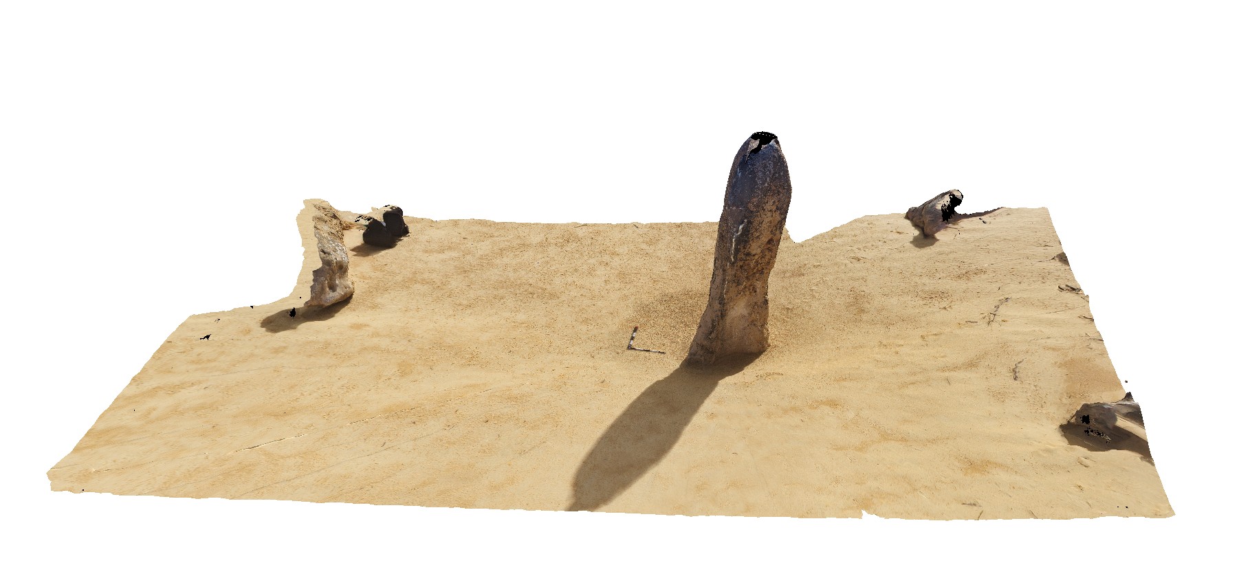
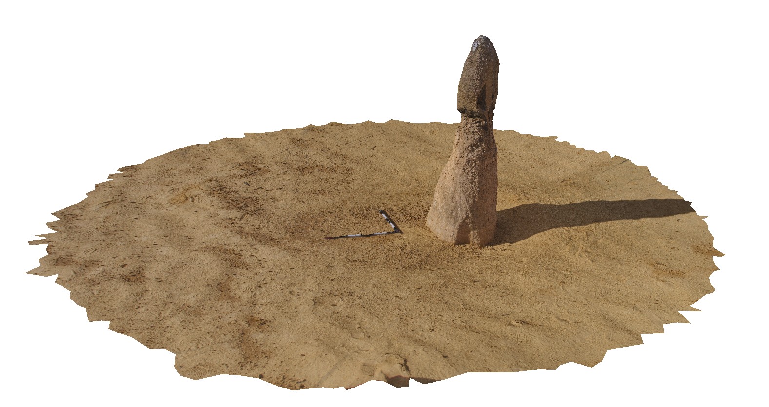
Cervantes1 Map
 |
0 |
05/18/2016 noon |
3D |
detail of a single pillar of limestone at the 'Pinnacles Desert', Nambung National Park, Cervantes, W.A. |
3.20 |
-30.60425000000 |
115.16113000000 |
-9999.000 |
limestone pinnacles, weathering features |
limestone |
Cervantes2 Map
 |
0 |
05/18/2016 noon |
3D |
detail of single large pillar at 'Pinnacles Desert', Nambung National Park, Cervantes, W.A. |
10.00 |
-30.60414000000 |
115.16162000000 |
-9999.000 |
limestone pillar, weathering feature |
limestone |
Cervantes3 Map
 |
0 |
05/18/2016 noon |
3D |
detail of single small pillar at 'Pinnacles Desert', Nambung National Park, Cervantes, W.A. |
3.80 |
-30.60425000000 |
115.16090000000 |
-9999.000 |
weathering feature, limestone weathering |
limestone |
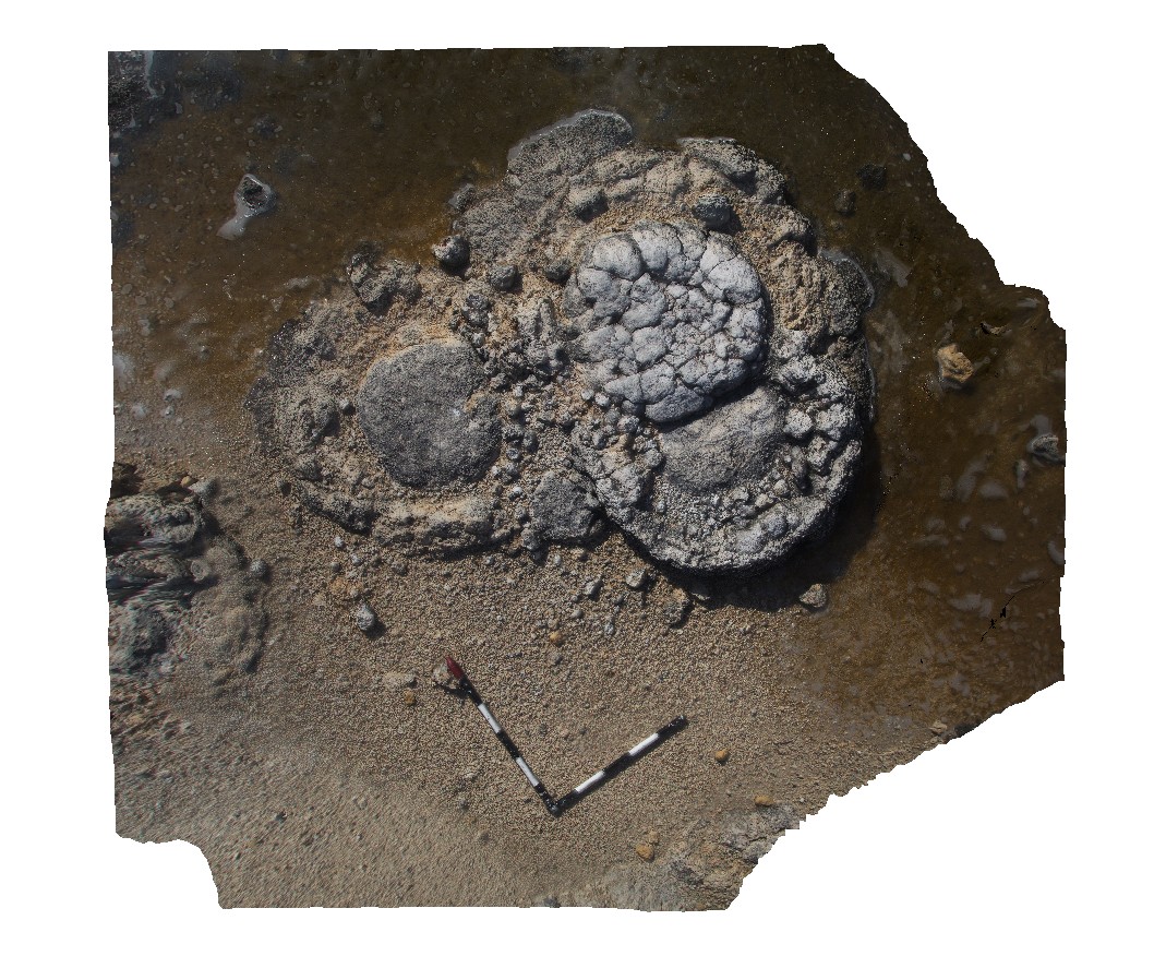
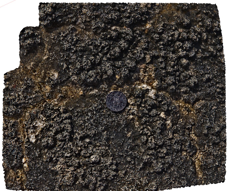
Cervantes4 Map
 |
0 |
05/18/2016 noon |
3D |
detail of large stromatolite at Lake Thetis, Cervantes, W.A. |
2.20 |
-30.50755000000 |
115.08070000000 |
-9999.000 |
stromatolites |
limestone |
Cervantes5 Map
 |
0 |
05/18/2016 noon |
3D |
view of large domed stromatolite at Lake Thetis, Cervantes, W.A. |
2.60 |
-30.50760000000 |
115.08094000000 |
-9999.000 |
stromatolite |
limestone |
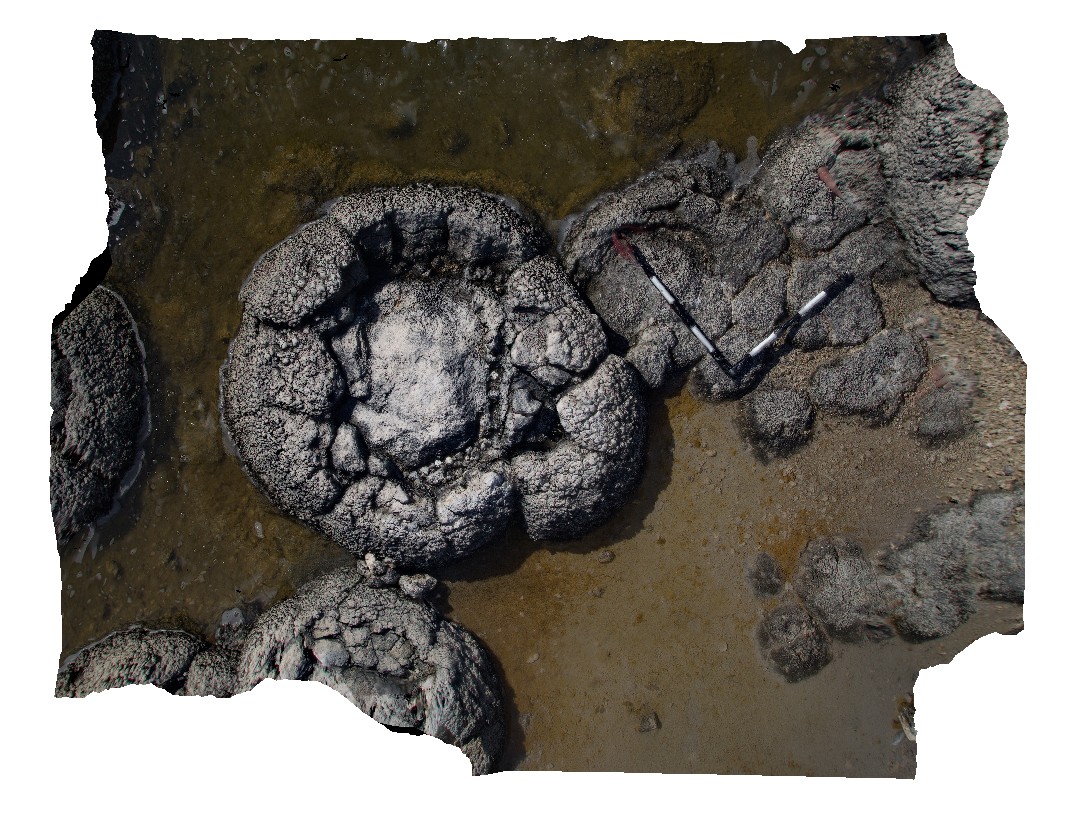
Cervantes6 Map
 |
0 |
05/18/2016 noon |
3D |
detail of nodular texture on flat surface of stromatolite at Lake Thetis, Cervantes, W.A. |
0.60 |
-30.50757000000 |
115.08096000000 |
-9999.000 |
stromatolite, nodular texture |
limestone |
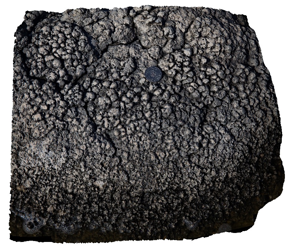
Cervantes7 Map
 |
0 |
05/18/2016 noon |
3D |
detail of nodular texture on flat surface of stromatolite at Lake Thetis, Cervantes, W.A. |
0.45 |
-30.50757000000 |
115.08096000000 |
-9999.000 |
stromatolite, nodular texture |
limestone |
CervantesFSP1 Map
 |
0 |
05/18/2016 noon |
FSP |
stromatolite at Lake Thetis, Cervantes, W.A. |
200.00 |
-30.50755000000 |
115.08086000000 |
-9999.000 |
stromatolite |
limestone |
CervantesFSP2 Map
 |
0 |
05/18/2016 noon |
FSP |
stromatolite at Lake Thetis, Cervantes, W.A. |
200.00 |
-30.50752000000 |
115.08070000000 |
-9999.000 |
stromatolite |
limestone |
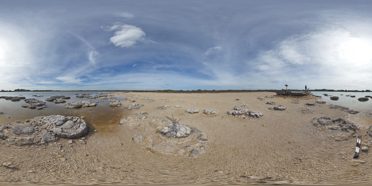
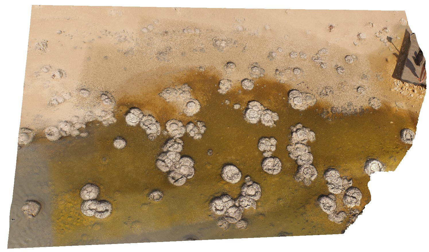
CervantesUAV2 Map
 |
0 |
05/18/2016 noon |
UAV |
aerial view of pinnacles, 'Pinnacles Desert', Nambung National Park, Cervantes, W.A. |
50.00 |
-30.60426800000 |
115.16101400000 |
-9999.000 |
weathering features, limestone weathering feature |
limestone |
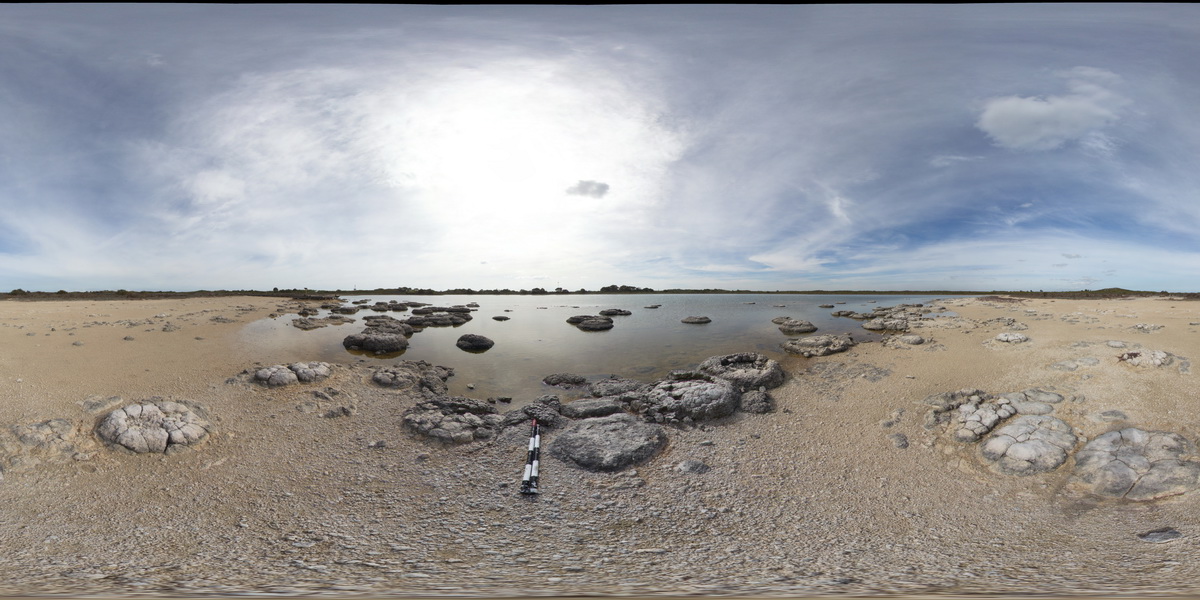
CervantesUAV4 Map
 |
0 |
05/18/2016 noon |
UAV |
detail of stromatolites in Lake Thetis, Cervantes, W.A. |
50.00 |
-30.50759200000 |
115.08074200000 |
-9999.000 |
stromatolites |
limestone |
Chichester1 Map
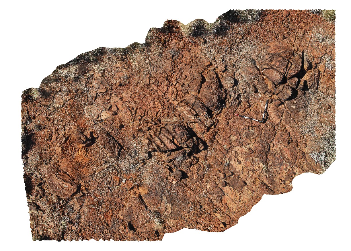 |
0 |
05/31/2016 noon |
3D |
plan view of large domed stromatolites in carbonate pavement near the Great Northern Highway, Cooletha Hill, W.A. |
5.80 |
-22.00139000000 |
118.82688000000 |
-9999.000 |
stromatolites, carbonate, sedimentology |
carbonate |
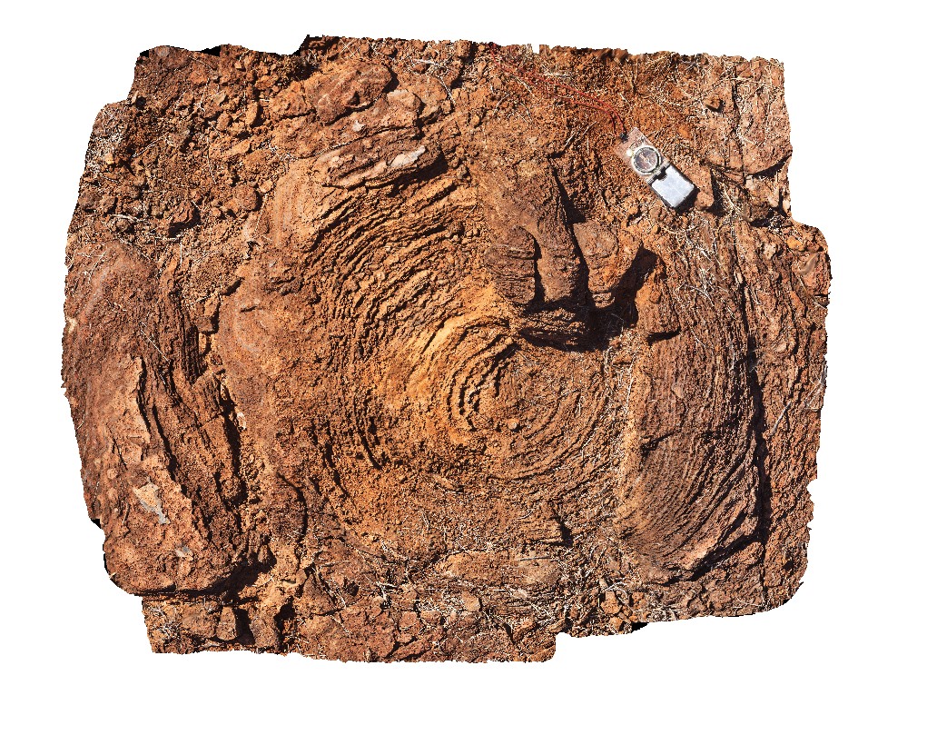
Chichester2 Map
 |
0 |
05/31/2016 noon |
3D |
detail of eastern domed stromatolite from image Chichester1, showing concentric zones. Carbonate pavement near the Great Northern Highway, Cooletha Hill, W.A. |
1.30 |
-22.00139000000 |
118.82688000000 |
-9999.000 |
stromatolite, carbonate |
carbonate |
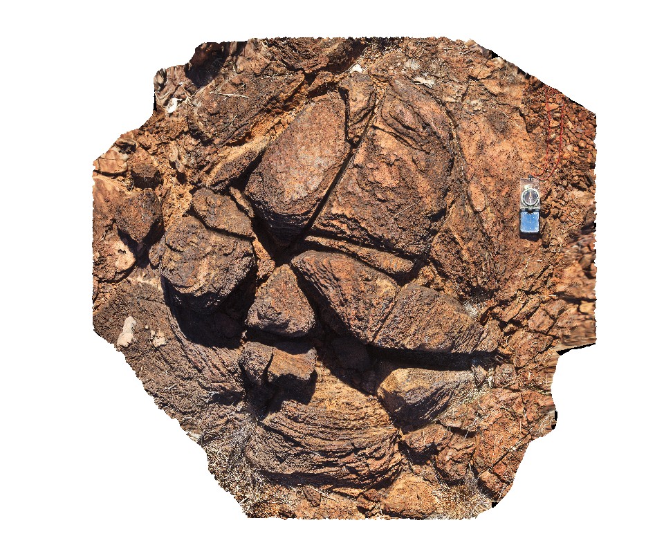
Chichester3 Map
 |
0 |
05/31/2016 noon |
3D |
detail of western domed stromatolite from image Chichester1, showing concentric zones. Carbonate pavement near the Great Northern Highway, Cooletha Hill, W.A. |
1.20 |
-22.00139000000 |
118.82688000000 |
-9999.000 |
stromatolite, carbonate, sedimentology |
carbonate |