EPilbara31 Map
 |
0 |
06/01/2016 noon |
3D |
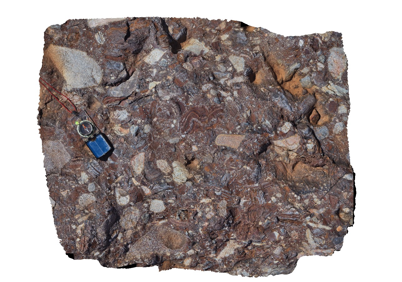
polymict cobble-boulder conglomerate, including sediments and granitic clasts. Hillside-Marble Bar Road, East Pilbara, W.A. |
1.00 |
-21.34930000000 |
119.61591000000 |
-9999.000 |
conglomerate, polymict, sub angular clasts |
conglomerate |
EPilbara32 Map
 |
0 |
06/01/2016 noon |
3D |
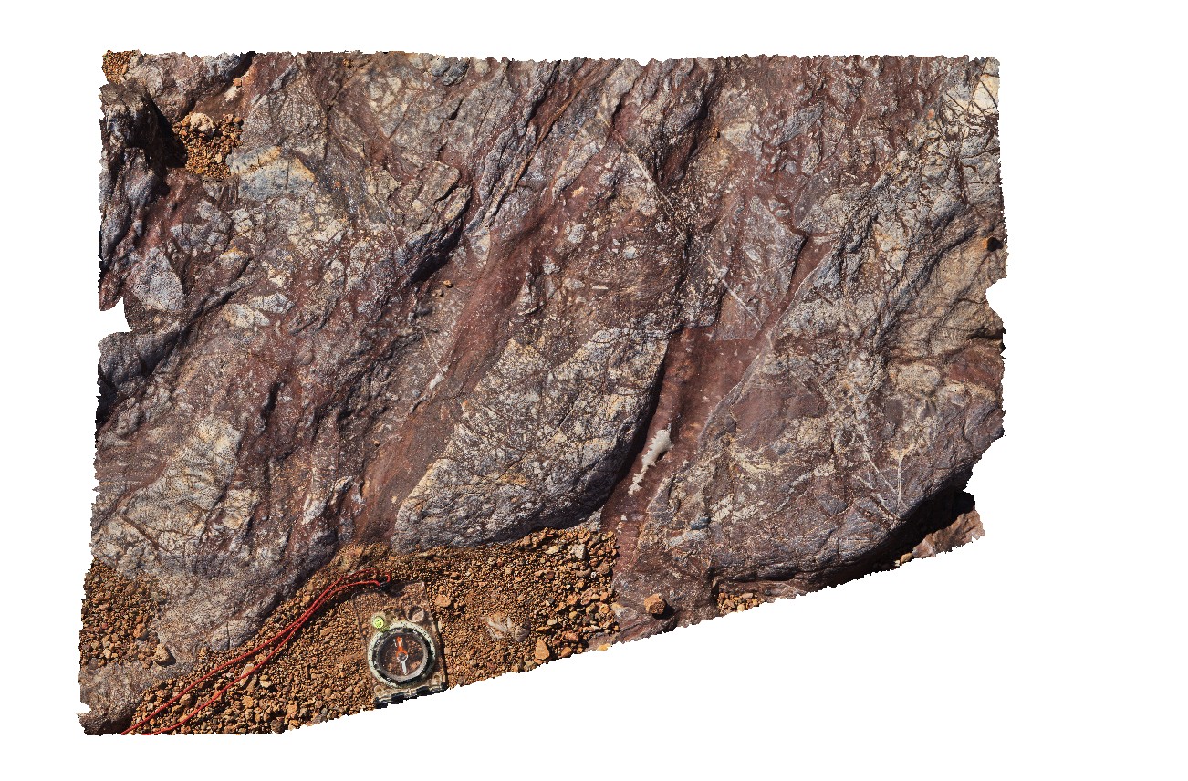
oxidised, hematite rich, hydrothermal chert breccia. Hillside-Marble Bar Road, East Pilbara, W.A. |
0.80 |
-21.35007000000 |
119.61578000000 |
-9999.000 |
hydrothermal breccia, chert, oxidised |
breccia |
EPilbara33 Map
 |
0 |
06/01/2016 noon |
3D |
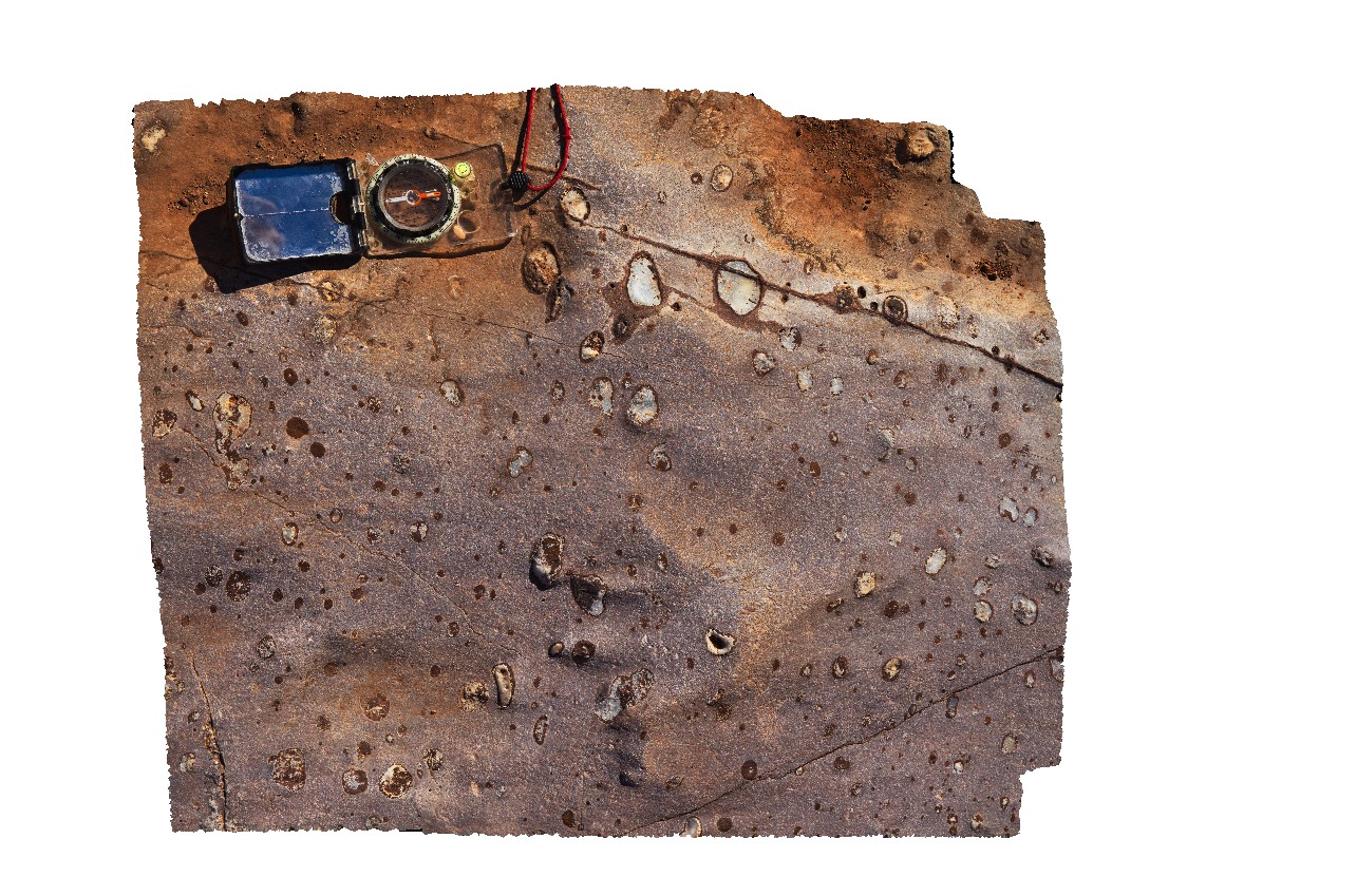
Amygdaloidal basalt with opaline silica infill. Hillside-Marble Bar Road, East Pilbara, W.A. |
0.55 |
-21.35107000000 |
119.61578000000 |
-9999.000 |
amygdales, basalt flow |
basalt |
EPilbara34 Map
 |
0 |
06/01/2016 noon |
3D |
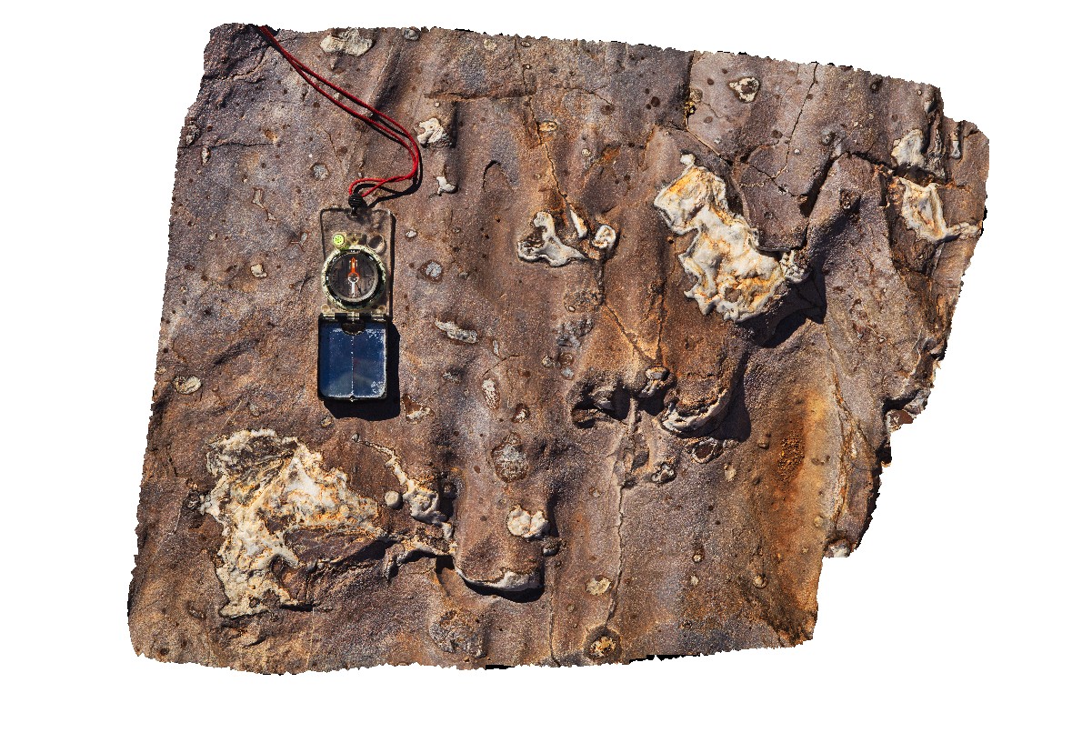
Amygdaloidal basalt with opaline silica infill. Hillside-Marble Bar Road, East Pilbara, W.A. |
0.60 |
-21.35101000000 |
119.61575000000 |
-9999.000 |
Amygdaloidal basalt, opaline silica, basalt flow |
basalt |
EPilbara4 Map
 |
0 |
05/31/2016 noon |
3D |
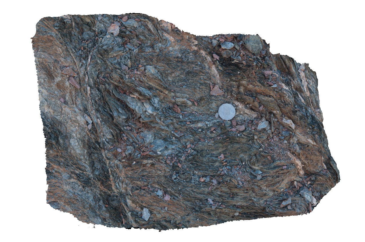
detail of intense deformation of schistosity in zone between carbonate veins in site Epilbara3. Woodstock - Rocky Island Road, East Pilbara, W.A. |
0.45 |
-21.61430000000 |
119.12663000000 |
-9999.000 |
deformation, schistosity, folding, structure |
Basalt |
EPilbara5 Map
 |
0 |
05/31/2016 noon |
3D |
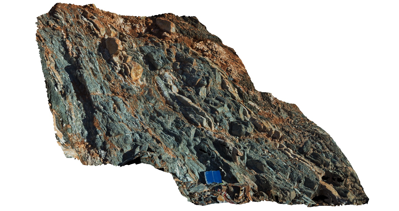
steeply NW plunging isoclinal folds in mafic schist. Woodstock - Rocky Island Road, East Pilbara, W.A. |
1.10 |
-21.61109000000 |
119.13963000000 |
-9999.000 |
fold plunge, isoclinal folds, folding |
basalt |
EPilbara6 Map
 |
0 |
05/31/2016 noon |
3D |
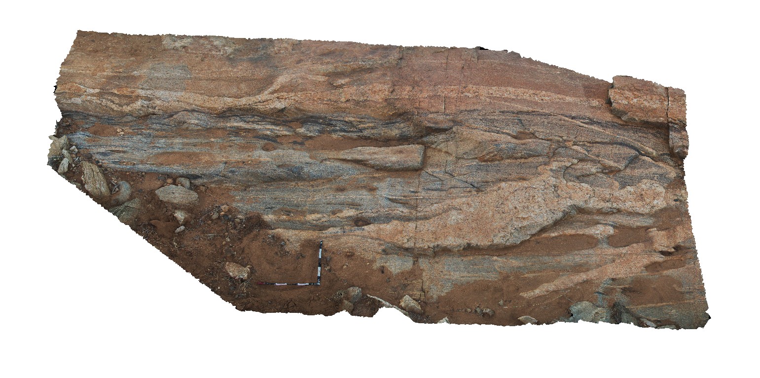
possible granite gneiss with numerous mafic zones that have been stretched and cut by multiple pegmatite phases. Woodstock - Rocky Island Road, East Pilbara, W.A. |
5.20 |
-21.53966000000 |
119.33646000000 |
-9999.000 |
gneiss, structure |
gneiss |
EPilbara7 Map
 |
0 |
05/31/2016 noon |
3D |
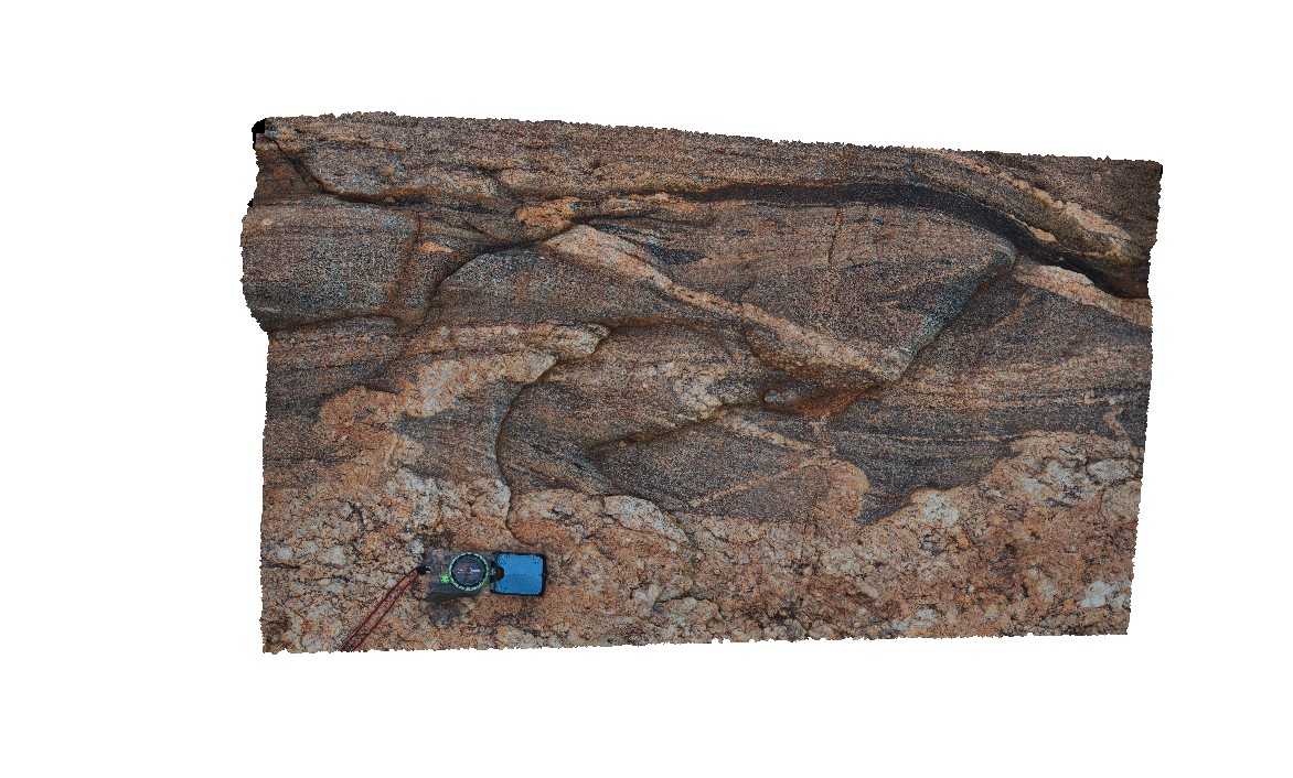
detail from site EPilbara6, showing folding of pegmatite intrusion with main foliation axial planar to folds. Granite also truncates the foliation. Woodstock - Rocky Island Road, East Pilbara, W.A. |
4.80 |
-21.53966000000 |
119.33646000000 |
-9999.000 |
granite, pegmatite, intrusion, folding, structure, foliation |
pegmatite, gneiss |
EPilbara8 Map
 |
0 |
05/31/2016 noon |
3D |
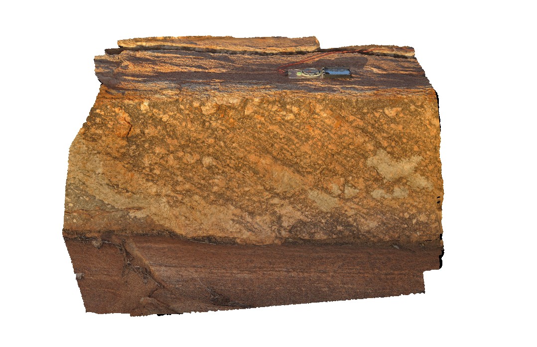
mineral stretching lineation on foliation plane in granitic? Gneiss. Woodstock - Rocky Island Road, East Pilbara, W.A. |
0.90 |
-21.53952000000 |
119.33662000000 |
-9999.000 |
mineral stretching lineation, foliation plane |
gneiss |
EPilbara9 Map
 |
0 |
05/31/2016 noon |
3D |
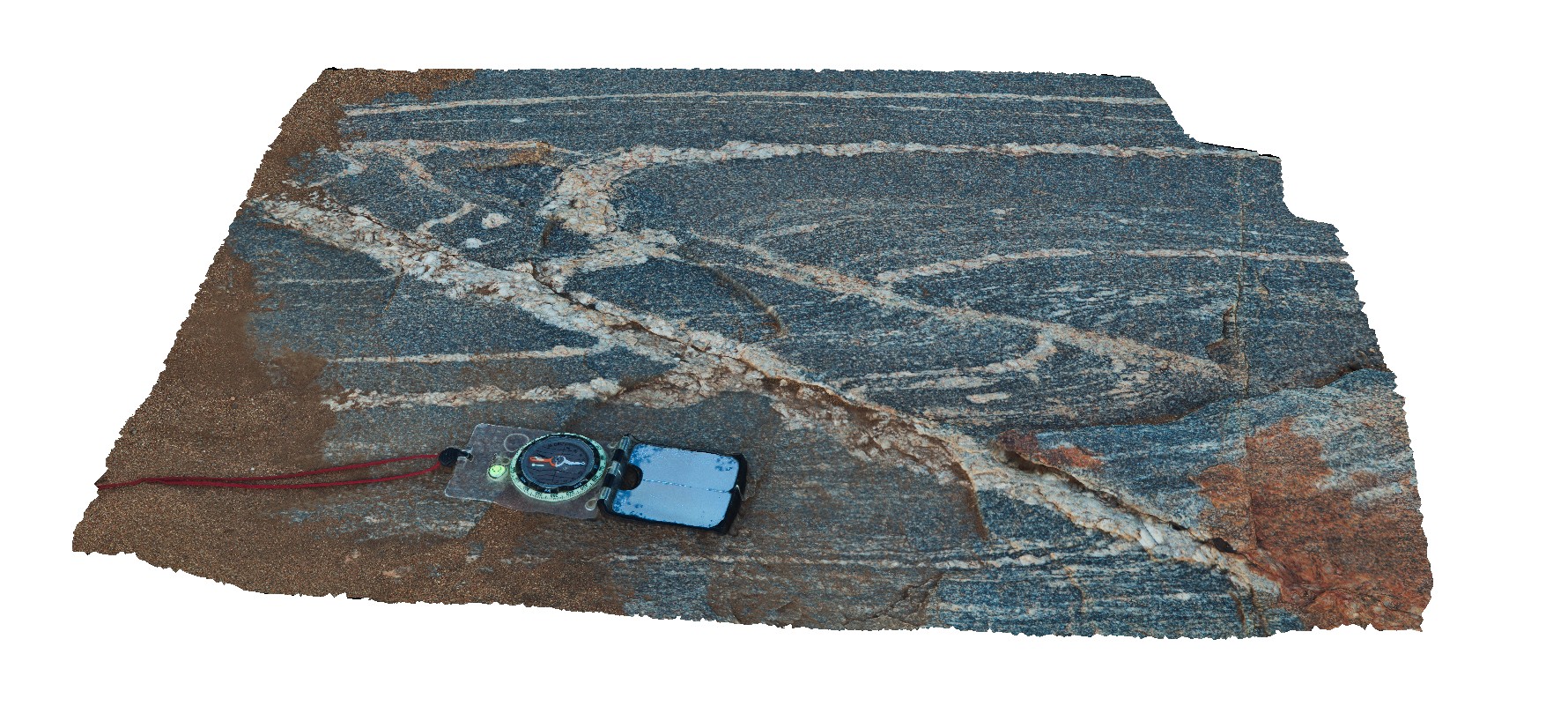
folded foliation and leucosomes cut by sheers and late pegmatite / leucosomes. Sinistral movement. Woodstock - Rocky Island Road, East Pilbara, W.A. |
3.50 |
-21.53952000000 |
119.33662000000 |
-9999.000 |
sinistral movement, leucosome, shearing, structure |
gneiss |
EPilbaraFSP1 Map
 |
0 |
06/01/2016 noon |
FSP |
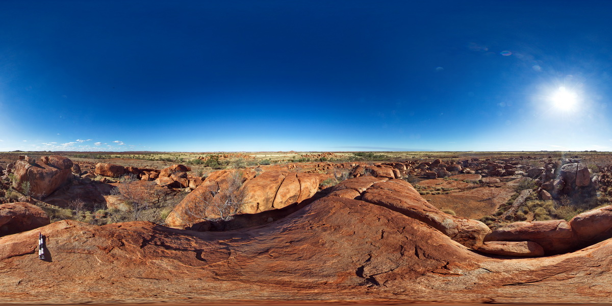
view of granite outcrops and surrounding area. Woodstock - Rocky Island Road, East Pilbara, W.A. |
5000.00 |
-21.60411000000 |
119.02820000000 |
-9999.000 |
granite outcrop |
granite |
EPilbaraFSP2 Map
 |
0 |
06/01/2016 noon |
FSP |
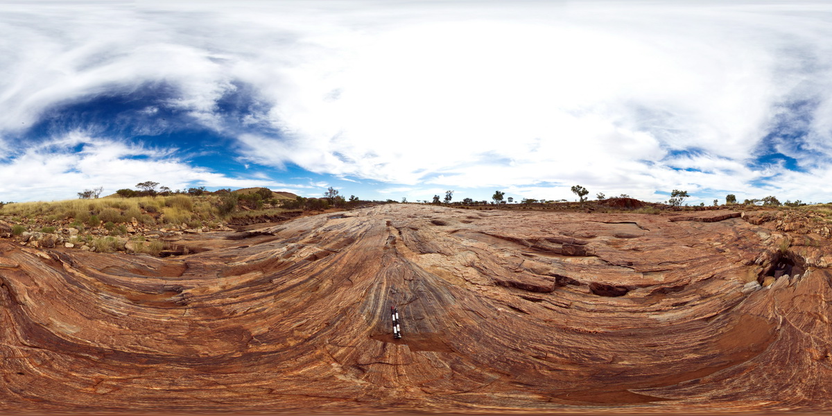
view of pavement of amphibolite stringers in granitic gneiss. Woodstock - Rocky Island Road, East Pilbara, W.A. |
1000.00 |
-21.53943000000 |
119.33561000000 |
-9999.000 |
granitic gneiss, outcrop |
gneiss |
EPilbaraFSP3 Map
 |
0 |
06/01/2016 noon |
FSP |
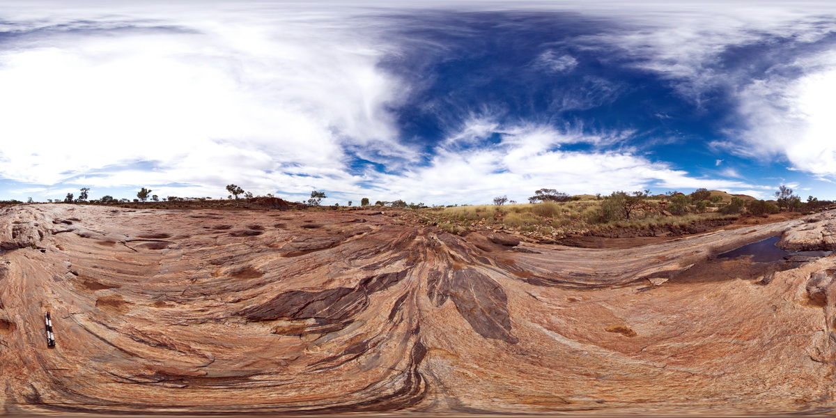
view of boudinaged amphibolite segments in granitic gneiss. Woodstock - Rocky Island Road, East Pilbara, W.A. |
1000.00 |
-21.53932000000 |
119.33559000000 |
-9999.000 |
boudinage, mylonite, amphibolite |
gneiss |
EPilbaraFSP4 Map
 |
0 |
06/01/2016 noon |
FSP |
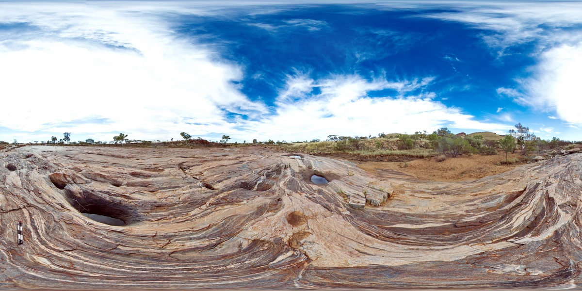
view of boudinaged amphibolite segments in granitic gneiss pavement. Woodstock - Rocky Island Road, East Pilbara, W.A. |
1000.00 |
-21.53913000000 |
119.33559000000 |
-9999.000 |
boudinage, amphibolite, granitic gneiss, structure |
granitic gneiss |
EPilbaraFSP5 Map
 |
0 |
06/01/2016 noon |
FSP |
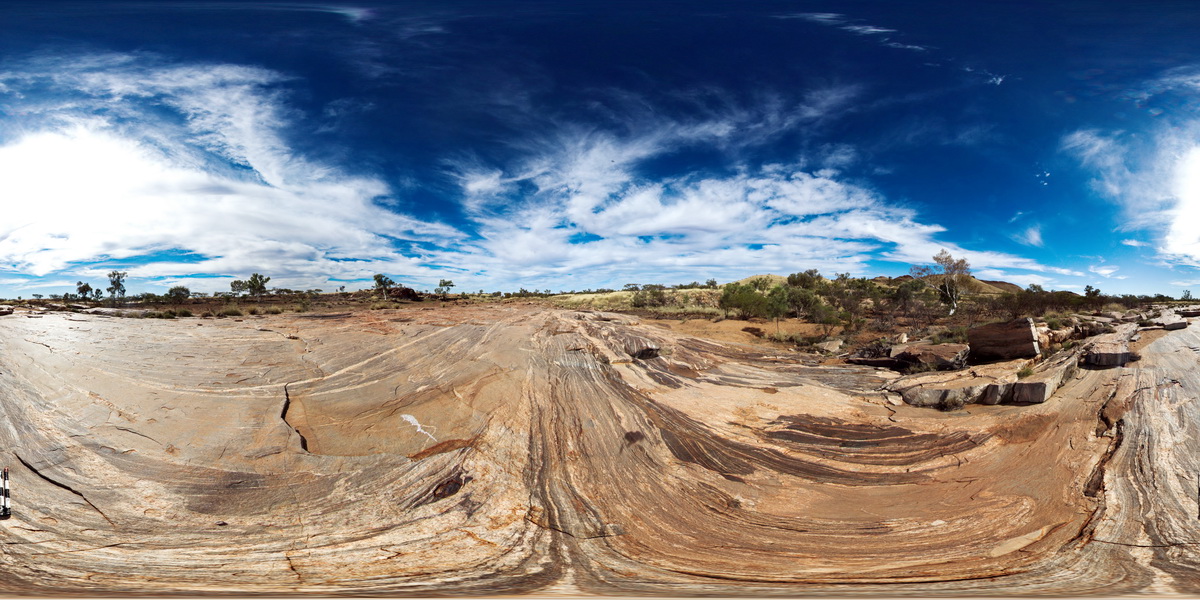
stretched, faulted and sheared amphibolite boudins / segments in granitic gneiss pavement. Woodstock - Rocky Island Road, East Pilbara, W.A. |
1000.00 |
-21.53904000000 |
119.33562000000 |
-9999.000 |
shear, fault, structure, amphibolite, granitic gneiss |
granitic gneiss |
EPilbaraFSP6 Map
 |
0 |
06/01/2016 noon |
FSP |
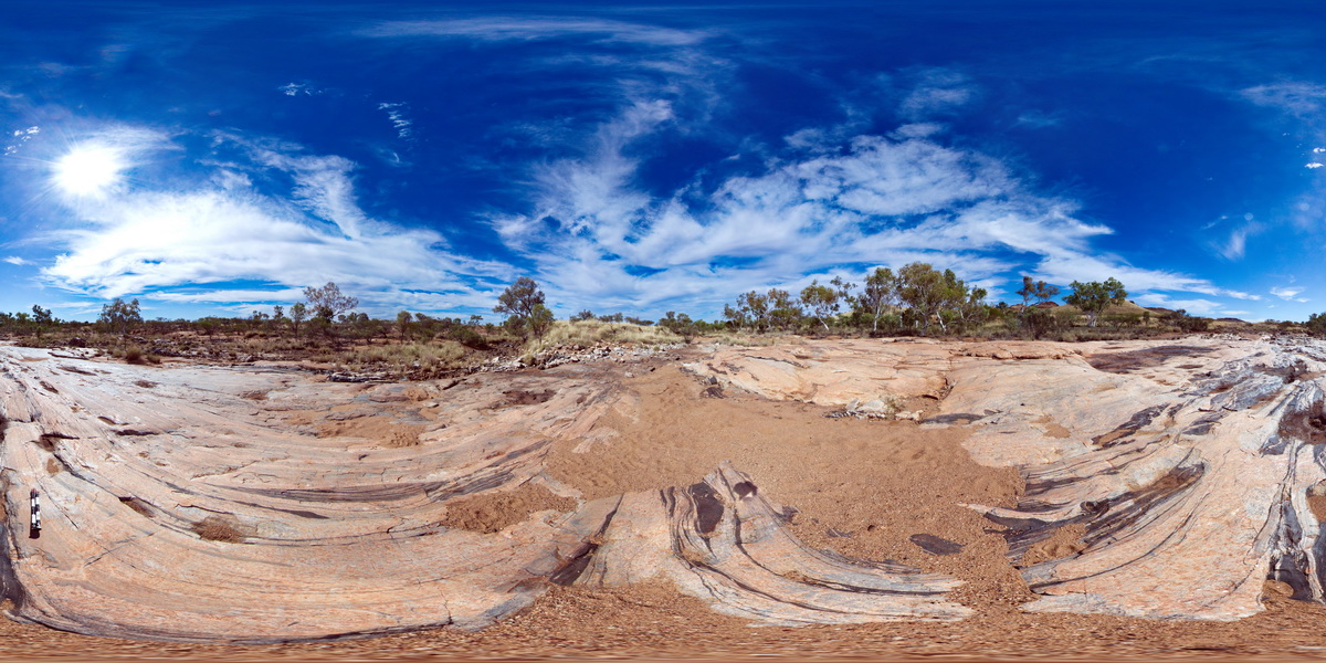
stretched, faulted and sheared amphibolite boudins / segments in granitic gneiss pavement. Woodstock - Rocky Island Road, East Pilbara, W.A. |
1000.00 |
-21.53887000000 |
119.33496000000 |
-9999.000 |
boudinage, amphibolite, faulted, sheared, structure |
granitic gneiss |
EPilbaraFSP7 Map
 |
0 |
06/01/2016 noon |
FSP |
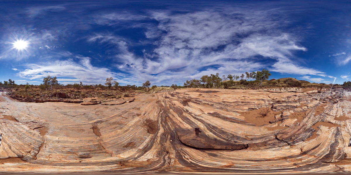
stretched, faulted and sheared amphibolite boudins / segments in granitic gneiss pavement. Woodstock - Rocky Island Road, East Pilbara, W.A. |
1000.00 |
-21.53873000000 |
119.33498000000 |
-9999.000 |
boudinage, amphibolite, structure, shear, fault |
granitic gneiss |
EPilbaraFSP8 Map
 |
0 |
06/01/2016 noon |
FSP |
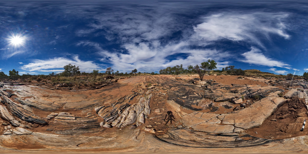
view of folded and faulted amphibolite bands in granitic gneiss pavement. Woodstock - Rocky Island Road, East Pilbara, W.A. |
1000.00 |
-21.53857000000 |
119.33494000000 |
-9999.000 |
fold, fault, amphibolite, granitic gneiss, structure |
granitic gneiss |
EPilbaraFSP9 Map
 |
0 |
06/01/2016 noon |
FSP |
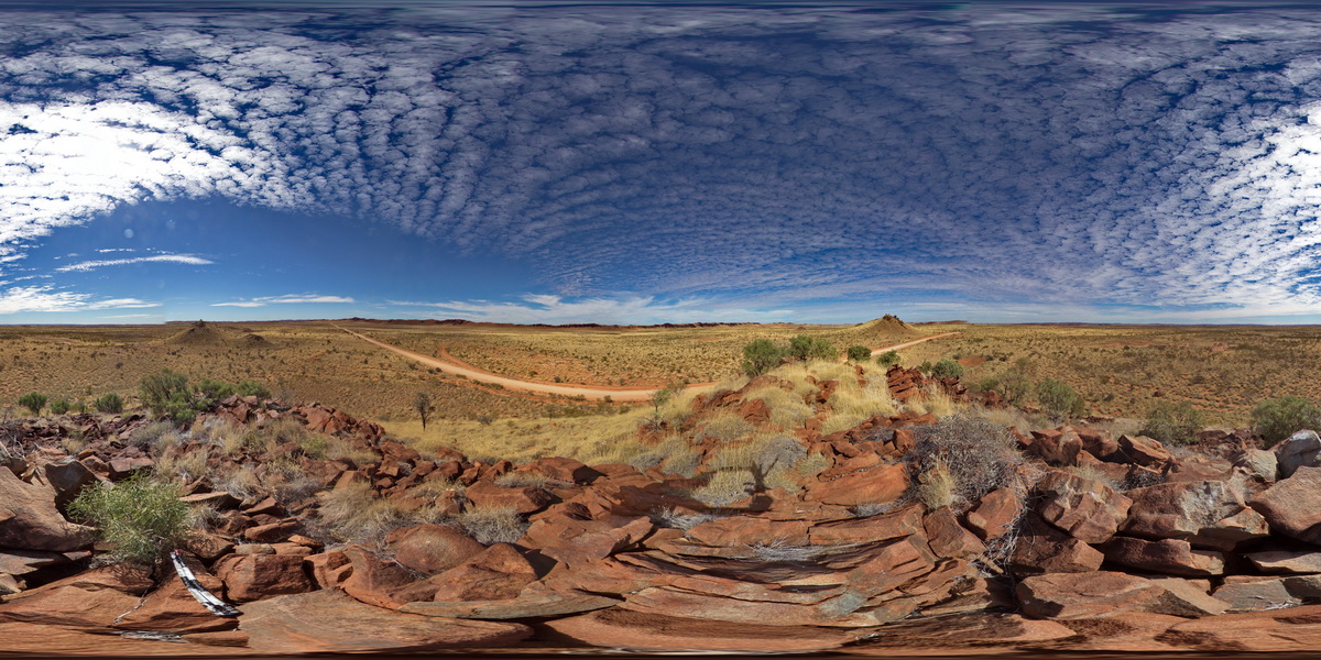
view from small gabbroic? Knoll looking to N and W. Also showing large black dolerite? Dyke 'wall' to the SE. Woodstock - Rocky Island Road, East Pilbara, W.A. |
5000.00 |
-21.53850000000 |
119.33490000000 |
-9999.000 |
mafic dyke, structural weakness |
dolerite |
EPilbaraUAV1 Map
 |
0 |
06/01/2016 noon |
UAV |
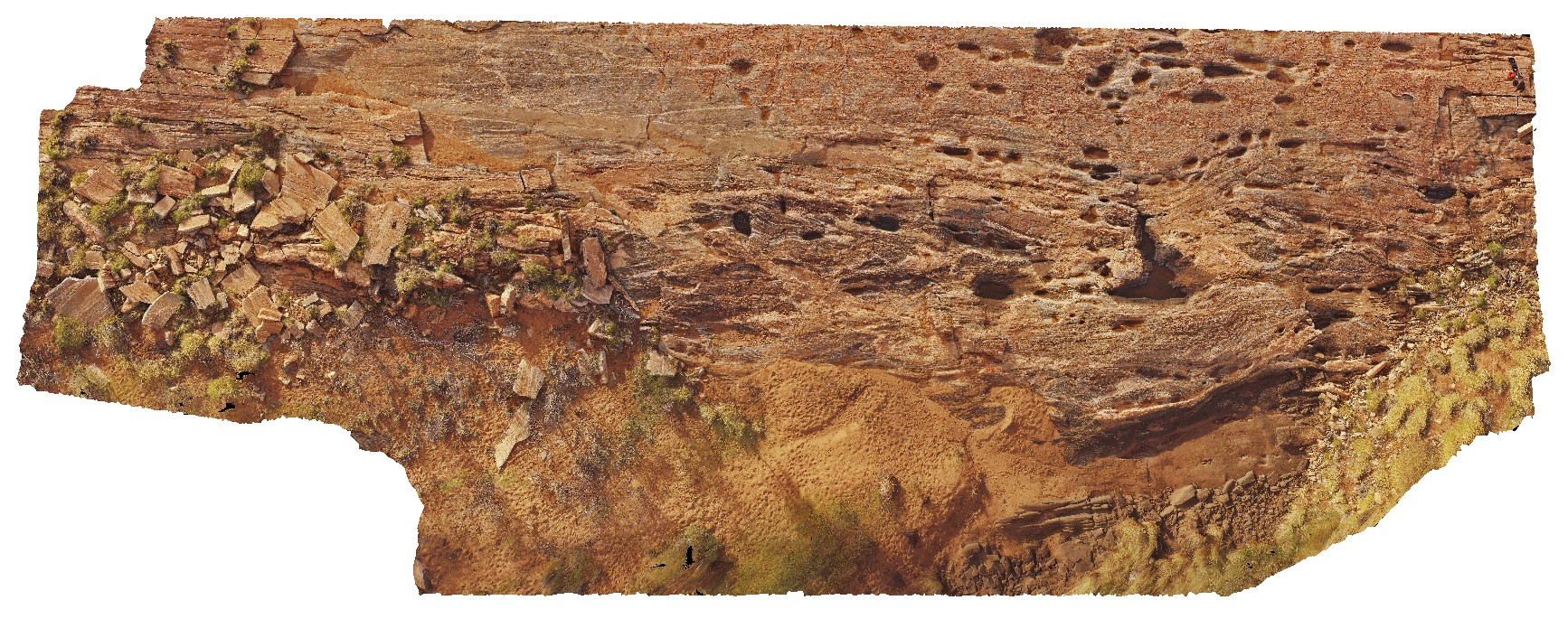
pavement of amphibolite stringers in granitic gneiss with pegmatite and other granitic intrusions. Woodstock - Rocky Island Road, East Pilbara, W.A. |
50.00 |
-21.53905700000 |
119.33549700000 |
-9999.000 |
amphibolite, granitic gneiss, igneous intrusions |
granitic gneiss |
EPilbaraUAV2 Map
 |
0 |
06/01/2016 noon |
UAV |
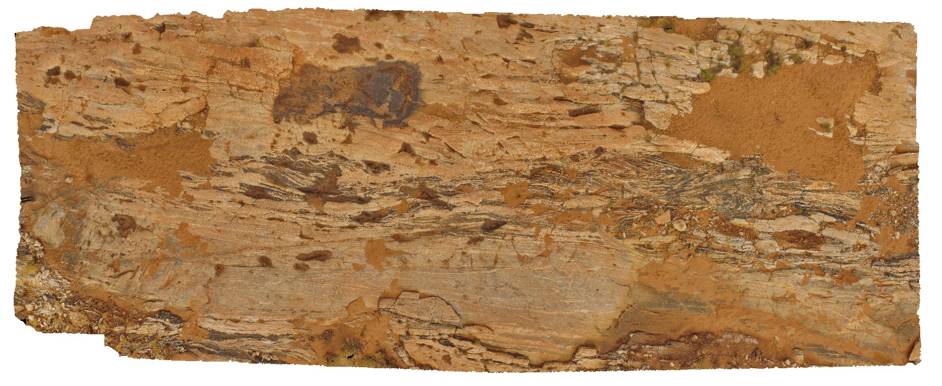
pavement of amphibolite stringers in granitic gneisses and pegmatite. Woodstock - Rocky Island Road, East Pilbara, W.A. |
50.00 |
-21.53884610000 |
119.33498690000 |
-9999.000 |
amphibolite stringers, granitic gneiss, pegmatite |
gneiss |
Erong1 Map
 |
0 |
05/26/2016 noon |
3D |
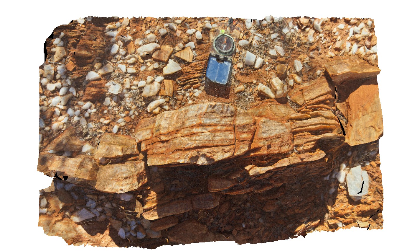
quartz mylonite with steeply east plunging lineations. Erong, East Murchison. W.A. |
0.00 |
-26.50613000000 |
116.74168000000 |
-9999.000 |
mylonite, lineation, structure |
mylonite |
Erong2 Map
 |
0 |
05/26/2016 noon |
3D |
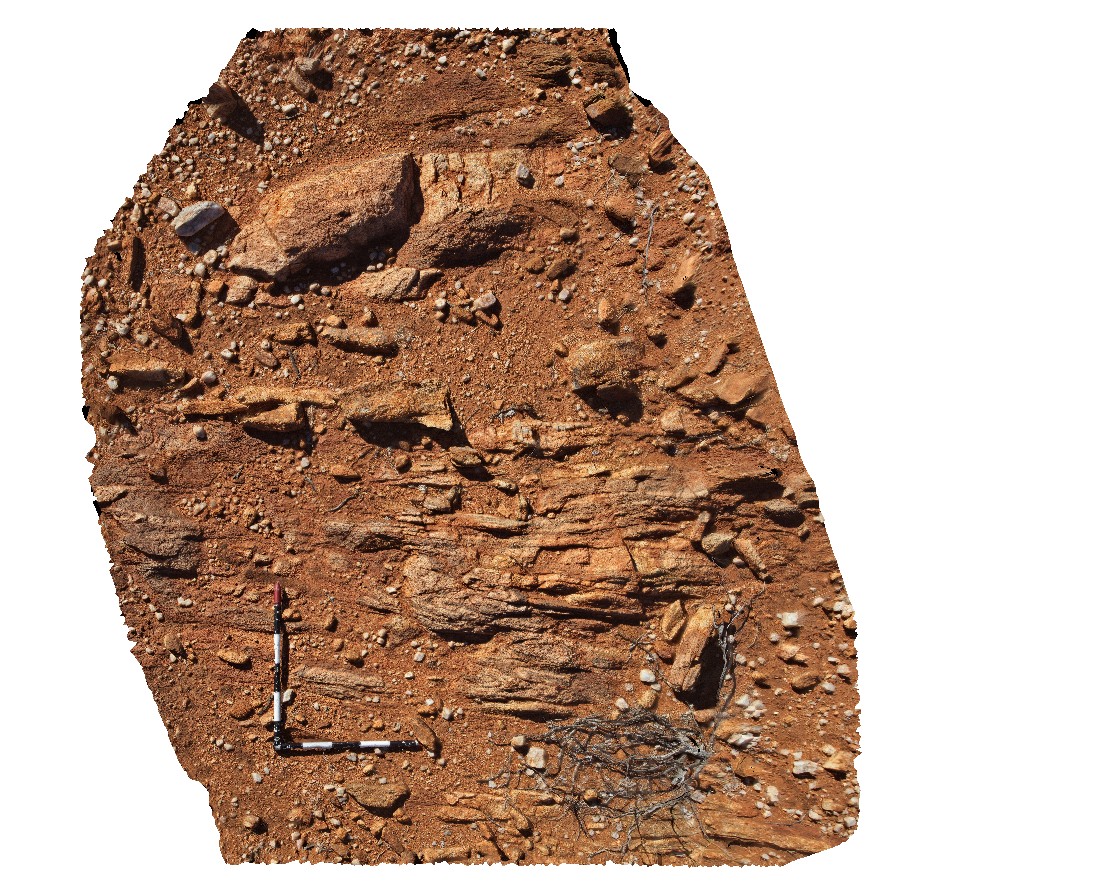
gneiss with folded leucosomes and boudinaged granite. Erong, East Murchison. W.A. |
2.70 |
-25.50815000000 |
116.65125000000 |
-9999.000 |
granite gneiss, leucosome, boudinage, structure |
granite gneiss |
Erong3 Map
 |
0 |
05/26/2016 noon |
3D |
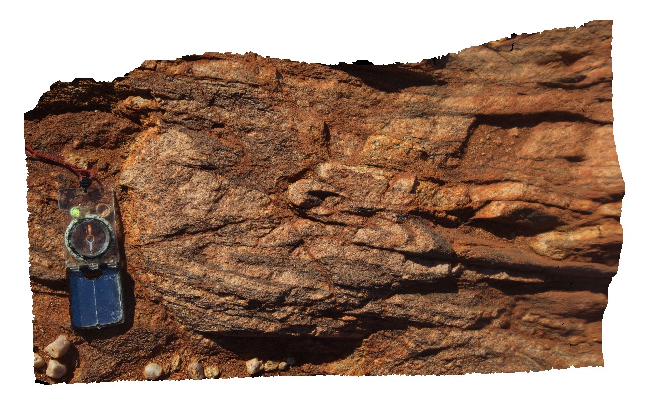
detail of tight to isoclinal folds in Erong granite / mylonite from site Erong2. Erong, East Murchison. W.A. |
0.90 |
-25.50816000000 |
116.65123000000 |
-9999.000 |
isoclinal fold, mylonite, structure |
granite gneiss |
ESCape1 Map
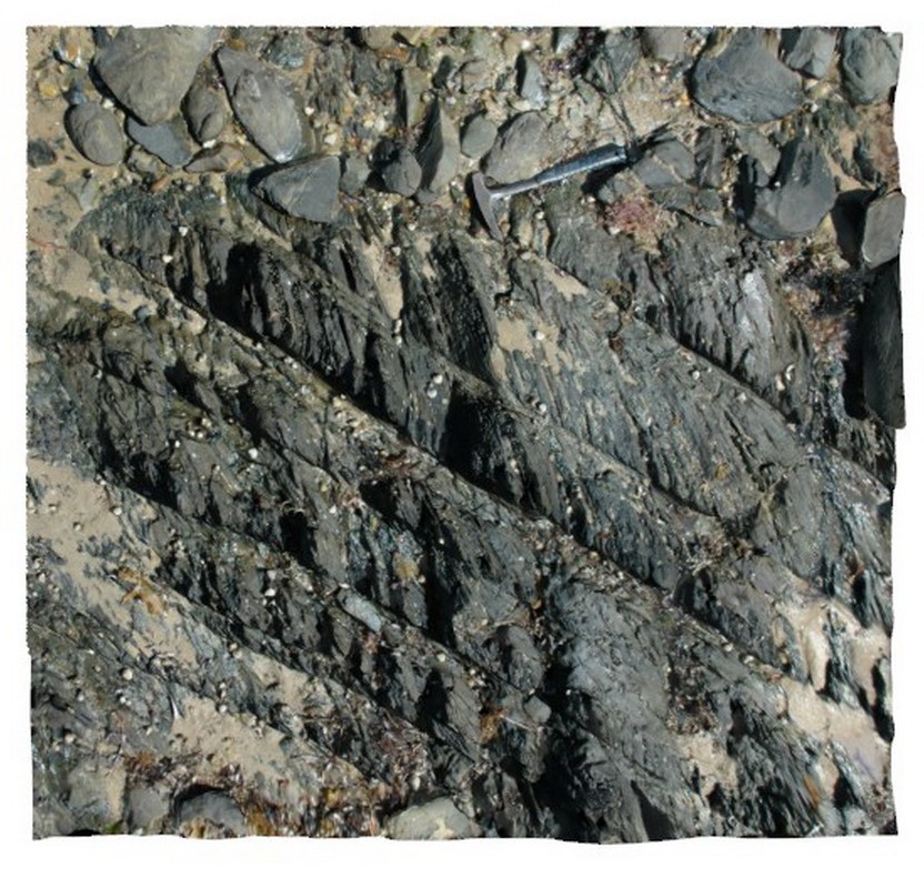 |
20 |
05/04/2016 1:50 p.m. |
3D |
Bedding and cross-cutting cleavage in fine to medium grained sandstone of the Mathinna Group. Sandy Point, Tas. |
1.50 |
-40.95676409000 |
147.35477482000 |
0.000 |
structure, cleavage, bedding, turbidite |
sandstone |


