Liptrap10 Map
 |
20 |
03/13/2015 9:17 a.m. |
3D |
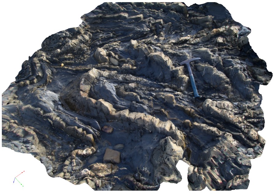
gently to moderately plunging folds in thinly bedded turbiditic sequence. Folds show thinning along limbs. Cape Liptrap, Vic. |
3.00 |
-38.90403789000 |
145.91713444000 |
0.000 |
folding, structure |
turbidite |
Liptrap11 Map
 |
20 |
03/13/2015 9:17 a.m. |
3D |
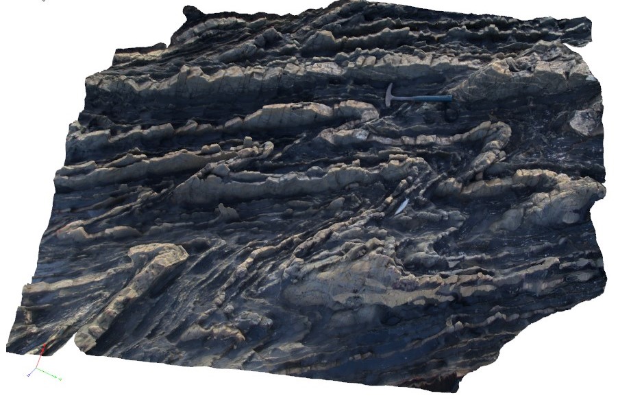
gently to moderately asymmetric folding, showing 'z' sense. Cape Liptrap, Vic. |
2.50 |
-38.90396425000 |
145.91697334000 |
0.000 |
z asymmetric folds, structure |
turbidite |
Liptrap12 Map
 |
20 |
03/13/2015 9:18 a.m. |
3D |
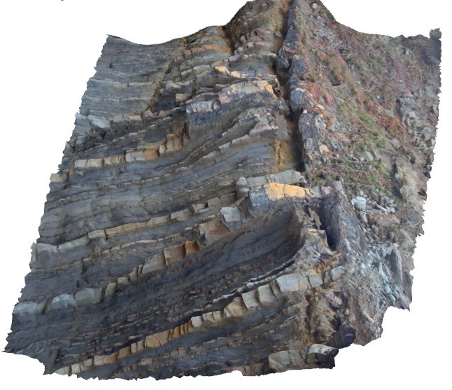
Geological unconformity between steeply dipping, finely bedded distal turbidites and Cenozoic? aged unconsolidated pebble deposits. Cape Liptrap, Vic. |
3.50 |
-38.90351876000 |
145.91685797000 |
0.000 |
unconformity, sedimentology |
turbidite, conglomerate |
Liptrap13 Map
 |
20 |
03/13/2015 9:18 a.m. |
3D |
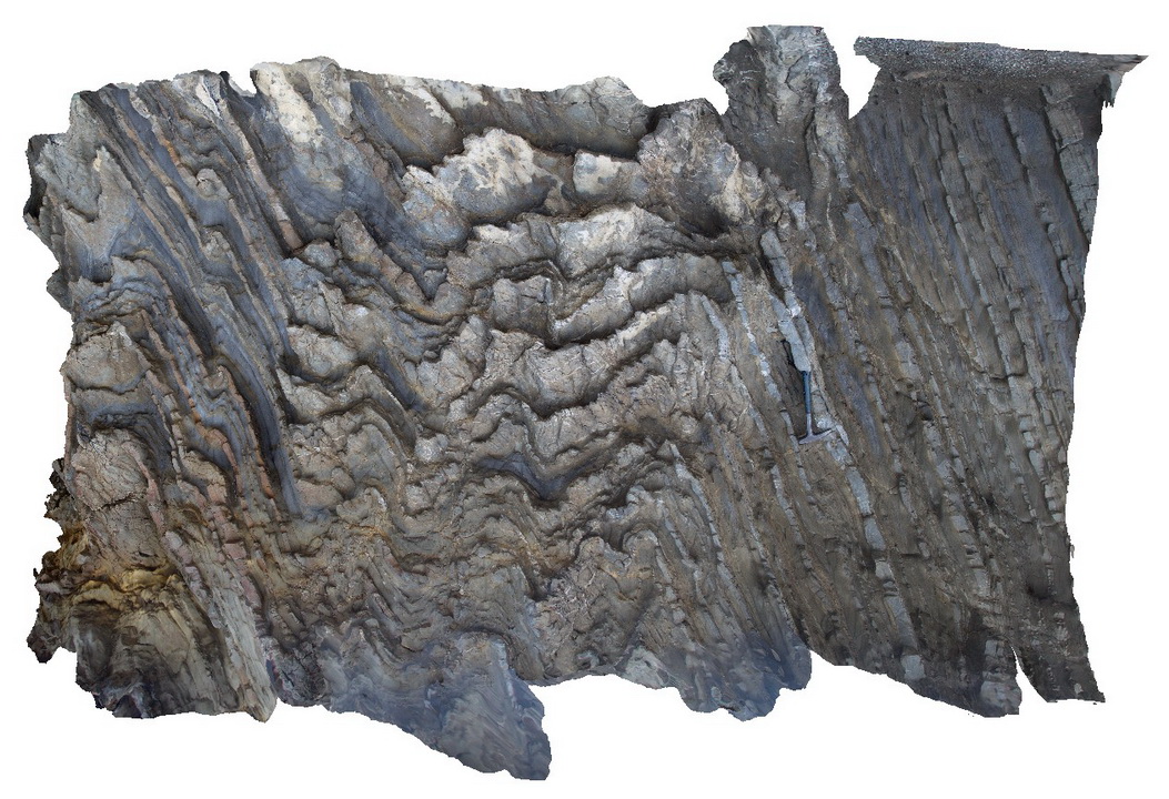
moderately plunging anticline, exhibiting asymmetrical 'z', 'm' and 's' type parasitic fold geometries in finely bedded distal turbidites. Cape Liptrap, Vic. |
3.50 |
-38.90339302000 |
145.91657564000 |
0.000 |
folding |
turbidite |
Liptrap14 Map
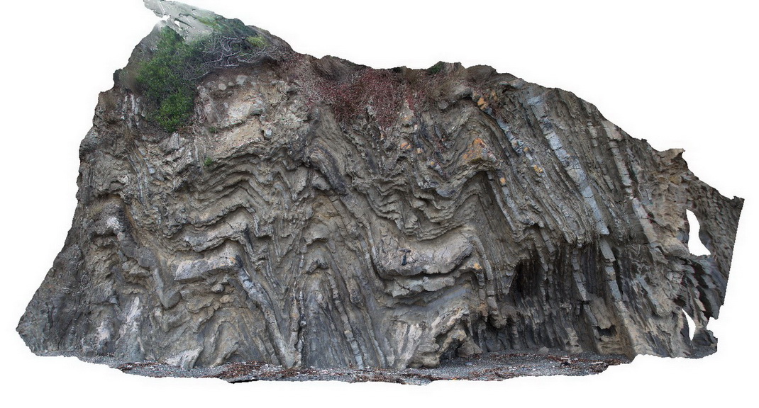 |
20 |
03/13/2015 9:19 a.m. |
3D |
tightly folded distal turbidites. Cape Liptrap, Vic. |
0.00 |
-38.90333045000 |
145.91635312000 |
0.000 |
structure, folding |
turbidite |
Liptrap15 Map
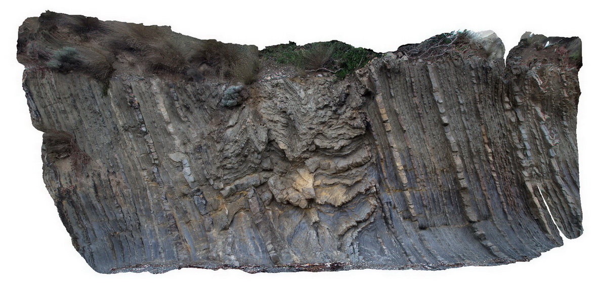 |
20 |
03/13/2015 9:19 a.m. |
3D |
zone of intense folding within distal turbidites. Cape Liptrap, Vic. |
6.00 |
-38.90319550000 |
145.91621653000 |
0.000 |
turbidite, sedimentology, structure, fold |
turbidite |
Liptrap16 Map
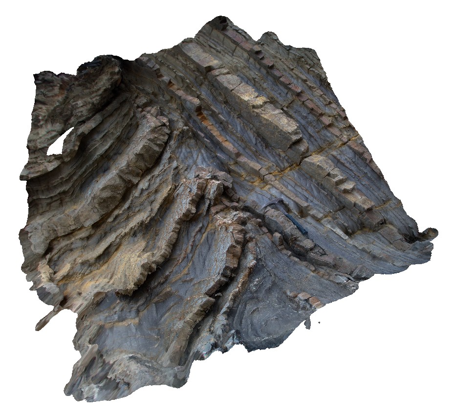 |
20 |
03/13/2015 9:19 a.m. |
3D |
zone of asymmetric folding within distal turbidites. Cape Liptrap, Vic. |
2.00 |
-38.90319180000 |
145.91613787000 |
0.000 |
structure, sedimentology, fold, turbidite |
turbidite |
Liptrap17 Map
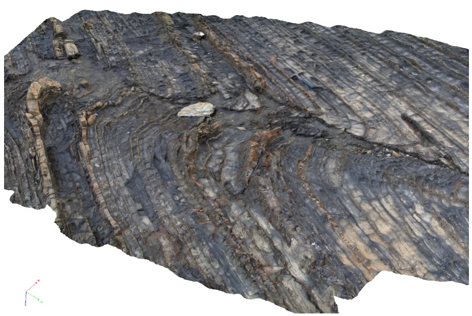 |
20 |
03/13/2015 9:20 a.m. |
3D |
drag movement indicators on fault within distal turbidite beds. Cape Liptrap, Vic. |
6.00 |
-38.90295236000 |
145.91582598000 |
0.000 |
turbidite, structure, sedimentology, fault |
turbidite |
Liptrap18 Map
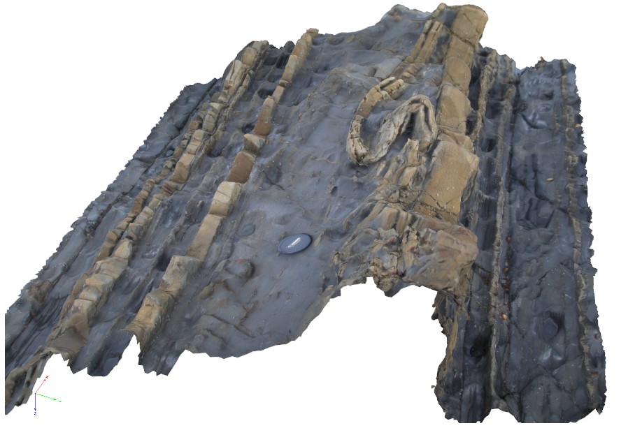 |
20 |
03/13/2015 9:20 a.m. |
3D |
soft sediment deformation feature within distal turbidite layering. Cape Liptrap, Vic. |
1.00 |
-38.90319102000 |
145.91572370000 |
0.000 |
turbidite, sedimentology, soft sediment folding |
turbidite |
Liptrap2 Map
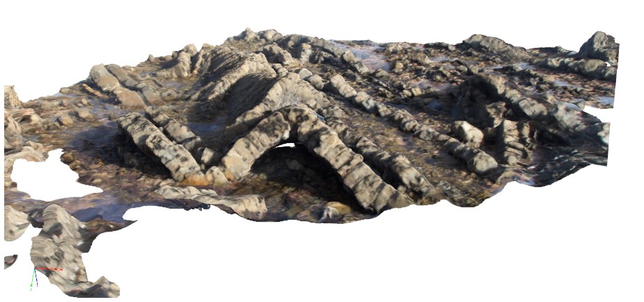 |
20 |
03/13/2015 9:21 a.m. |
3D |
gently plunging, sandstone and siltstone layers in distal turbidite. Cape Liptrap, Vic. |
6.00 |
-38.90407023000 |
145.91742896000 |
0.000 |
structure, turbidite, folding, sedimentology |
turbidite |
Liptrap3 Map
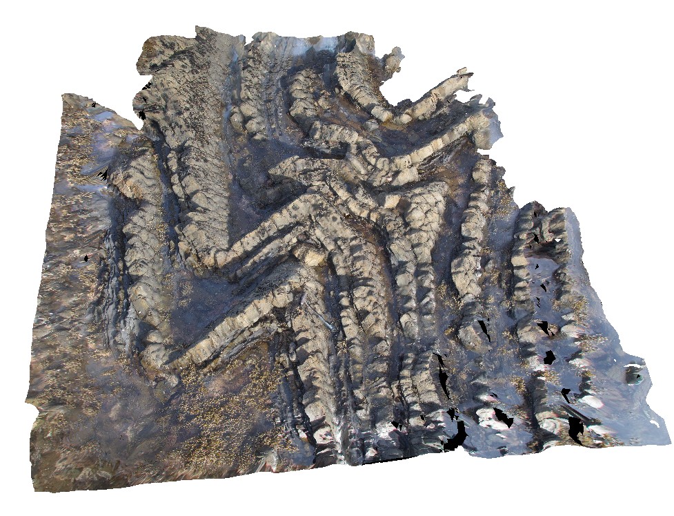 |
20 |
03/13/2015 9:21 a.m. |
3D |
gently to moderately plunging folds in distal turbidites. Cape Liptrap, Vic. |
4.00 |
-38.90415956000 |
145.91751813000 |
0.000 |
sedimentology, fold, turbidite, structure |
turbidite |
Liptrap4 Map
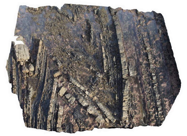 |
0 |
03/13/2015 9:21 a.m. |
3D |
open to closed folding of sandstone and siltstone layers in distal turbidites. Cape Liptrap, Vic. |
6.00 |
-38.90403052000 |
145.91719914000 |
-9999.000 |
turbidite, sedimentology, fold |
turbidite |
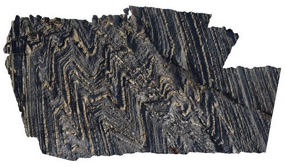
Liptrap5 Map
 |
20 |
03/13/2015 9:22 a.m. |
3D |
zone of structural deformation, showing faulting of finely bedded distal turbidites. Cape Liptrap, Vic. |
10.00 |
-38.90400517000 |
145.91716871000 |
0.000 |
structure, fold, turbidite, sedimentology |
turbidite |
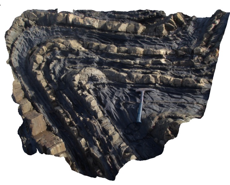
Liptrap6 Map
 |
20 |
03/13/2015 9:23 a.m. |
3D |
folded sandstone and siltstone distal turbidite beds. Cape Liptrap, Vic. |
2.00 |
-38.90401199000 |
145.91709832000 |
0.000 |
turbidite, fold, sedimentology |
turbidite |
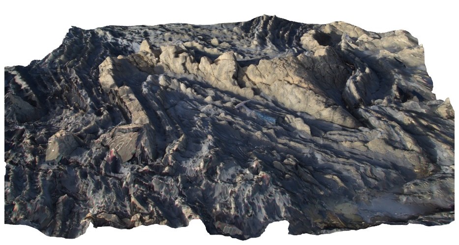
Liptrap7 Map
 |
20 |
03/13/2015 9:23 a.m. |
3D |
deformed and folded bedded distal turbidite. Cape Liptrap, Vic. |
3.50 |
-38.90403776000 |
145.91718063000 |
0.000 |
turbidite, fold, sedimentology |
turbidite |
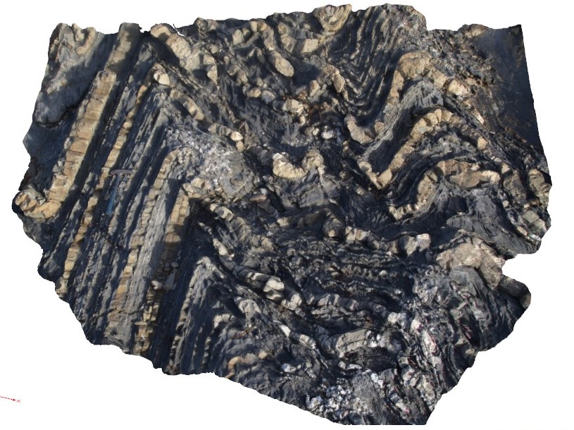
Liptrap8 Map
 |
20 |
03/13/2015 9:24 a.m. |
3D |
zone of deformation, quartz veining and folding, showing asymmetrical folding in finely bedded distal turbidites. Cape Liptrap, Vic. |
3.00 |
-38.90412340000 |
145.91723000000 |
0.000 |
fold, turbidite, sedimentology |
turbidite |
Liptrap9 Map
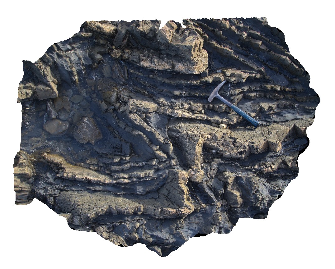 |
20 |
03/13/2015 9:24 a.m. |
3D |
moderately plunging folds in distal turbidite sequence. Cape Liptrap, Vic. |
2.00 |
-38.90401762000 |
145.91706274000 |
0.000 |
sedimentology, fold, structure, turbidite |
turbidite |
LiptrapPole1 Map
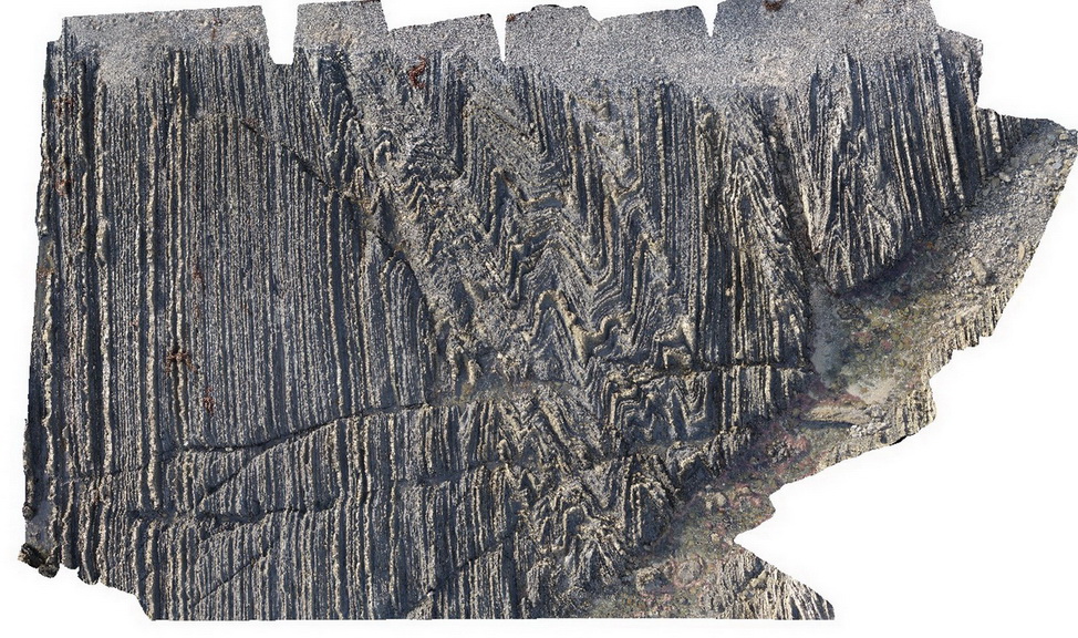 |
20 |
03/13/2015 9:25 a.m. |
3D |
wave cut platform showing chevron folding and cross cutting faults in finely bedded turbidites. Cape Liptrap, Vic. |
0.00 |
-38.90406232000 |
145.91729772000 |
0.000 |
turbidite, chevron folds, structure |
turbidite |
LiptrapPole2 Map
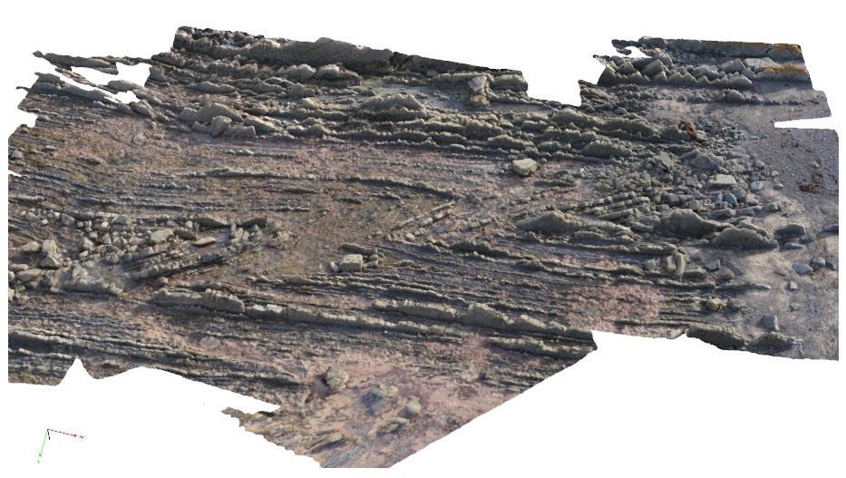 |
20 |
03/13/2015 9:25 a.m. |
3D |
wave cut platform showing steeply plunging chevron folding in finely bedded turbiditic sequence. Cape Liptrap, Vic. |
0.00 |
-38.90414711000 |
145.91743374000 |
0.000 |
structure, chevron folds |
turbidite |
LiptrapPole3 Map
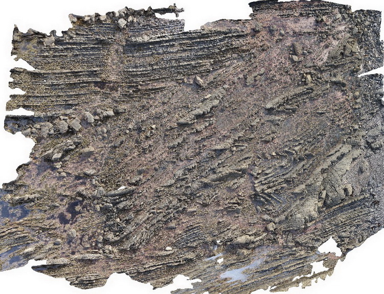 |
20 |
03/13/2015 9:25 a.m. |
3D |
steeply dipping Asymmetrical and chevron folding with cross cutting faults in finely bedded turbidites. Cape Liptrap, Vic. |
0.00 |
-38.90395783000 |
145.91709577000 |
0.000 |
folding, structure, fault |
turbidite |
Litchfield1 Map
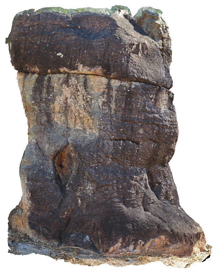 |
0 |
06/23/2016 noon |
3D |
cross-bedding in conglomerate outcrop. Lost City Rock Formations, Litchfield National Park. N.T. |
4.00 |
-13.21803000000 |
130.73550000000 |
-9999.000 |
cross bedding, conglomerate, Litchfield National Park |
conglomerate |
Litchfield2 Map
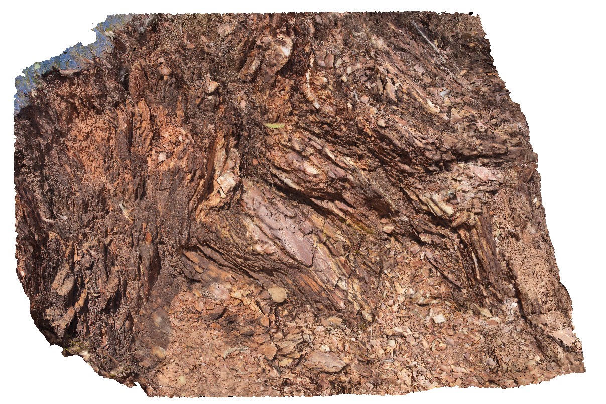 |
0 |
06/23/2016 noon |
3D |
chevron fold in foliated phyllite. Litchfield National Park. N.T. |
0.00 |
-13.07390000000 |
130.69806000000 |
-9999.000 |
chevron fold, foliation, phyllite |
phyllite |
Litchfield3 Map
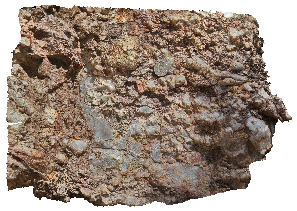 |
0 |
06/23/2016 noon |
3D |
quartz-muscovite pegmatite and breccia crosscutting a metasomatised mica-schist. Litchfield Park Road, Litchfield National Park. N.T. |
0.50 |
-13.06886000000 |
130.71255000000 |
-9999.000 |
muscovite-quartz pegmatite, mica schist, breccia |
schist, pegmatite |
Litchfield4 Map
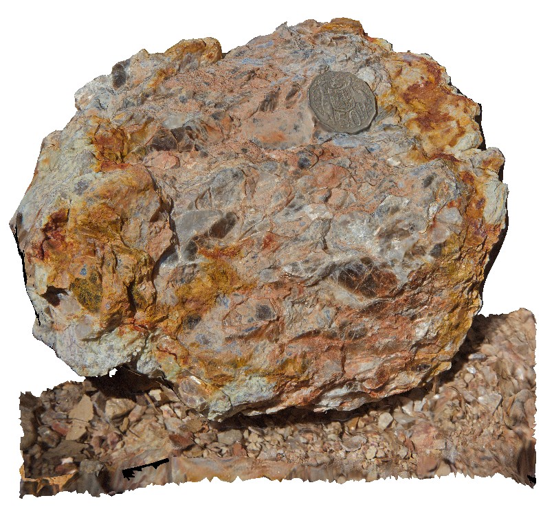 |
0 |
06/23/2016 noon |
3D |
quartz-muscovite pegmatite float near Litchfield Park Road, Litchfield National Park. N.T. |
0.15 |
-13.06886000000 |
130.71255000000 |
-9999.000 |
quartz-muscovite pegmatite, igneous, two sisters granite |
pegmatite |
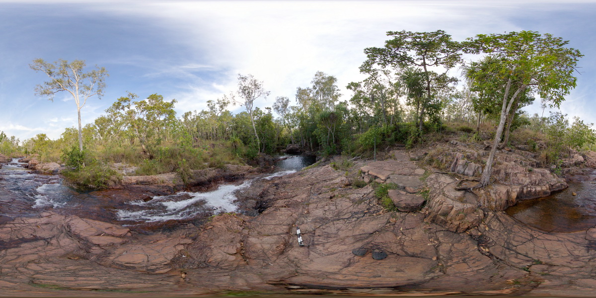
LitchfieldFSP1 Map
 |
0 |
06/23/2016 noon |
FSP |
panorama of blocky, jointed, cross bedded, fine-grained sandstone with ripple marks on bedding surface. Cut by waterfall. Buley Rockhole, Litchfield National Park, N.T. |
100.00 |
-13.11299000000 |
130.78574000000 |
-9999.000 |
joint, ripple marks, sedimentology, sandstone, Litchfield National Park |
sandstone |


