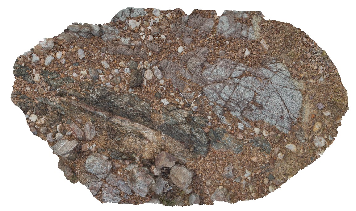
LakeArgyle2 Map
 |
5 |
06/16/2016 noon |
3D |
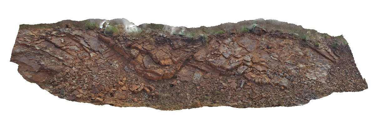
granite intruded by brecciated mafic dyke with faulted contacts. River crossing of Lake Argyle Road, W.A. |
8.00 |
-16.03106000000 |
128.78183000000 |
-9999.000 |
mafic dyke, igneous intrusion, granite, fault |
mafic, granite |
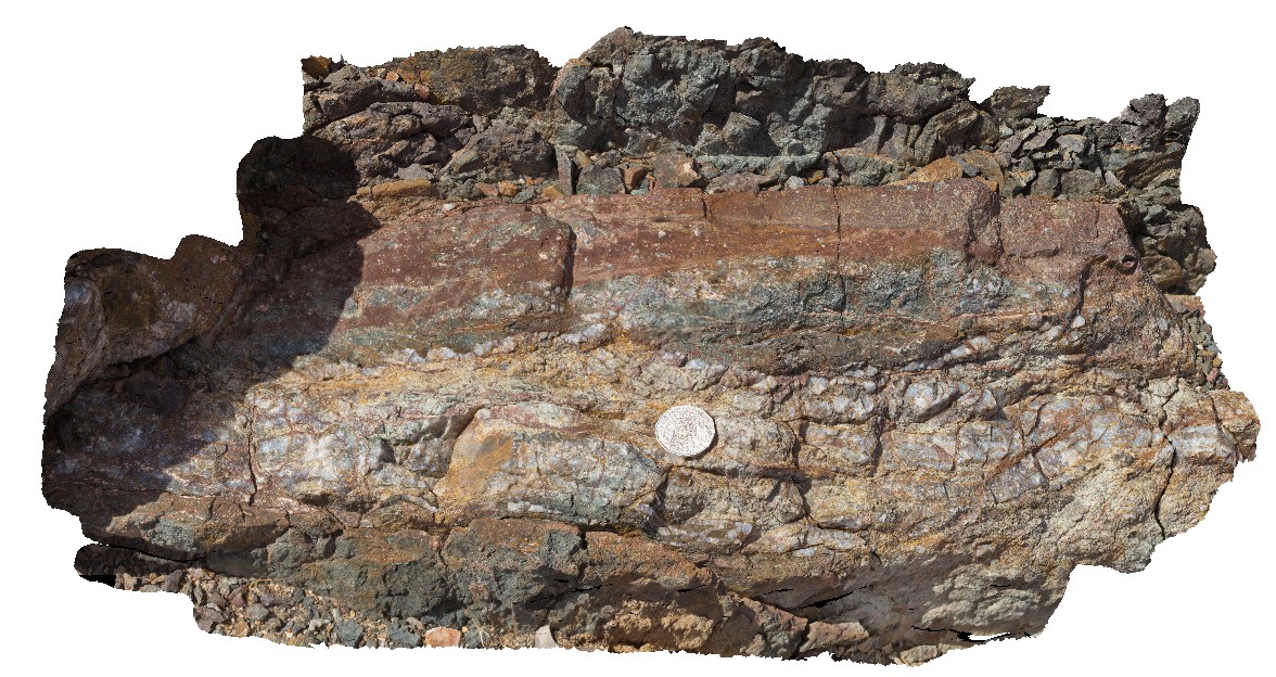
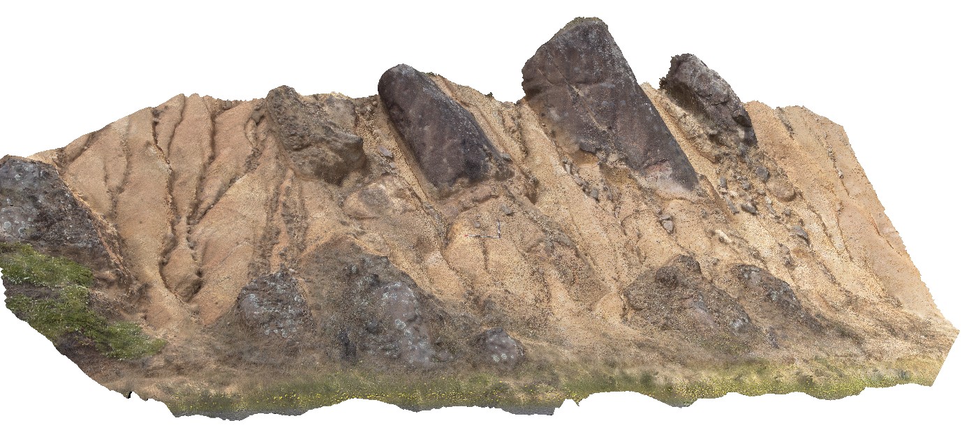
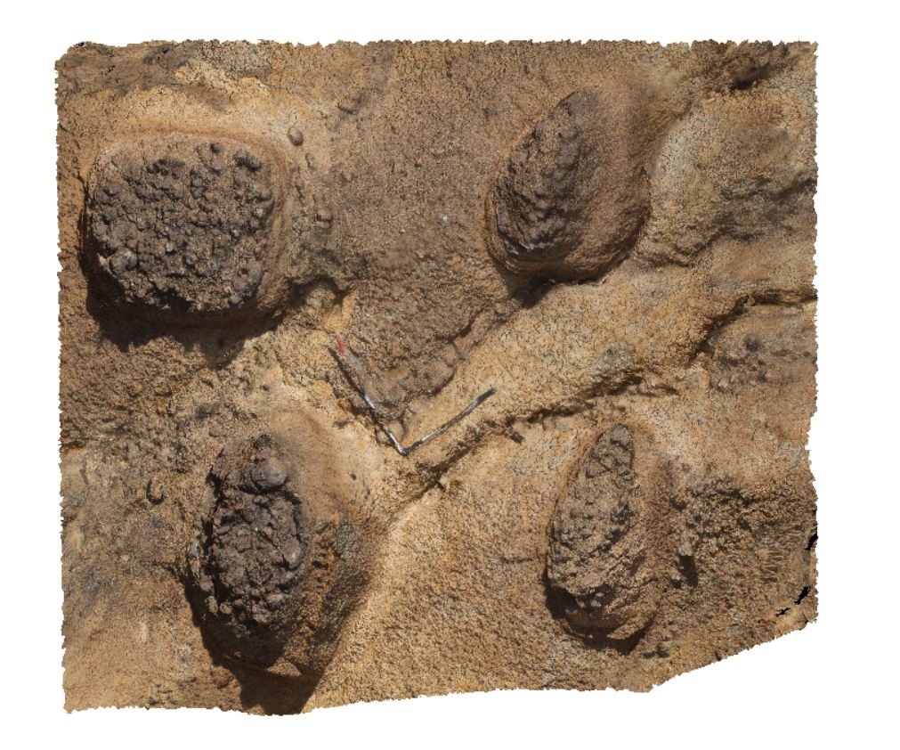
LakeArgyle3 Map
 |
5 |
06/16/2016 noon |
3D |
close-up of quartz-cemented breccia / stock work veining within mafic dyke from site LakeArgyle2. River crossing of Lake Argyle Road, W.A. |
0.60 |
-16.03106000000 |
128.78183000000 |
-9999.000 |
breccia, quartz vein stockwork, mafic dyke |
mafic |
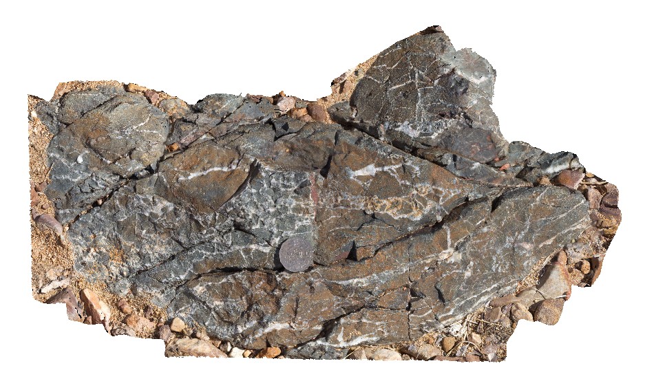
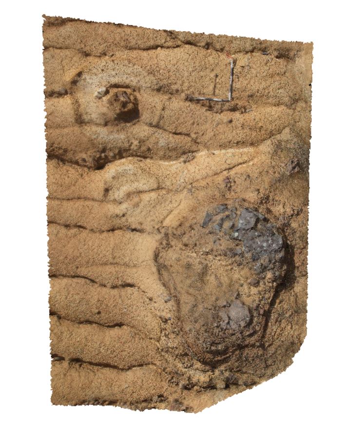
LakeArgyle4 Map
 |
0 |
06/16/2016 noon |
3D |
close-up of cataclasite breccia and massive quartz vein zone in mafic dyke from site LakeArgyle2. River crossing of Lake Argyle Road, W.A. |
1.70 |
-16.03106000000 |
128.78183000000 |
-9999.000 |
cataclasite, breccia, quartz vein, fault, structure, mafic dyke |
mafic |
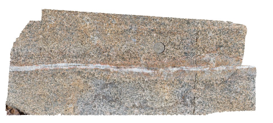
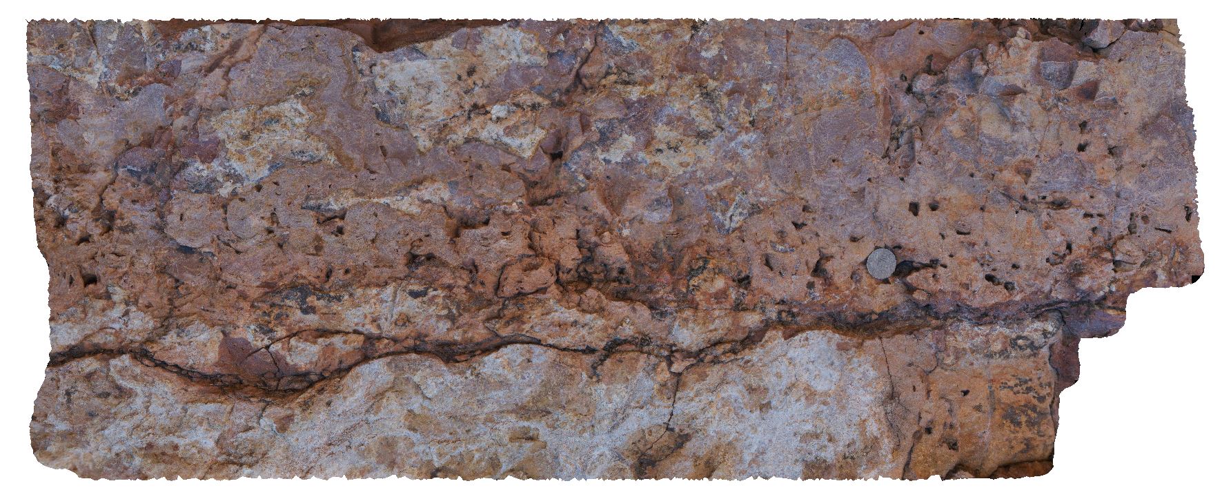
LakeArgyle5 Map
 |
0 |
06/16/2016 noon |
3D |
close up view of granite, crosscut by quartz vein with 1.5cm-thick feldspar vein halo. River crossing of Lake Argyle Road, W.A. |
0.70 |
-16.03115000000 |
128.78174000000 |
-9999.000 |
vein halo alteration, feldspar alteration, granite |
granite |
LakeArgyle6 Map
 |
0 |
06/16/2016 noon |
3D |
gently dipping, wavy, laminated red and white banded siltstone cut by small fault offset. Lake Argyle Road, W.A. |
11.00 |
-16.05236000000 |
128.76532000000 |
-9999.000 |
siltstone, fault |
siltstone |
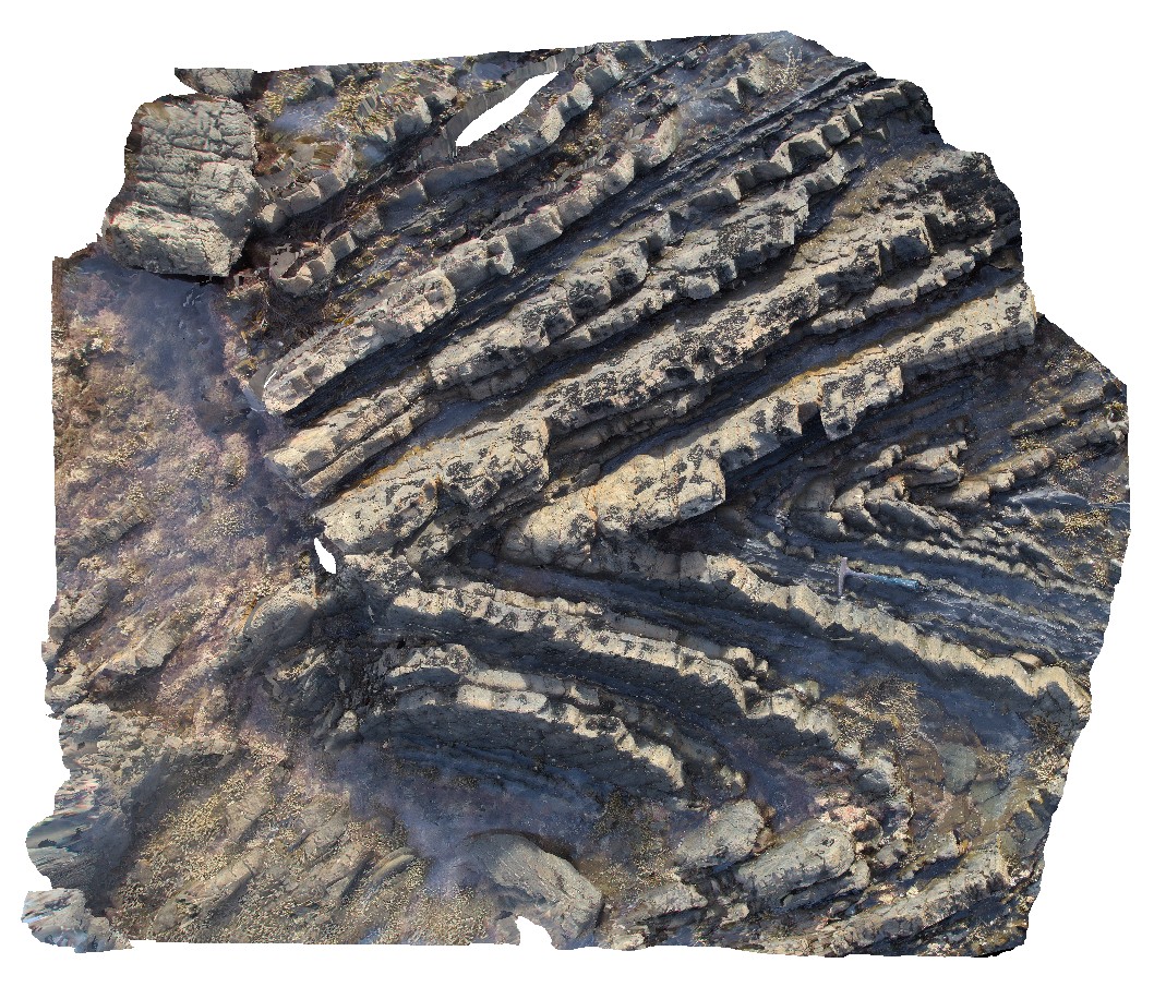
LakeArgyleFSP1 Map
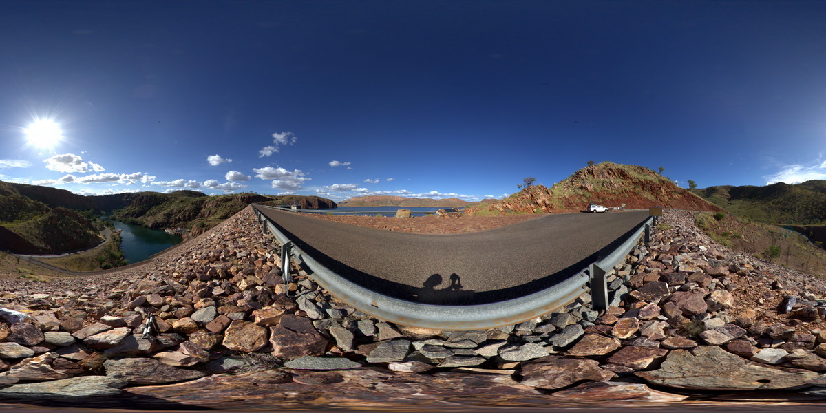 |
0 |
06/16/2016 noon |
FSP |
view from atop Lake Argyle dam, illustrating moderately to steeply dipping quartzite and phyllite of the Carr Boyd Group. Lake Argyle Dam. W.A. |
1000.00 |
-16.12274000000 |
128.73785000000 |
-9999.000 |
metasediments, structure, fold, dip |
metasediment |
LakeRowallan Map
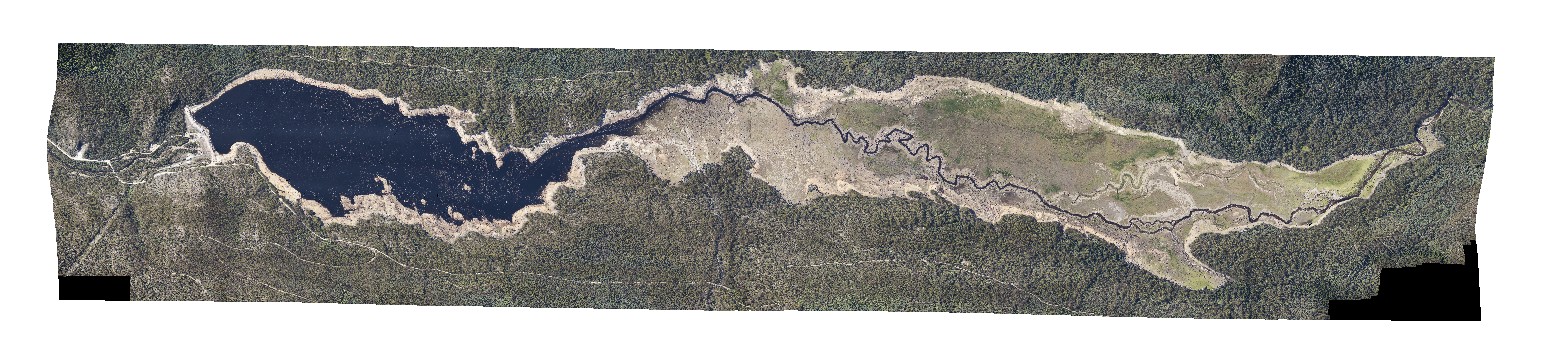 |
20 |
01/01/9999 midnight |
3D |
aerial view of lake Rowallan during low water level. Tasmania. |
0.00 |
-41.73505940000 |
146.21744630000 |
-9999.000 |
|
|
Launceston1 Map
 |
5 |
01/01/9999 midnight |
3D |
dolerite lone stones, Launceston, Tas. |
18.00 |
-41.52943000000 |
147.18515000000 |
-9999.000 |
dolerite, lone stone |
dolerite |
Launceston2 Map
 |
5 |
01/01/9999 midnight |
3D |
dolerite lone stones, one very weathered. Launceston, Tas. |
4.55 |
-41.52905000000 |
147.18474000000 |
-9999.000 |
weathering, lone stone, dolerite |
dolerite |
Launceston3 Map
 |
5 |
01/01/9999 midnight |
3D |
dolerite lone stones in road cutting with weathering rinds. Launceston, Tas. |
3.50 |
-41.52900000000 |
147.18469000000 |
-9999.000 |
dolerite, lone stone, weathering rind |
dolerite |
Limebay1 Map
 |
5 |
01/01/9999 midnight |
3D |
ripple marks and cross bedding in Triassic sandstone. Lime Bay, Tas. |
0.00 |
-42.94673000000 |
147.70013000000 |
-9999.000 |
sandstone, ripple marks, sedimentological |
sandstone |
Limebay10 Map
 |
5 |
01/01/9999 midnight |
3D |
view of volcanic breccia. Lime Bay, Tas. |
0.00 |
-42.94026000000 |
147.69432000000 |
-9999.000 |
Triassic sandstone, cross bedding, ripple marks, sedimentology |
basalt |
Limebay2 Map
 |
5 |
01/01/9999 midnight |
3D |
close-up of ripple marks and cross bedding in Triassic sandstone from site Limebay1. Lime Bay, Tas. |
0.00 |
-42.94673000000 |
147.70013000000 |
-9999.000 |
ripple marks, cross bedding, Triassic sandstone, sedimentological |
sandstone |
Limebay3 Map
 |
5 |
01/01/9999 midnight |
3D |
close-up of ripple marks and cross bedding in Triassic sandstone from site Limebay1. Lime Bay, Tas. |
0.00 |
-42.94668000000 |
147.70016000000 |
-9999.000 |
Triassic sandstone, ripple marks, cross bedding, sedimentological |
sandstone |
Limebay4 Map
 |
5 |
01/01/9999 midnight |
3D |
overturned cross beds in Triassic Sandstone. Lime Bay, Tas. |
0.00 |
-42.94368000000 |
147.69635000000 |
-9999.000 |
Triassic sandstone, overturned bedding, cross bedding |
sandstone |
Limebay5 Map
 |
5 |
01/01/9999 midnight |
3D |
laminated tuff and bomb beds , including sandstone lithic bombs in Tertiary Basalt units. Lime Bay, Tas. |
0.00 |
-42.94318000000 |
147.69609000000 |
-9999.000 |
bomb, tuff, laminated, volcaniclastic, volcanic |
basalt |
Limebay6 Map
 |
5 |
01/01/9999 midnight |
3D |
laminated tuff and bomb beds , including sandstone lithic bombs in contact with Tertiary Basalt lava flows? Lime Bay, Tas. |
0.00 |
-42.94311000000 |
147.69608000000 |
-9999.000 |
geological contact, basalt lava, bomb, volcanics, volcaniclastic, tuff |
basalt |
Limebay7 Map
 |
5 |
01/01/9999 midnight |
3D |
bombs, scoria and agglutinated lava flow. Lime Bay, Tas. |
0.00 |
-42.94200000000 |
147.69533000000 |
-9999.000 |
basalt lava, agglutinated, bomb, scoria, volcanic |
basalt |
Limebay8 Map
 |
5 |
01/01/9999 midnight |
3D |
view of large breccia fragments in lava flow. Lime Bay, Tas. |
0.00 |
-42.94120000000 |
147.69443000000 |
-9999.000 |
volcanic breccia, basalt flow, basalt, flow, volcanic |
basalt |
Limebay9 Map
 |
5 |
01/01/9999 midnight |
3D |
view of volcanic breccia. Lime Bay, Tas. |
0.00 |
-42.94123000000 |
147.69441000000 |
-9999.000 |
volcanic, breccia, basalt |
basalt |
LimebayUAV1 Map
 |
20 |
01/01/9999 midnight |
UAV |
overview of Lime Bay volcanic outcrop. Lime Bay, Tas. |
631.00 |
-42.94194700000 |
147.69510100000 |
70.000 |
Tertiary Basalt, volcanics, basalts |
basalt |
LimebayUAV2 Map
 |
20 |
01/01/9999 midnight |
UAV |
overview of basaltic dyke and volcanic breccia. Lime Bay, Tas. |
36.00 |
-42.94087600000 |
147.69450600000 |
10.000 |
dyke, volcanic breccia, Tertiary Basalt |
basalt |
LimebayUAV3 Map
 |
20 |
01/01/9999 midnight |
UAV |
Aerial view of basaltic volcanic breccia and volcanic deposits intruded by multiple, thin basaltic dykes. Lime Bay, Tasmania. |
300.00 |
-42.94014400000 |
147.69268800000 |
18.000 |
volcanics, basalt dyke, dyke |
basalt, basalt |
LimestoneCreek1 Map
 |
0 |
06/21/2016 noon |
3D |
bed of laminated, conchoidal stromatolitic limestone with irregular, wavy contact with massive dolostone. Near Limestone Creek, Victoria Highway, N.T. |
0.00 |
-14.81136000000 |
131.93707000000 |
-9999.000 |
stromatolitic limestone, dolostone, stromatolite, fossil, palaeontology |
limestone |
Liptrap1 Map
 |
20 |
03/13/2015 9:17 a.m. |
3D |
moderately plunging syncline and anticline in turbiditic sandstone and siltstone. Cape Liptrap, Vic. |
3.50 |
-38.90420975000 |
145.91757337000 |
0.000 |
anticline, syncline |
turbidite |