NewcastleUAV6 Map
 |
5 |
01/01/9999 midnight |
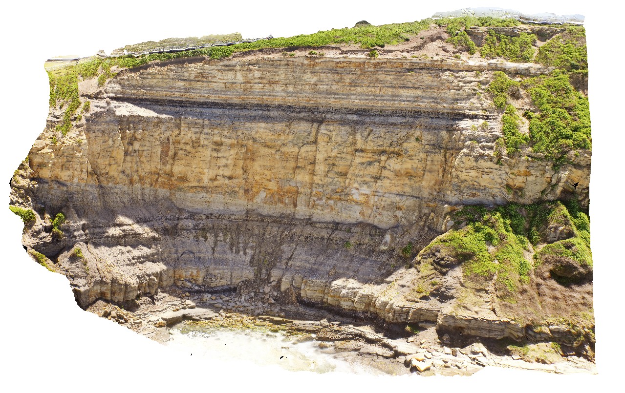
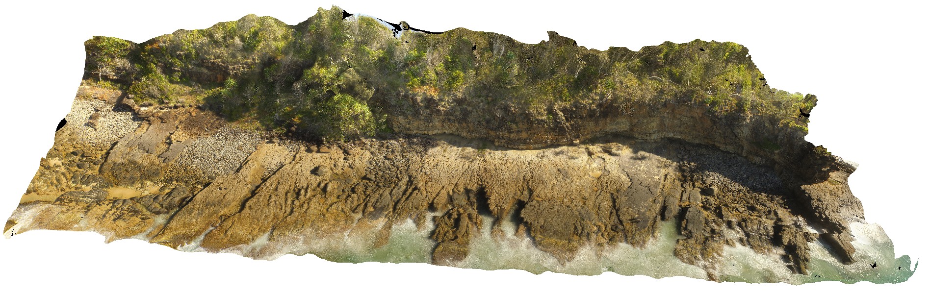
UAV |
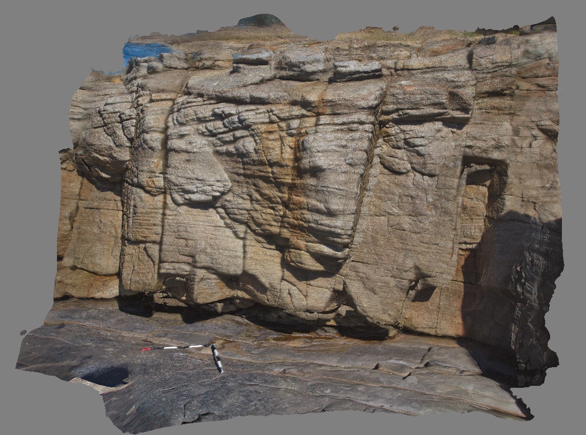
large cliff at Northern end of Bar / Susan Gilmore Beach, showing exposure of Yard coal seam, Dudley and Nobby sediments. Newcastle, N.S.W. |
70.00 |
-32.93887600000 |
151.77379900000 |
70.400 |
sedimentology, tuffaceous sandstone, coal measures |
tuffaceous sandstone |
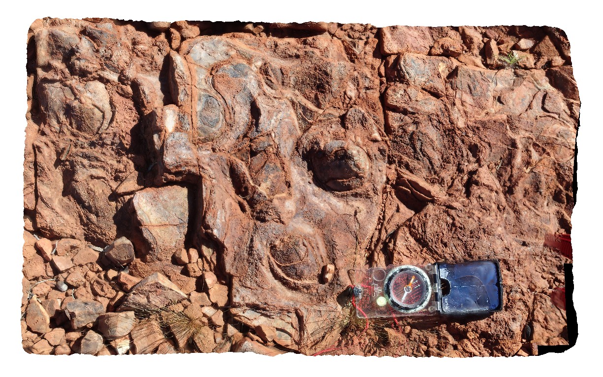
Ninghan1 Map
 |
5 |
01/01/9999 midnight |
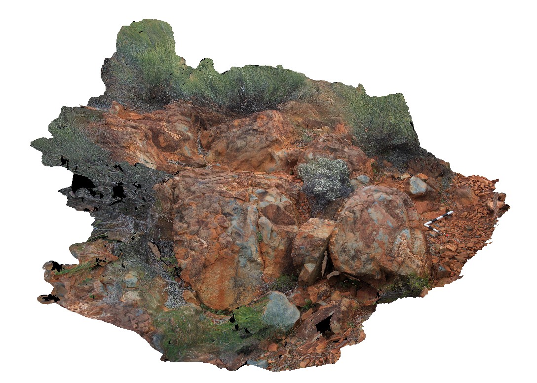
3D |
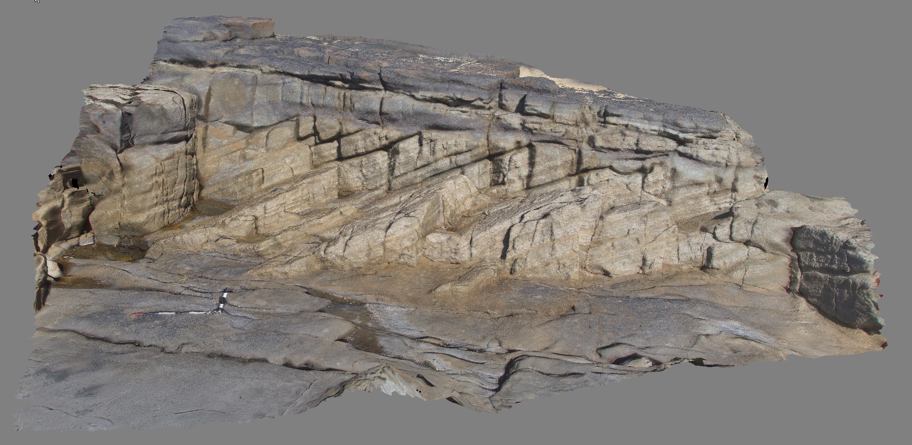
Folded Archean banded-iron formation composed of alternating hematitic/chert laminae. Weakly magnetic. Exposed in isolated hinge of anticline in the Ningham Foldbelt. Near Great Northern Highway, W.A. |
4.00 |
-29.37333320000 |
117.27916670000 |
320.000 |
banded Iron Formation, anticline, fold, structure, BIF, sedimentology |
BIF |
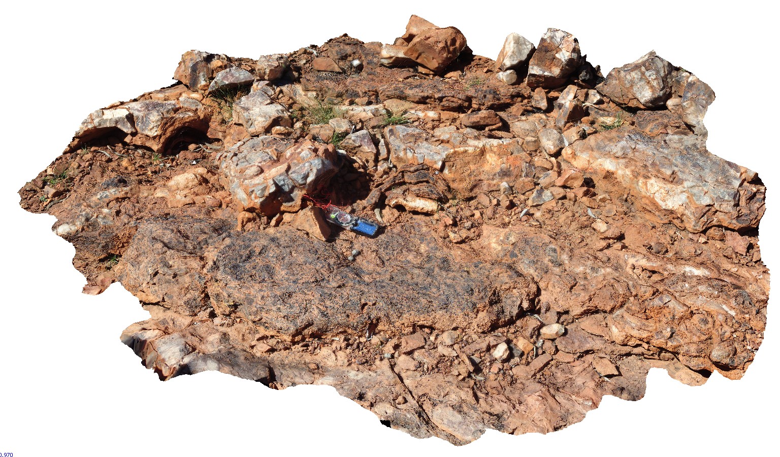
Ninghan2 Map
 |
5 |
01/01/9999 midnight |
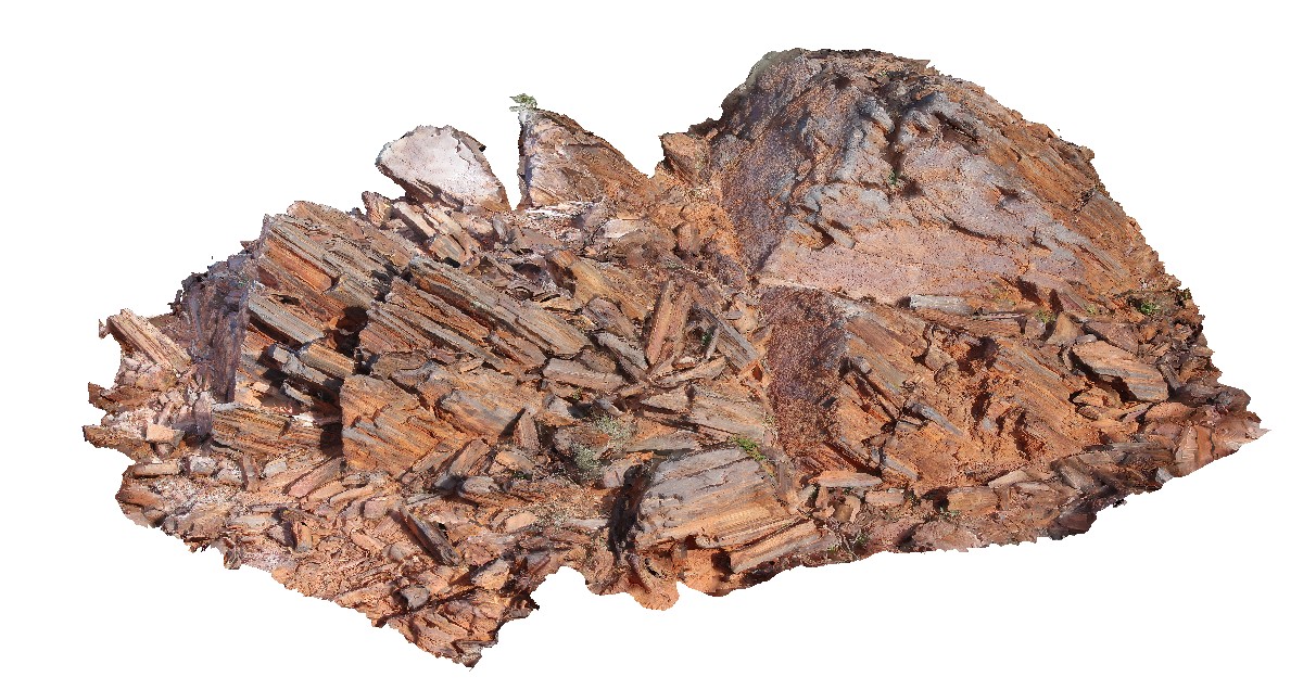
3D |
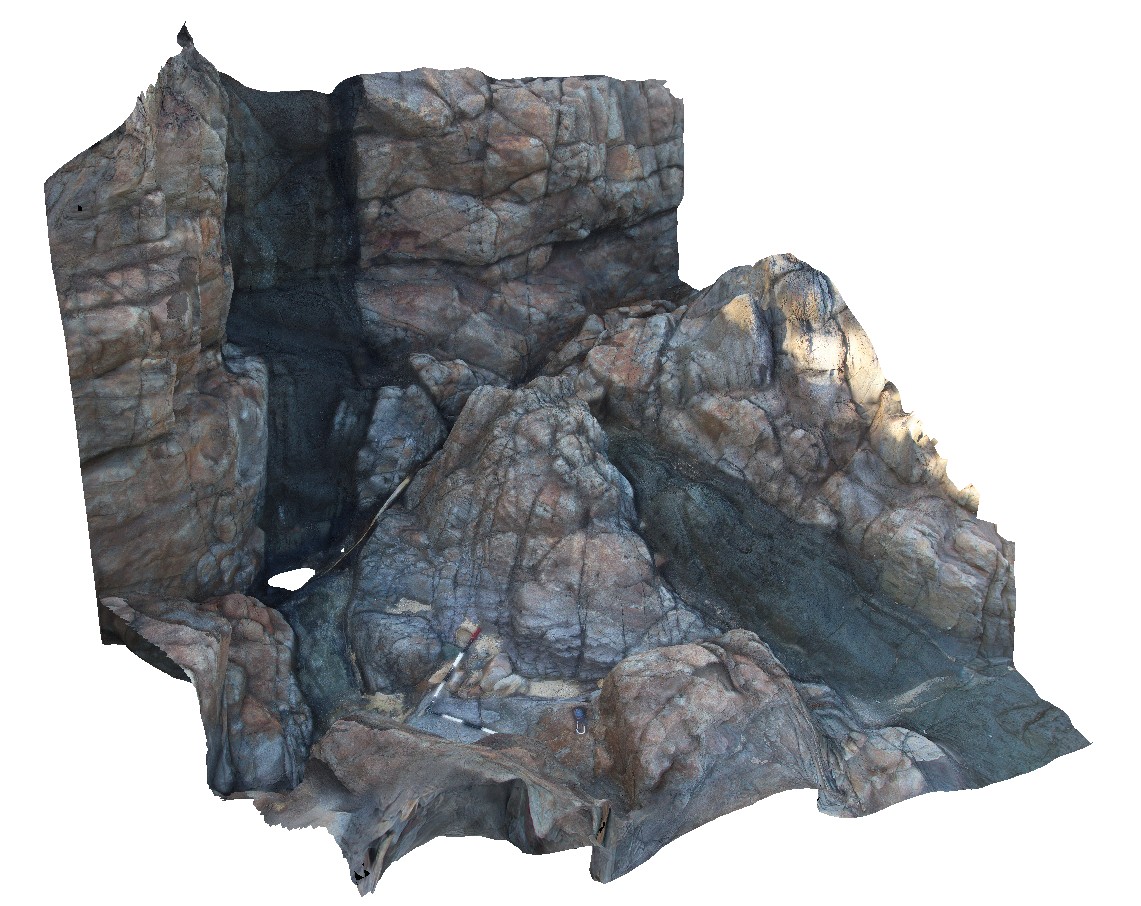
Archean meta-pillow basalts with interpillow quartz-cemented breccia. Thick unit located at the top of Mount Singleton, near Great Northern Highway, W.A. |
4.35 |
-29.37333320000 |
117.27916670000 |
650.000 |
Metabasalt, Pillow basalt, Interpillow breccia |
basalt |
Noosa1 Map
 |
5 |
02/23/2016 12:30 p.m. |
3D |
cross bedding in Jurassic aged Myrtle Creek Sandstone. Noosa National Park. N.S.W |
4.00 |
-26.37943000000 |
153.10087000000 |
-9999.000 |
cross bedding, sedimentology |
sandstone |
Noosa2 Map
 |
5 |
02/23/2016 12:30 p.m. |
3D |
cross bedding in Jurassic aged Myrtle Creek Sandstone. Noosa National Park. N.S.W |
3.50 |
-26.37941000000 |
153.10089000000 |
-9999.000 |
cross bedded, sedimentology |
sandstone |
Noosa3 Map
 |
5 |
02/23/2016 12:31 p.m. |
3D |
cross bedding in Jurassic aged Myrtle Creek Sandstone. Noosa National Park. N.S.W |
5.00 |
-26.37944000000 |
153.10135000000 |
-9999.000 |
cross bedding, sedimentology |
sandstone |
Noosa4 Map
 |
5 |
02/23/2016 12:31 p.m. |
3D |
dyke step-over in mafic dyke in contact altered metasandstone. Noosa National Park. N.S.W |
8.00 |
-26.37792000000 |
153.10896000000 |
-9999.000 |
dyke, step-over, intrusive contact |
sandstone, diorite |
Noosa5 Map
 |
5 |
02/23/2016 12:32 p.m. |
3D |
parallel aplite / magmatic hydrothermal veins in diorite. Noosa National Park. N.S.W |
0.40 |
-26.37827000000 |
153.10944000000 |
-9999.000 |
veining, diorite, dyke |
diorite |
Noosa6 Map
 |
5 |
02/23/2016 12:32 p.m. |
3D |
aplite dykes or veins in diorite boulder. Noosa National Park. N.S.W |
0.50 |
-26.37830000000 |
153.10950000000 |
-9999.000 |
aplite, diorite, veins, dyke |
diorite |
Noosa7 Map
 |
5 |
02/23/2016 12:32 p.m. |
3D |
aplite dykes or veins in quartz diorite boulder. Noosa National Park. N.S.W |
1.00 |
-26.37937000000 |
153.11195000000 |
-9999.000 |
quartz diorite, intrusive contact, dyke |
quartz diorite |
Noosa8 Map
 |
5 |
02/23/2016 12:33 p.m. |
3D |
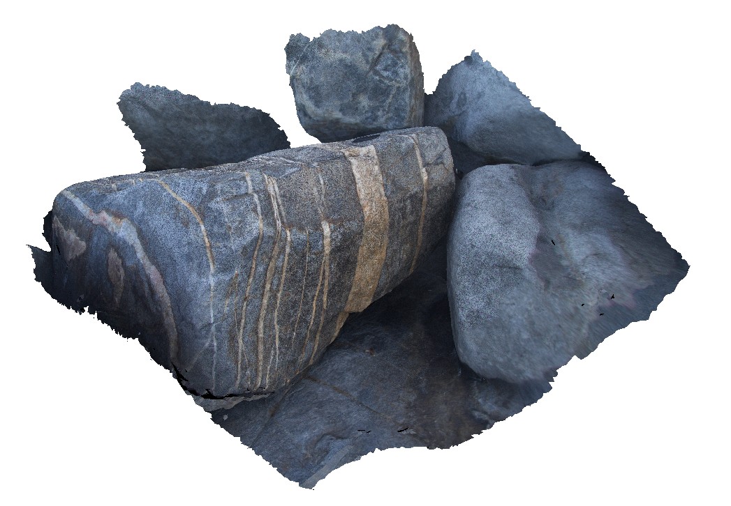
Brecciated siltstone slabs floating in quartz diorite, Noosa National Park. N.S.W |
12.00 |
-26.37903000000 |
153.11035000000 |
-9999.000 |
xenolith, wall rock, diorite, breccia |
quartz diorite, siltstone |
Noosa9 Map
 |
0 |
02/23/2016 12:34 p.m. |
3D |
partially deformed quartzite xenolith in quartz diorite. Noosa National Park. N.S.W |
3.00 |
-26.37903000000 |
153.11041000000 |
-9999.000 |
xenolith, quartz diorite |
quartzite, quartz diorite |
NoosaUAV1 Map
 |
0 |
02/23/2016 12:34 p.m. |
UAV |
exposed shoreline platform, showing cross bedding in Jurassic aged Myrtle Creek Sandstone. Noosa National Park. N.S.W |
50.00 |
-26.37903000000 |
153.11041000000 |
-9999.000 |
cross bedding, shoreline platform |
sandstone |
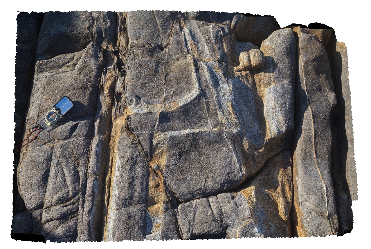
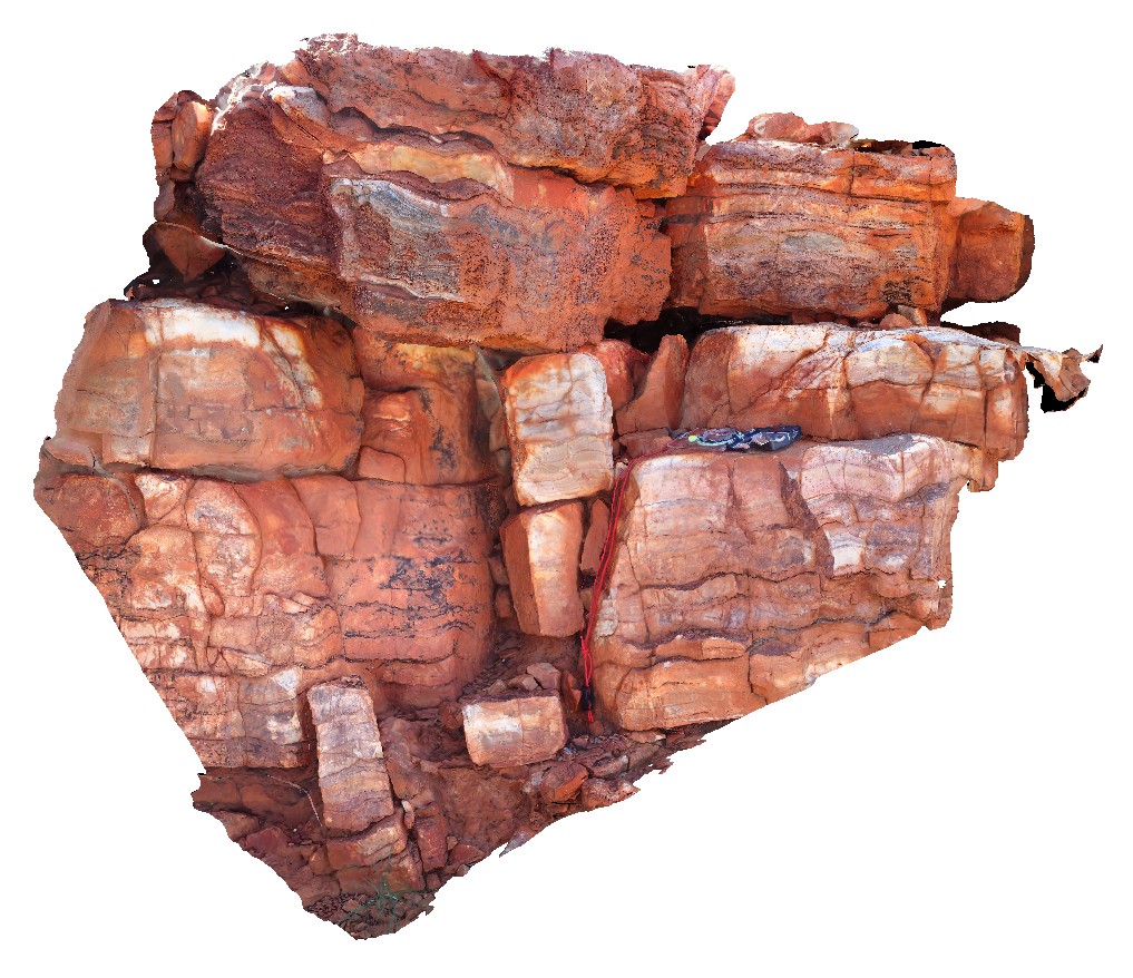
NorthPole1 Map
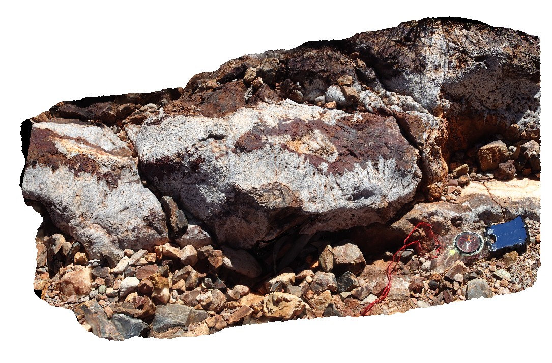 |
10000 |
08/02/2016 noon |
3D |
Epithermal crystalline barite-silica vein with radiating crystals. Iron-oxides in vein centre result from oxidation of pyrite. Marble Bar Rd, near Coppin Gap, W.A. |
1.00 |
-20.72168000000 |
119.35366400000 |
-9999.000 |
epithermal, barite, vein |
sediments |
NorthPole2 Map
 |
10000 |
08/02/2016 noon |
3D |
3.49Ga stromatolite beds in the Dresser Formation. Marble Bar Rd, near Coppin Gap, W.A. |
2.50 |
-20.72168000000 |
119.35366400000 |
-9999.000 |
stromatolite, fossil, palaeontology |
limestone |
NorthPole3 Map
 |
10000 |
08/02/2016 noon |
3D |
3.49Ga conical stromatolites in the Dresser Formation. Marble Bar Rd, near Coppin Gap, W.A. |
0.80 |
-20.72168000000 |
119.35366400000 |
-9999.000 |
stromatolite, chert, palaeontology, fossil |
limestone |
NorthPole4 Map
 |
10000 |
08/02/2016 noon |
3D |
Section through 3.49Ga Ga stromatolites (top layer) in the Dresser Formation. Marble Bar Rd, near Coppin Gap, W.A. |
1.50 |
-20.72168000000 |
119.35366400000 |
-9999.000 |
stromatolite, fossil, sedimentology, palaeontology |
limestone |
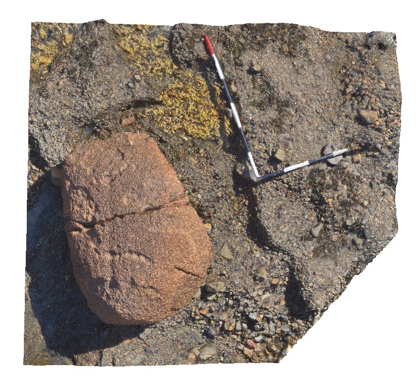
NTas1 Map
 |
5 |
01/01/9999 midnight |
3D |
rounded, large granite erratic in Wynyard Tillite. Wynyard, North Tasmania. |
1.20 |
-41.00700000000 |
145.78101000000 |
-9999.000 |
tillite, erratic |
tillite |
NTas10 Map
 |
5 |
01/01/9999 midnight |
3D |
detailed view of fossils from the Fossil Bluff Sandstone. Fossil Bluff Conservation Area, Wynyard. North Tasmania. |
0.30 |
-40.98133000000 |
145.73302000000 |
-9999.000 |
gastropod, palaeontology, fossil, fossiliferous, Fossil Bluff Sandstone |
sandstone |
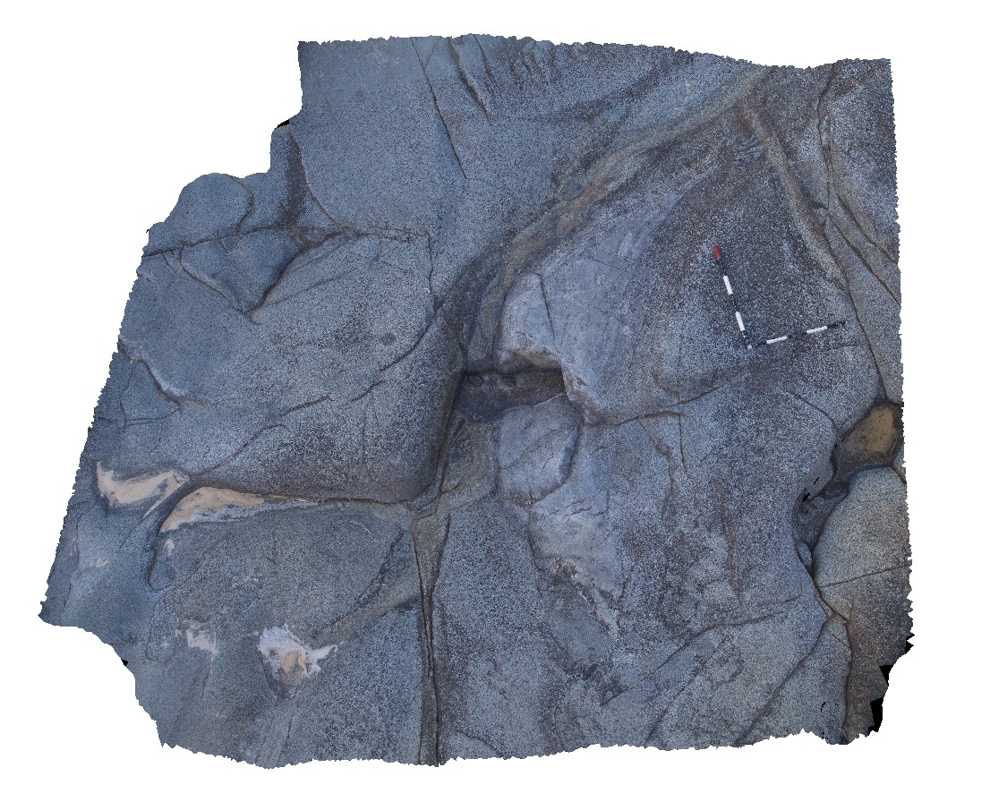
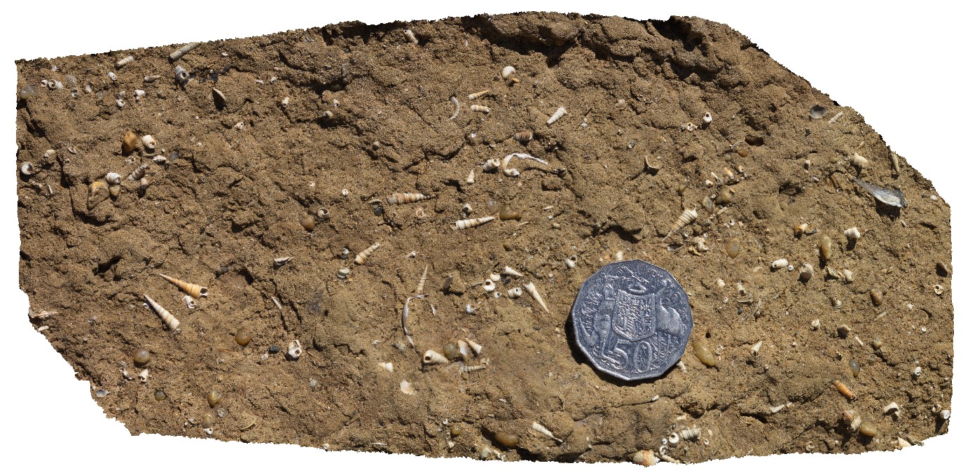
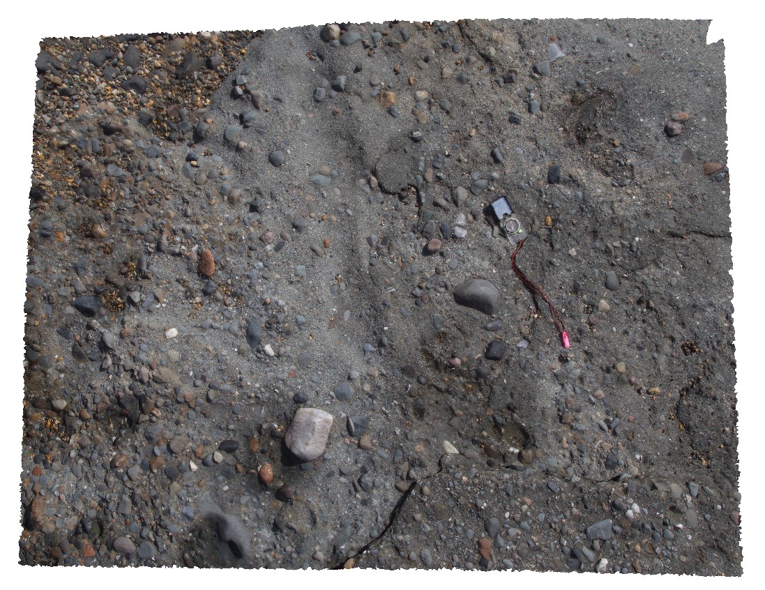
NTas11 Map
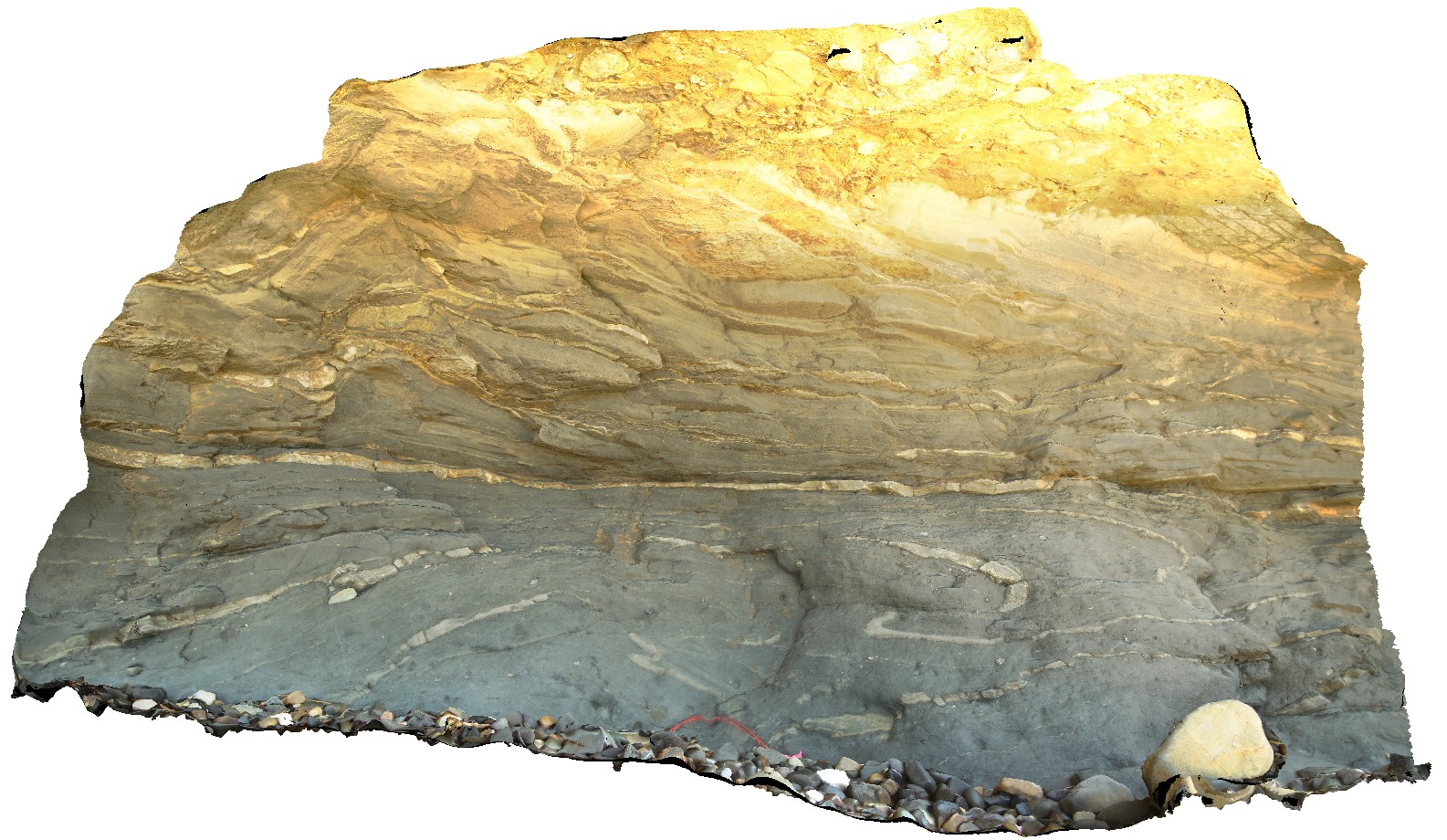 |
5 |
01/01/9999 midnight |
3D |
soft sediment deformation in Permian rocks immediately below the unconformity with Tertiary sandstone. Fossil Bluff Conservation Area, Wynyard. North Tasmania. |
2.30 |
-40.98043000000 |
145.73145000000 |
-9999.000 |
Wynyard Tillite, soft sediment deformation, sedimentology |
tillite |
NTas12 Map
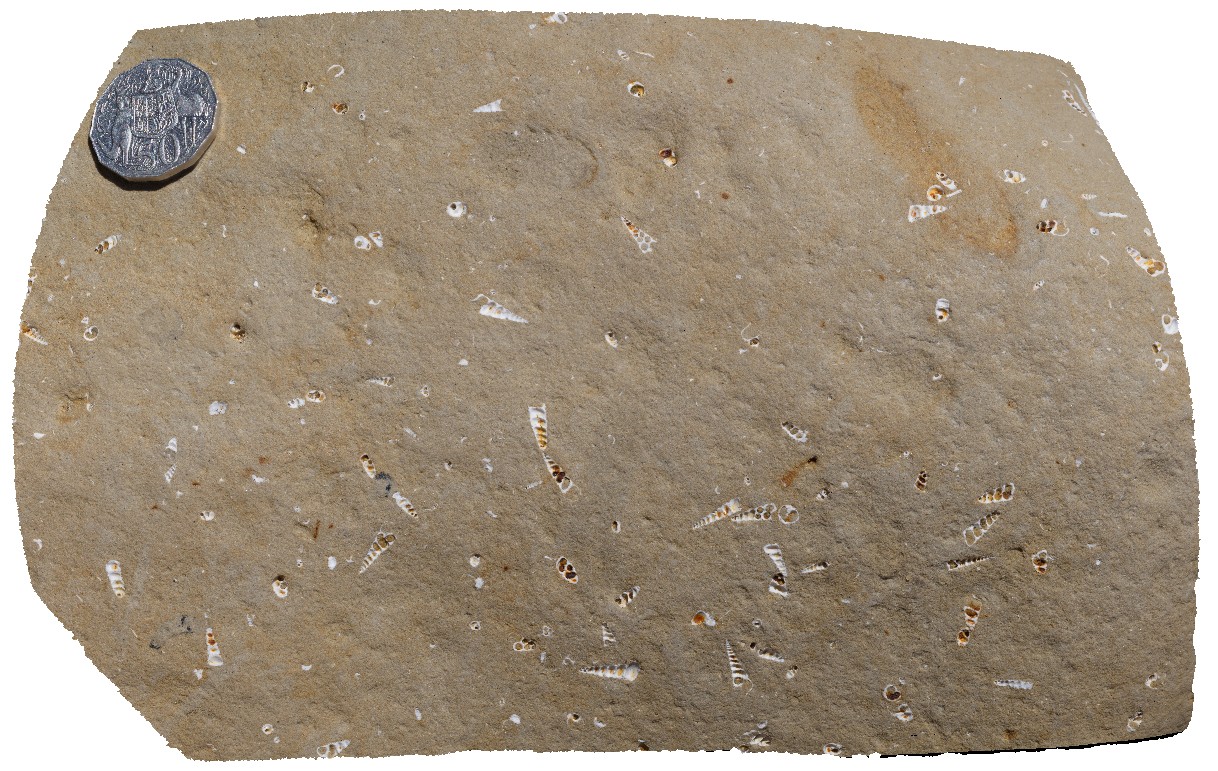 |
5 |
01/01/9999 midnight |
3D |
Turritellid gastropods exposed in weathered surface. Fossil Bluff Conservation Area, Wynyard. North Tasmania. |
0.20 |
-40.98050000000 |
145.73151000000 |
-9999.000 |
gastropod, Tentaculites, fossil, fossiliferous, Palaeontology |
sandstone |
NTas13 Map
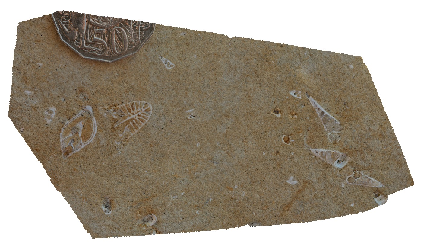 |
5 |
01/01/9999 midnight |
3D |
detailed view of gastropod fossils exposed in cross section. Fossil Bluff Conservation Area, Wynyard. North Tasmania. |
0.10 |
-40.98050000000 |
145.73151000000 |
-9999.000 |
gastropod, fossil, fossiliferous, Palaeontology |
sandstone |
NTas2 Map
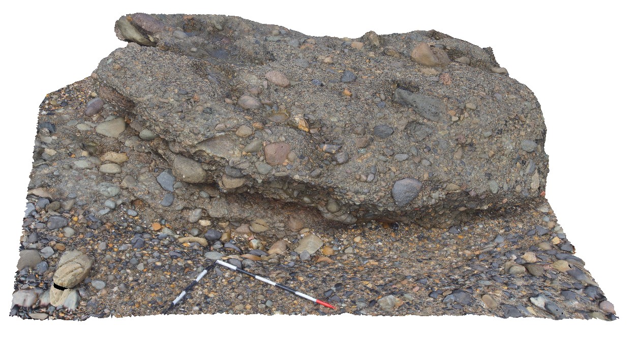 |
5 |
01/01/9999 midnight |
3D |
rounded, polymict, pebble to cobble sized erratics in Wynyard Tillite. Wynyard, North Tasmania. |
3.00 |
-41.00551000000 |
145.77982000000 |
-9999.000 |
tillite, erratic |
tillite |
NTas3 Map
 |
5 |
01/01/9999 midnight |
3D |
rounded, polymict, pebble to cobble sized erratics in Wynyard Tillite. Wynyard, North Tasmania. |
3.00 |
-41.00561000000 |
145.77980000000 |
-9999.000 |
tillite, erratic |
tillite |
NTas4 Map
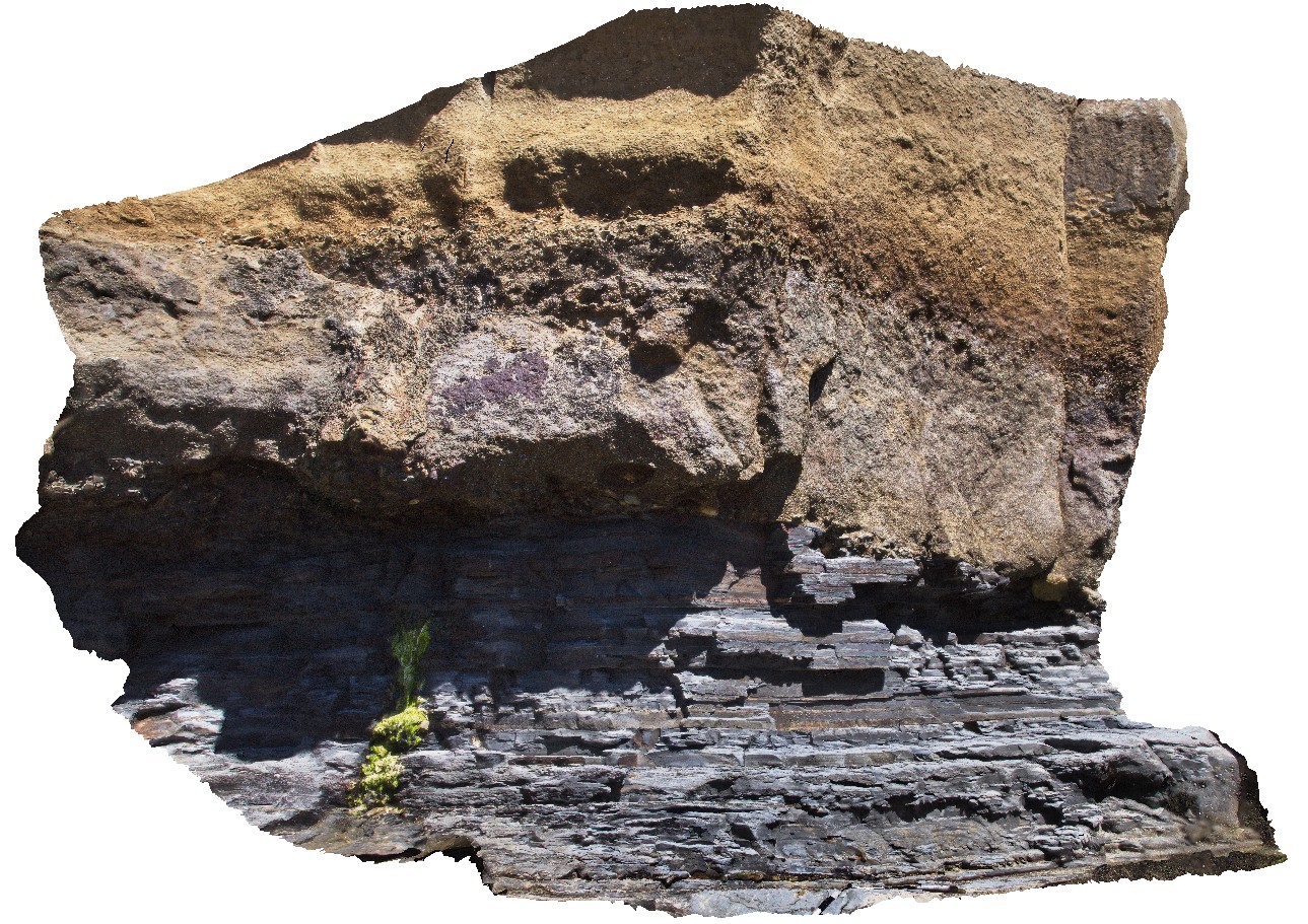 |
5 |
01/01/9999 midnight |
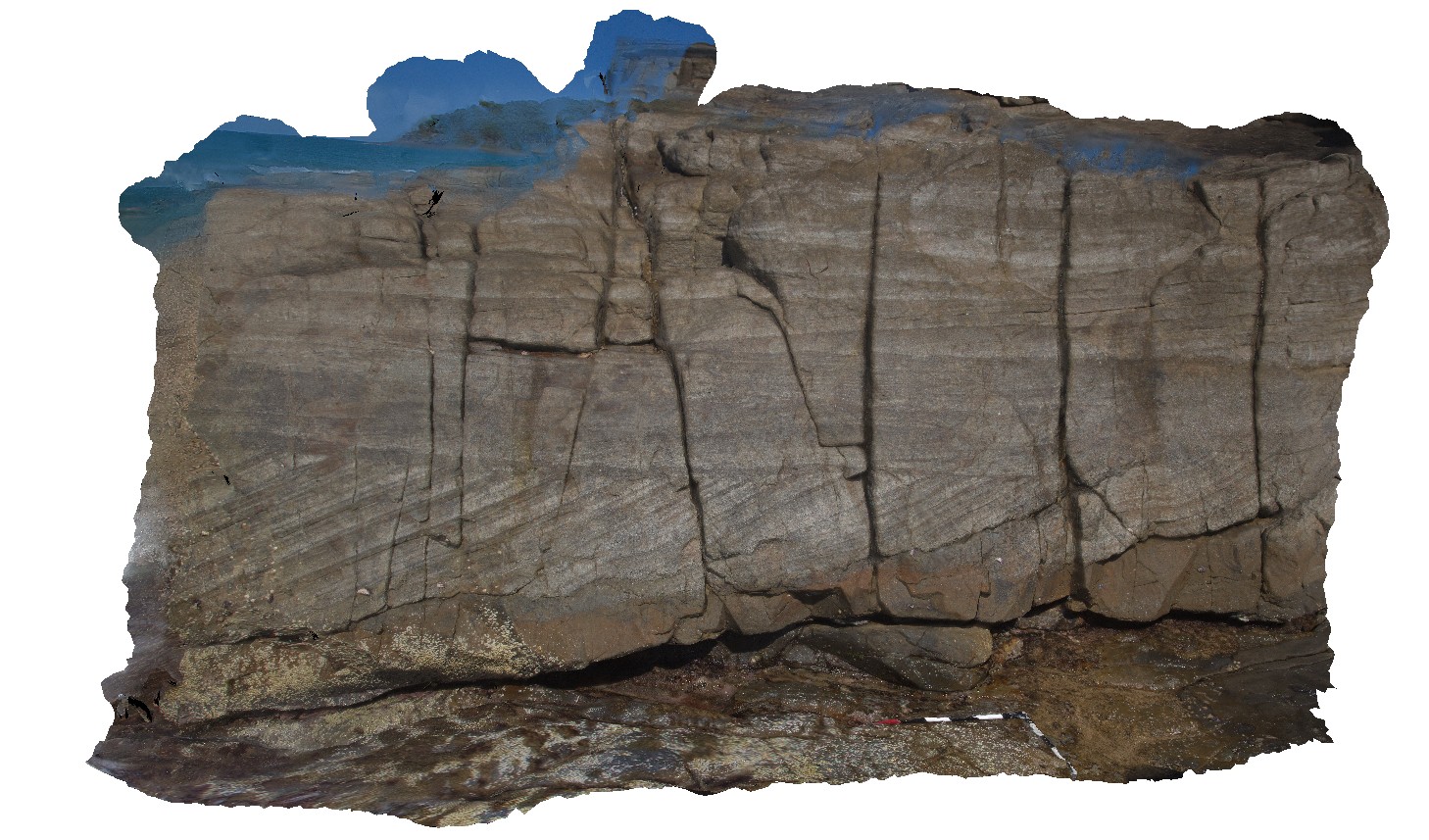
3D |
geological unconformity between the Fossil Bluff Sandstone and underlying Permian rocks. Fossil Bluff Conservation Area, Wynyard. North Tasmania. |
5.30 |
-40.98105000000 |
145.73289000000 |
-9999.000 |
unconformity, geological contact |
sandstone, sandstone |