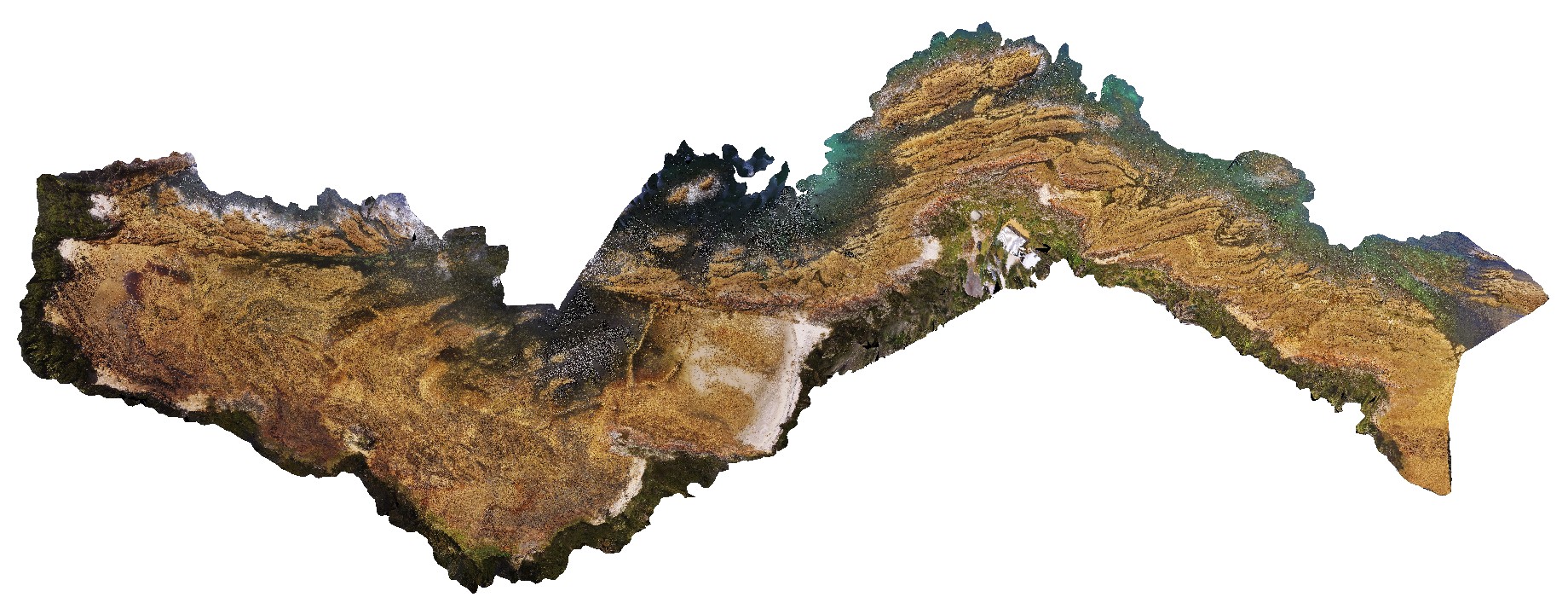
NTas5 Map
 |
5 |
01/01/9999 midnight |
3D |
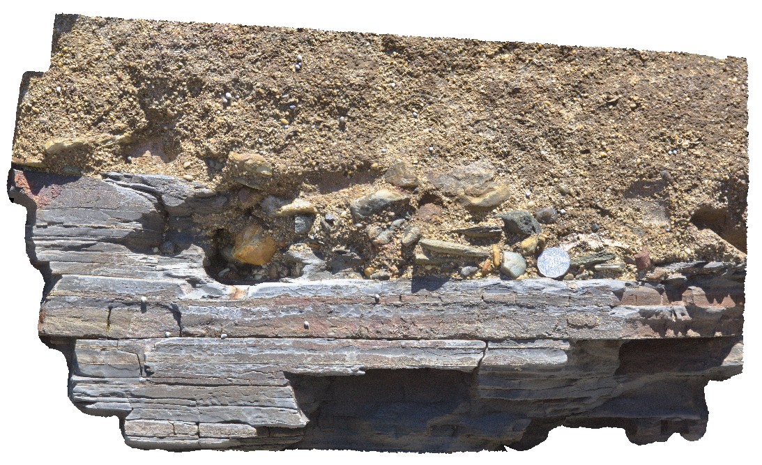
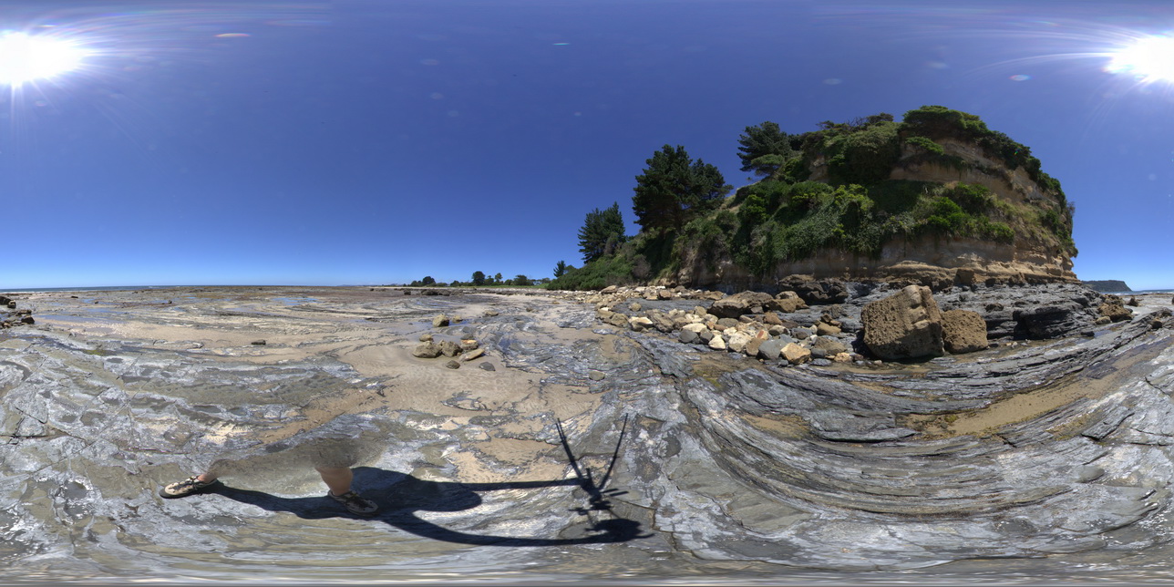
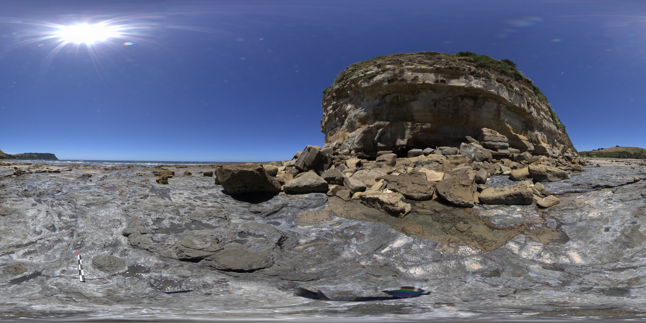
detailed view of geological unconformity between the Fossil Bluff Sandstone and underlying Permian rocks, showing irregular contact surface with large polymict cobbles in the Miocene rocks. Fossil Bluff Conservation Area, Wynyard. North Tasmania. |
0.50 |
-40.98105000000 |
145.73289000000 |
-9999.000 |
unconformity, geological contact |
sandstone, sandstone |
NTas6 Map
 |
5 |
01/01/9999 midnight |
3D |
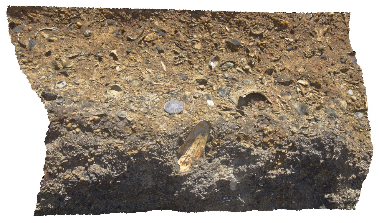
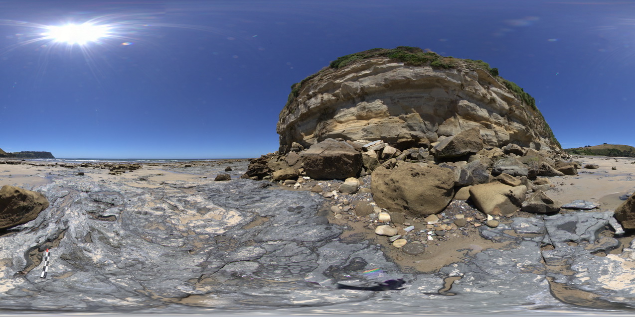
detail of fossiliferous layers, 1m above basal unconformity. Fossil Bluff Conservation Area, Wynyard. North Tasmania. |
0.50 |
-40.98113000000 |
145.73289000000 |
-9999.000 |
fossil, fossiliferous, palaeontology, Fossil Bluff Sandstone |
sandstone |
NTas8 Map
 |
5 |
01/01/9999 midnight |
3D |
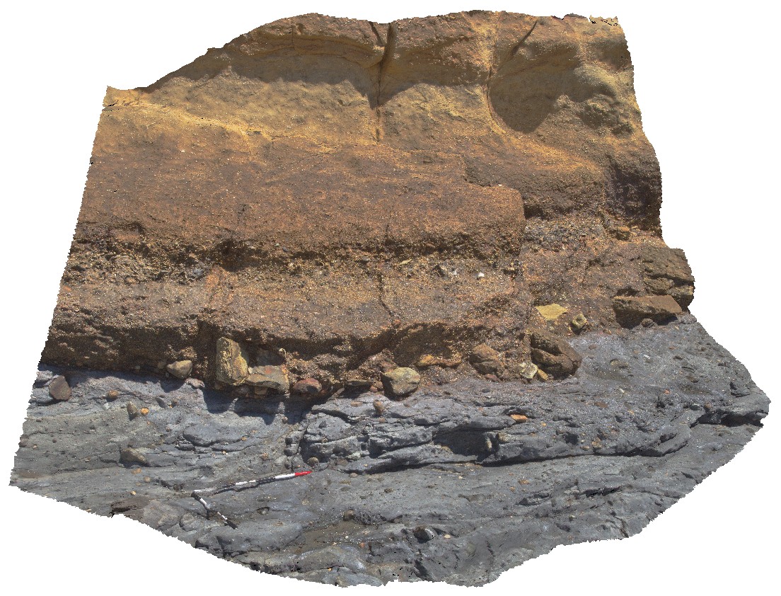
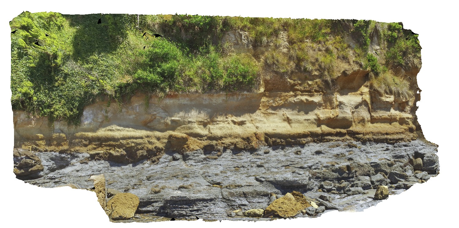
unconformity between Permian tillite and Tertiary Diamictite. Fossil Bluff Conservation Area, Wynyard. North Tasmania. |
3.20 |
-40.98133000000 |
145.73302000000 |
-9999.000 |
unconformity, geological contact, tillite, diamictite |
diamictite, tillite |
NTas9 Map
 |
5 |
01/01/9999 midnight |
3D |
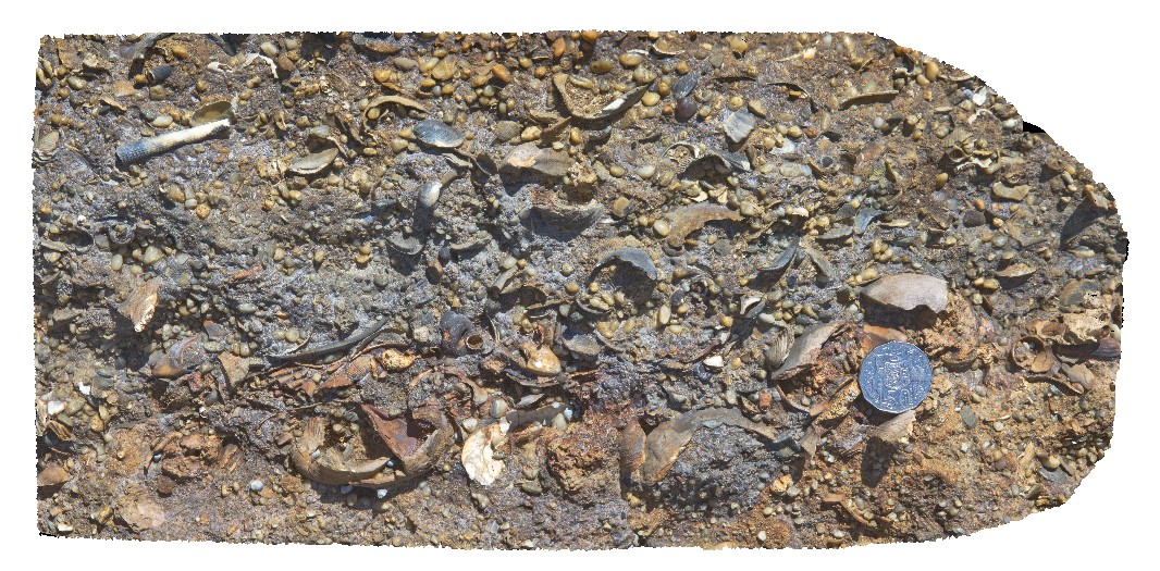
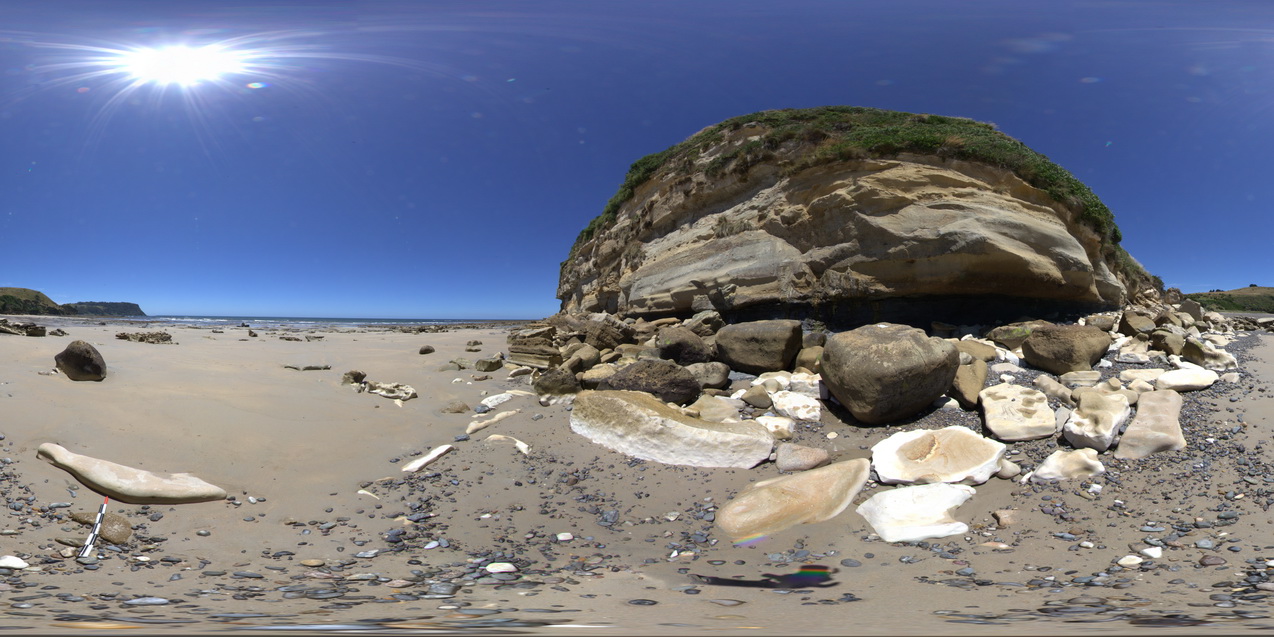
detailed view of fossils from the Fossil Bluff Sandstone. Fossil Bluff Conservation Area, Wynyard. North Tasmania. |
0.50 |
-40.98133000000 |
145.73302000000 |
-9999.000 |
Fossil Bluff Sandstone, fossil, palaeontology, sedimentology |
sandstone |
NTasFSP1 Map
 |
5 |
01/01/9999 midnight |
FSP |
shore-cut platform on Wynyard Tillite, with Fossil Bluff cliff in background. Fossil Bluff Conservation Area, Wynyard. North Tasmania. |
200.00 |
-40.98151000000 |
145.73306000000 |
-9999.000 |
Wynyard Tillite, Fossil Bluff, tillite |
tillite |
NTasFSP2 Map
 |
5 |
01/01/9999 midnight |
FSP |
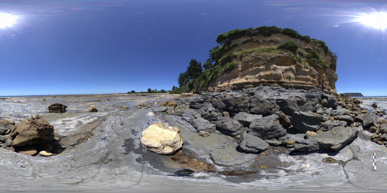
shore-cut platform on Wynyard Tillite, with unconformity with the Fossil Bluff Sandstone in background. Fossil Bluff Conservation Area, Wynyard. North Tasmania. |
500.00 |
-40.98151000000 |
145.73300000000 |
-9999.000 |
tillite, unconformity, Fossil Bluff Sandstone |
tillite, sandstone |
NTasFSP3 Map
 |
5 |
01/01/9999 midnight |
FSP |
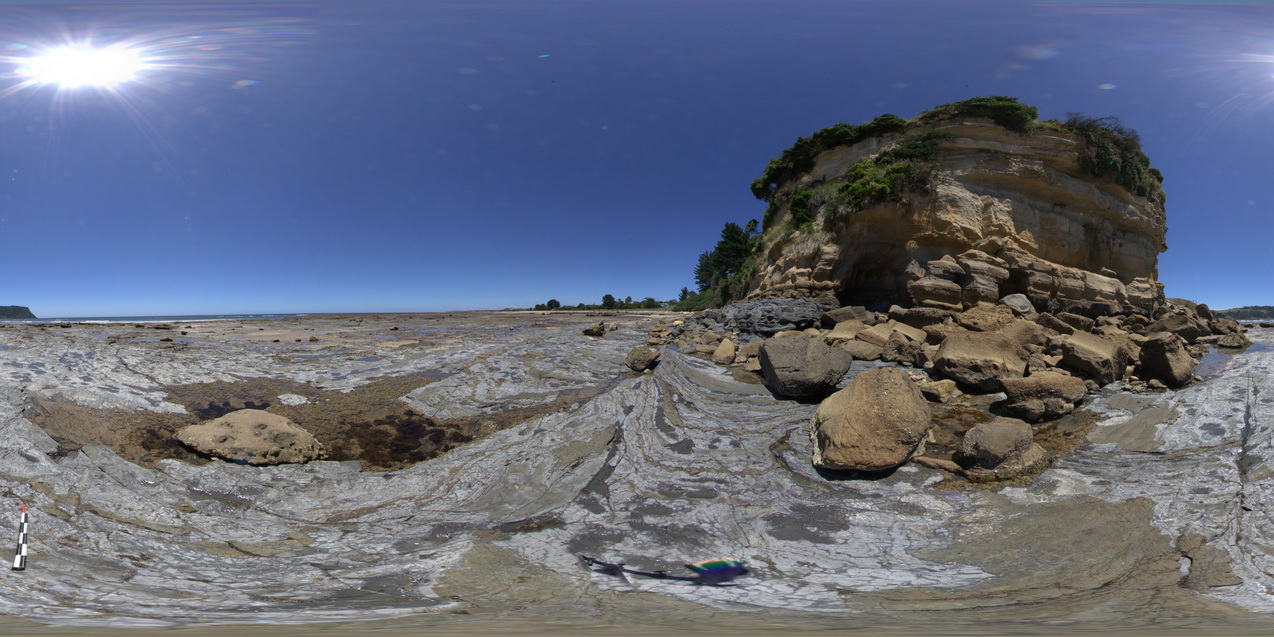
shore-cut platform on Wynyard Tillite, with unconformity with the Fossil Bluff Sandstone in background. Fossil Bluff Conservation Area, Wynyard. North Tasmania. |
500.00 |
-40.98135000000 |
145.73312000000 |
-9999.000 |
tillite, unconformity, Fossil Bluff Sandstone |
Tillite, sandstone |
NTasFSP4 Map
 |
5 |
01/01/9999 midnight |
FSP |
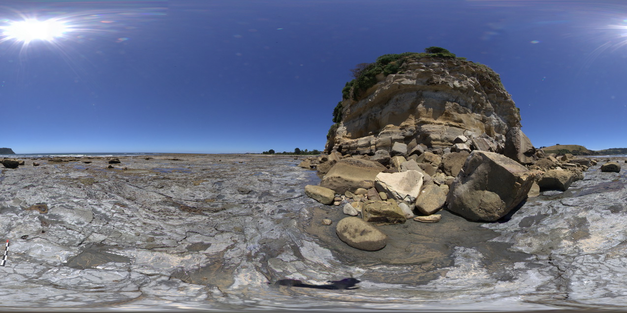
shore-cut platform in Wynyard Tillite with unconformity with the Fossil Bluff Sandstone at the base of the cliff. Fossil Bluff Conservation Area, Wynyard. North Tasmania. |
500.00 |
-40.98121000000 |
145.73308000000 |
-9999.000 |
Fossil Bluff Sandstone, unconformity |
tillite, sandstone |
NTasFSP5 Map
 |
5 |
01/01/9999 midnight |
FSP |
shore-cut platform in Wynyard Tillite with unconformity with the Fossil Bluff Sandstone at the base of the cliff. Fossil Bluff Conservation Area, Wynyard. North Tasmania. |
500.00 |
-40.98098000000 |
145.73296000000 |
-9999.000 |
unconformity, geological contact, tillite, Fossil Bluff |
tillite, sandstone |
NTasFSP6 Map
 |
5 |
01/01/9999 midnight |
FSP |
shore-cut platform in Wynyard Tillite with unconformity with the Fossil Bluff Sandstone at the base of the cliff. Fossil Bluff Conservation Area, Wynyard. North Tasmania. |
500.00 |
-40.98079000000 |
145.73262000000 |
-9999.000 |
unconformity, geological contact, Fossil Bluff Sandstone |
tillite, sandstone |
NTasFSP7 Map
 |
5 |
01/01/9999 midnight |
FSP |
shore-cut platform in Wynyard Tillite with unconformity with the Fossil Bluff Sandstone at the base of the cliff. Fossil Bluff Conservation Area, Wynyard. North Tasmania. |
500.00 |
-40.98064000000 |
145.73222000000 |
-9999.000 |
tillite, Fossil Bluff, geological contact, unconformity |
tillite, sandstone |
NTasFSP8 Map
 |
5 |
01/01/9999 midnight |
FSP |
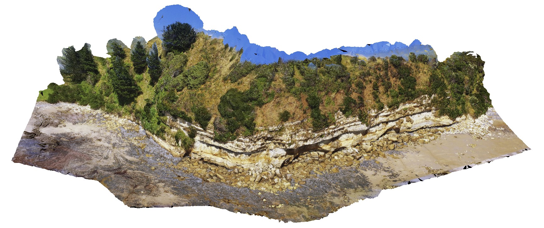
view of the stratigraphy of fossil bluff from the shore line. Fossil Bluff Conservation Area, Wynyard. North Tasmania. |
500.00 |
-40.98046000000 |
145.73158000000 |
-9999.000 |
stratigraphy, Fossil Bluff Sandstone |
sandstone |
NTasUAV1 Map
 |
20 |
01/01/9999 midnight |
UAV |
flat-lying sandstone beds of the Fossil Bluff Sandstone. Fossil Bluff Conservation Area, Wynyard. North Tasmania. |
200.00 |
-40.98145800000 |
145.73336400000 |
-9999.000 |
sandstone, bedding |
sandstone |
NTasUAV2 Map
 |
20 |
01/01/9999 midnight |
UAV |
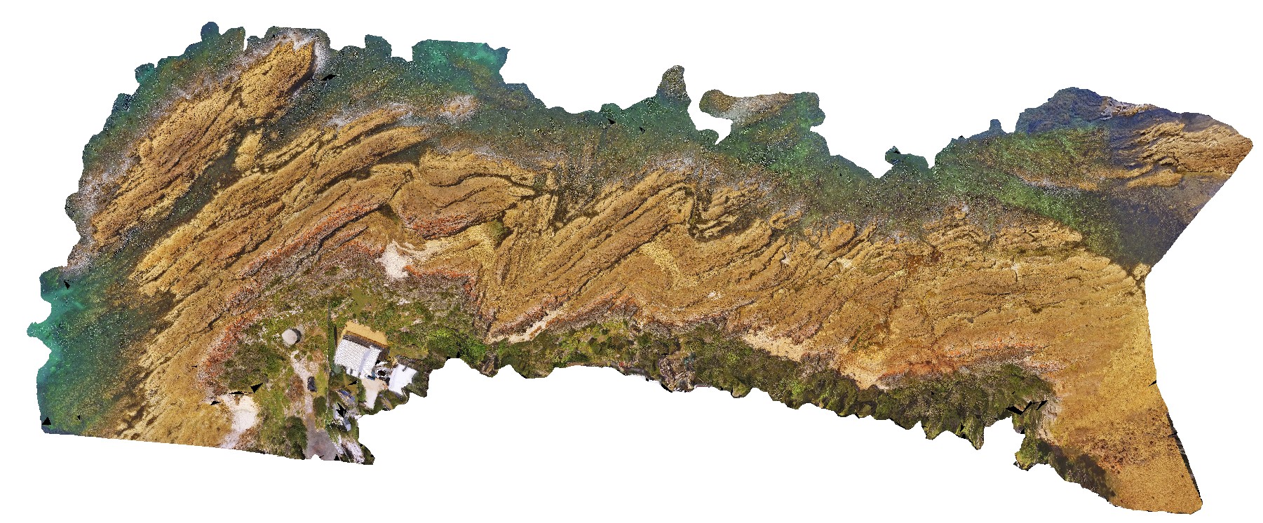
Permian wave-cut platform east of Fossil Cliff, showing bedforms in Permian Layers. Fossil Bluff Conservation Area, Wynyard. North Tasmania. |
100.00 |
-40.98142000000 |
145.73314000000 |
-9999.000 |
wave-cut platform, Permian bedding |
sandstone |
NTasUAV3 Map
 |
20 |
01/01/9999 midnight |
UAV |
aerial view of the unconformity at the base of Fossil Bluff, between the Permian and Tertiary units. Fossil Bluff Conservation Area, Wynyard. North Tasmania. |
50.00 |
-40.98138400000 |
145.73309700000 |
-9999.000 |
unconformity, geological contact, Fossil bluff |
sandstone, tillite |
NTasUAV4 Map
 |
20 |
01/01/9999 midnight |
UAV |
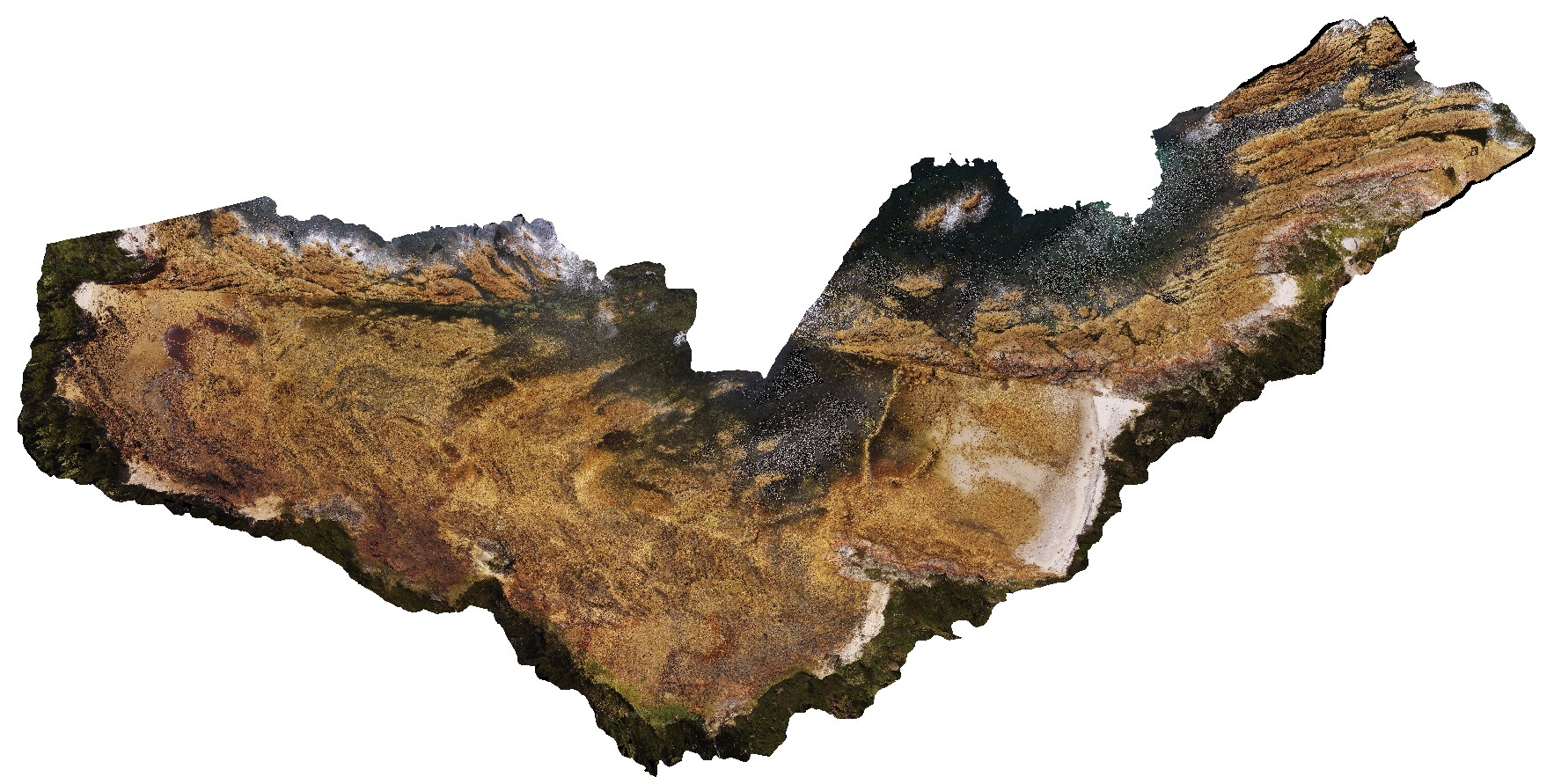
aerial view of Boat Harbour foreshore, showing macro-scale folding in moderately dipping rocks. Boat Harbour, north Tasmania. |
100.00 |
-40.92489400000 |
145.61249400000 |
-9999.000 |
fold, dip, structure |
quartzite |
NTasUAV5 Map
 |
20 |
01/01/9999 midnight |
UAV |
aerial view of Boat Harbour foreshore, showing macro-scale folding in moderately dipping rocks. Boat Harbour, north Tasmania. |
200.00 |
-40.92560000000 |
145.61093300000 |
-9999.000 |
fold, metamorphic rock |
quartzite |
NTasUAV6 Map
 |
20 |
01/01/9999 midnight |
UAV |
aerial view of Boat Harbour foreshore, combine NTasUAVs 4 & 5 |
0.00 |
-40.92560000000 |
145.61093300000 |
-9999.000 |
|
|
NTasUAVFSP1 Map
 |
20 |
01/01/9999 midnight |
UAV |
flat-lying sandstone beds of the Fossil Bluff Sandstone. Fossil Bluff Conservation Area, Wynyard. North Tasmania. |
0.00 |
-40.98145800000 |
145.73336400000 |
-9999.000 |
sandstone, Fossil Bluff |
sandstone |
NTasUAVFSP2 Map
 |
20 |
01/01/9999 midnight |
UAV |
aerial view of Boat Harbour foreshore, showing macro-scale folding in moderately dipping rocks. Boat Harbour, north Tasmania. |
0.00 |
-40.92531200000 |
145.61275600000 |
-9999.000 |
fold, structure, bedding |
quartzite |
Nugnug1 Map
 |
5 |
01/01/9999 midnight |
3D |
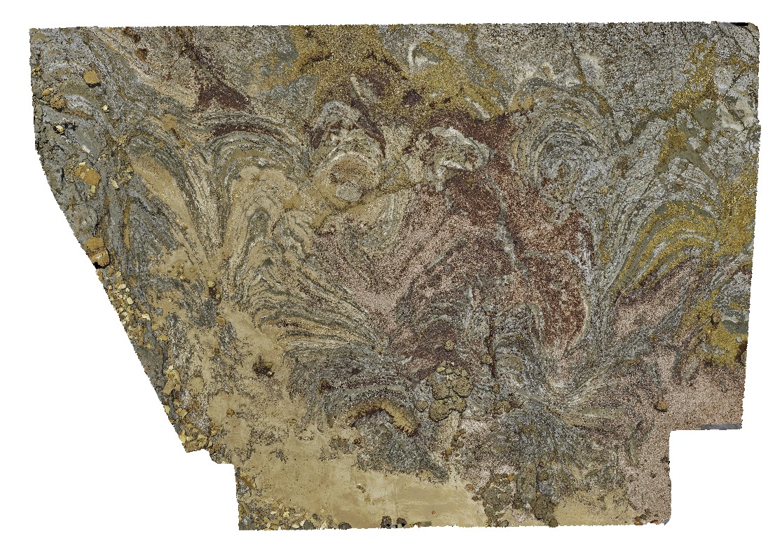
tectonic melange in Ordovician Pinnak Sandstone within the Nug Nug Shear Zone. Nugnug, Vic. |
1.00 |
-36.68114000000 |
146.67752000000 |
240.000 |
melange, mylonite, shear zone, structure |
melange |
Nugnug2 Map
 |
5 |
01/01/9999 midnight |
3D |
deformation (soft sediment?) in sandstone of the Ordovician Pinnak Sandstone. Nugnug, Vic. |
0.50 |
-36.68110000000 |
146.67729000000 |
240.000 |
folds, structure, sedimentology |
sandstone |
Nugnug3 Map
 |
5 |
01/01/9999 midnight |
3D |
tectonic melange in Ordovician Pinnak Sandstone within the Nug Nug Shear Zone. Nugnug, Vic. |
1.00 |
-36.68085000000 |
146.67783000000 |
240.000 |
melange, mylonite, structure |
melange |
Nugnug4 Map
 |
5 |
01/01/9999 midnight |
3D |
tectonic melange in Ordovician Pinnak Sandstone within the Nug Nug Shear Zone. Nugnug, Vic. |
0.30 |
-36.68085000000 |
146.67783000000 |
240.000 |
melange, mylonite, shear zone, structure |
melange |
Nugnug5 Map
 |
5 |
01/01/9999 midnight |
3D |
mylonite in tectonic melange in Ordovician Pinnak Sandstone within the Nug Nug Shear Zone. Nugnug, Vic. |
1.00 |
-36.68079000000 |
146.67789000000 |
240.000 |
mylonite, melange, shear zone, structure |
melange |