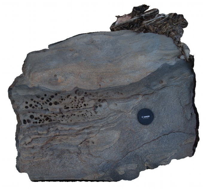
Nugnug6 Map
 |
5 |
01/01/9999 midnight |
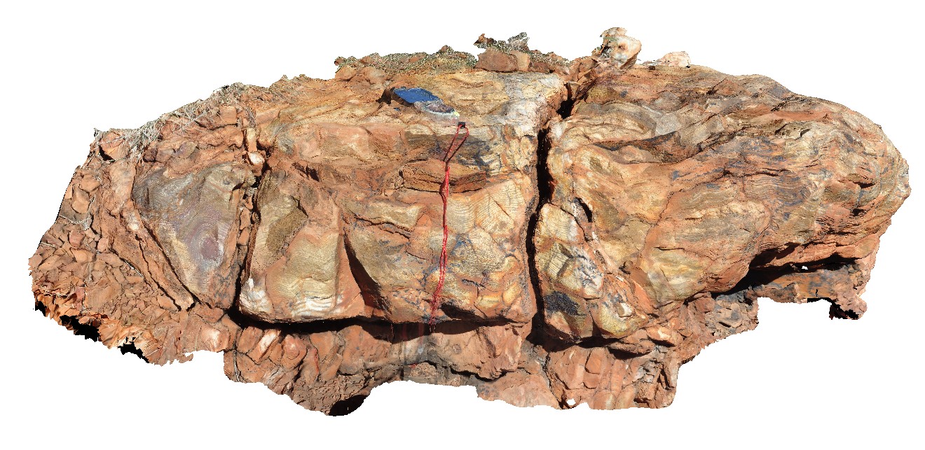
3D |
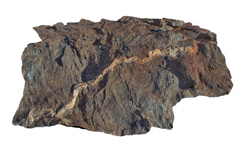
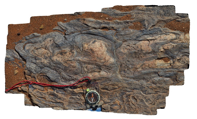
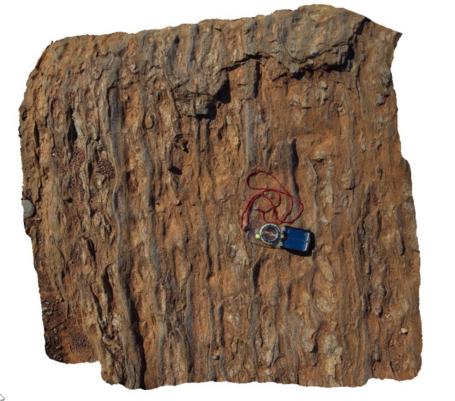
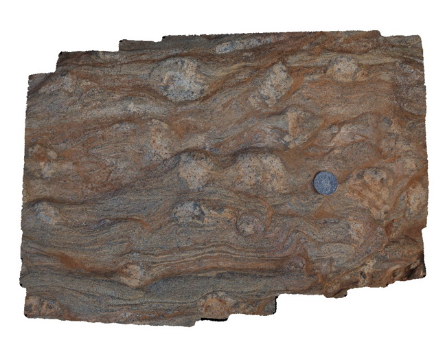
tectonic melange in Ordovician Pinnak Sandstone within the Nug Nug Shear Zone. Nugnug, Vic. |
0.40 |
-36.68078000000 |
146.67798000000 |
240.000 |
melange, mylonite, shear zone, structure |
melange |
Nugnug7 Map
 |
5 |
01/01/9999 midnight |
3D |
tectonic melange in Ordovician Pinnak Sandstone within the Nug Nug Shear Zone. Nugnug, Vic. |
1.00 |
-36.68078000000 |
146.67796000000 |
240.000 |
melange, mylonite, shear zone, structure |
melange |
Nullagine1 Map
 |
5 |
08/02/2016 noon |
3D |
3.4Ga stromatolite fossils in Strelley Pool Formation, Nullagine, as described in 'Discovery Trails to an Early Earth' . Marble Bar Rd, W.A. |
1.70 |
-21.47009500000 |
120.07242300000 |
-9999.000 |
stromatolite, fossil, palaeontology |
sediments |
Oatlands1 Map
 |
5 |
02/23/2016 9:25 a.m. |
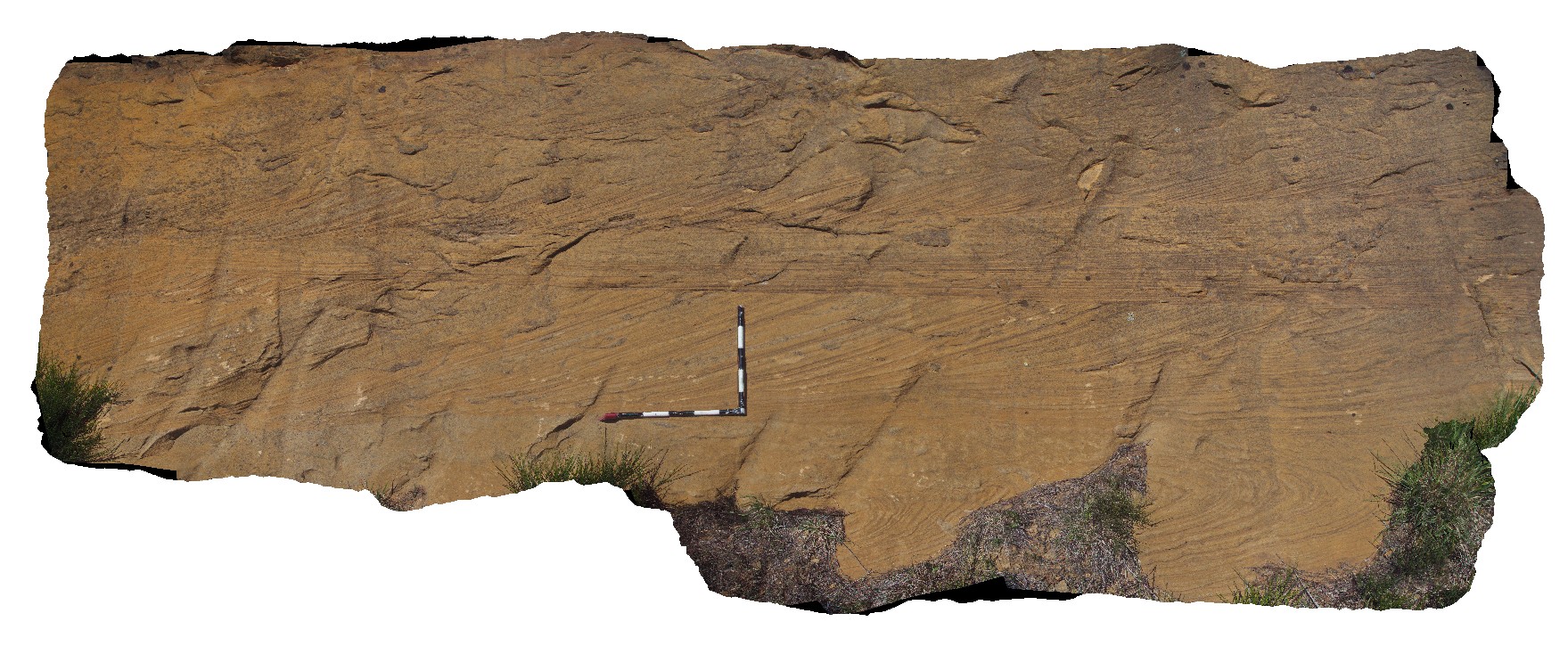
3D |
cross bedding in Triassic sandstone. Oatlands, Tasmania. |
5.00 |
-42.30169000000 |
147.35957000000 |
-9999.000 |
cross-bedding, sedimentology |
sandstone |
Oatlands2 Map
 |
0 |
02/23/2016 9:26 a.m. |
3D |
Jurassic? Dyke cross-cutting fine-grained Triassic sediments. Oatlands, Tasmania. |
2.50 |
-42.34642000000 |
147.33798000000 |
-9999.000 |
intrusive contact, dyke |
mudstone, dolerite |
OatlandsGiga1 Map
 |
0 |
02/23/2016 9:26 a.m. |
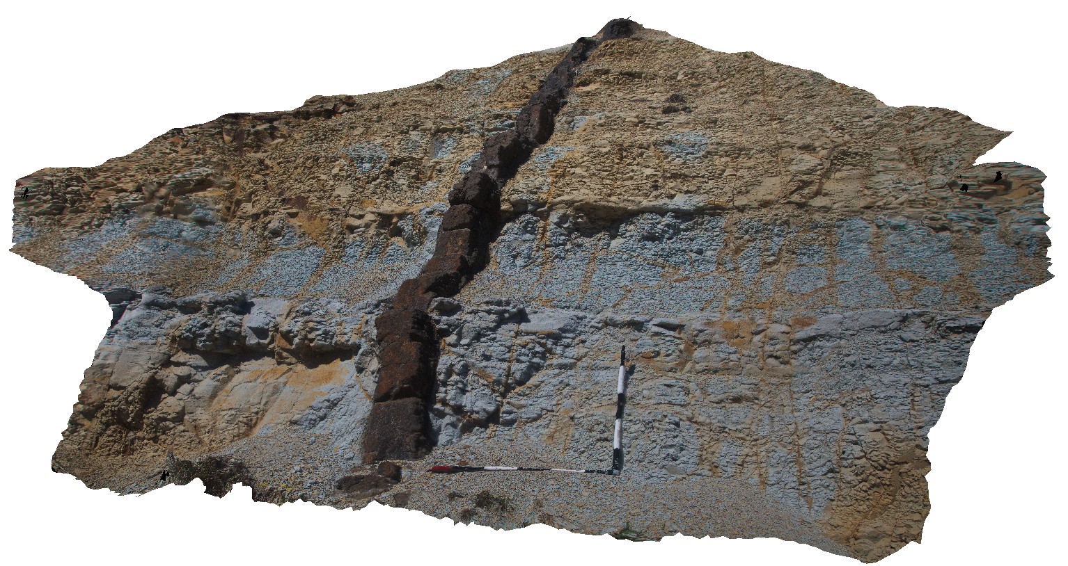
GIGA |
unconformity, showing Triassic Sediments overlain by younger, unconsolidated sediments. Oatlands, Tasmania. |
0.00 |
-42.42698000000 |
147.25957000000 |
-9999.000 |
unconformity |
sandstone, talus |
OatlandsUAV1 Map
 |
20 |
04/04/2016 3:03 p.m. |
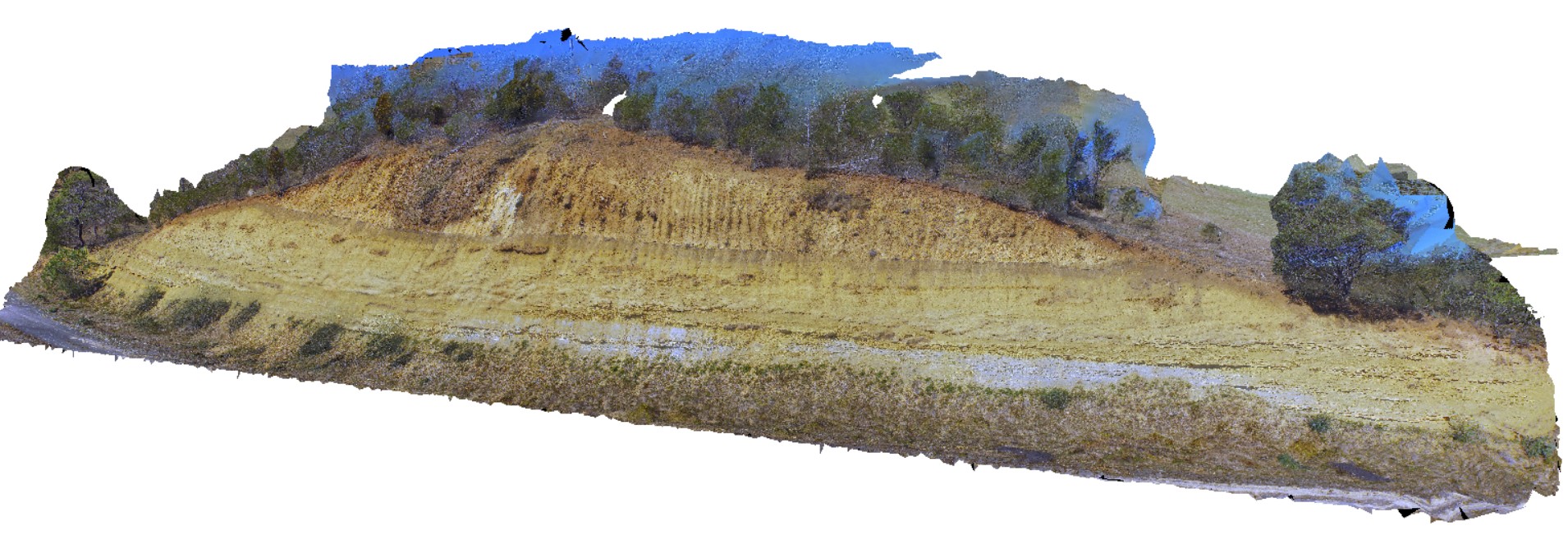
UAV |
unconformity, showing Triassic Sediments overlain by younger, unconsolidated sediments. Oatlands, Tasmania. |
20.00 |
-42.42698000000 |
147.25957000000 |
-9999.000 |
unconformity |
sandstone, talus |
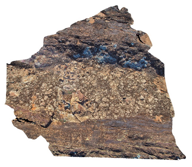
OCHRE1 Map
 |
5 |
08/02/2016 1:07 p.m. |
3D |
red (hematite), white (kaolinite) and yellow (limonite) layers in Adameus Basin sediments. Ochre Pits, Namatmira Drive, N.T. |
9.00 |
-23.73393800000 |
132.86925200000 |
746.600 |
ochre, ochre pits, clay, kaolinite, weathering |
clay |
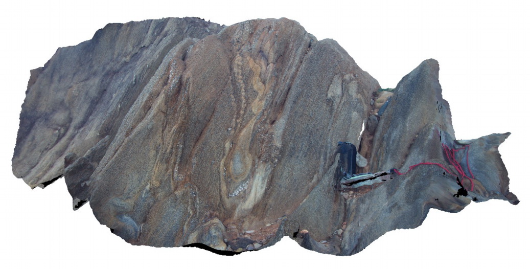
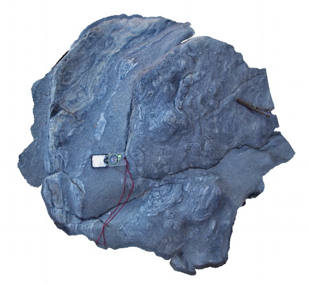
Olary1 Map
 |
5 |
07/14/2015 10:38 a.m. |
3D |
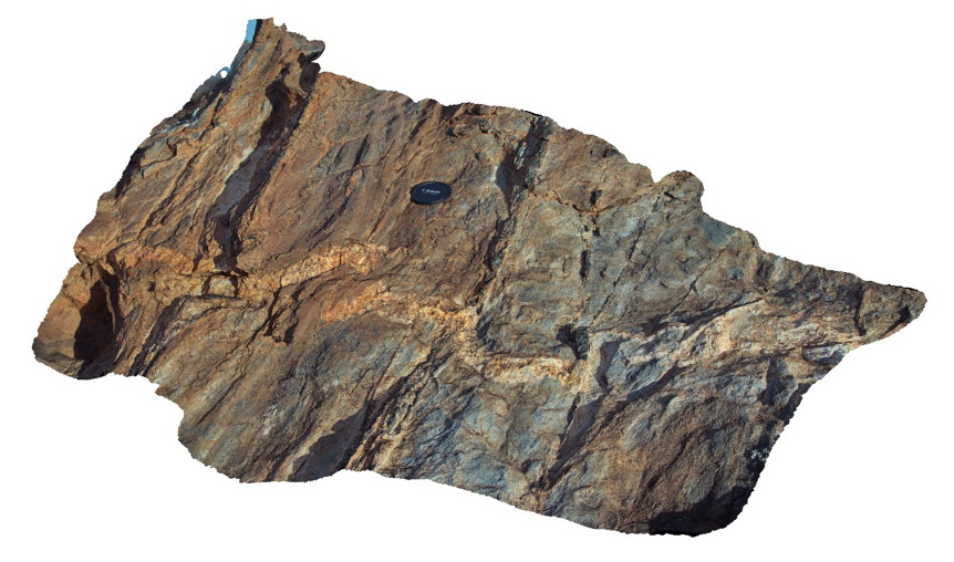
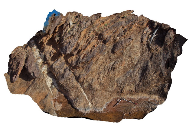
thin, folded pegmatite dyke cross cutting earlier green amphibolite? Veins in psammitic metasediments. Cathedral Rock, Olary. S.A. |
1.80 |
-32.09032000000 |
140.31961000000 |
-9999.000 |
pegmatite dyke, psammite, amphibole |
psammite, pegmatite |
Olary10 Map
 |
5 |
07/14/2015 10:39 a.m. |
3D |
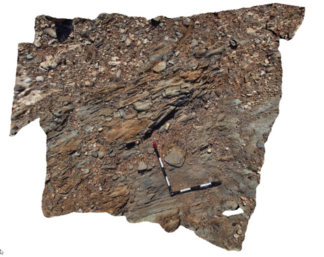
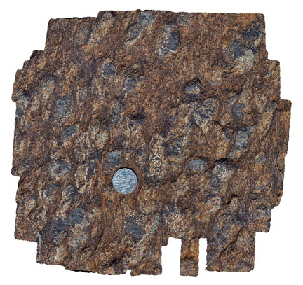
diamictite pavement, showing angular to sub-angular matrix supported clasts and other beds. Olary. S.A. |
4.50 |
-32.09558000000 |
140.27917000000 |
-9999.000 |
diamictite |
diamictite |
Olary11 Map
 |
5 |
07/14/2015 10:41 a.m. |
3D |
disharmonic folding metasediments in creek to waterfall. Weekaroo, Olary. S.A. |
0.70 |
-32.17042000000 |
139.98358000000 |
-9999.000 |
disharmonic folds, structure, metamorphic |
metasediments |
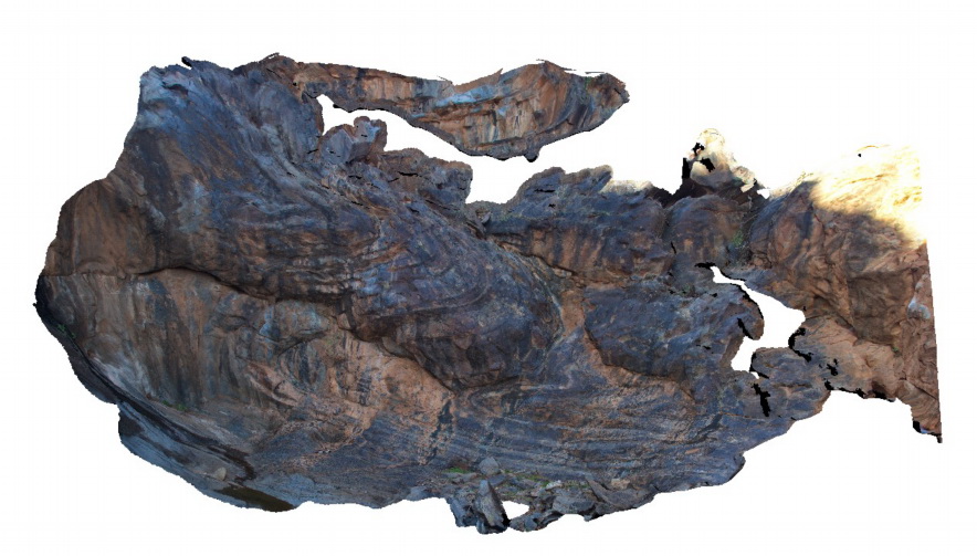
Olary12 Map
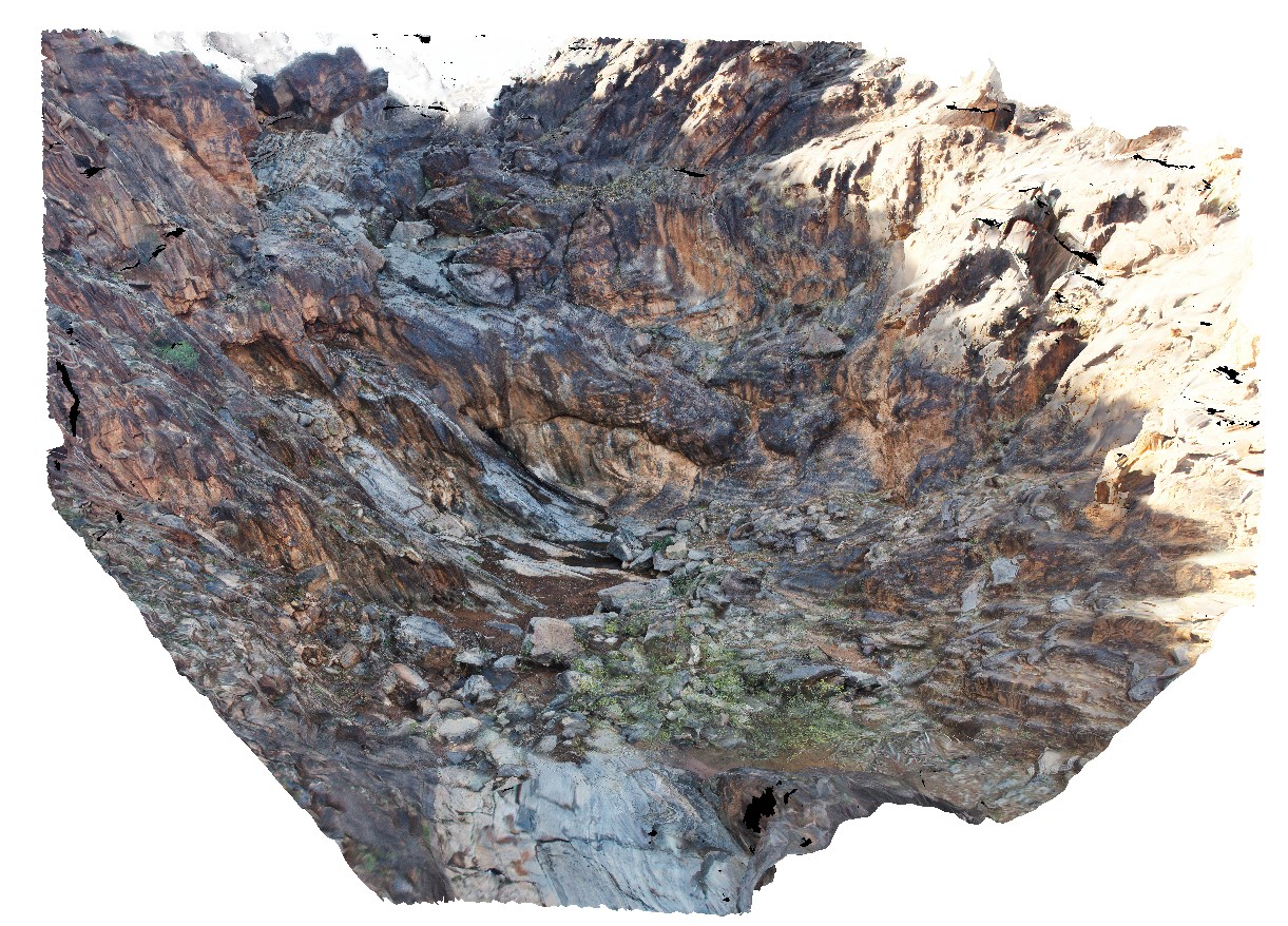 |
5 |
07/14/2015 10:41 a.m. |
3D |
over view of dry waterfall, showing tightly folded metasediment beds on gully walls and floor. Weekaroo, Olary. S.A. |
9.00 |
-32.17093700000 |
139.98501000000 |
-9999.000 |
fold, structure, metamorphic |
metasediments |
Olary13 Map
 |
5 |
07/14/2015 10:42 a.m. |
3D |
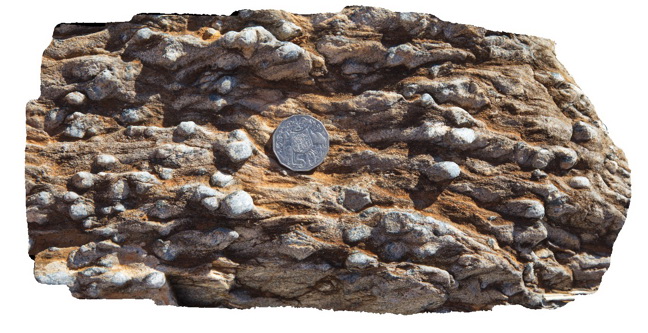
honeycomb weathering texture? In folded, finely banded psammites, with cleavage apparent in pelitic layers. Weekaroo. Olary, S.A. |
0.50 |
-32.17092000000 |
139.98489000000 |
-9999.000 |
weathering features, sedimentology |
psammite |
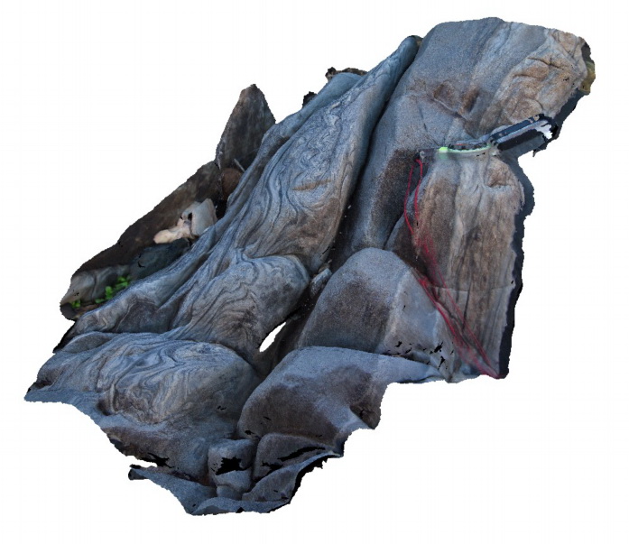
Olary14 Map
 |
5 |
07/14/2015 10:43 a.m. |
3D |
view of reclined fold at the base of a waterfall, in banded metasediments. Weekaroo, Olary. S.A. |
13.00 |
-32.17109000000 |
139.98505000000 |
-9999.000 |
reclined fold, fold, structure |
psammite |
Olary15 Map
 |
5 |
07/14/2015 10:43 a.m. |
3D |
softs sediment deformation in finely layered metasediments. Weekaroo, Olary. S.A. |
1.00 |
-32.17094000000 |
139.98524000000 |
-9999.000 |
soft sediment deformation, sedimentology |
psammite |
Olary16 Map
 |
5 |
07/14/2015 11:19 a.m. |
3D |
softs sediment deformation in finely layered metasediments. Weekaroo, Olary. S.A. |
0.50 |
-32.17091000000 |
139.98528000000 |
-9999.000 |
soft sediment deformation, psammite, sedimentology |
psammite |
Olary17 Map
 |
5 |
07/14/2015 11:19 a.m. |
3D |
fold interference patterns / soft sediment deformation in finely layered sediments. Weekaroo, Olary, S.A. |
0.60 |
-32.17105000000 |
139.98546000000 |
-9999.000 |
fold interference pattern, soft sediment deformation, metasediment |
psammite |
Olary18 Map
 |
5 |
07/14/2015 11:20 a.m. |
3D |
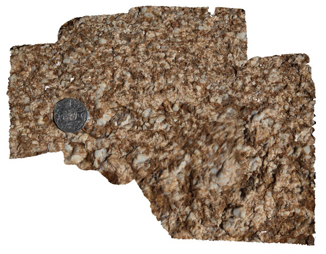
quartz-feldspar-mica pegmatitic texture in rock. Weekaroo, Olary, S.A. |
0.30 |
-32.17111000000 |
139.98607000000 |
-9999.000 |
pegmatitic texture |
pegmatite |
Olary19 Map
 |
5 |
07/14/2015 11:20 a.m. |
3D |
gently WSW plunging, tight to isoclinal fold with axial planar fabric in pelitic layers. Weekaroo, Olary. S.A. |
0.50 |
-32.17194000000 |
139.98773000000 |
-9999.000 |
fold, isoclinal, structure |
pelite |
Olary2 Map
 |
5 |
07/14/2015 11:20 a.m. |
3D |
thin, folded pegmatite dyke cross cutting earlier amphibole? Veins in psammitic metasediments. Cathedral Rock, Olary. S.A. |
0.50 |
-32.09035000000 |
140.31961000000 |
-9999.000 |
pegmatite dyke |
psammite, pegmatite |
Olary20 Map
 |
5 |
07/14/2015 11:21 a.m. |
3D |
psammopelitic metasediments with large retrogressed porphyroblasts in pelitic layers, possibly muscovite. Weekaroo. Olary, S.A. |
0.80 |
-32.17517000000 |
139.99251000000 |
-9999.000 |
psammopelitic, porphyroblast |
psammopelitic |
Olary21 Map
 |
5 |
07/14/2015 11:21 a.m. |
3D |
large andalusite porphyroblasts in pelitic metasediments / schist. Weekaroo, Olary. S.A. |
0.40 |
-32.17545000000 |
139.99261000000 |
-9999.000 |
andalusite, porphyroblasts |
pelite |
Olary22 Map
 |
5 |
07/14/2015 11:22 a.m. |
3D |
pelitic metasediments with thin psammite layers. Pelitic units have large andalusite porphyroblasts. Unit is cut by quartz vein. Olary. S.A. |
3.70 |
-32.17560000000 |
139.99271000000 |
-9999.000 |
andalusite, porphyroblasts |
pelite |
Olary23 Map
 |
5 |
07/14/2015 11:22 a.m. |
3D |
weathered pelite, showing exposed prismatic andalusite forms. Weekaroo, Olary. S.A. |
0.30 |
-32.17537000000 |
139.99341000000 |
-9999.000 |
andalusite, pelite |
pelite |
Olary24 Map
 |
5 |
07/14/2015 11:22 a.m. |
3D |
large retrogressed and rotated? Andalusite Porphyroblast in boulder. Weekaroo, Olary. S.A. |
0.50 |
-32.17511000000 |
139.99477000000 |
-9999.000 |
porphyroblast, andalusite |
pelite |