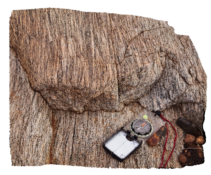
Yinnetharra1 Map
 |
5 |
05/27/2016 noon |
3D |
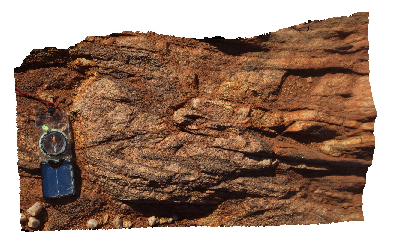
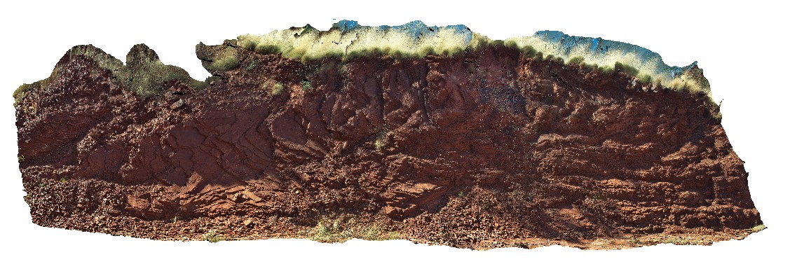
L (LS) tectonised granodiorite with plagioclase augens and mineral banding. Cobra-Dairy Creek Road - Gascoyne crossing, W.A. |
1.00 |
-25.65487000000 |
116.16776000000 |
-9999.000 |
L fabric, gneiss, fold, sheared, structure |
granodiorite |
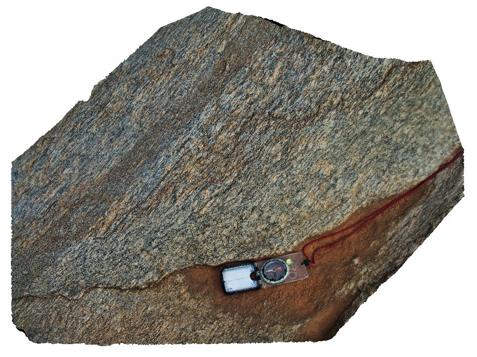
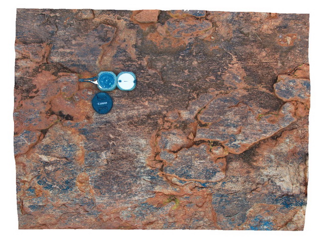
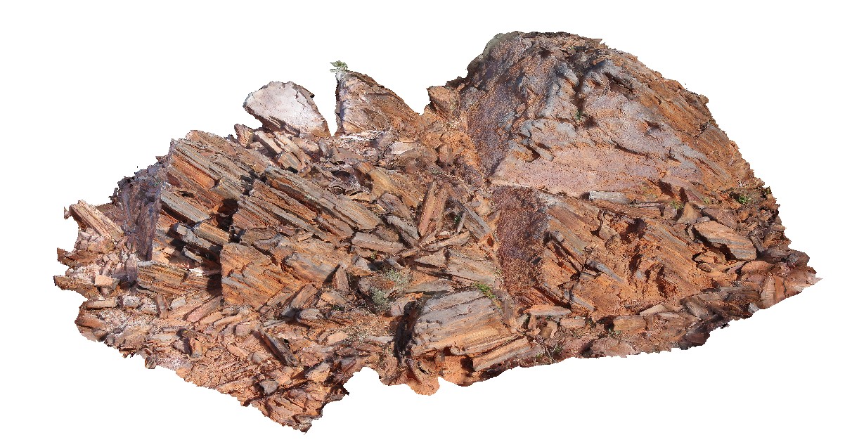
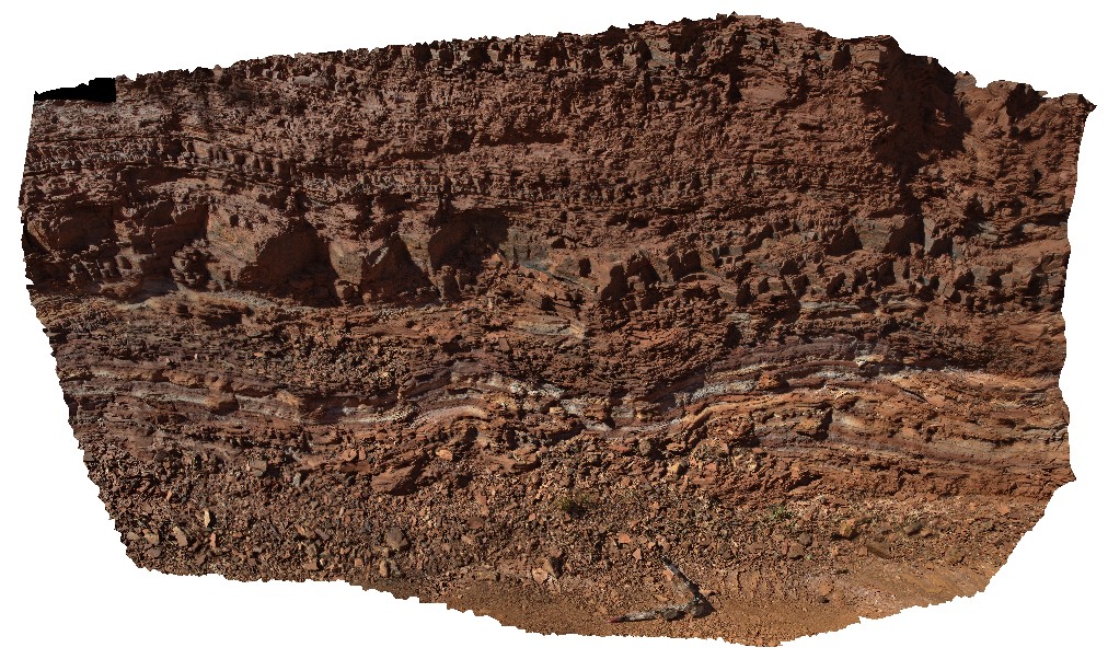
Yinnetharra2 Map
 |
5 |
05/27/2016 noon |
3D |
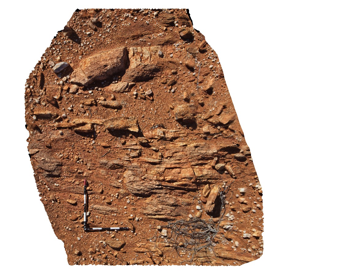
3D exposure of L tectonic fabric in granodiorite gneiss. Cobra-Dairy Creek Road - Gascoyne crossing, W.A. |
0.60 |
-25.65475000000 |
116.16776000000 |
-9999.000 |
L tectonic fabric, granodiorite, gneiss, metamorphism |
gneiss |
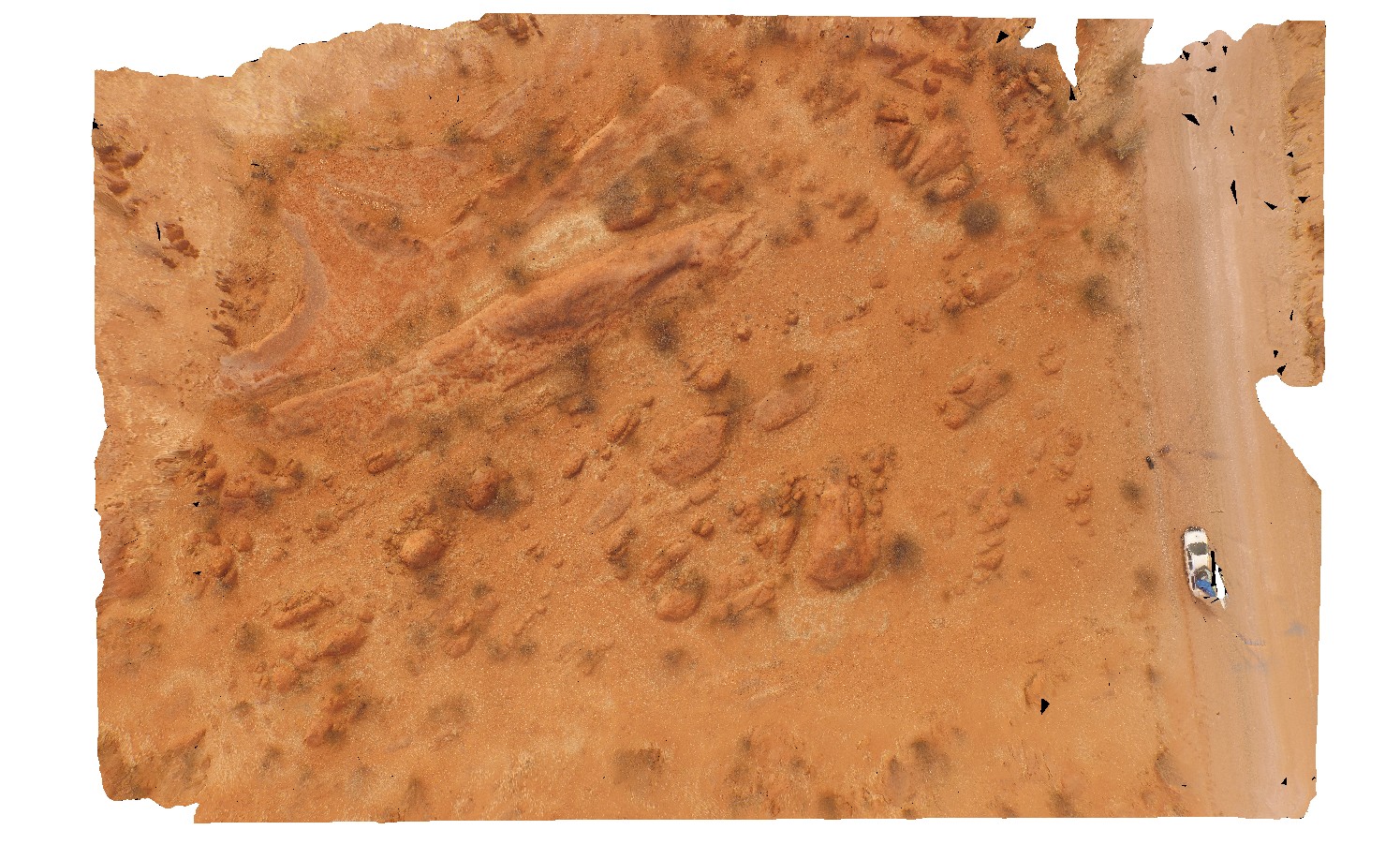
YinnetharraUAV1 Map
 |
20 |
05/27/2016 noon |
UAV |
aerial view of typical outcrop of rounded granitic tors. North of Thirty Three River, Cobra-Dairy Creek Road, W.A. |
50.00 |
-24.51352090000 |
116.24685660000 |
-9999.000 |
granite, outcrop, granite tor |
granite |
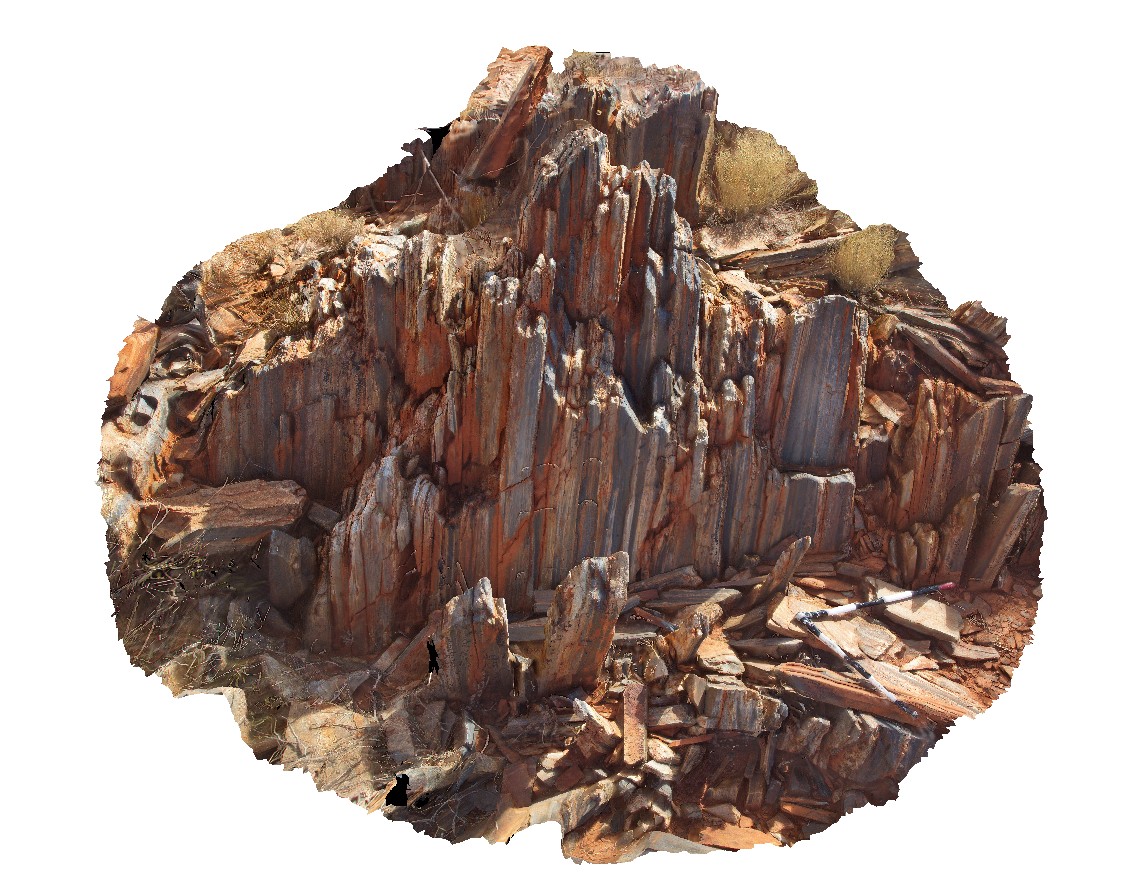
Cobra3 Map
 |
0 |
05/27/2016 noon |
3D |
3D view of outcrop of sub-vertical bedding with micro folds, cleavage and lineations on cleavage surface. Cobra-Dairy Creek, Wanna Road Junction, W.A. |
1.00 |
-24.20044000000 |
116.44952000000 |
-9999.000 |
cleavage, lineation, structure, fold |
siltstone |
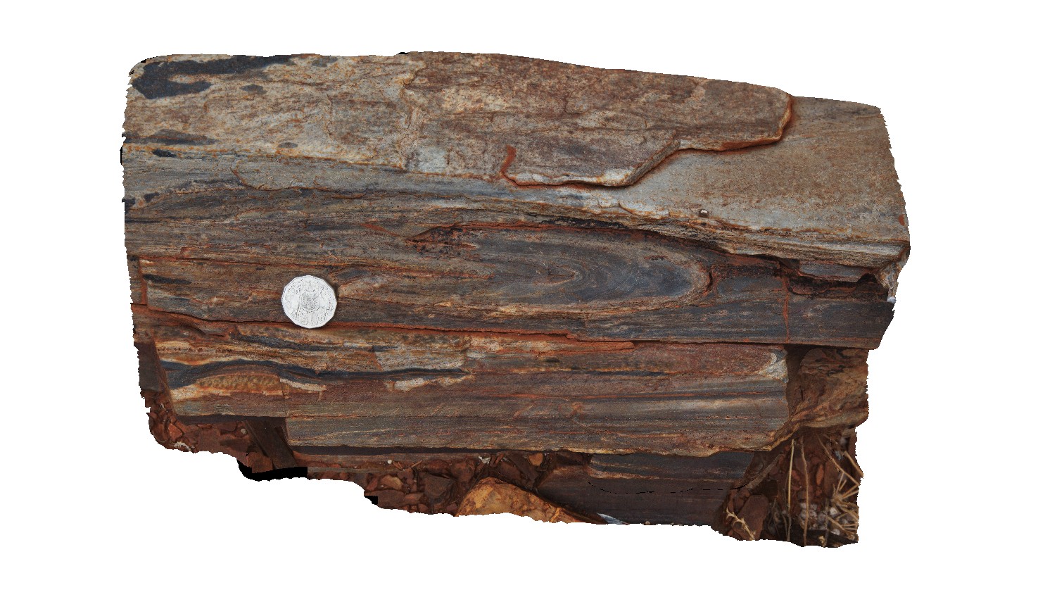
Cobra5 Map
 |
0 |
05/27/2016 noon |
3D |
Isoclinal fold in loose block of silicified siltstone. Cobra-Dairy Creek, Wanna Road Junction, W.A. |
0.45 |
-24.20044000000 |
116.44952000000 |
-9999.000 |
isoclinal fold, fold, structure |
siltstone |
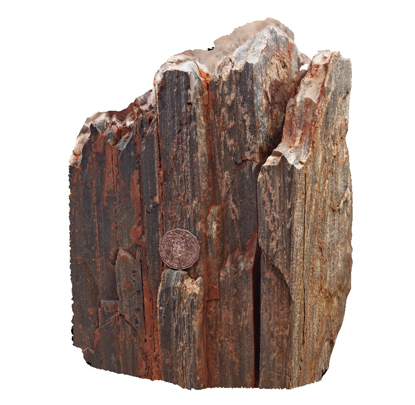
Cobra4 Map
 |
0 |
05/27/2016 noon |
3D |
detailed view of micro folds, cleavage and lineations on cleavage surface. Cobra-Dairy Creek, Wanna Road Junction, W.A. |
0.40 |
-24.20044000000 |
116.44952000000 |
-9999.000 |
lineation, fold, cleavage, structure |
siltstone |
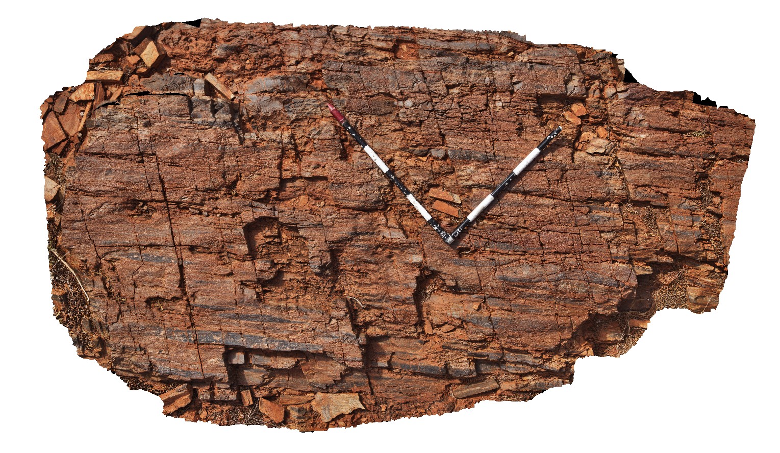
Cobra2 Map
 |
0 |
05/27/2016 noon |
3D |
outcrop of steeply 'dipping', finely banded, silicified siltstone. Cobra-Dairy Creek, Wanna Road Junction, W.A. |
3.00 |
-24.20045000000 |
116.44955000000 |
-9999.000 |
siltstone, steeply dipping, fold, structure |
siltstone |
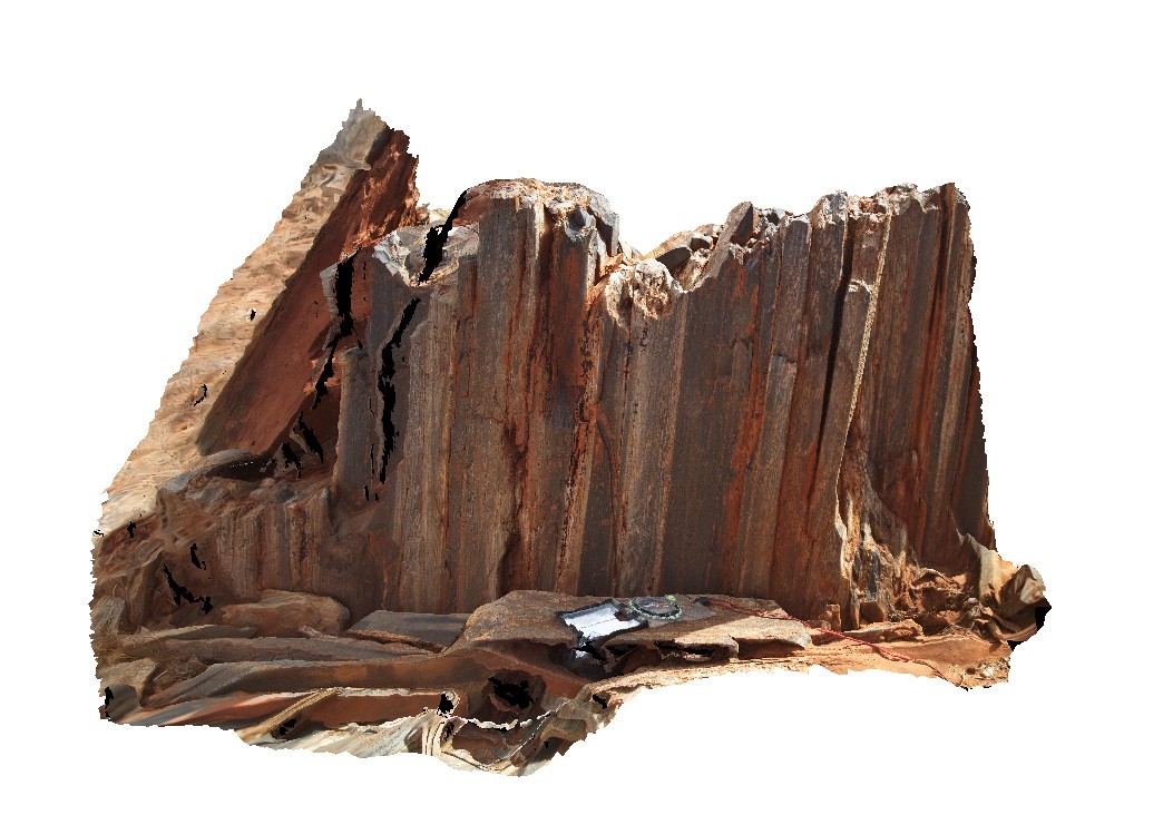
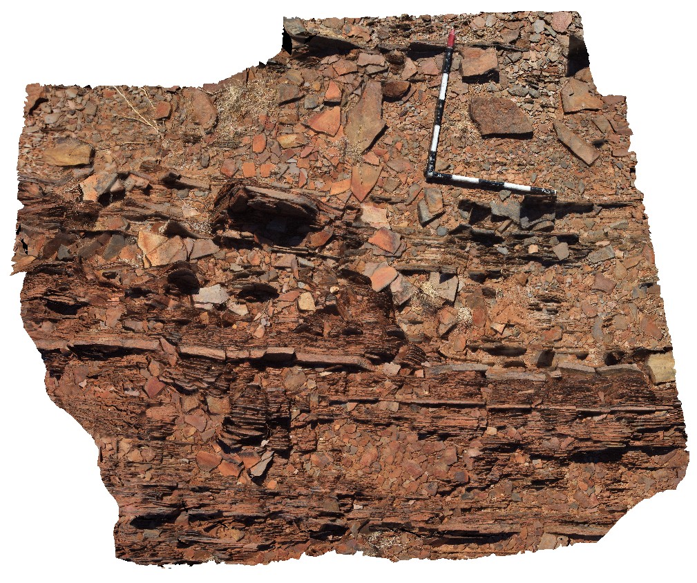
Cobra1 Map
 |
0 |
05/27/2016 noon |
3D |
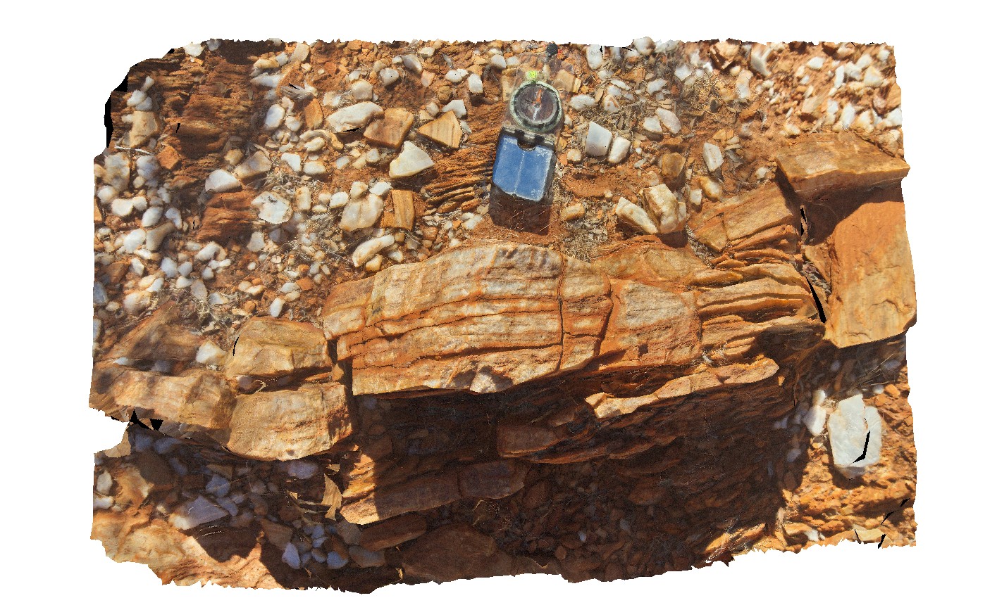
boudinaged 'bedding' in silicified siltstone of the Discovery Formation in the Edmund Group. Cobra-Dairy Creek, Wanna Road Junction, W.A. |
2.00 |
-24.20047000000 |
116.44970000000 |
-9999.000 |
boudinage, sediments |
siltstone |
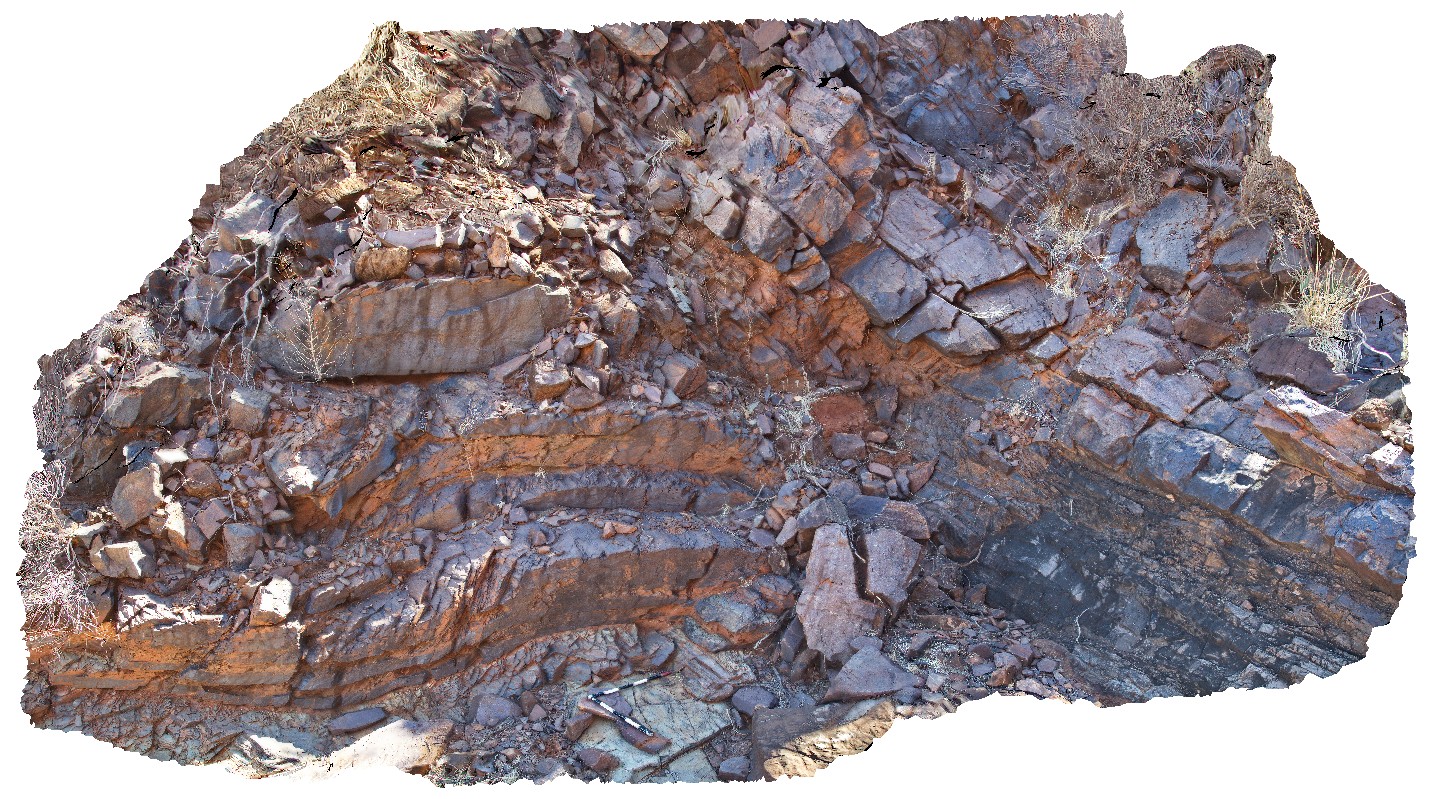
Erong3 Map
 |
0 |
05/26/2016 noon |
3D |
detail of tight to isoclinal folds in Erong granite / mylonite from site Erong2. Erong, East Murchison. W.A. |
0.90 |
-25.50816000000 |
116.65123000000 |
-9999.000 |
isoclinal fold, mylonite, structure |
granite gneiss |
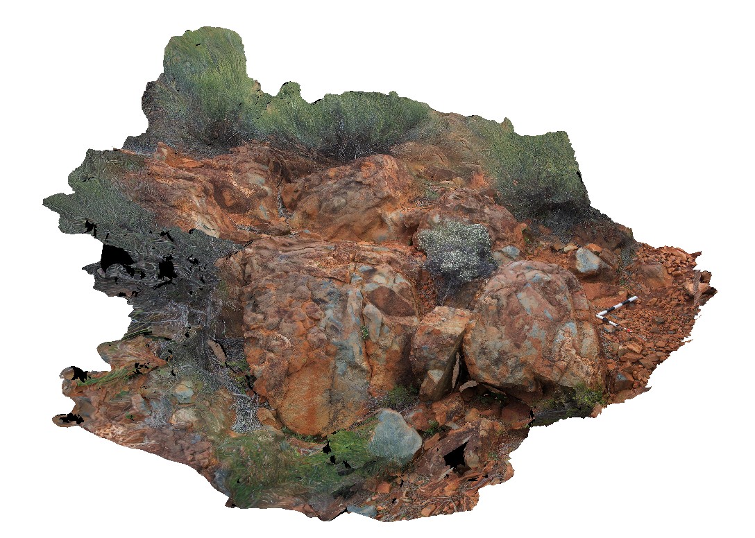
Erong2 Map
 |
0 |
05/26/2016 noon |
3D |
gneiss with folded leucosomes and boudinaged granite. Erong, East Murchison. W.A. |
2.70 |
-25.50815000000 |
116.65125000000 |
-9999.000 |
granite gneiss, leucosome, boudinage, structure |
granite gneiss |
Erong1 Map
 |
0 |
05/26/2016 noon |
3D |
quartz mylonite with steeply east plunging lineations. Erong, East Murchison. W.A. |
0.00 |
-26.50613000000 |
116.74168000000 |
-9999.000 |
mylonite, lineation, structure |
mylonite |
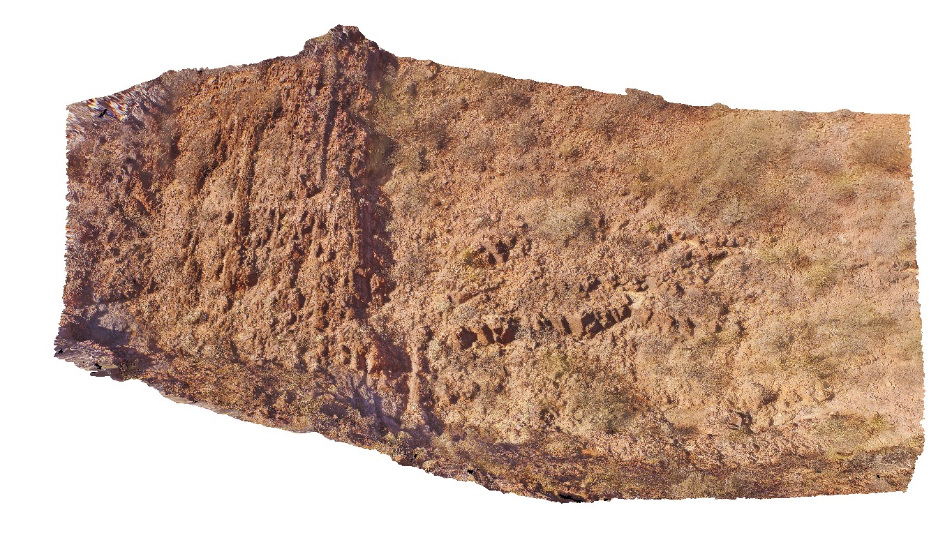
Augustus1 Map
 |
0 |
05/27/2016 noon |
3D |
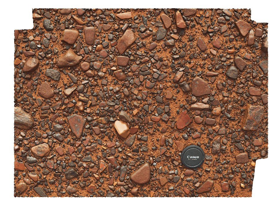
gibber plain with desert varnish. Near Mount Augustus, W.A. |
0.60 |
-24.25354000000 |
117.00278000000 |
-9999.000 |
desert varnish, detrital material |
lag |
JackHills1 Map
 |
5 |
08/02/2016 noon |
3D |
Sigmoidal quartz vein in sheared augen gneiss on W side of the Jack Hills, East Murchison. W.A. |
0.80 |
-26.14334000000 |
117.08675000000 |
-9999.000 |
gneiss, augen, metamorphic |
gneiss |
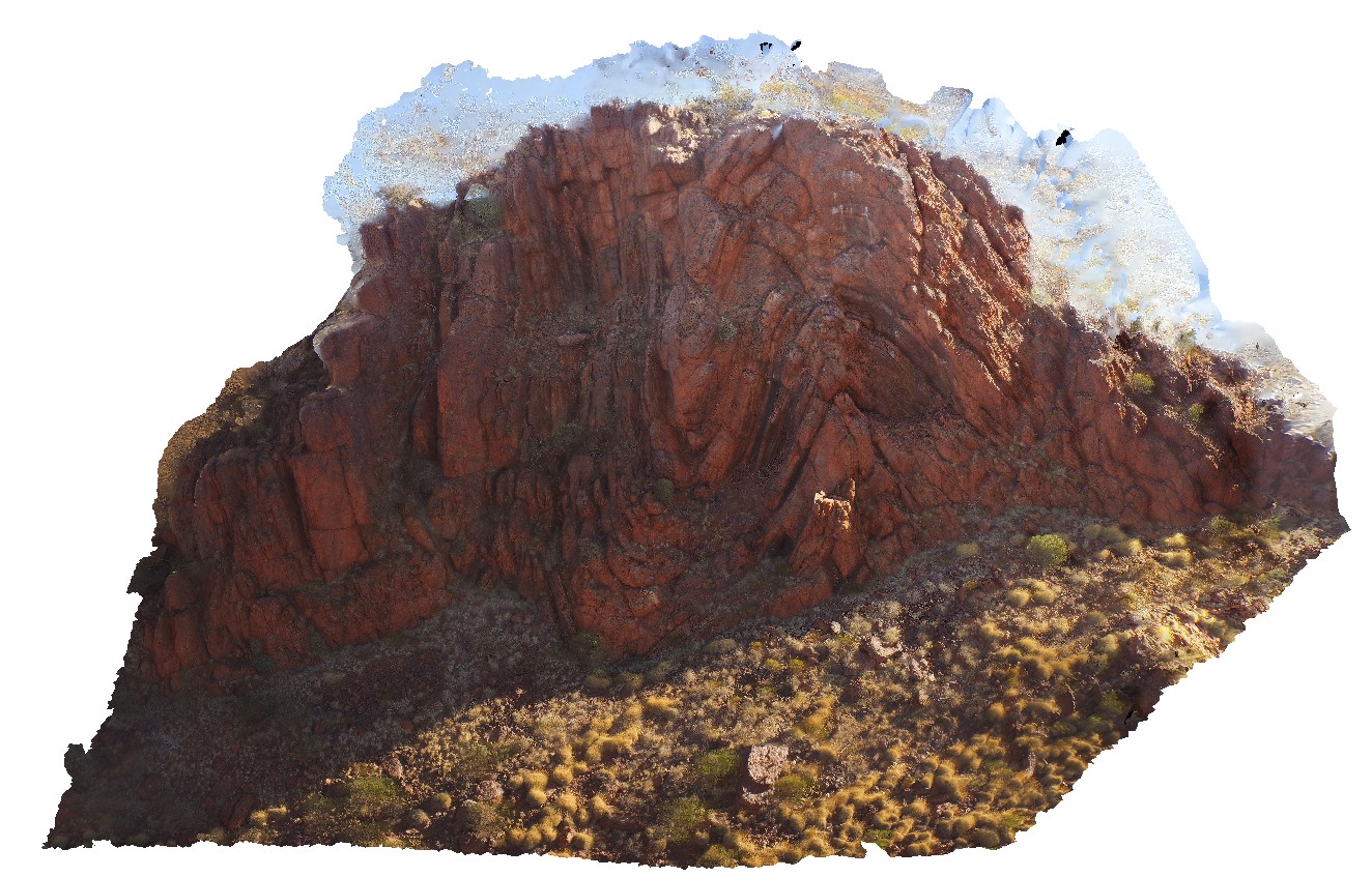
MtBlair2 Map
 |
0 |
05/28/2016 noon |
3D |
detail of the angular Ashburton-Capricorn unconformity, with open folds in the Ashburton rocks. Near Mount Blair on the Ashburton - Meekatharra Road, W.A. |
5.00 |
-23.44297000000 |
117.13130000000 |
-9999.000 |
angular unconformity, folds |
siltstone, siltstone |
MtBlairUAV1 Map
 |
0 |
05/28/2016 noon |
UAV |
angular Ashburton-Capricorn unconformity, with open folds in the Ashburton rocks. Near Mount Blair on the Ashburton - Meekatharra Road, W.A. |
0.00 |
-23.44284800000 |
117.13132500000 |
-9999.000 |
angular unconformity, Ashburton-Capricorn unconformity |
siltstone, siltstone |
MtBlair1 Map
 |
0 |
05/28/2016 noon |
3D |
steeply dipping siltstone and very fine-grained sandstone with prominent bedding cleavage. Near Mount Blair on the Ashburton - Meekatharra Road, W.A. |
2.70 |
-23.45285000000 |
117.13874000000 |
-9999.000 |
bedding cleavage, siltstone, structure |
siltstone |
Ninghan1 Map
 |
5 |
01/01/9999 midnight |
3D |
Folded Archean banded-iron formation composed of alternating hematitic/chert laminae. Weakly magnetic. Exposed in isolated hinge of anticline in the Ningham Foldbelt. Near Great Northern Highway, W.A. |
4.00 |
-29.37333320000 |
117.27916670000 |
320.000 |
banded Iron Formation, anticline, fold, structure, BIF, sedimentology |
BIF |
Ninghan2 Map
 |
5 |
01/01/9999 midnight |
3D |
Archean meta-pillow basalts with interpillow quartz-cemented breccia. Thick unit located at the top of Mount Singleton, near Great Northern Highway, W.A. |
4.35 |
-29.37333320000 |
117.27916670000 |
650.000 |
Metabasalt, Pillow basalt, Interpillow breccia |
basalt |
HardyUAV1 Map
 |
0 |
05/28/2016 noon |
UAV |
'M' folding in the Marra Mamba Iron Formation outcrop. Nanutarra Road, W.A. |
100.00 |
-22.95306990000 |
117.31003260000 |
-9999.000 |
M folding, banded Iron Formation, BIF, structure, folding |
BIF |
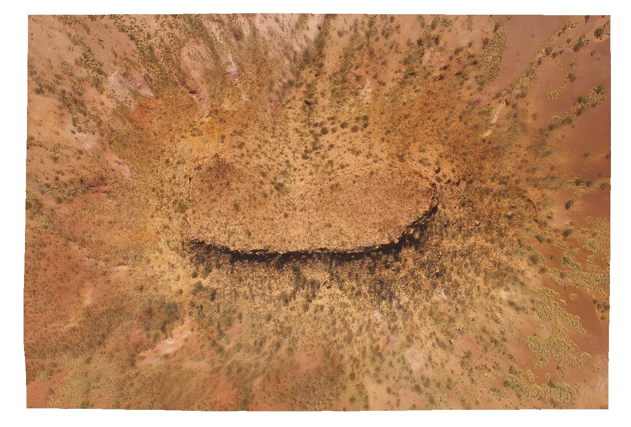
TableHillUAV1 Map
 |
0 |
05/28/2016 noon |
UAV |
aerial view of a Mesa, capped by calcrete - Tertiary land surface. Ashburton Downs - Meekatharra Road, W.A. |
100.00 |
-23.64748200000 |
117.45549200000 |
-9999.000 |
mesa, tertiary land surface |
sediments, calcrete |
TomPrice1 Map
 |
0 |
05/29/2016 noon |
3D |
oblique section through open folds in the Mount McRae Shale on the western side of Mount Nameless, Tom Price. W.A. |
16.00 |
-22.72532000000 |
117.74970000000 |
-9999.000 |
open folds, Hamersley Group, Mount McRae Shale, structure |
shale |
TomPrice2 Map
 |
0 |
05/29/2016 noon |
3D |
view of open folds in interbedded Shale and banded Iron on the western side of Mount Nameless, Tom Price. W.A. |
5.50 |
-22.72650000000 |
117.74983000000 |
-9999.000 |
shale, open folds, structure, folding, Hamersley Group |
shale |
TomPriceFSP2 Map
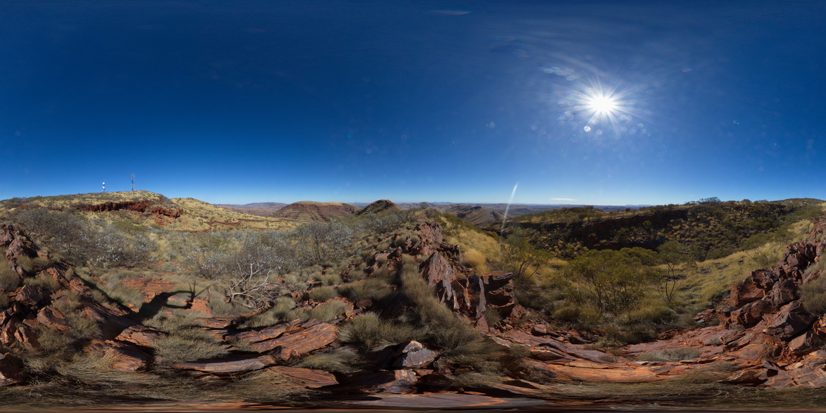 |
0 |
05/29/2016 noon |
FSP |
360 degree view from near the summit of Mount Nameless, showing surrounding ridge dominated landscape of sedimentary geology. Tom Price, W.A. |
5000.00 |
-22.71666000000 |
117.76108000000 |
-9999.000 |
Brockman Iron Formation, Pilbara, Hamersley Basin |
BIF |
TomPriceFSP1 Map
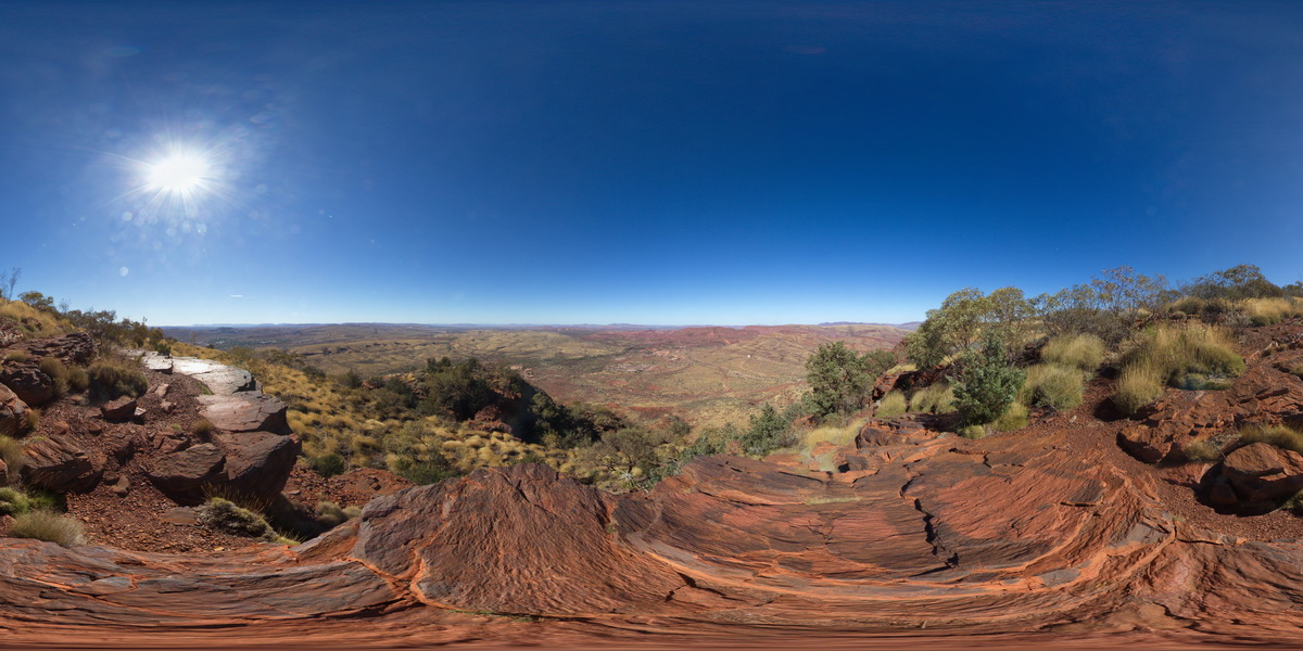 |
0 |
05/29/2016 noon |
FSP |
360 degree view from near the summat of Mount Nameless, showing Mount Tom Price mine operations and surrounding country. Tom Price, W.A. |
5000.00 |
-22.71881000000 |
117.76555000000 |
-9999.000 |
Brockman Iron Formation, Tom Price |
BIF |
TomPriceGIGa1 Map
 |
0 |
05/29/2016 noon |
GIGA |
360 degree view from near the summit of Mount Nameless, showing Mount Tom Price mine operations and surrounding country. Tom Price, W.A. |
5000.00 |
-22.71881000000 |
117.76555000000 |
-9999.000 |
banded iron formation, chert |
BIF |