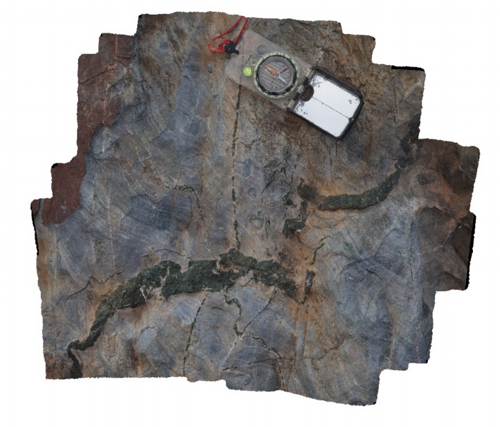
Olary25 Map
 |
5 |
07/14/2015 11:23 a.m. |
3D |
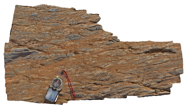
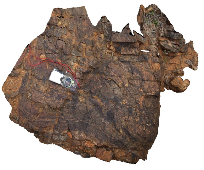
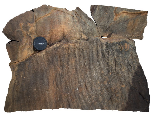
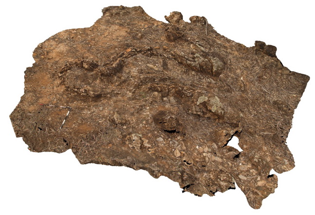
folded psammitic and pelite layers, with stretched and sheared porphyroblasts in pelite. Olary. S.A. |
0.90 |
-32.17536000000 |
139.99474000000 |
-9999.000 |
pelite, psammite, porphyroblast |
pelite |
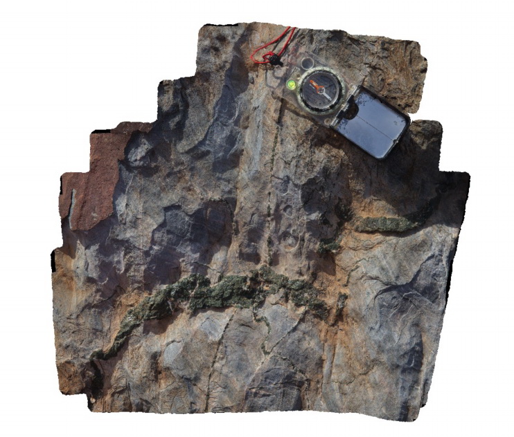
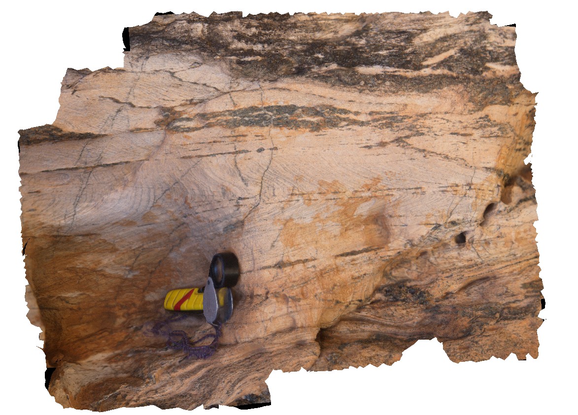
Olary26 Map
 |
5 |
07/14/2015 11:24 a.m. |
3D |
sheared pelitic metasediments. Weekaroo, Olary. S.A. |
0.40 |
-32.17587000000 |
139.99420000000 |
-9999.000 |
shear, structure |
pelite |
Olary27 Map
 |
5 |
07/14/2015 11:25 a.m. |
3D |
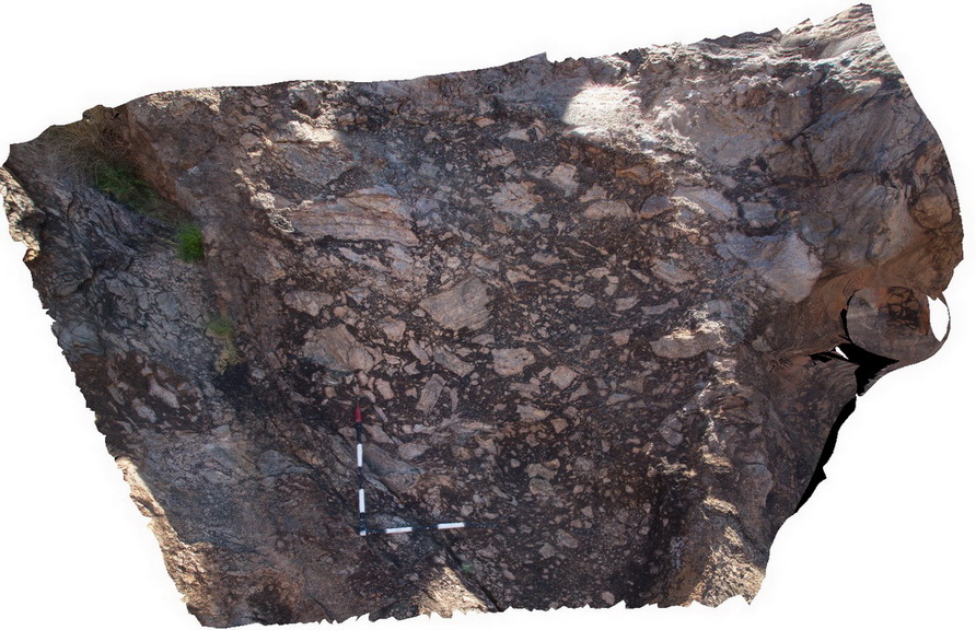
flattened and sheared porphyroblasts in metasediment? Weekaroo, Olary. S.A. |
0.70 |
-32.17752000000 |
139.99648000000 |
-9999.000 |
shear, structure |
metasediment |
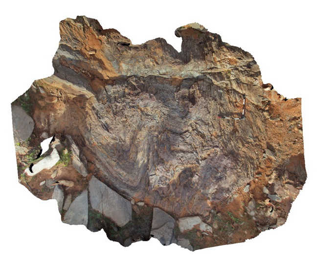
Olary28 Map
 |
5 |
07/14/2015 11:26 a.m. |
3D |
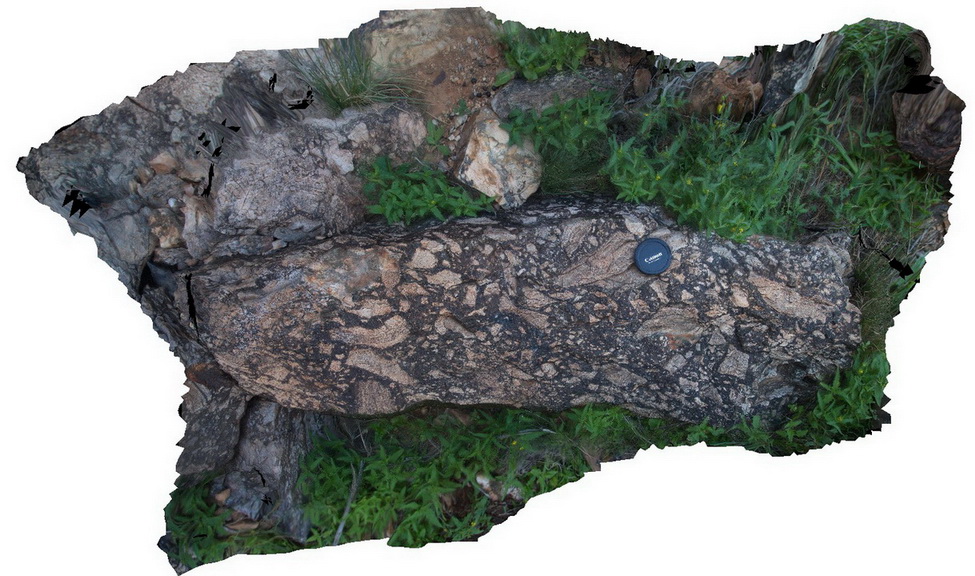
dyke intruding metasediments, containing amphibole and large feldspar domains. Weekaroo, Olary. S.A. |
2.30 |
-32.17818000000 |
139.99782000000 |
-9999.000 |
dyke, intrusive |
igneous rock |
Olary29 Map
 |
5 |
07/14/2015 11:26 a.m. |
3D |
alteration zone, defined by tremolite? Veins and epidote and feldspar intense alteration. Olary. S.A. |
0.80 |
-32.17525000000 |
140.00250000000 |
-9999.000 |
alteration zone, epidote, feldspar |
metasediments |
Olary3 Map
 |
5 |
07/14/2015 11:27 a.m. |
3D |
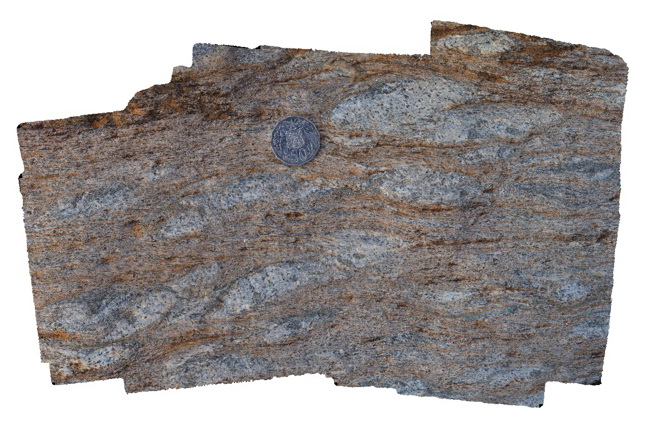
green mineral (amphibolite?) in veins, cutting folded metasediments. Cathedral Rock, Olary. S.A. |
0.50 |
-32.09031000000 |
140.31964000000 |
-9999.000 |
amphibole, vein |
metasediment |
Olary30 Map
 |
5 |
07/14/2015 11:27 a.m. |
3D |
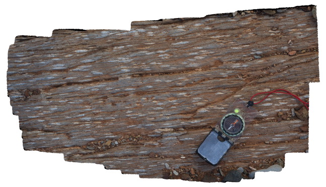
steeply plunging, open to tight folds in finely bedded metasediments in creek bed. Weekaroo, Olary. S.A. |
5.00 |
-32.16764000000 |
139.99287000000 |
-9999.000 |
fold, fold plunge, structure |
psammite |
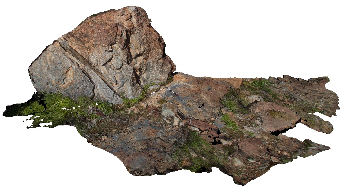
Olary31 Map
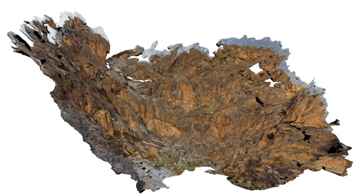 |
5 |
07/14/2015 11:27 a.m. |
3D |
3D of waterfall, showing reclined, tight folding of metasediments. Weekaroo. Olary, S.A. |
15.00 |
-32.17093700000 |
139.98501000000 |
-9999.000 |
tight fold, reclined fold, structure |
psammite |
Olary32 Map
 |
5 |
07/14/2015 11:30 a.m. |
3D |
crenulation of cleavage in metasediments. Weekaroo, Olary. S.A. |
1.20 |
-32.17087100000 |
139.98479000000 |
-9999.000 |
crenulation cleavage, structure |
pelite |
Olary33 Map
 |
5 |
07/14/2015 11:30 a.m. |
3D |
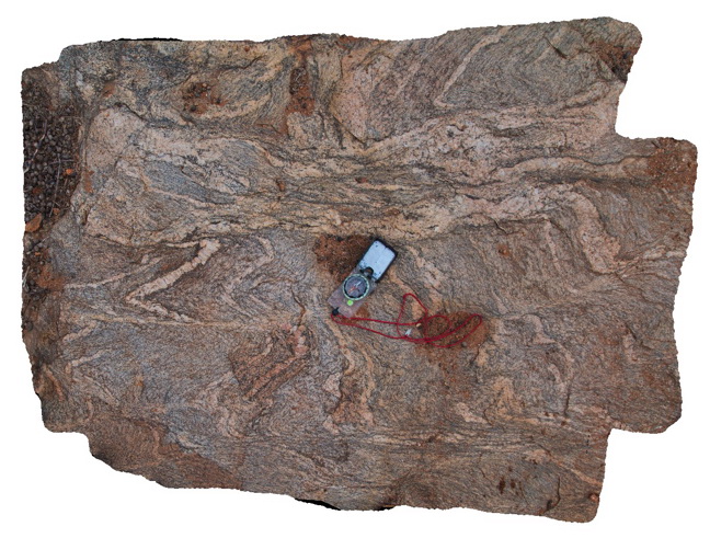
intensely deformed migmatite. Weekaroo, Olary. S.A. |
4.50 |
-32.18707000000 |
139.97440000000 |
-9999.000 |
migmatite, deformation |
migmatite |
Olary34 Map
 |
5 |
07/14/2015 11:30 a.m. |
3D |
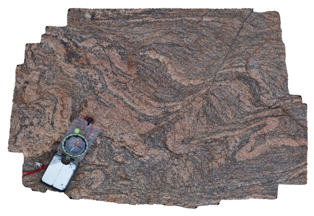
intensely deformed migmatite. Weekaroo, Olary. S.A. |
1.00 |
-32.18707000000 |
139.97444000000 |
-9999.000 |
migmatite |
migmatite |
Olary35 Map
 |
5 |
07/14/2015 11:30 a.m. |
3D |
intensely deformed migmatite. Weekaroo, Olary. S.A. |
0.40 |
-32.18712000000 |
139.97440000000 |
-9999.000 |
migmatite |
migmatite |
Olary36 Map
 |
5 |
07/14/2015 11:31 a.m. |
3D |
view of a refolded fold in calcareous mudstone and sandstones. Weekaroo, Olary. S.A. |
4.00 |
-32.19386000000 |
139.95740000000 |
-9999.000 |
refolded fold, fold, structure |
sandstone |
Olary37 Map
 |
5 |
07/14/2015 11:33 a.m. |
3D |
view of orientated fabric (pebbles) in the core of F2 fold in conglomerate band. Related to image Olary36. Weekaroo. Olary, S.A. |
0.40 |
-32.19503000000 |
139.95515000000 |
-9999.000 |
F2 fold, structural fabric, fold |
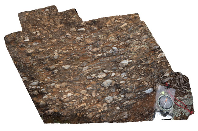
conglomerate |
Olary38 Map
 |
5 |
07/14/2015 11:34 a.m. |
3D |
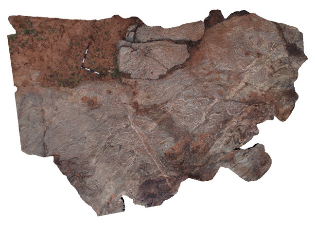
small outcrop showing very irregular unconformity between the basement and the overlying younger Adelaidean stratigraphy. Olary. S.A. |
1.30 |
-32.19519000000 |
139.95514000000 |
-9999.000 |
unconformity |
metasediments, metasediments |
Olary39 Map
 |
0 |
09/27/2015 6:21 p.m. |
3D |
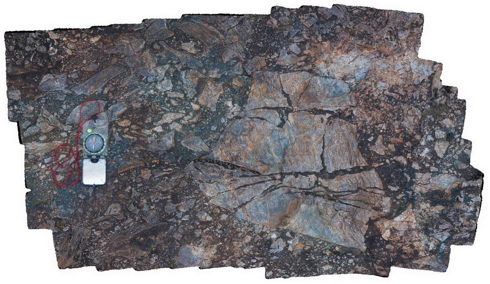
shear zone with sheared quartz vein in margin of calc-silicate lode of Cathedral Rock. Olary, S.A. |
0.60 |
-32.09121000000 |
140.31769000000 |
-9999.000 |
shear zone, quartz vein |
metasediments |
Olary4 Map
 |
5 |
07/14/2015 11:34 a.m. |
3D |
green mineral (amphibole?) in veins, cutting folded metasediments. Cathedral Rock, Olary. S.A. |
0.60 |
-32.09031000000 |
140.31964000000 |
-9999.000 |
vein mineral, amphibole, calc-silicate |
psammite |
Olary40 Map
 |
0 |
09/27/2015 6:21 p.m. |
3D |
view of folded layering or foliation cut by axial planar amphiboles / dark mineral veins. Cathedral Rock. Olary, S.A. |
0.20 |
-32.09106000000 |
140.31787000000 |
-9999.000 |
fold, axial plane, structure |
metasediments |
Olary41 Map
 |
0 |
09/27/2015 6:22 p.m. |
3D |
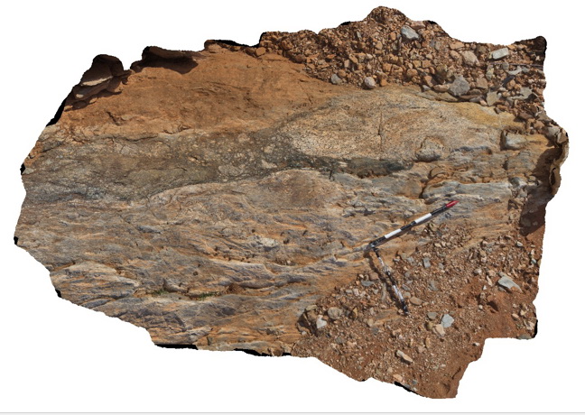
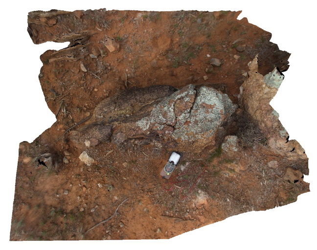
large boulder with hydrothermal breccia crosscutting sheared calc-silicate units. Cathedral Rock. Olary, S.A. |
4.00 |
-32.09007000000 |
140.31912000000 |
-9999.000 |
calc-silicate, breccia |
breccia |
Olary42 Map
 |
0 |
09/27/2015 6:22 p.m. |
3D |
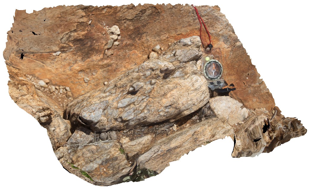
detail of the brecciated contact in site Olary41, showing breccia boundary and clasts. Cathedral Rock, Olary, S.A. |
0.50 |
-32.09007000000 |
140.31912000000 |
-9999.000 |
calc-silicate, breccia |
breccia |
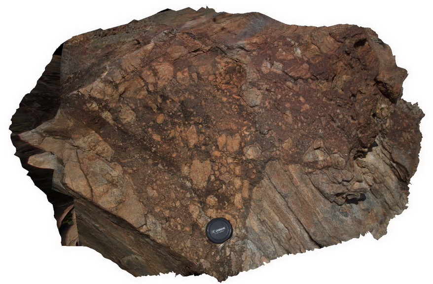
Olary43 Map
 |
0 |
09/27/2015 6:23 p.m. |
3D |
view of hydrothermal breccia in boulder, showing relic layering in clasts. Cathedral Rock, Olary, S.A. |
1.50 |
-32.08998000000 |
140.31932000000 |
-9999.000 |
breccia |
breccia |
Olary44 Map
 |
0 |
09/27/2015 6:23 p.m. |
3D |
out crop of breccia, with angular and randomly orientated clasts. Cathedral Rock, Olary, S.A |
3.20 |
-32.09000000000 |
140.31943000000 |
-9999.000 |
breccia, calc-silicate |
breccia |
Olary45 Map
 |
0 |
09/27/2015 6:23 p.m. |
3D |
detail of breccia, with large veined, calc-silicate clast. Cathedral Rock, Olary. S.A. |
1.00 |
-32.08995000000 |
140.31944000000 |
-9999.000 |
breccia, calc-silicate |
breccia |
Olary46 Map
 |
0 |
09/27/2015 6:24 p.m. |
3D |
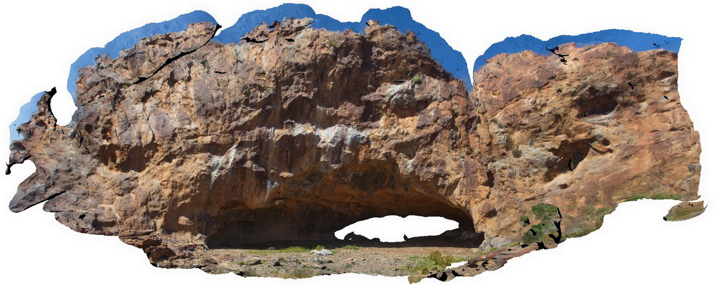
view of cave entrance and surrounding rock face. Cathedral Rock, Olary. S.A. |
15.00 |
-32.09034000000 |
140.31938000000 |
-9999.000 |
cave, outcrop |
metasediment |
Olary47 Map
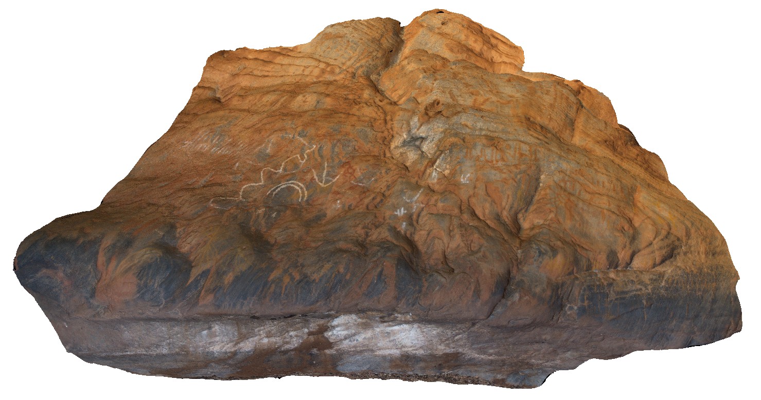 |
0 |
09/27/2015 6:25 p.m. |
3D |
view of inside of cave from image Olary47, showing Aboriginal rock art. Cathedral Rock, Olary. S.A. |
5.00 |
-32.09034000000 |
140.31938000000 |
-9999.000 |
cave, rock art |
metasediments |