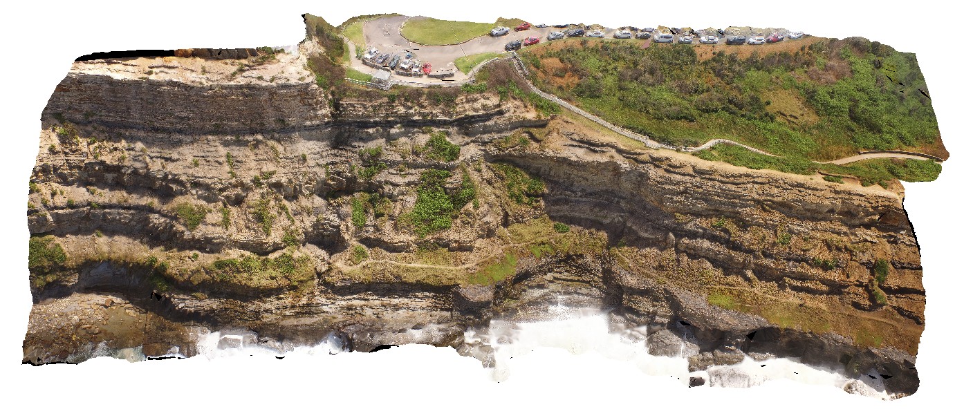
NewcastleUAV5 Map
 |
20 |
01/01/9999 midnight |
UAV |
coastal cliff, south of the Bogey Hole. Newcastle, N.S.W. |
210.00 |
-32.93545400000 |
151.78061500000 |
20.000 |
sedimentology, sediments, tuff, sandstone |
sediments |
EaglehawkUAV1 Map
 |
20 |
01/01/9999 midnight |
UAV |
aerial view of Permian sea cliffs at Eaglehawk Neck, Tasmania. |
500.00 |
-43.03373200000 |
147.94973000000 |
94.070 |
sea cliff, Permian sediments |
sediments |
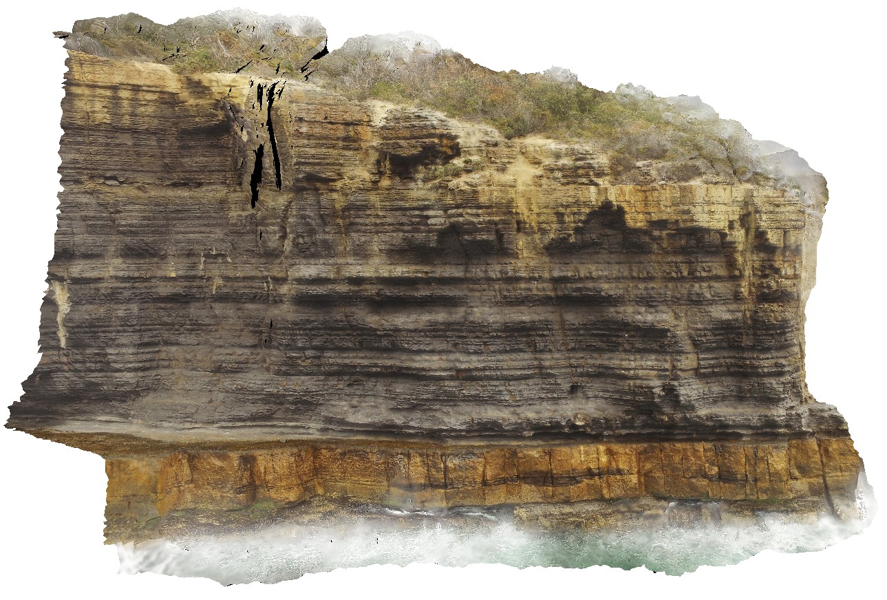
EaglehawkUAV2 Map
 |
20 |
01/01/9999 midnight |
UAV |
aerial view from the water of cliff, showing finely layered fine-grained mudstones / siltstones overlying blocky silt / sandstone beds. Eaglehawk Neck, Tasmania. |
120.00 |
-43.03425300000 |
147.94985100000 |
41.000 |
sedimentology, sediments, Parmeener Supergroup |
sediments |
WaterfallbayUAV1 Map
 |
20 |
01/01/9999 midnight |
UAV |
extensive aerial view of 'clean' Permian sediment cliffs. Waterfall Bay, Tasmania. |
500.00 |
-43.05168000000 |
147.94986900000 |
170.448 |
Permian sediments, dolerite dyke, faults, sedimentology |
sediments |
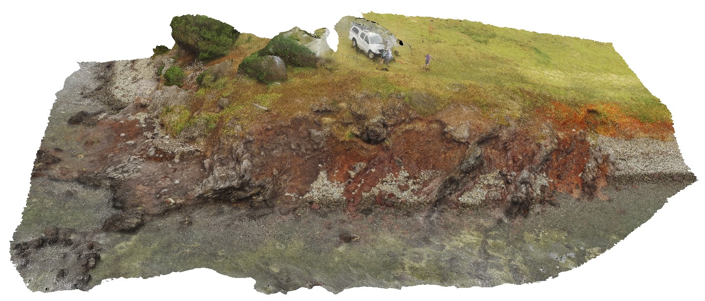
BlackjackUAV1 Map
 |
20 |
01/01/9999 midnight |
UAV |
aerial view of exposed layered volcanic package, including basalt lava flows and volcanic breccias. Black Jack Hills, Tas. |
100.00 |
-42.99280500000 |
147.65259900000 |
-9999.000 |
breccia, lava flow, basalt, volcanics, volcanic package |
basalt |
BlackjackUAV2 Map
 |
20 |
01/01/9999 midnight |
UAV |
aerial view of exposed modern paleo-beach deposits of flat cobble shingles. Black Jack Hills, Tas. |
50.00 |
-42.99353100000 |
147.65130500000 |
70.729 |
paleo-beach deposit, paleo land form, shingles |
conglomerate |
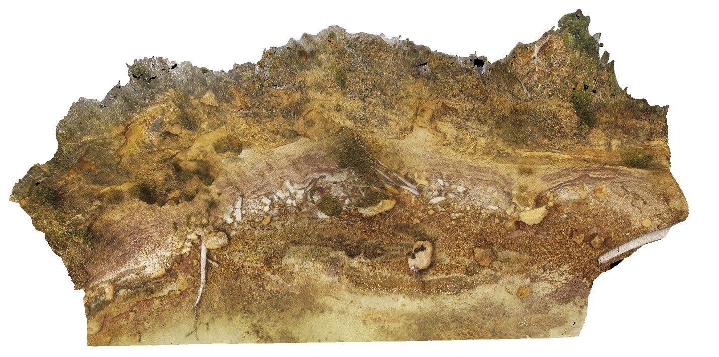
ParkersUAV1 Map
 |
20 |
01/01/9999 midnight |
UAV |
aerial overall view of Triassic outcrop, showing fluvial and floodplain sediments. Parkers Beach, Nubeena Tasmania. |
65.00 |
-43.04808900000 |
147.79449400000 |
27.000 |
fluvial, flood plain, sedimentology, Triassic |
sandstone |
ParkersUAV2 Map
 |
20 |
01/01/9999 midnight |
UAV |
detailed view of Triassic fluvial and flood plain sediments. Parkers Beach, Nubeena Tasmania. |
180.00 |
-43.04860200000 |
147.79403500000 |
26.000 |
Triassic, fluvial, floodplain, sedimentology |
sandstone |
ParkersUAV3 Map
 |
20 |
01/01/9999 midnight |
UAV |
aerial view of entire Parkers Beach outcrop of fluvial and flood plain Triassic sediments. Parkers Beach, Nubeena Tasmania. |
385.00 |
-42.94254100000 |
147.69614700000 |
19.000 |
fluvial, floodplain, sedimentology, Triassic |
sandstone |
LimebayUAV1 Map
 |
20 |
01/01/9999 midnight |
UAV |
overview of Lime Bay volcanic outcrop. Lime Bay, Tas. |
631.00 |
-42.94194700000 |
147.69510100000 |
70.000 |
Tertiary Basalt, volcanics, basalts |
basalt |
LimebayUAV2 Map
 |
20 |
01/01/9999 midnight |
UAV |
overview of basaltic dyke and volcanic breccia. Lime Bay, Tas. |
36.00 |
-42.94087600000 |
147.69450600000 |
10.000 |
dyke, volcanic breccia, Tertiary Basalt |
basalt |
LimebayUAV3 Map
 |
20 |
01/01/9999 midnight |
UAV |
Aerial view of basaltic volcanic breccia and volcanic deposits intruded by multiple, thin basaltic dykes. Lime Bay, Tasmania. |
300.00 |
-42.94014400000 |
147.69268800000 |
18.000 |
volcanics, basalt dyke, dyke |
basalt, basalt |
IronstonePtUAV1 Map
 |
20 |
01/01/9999 midnight |
UAV |
aerial view around Ironstone Point and basaltic flows and associated volcanics. Ironstone Point. Tasmania. |
200.00 |
-42.97061200000 |
147.73363000000 |
35.300 |
basalt flow, basalt, volcanics |
basalt |
WTasUAV1 Map
 |
20 |
01/01/9999 midnight |
UAV |
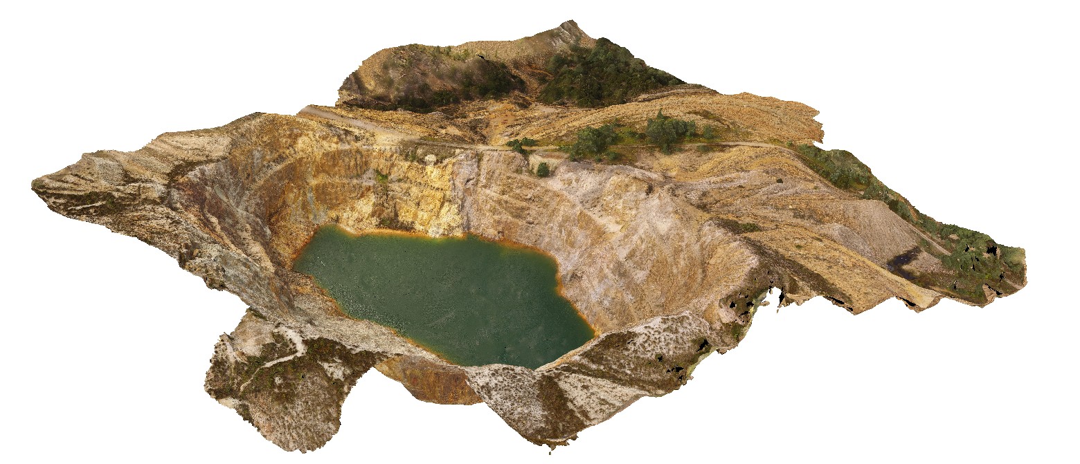
aerial view of the Iron Blow open pit at My Lyell with view of the Lyell Schist and Owen Group. Gormanston, West Tasmania. |
0.00 |
-42.06835300000 |
145.59241300000 |
-9999.000 |
fault, contact, structure, Mount Lyell, Lyell Schist, Owen Group, conglomerate, Iron Blow Copper Mine |
schist, conglomerate |
WTasUAV2 Map
 |
20 |
01/01/9999 midnight |
UAV |
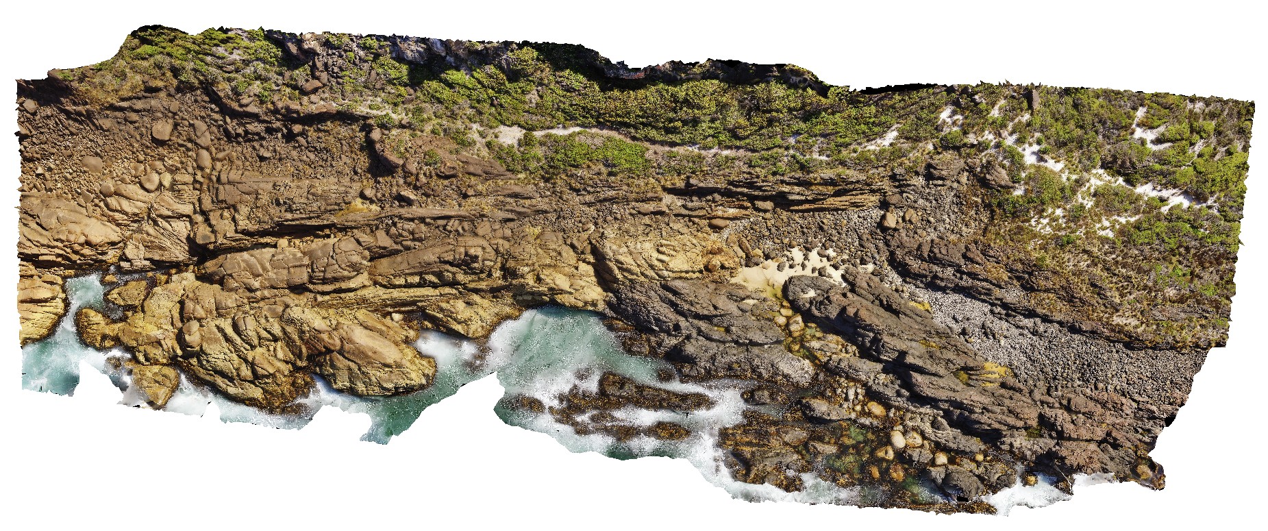
aerial view of Heemskirk Granite in contact with ultramafic suite at north end of Trial Harbour. Trial Harbour, West Tas. |
50.00 |
-41.92522000000 |
145.16256400000 |
-9999.000 |
igneous contact, contact, Heemskirk Granite |
granite, ultramafic |
WTasUAV3 Map
 |
20 |
01/01/9999 midnight |
UAV |
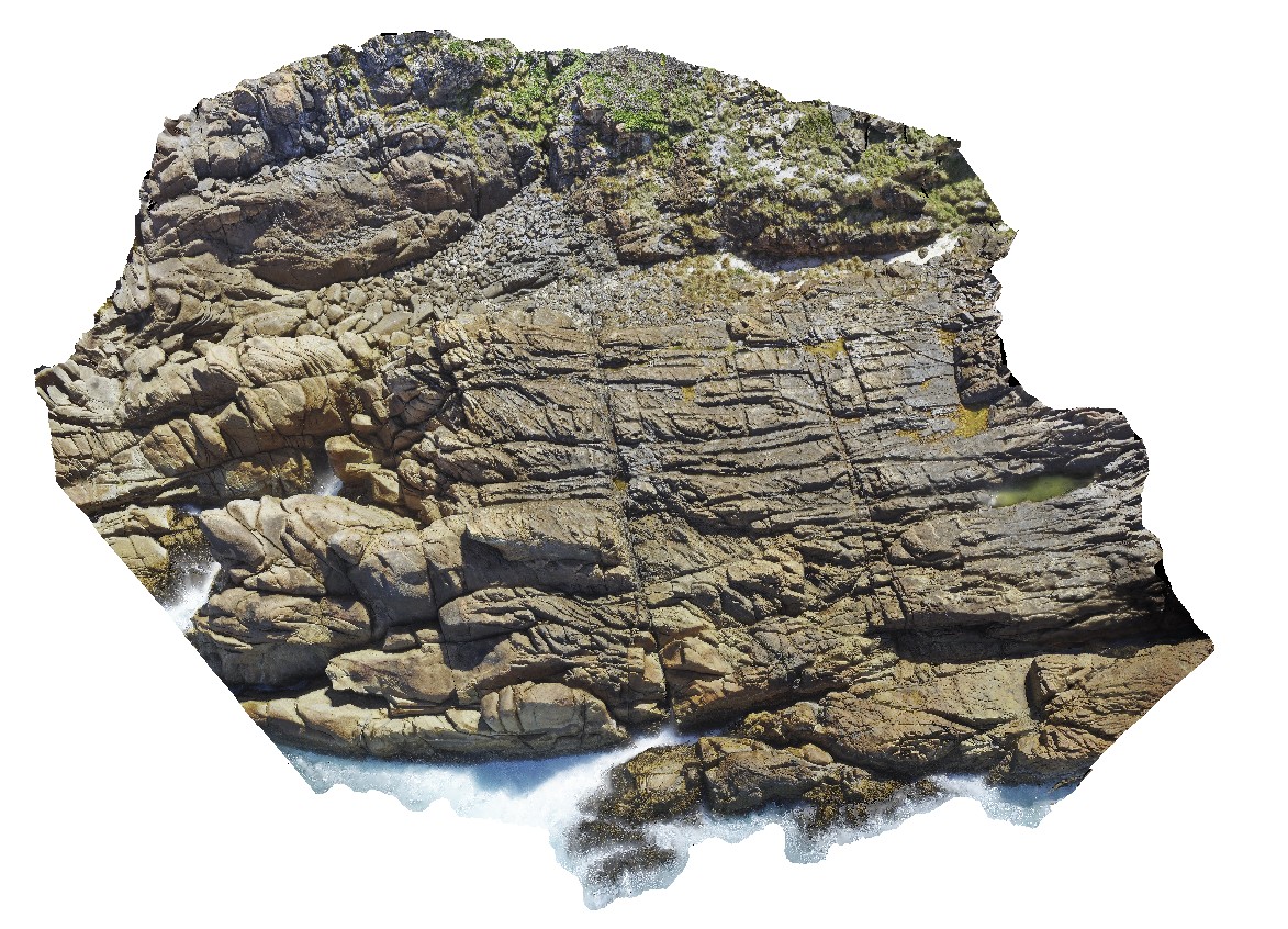
aerial view of jointed granite, with magmatic - hydrothermal alteration and veining. Trial Harbour, West Tasmania. |
100.00 |
-41.92280300000 |
145.15734300000 |
-9999.000 |
granite, tourmaline orbicules, intrusive contact |
granite |
WTasUAV5 Map
 |
5 |
01/01/9999 midnight |
UAV |
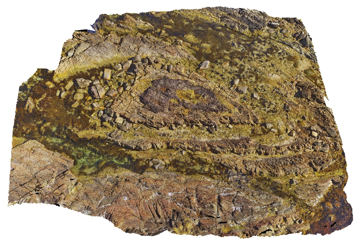
aerial view of folds in sandstone and siltstone Silurian aged rocks with detail of small basin. Duck Creek, west coast, Tasmania. |
20.00 |
-41.76892000000 |
145.00370700000 |
-9999.000 |
fold, basin, structure, multiple folds |
sandstone |
WTasUAV4 Map
 |
5 |
01/01/9999 midnight |
UAV |
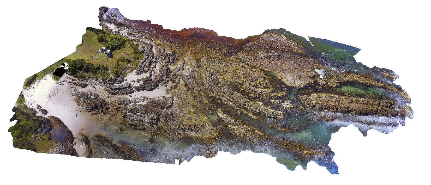
aerial view of folds in sandstone and siltstone Silurian aged rocks. Duck Creek, west coast, Tasmania. |
100.00 |
-41.76811000000 |
145.00443100000 |
-9999.000 |
fold, structure |
sandstone |
WTasUAV6 Map
 |
5 |
01/01/9999 midnight |
UAV |
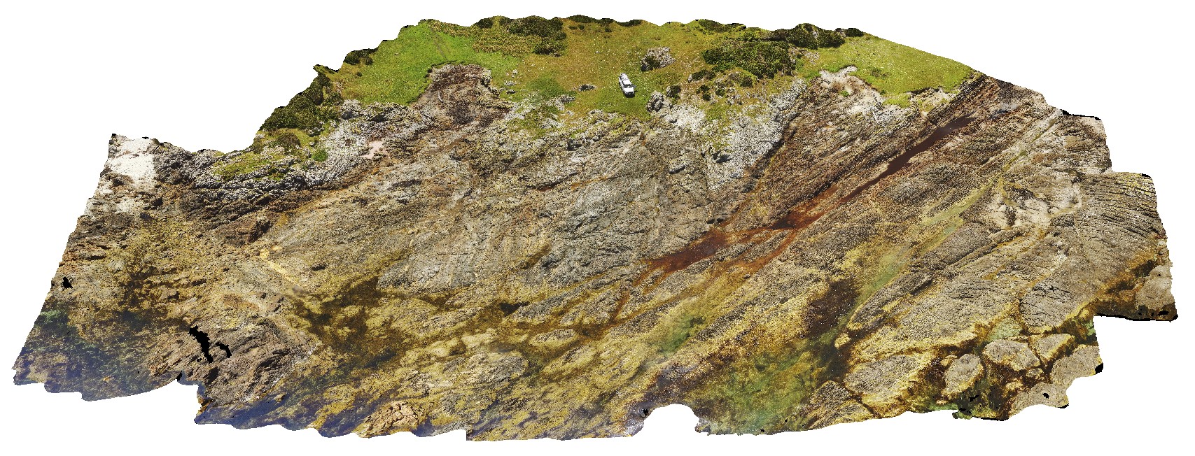
faulted contact between the Eldon Group and Oonah Formation, with strong cleavage associated with fault zone cutting bedding. North of Duck Creek, west coast, Tasmania. |
50.00 |
-41.76542300000 |
145.00094900000 |
-9999.000 |
fault, faulted contact, structure, Oonah Formation, Eldon Group, foliation, cleavage |
sandstone, sandstone |
NTasUAV1 Map
 |
20 |
01/01/9999 midnight |
UAV |
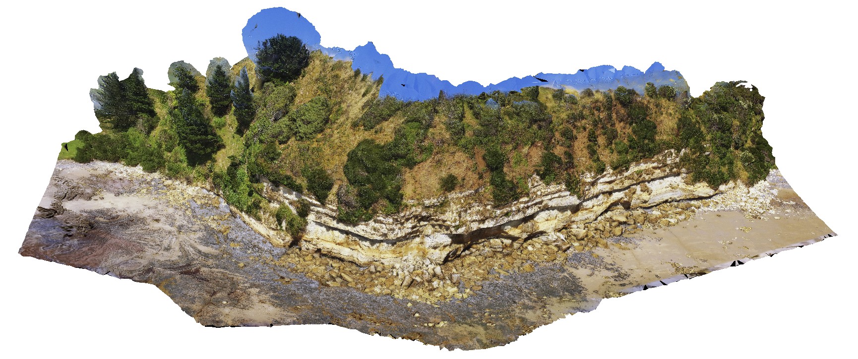
flat-lying sandstone beds of the Fossil Bluff Sandstone. Fossil Bluff Conservation Area, Wynyard. North Tasmania. |
200.00 |
-40.98145800000 |
145.73336400000 |
-9999.000 |
sandstone, bedding |
sandstone |
NTasUAVFSP1 Map
 |
20 |
01/01/9999 midnight |
UAV |
flat-lying sandstone beds of the Fossil Bluff Sandstone. Fossil Bluff Conservation Area, Wynyard. North Tasmania. |
0.00 |
-40.98145800000 |
145.73336400000 |
-9999.000 |
sandstone, Fossil Bluff |
sandstone |
NTasUAV2 Map
 |
20 |
01/01/9999 midnight |
UAV |
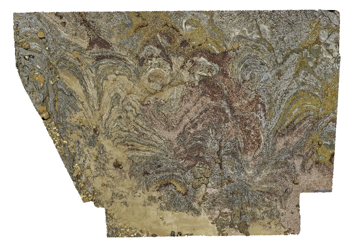
Permian wave-cut platform east of Fossil Cliff, showing bedforms in Permian Layers. Fossil Bluff Conservation Area, Wynyard. North Tasmania. |
100.00 |
-40.98142000000 |
145.73314000000 |
-9999.000 |
wave-cut platform, Permian bedding |
sandstone |
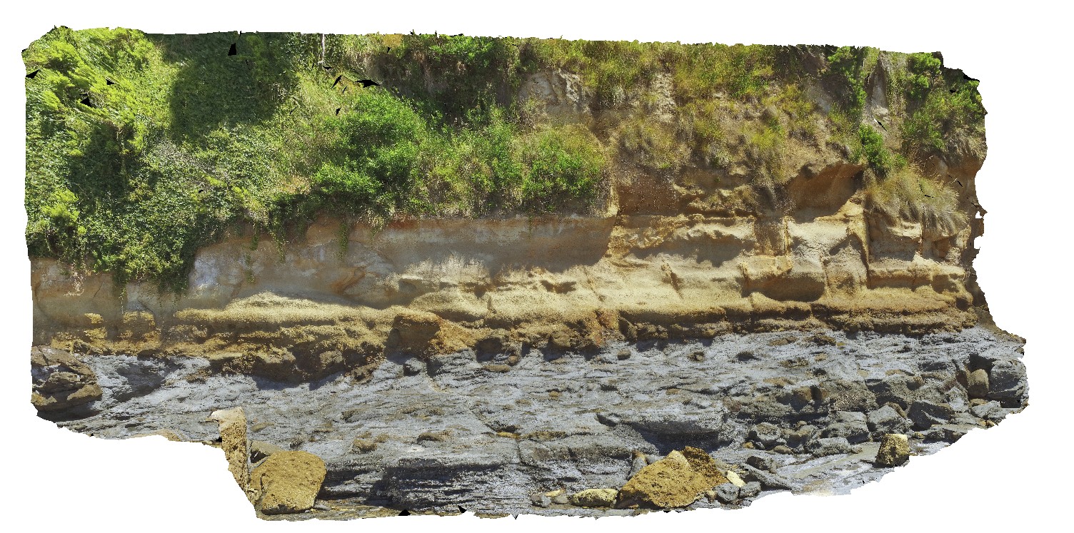
NTasUAV3 Map
 |
20 |
01/01/9999 midnight |
UAV |
aerial view of the unconformity at the base of Fossil Bluff, between the Permian and Tertiary units. Fossil Bluff Conservation Area, Wynyard. North Tasmania. |
50.00 |
-40.98138400000 |
145.73309700000 |
-9999.000 |
unconformity, geological contact, Fossil bluff |
sandstone, tillite |
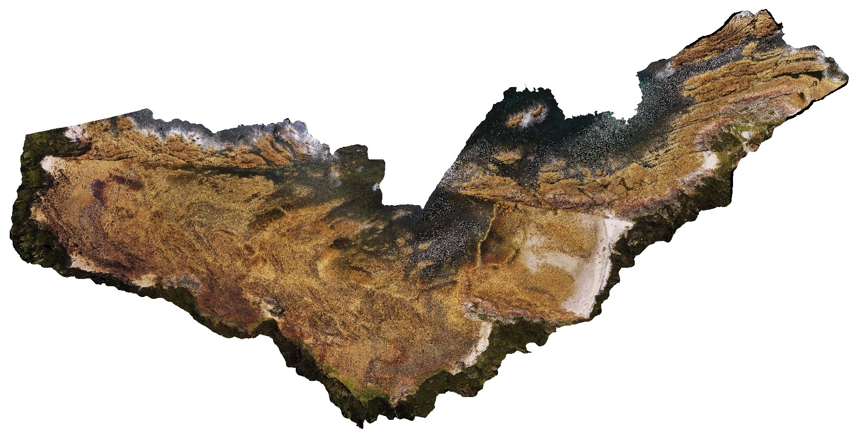
NTasUAV5 Map
 |
20 |
01/01/9999 midnight |
UAV |
aerial view of Boat Harbour foreshore, showing macro-scale folding in moderately dipping rocks. Boat Harbour, north Tasmania. |
200.00 |
-40.92560000000 |
145.61093300000 |
-9999.000 |
fold, metamorphic rock |
quartzite |
NTasUAVFSP2 Map
 |
20 |
01/01/9999 midnight |
UAV |
aerial view of Boat Harbour foreshore, showing macro-scale folding in moderately dipping rocks. Boat Harbour, north Tasmania. |
0.00 |
-40.92531200000 |
145.61275600000 |
-9999.000 |
fold, structure, bedding |
quartzite |


