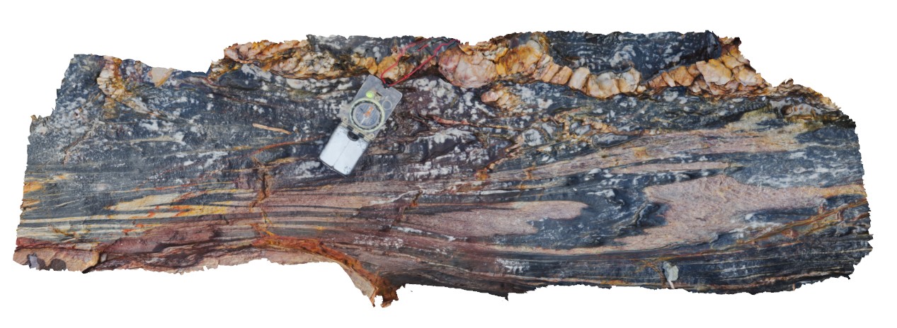
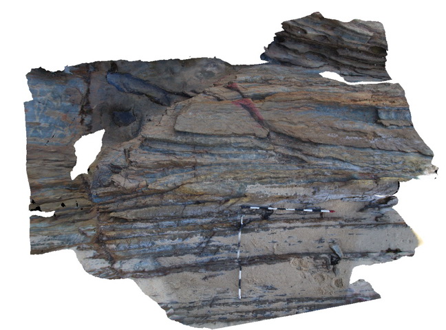
PointAnn4 Map
 |
0 |
06/05/2016 10:46 a.m. |
3D |
early isoclinal folds and later F2 folds with fold interference patterns. Point Ann, W.A. |
1.30 |
-34.17004000000 |
119.58205000000 |
-9999.000 |
isoclinal folds, F2 folds, fold interference pattern |
pelite |
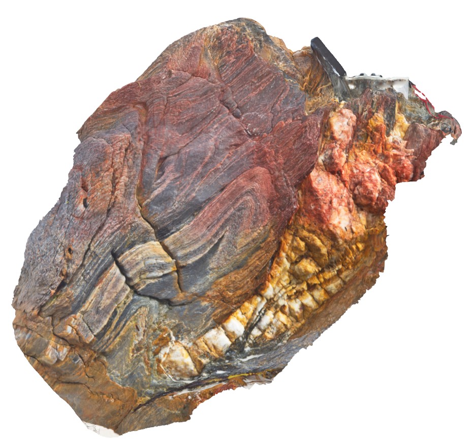
PointAnn5 Map
 |
0 |
06/05/2016 10:46 a.m. |
3D |
fold interference pattern, with 'hook' shape in meta sediments, Point Ann. |
0.60 |
-34.17026000000 |
119.58154000000 |
-9999.000 |
fold interference pattern. |
psammite |
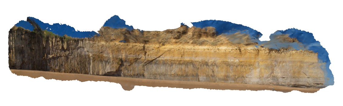
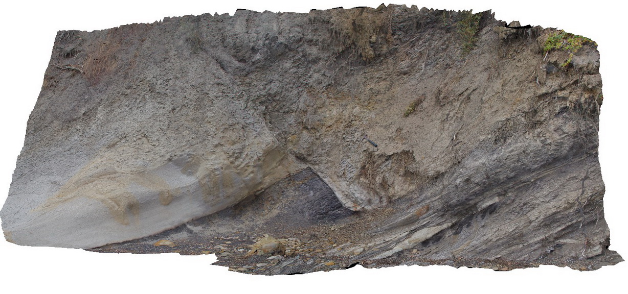
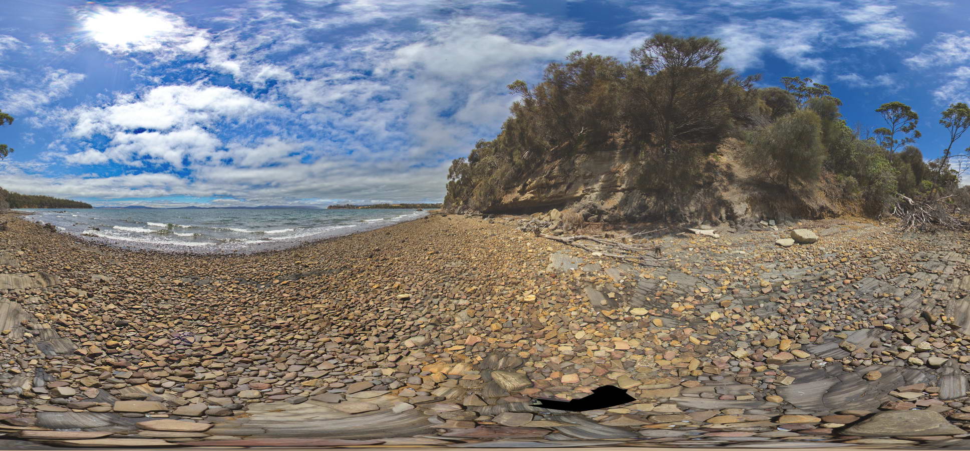
Portcampbell1 Map
 |
0 |
01/01/9999 midnight |
3D |
view along south coast of Victoria, showing bedded sediments. Near Port Campbell, Vic. |
1000.00 |
-38.64002770000 |
143.04897780000 |
-9999.000 |
|
|
PortcampbellFSP1 Map
 |
0 |
01/01/9999 midnight |
FSP |
view along south coast of Victoria, showing bedded sediments. Near Port Campbell, Vic. |
1000.00 |
-38.64003000000 |
143.04898000000 |
-9999.000 |
|
|
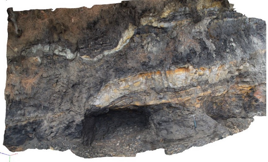
PotatoPt1 Map
 |
5 |
05/18/2015 1:29 p.m. |
3D |
small antiform and open synform in Ordovician turbidites. Potato Point, N.S.W |
5.00 |
-36.09296000000 |
150.13853000000 |
0.000 |
folds, synform, antiform, structure |
turbidite |
PotatoPt2 Map
 |
5 |
05/18/2015 1:29 p.m. |
3D |
gently plunging antiform/synform in Ordovician turbidites. Potato Point, N.S.W |
6.00 |
-36.09311000000 |
150.13795000000 |
0.000 |
folds, anticline, syncline, structure |
turbidite |
PotatoPt3 Map
 |
5 |
05/18/2015 1:31 p.m. |
3D |
detail of cross laminations in the top of a fine sandy turbidite layer. Potato Point, N.S.W |
0.40 |
-36.09311000000 |
150.13788000000 |
0.000 |
cross bedding, sedimentology |
turbidite |
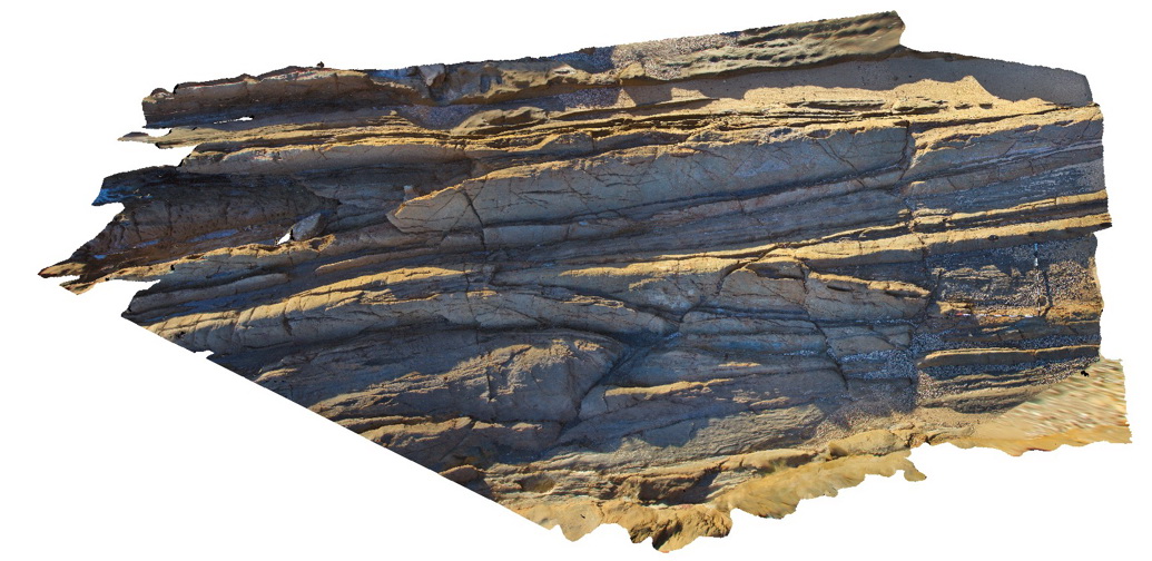
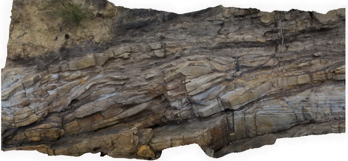
PotatoPt4 Map
 |
5 |
05/18/2015 1:31 p.m. |
3D |
gently plunging inclined folds exposed in cross section and plan view. Potato Point, N.S.W |
10.00 |
-36.08313000000 |
150.13397000000 |
0.000 |
folds, structure |
turbidite |
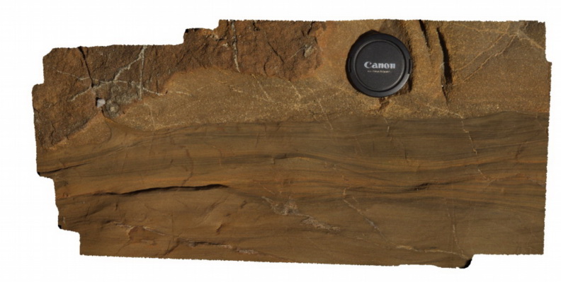
Powers1 Map
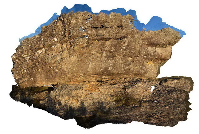 |
5 |
06/17/2015 10:38 a.m. |
3D |
conglomerate of the Devonian-Carboniferous Snowy Plains Formation. Powers Lookout, VIC. |
5.00 |
-36.84499000000 |
146.37143000000 |
750.000 |
sedimentology |
conglomerate |
PowersFSP1 Map
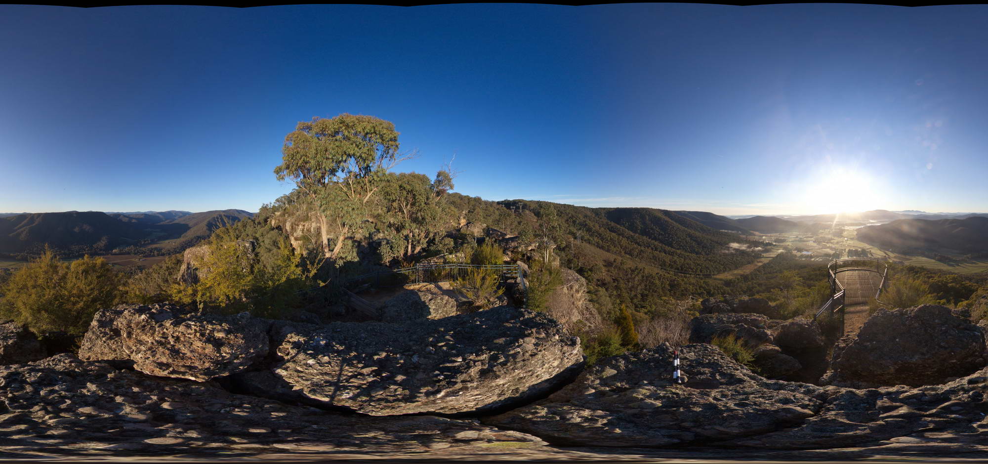 |
5 |
06/17/2015 10:39 a.m. |
FSP |
View of conglomerate of the Devonian-Carboniferous Snowy Plains Formation at Powers lookout, Vic. |
50.00 |
-36.84502000000 |
146.37177000000 |
750.000 |
sedimentology |
conglomerate |
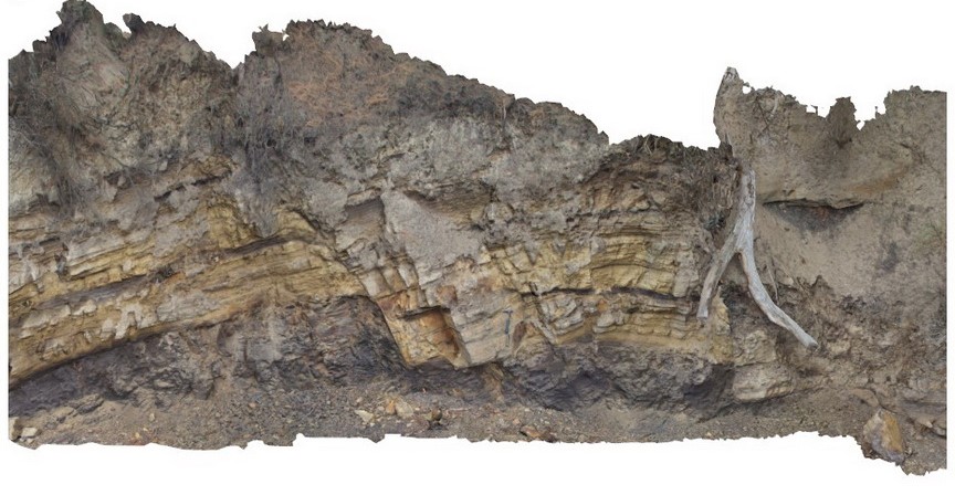
Prices1 Map
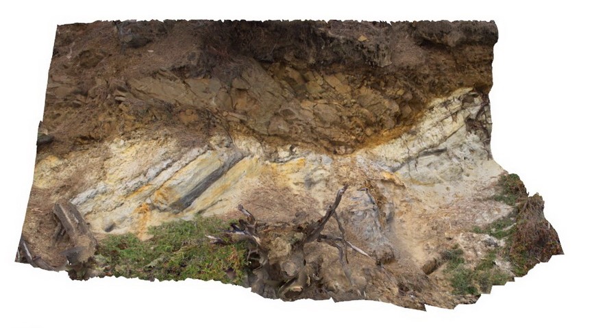 |
20 |
03/13/2015 9:12 a.m. |
3D |
low angle thrust fault? Contact between Triassic fluvial sediments and overlying Jurassic dolerite. Prices Point, Tasman Peninsula, Tasmania. |
10.00 |
-43.03506500000 |
147.74806700000 |
0.500 |
thrust fault, fluvial sediments, structure |
dolerite, sandstone |
Prices10 Map
 |
20 |
03/13/2015 9:12 a.m. |
3D |
Fault contact in the shore platform between steeply dipping carbonaceous siltstone and horizontal siltstone - thrust fault? Prices Point, Tasman Peninsula, Tasmania. |
10.00 |
-43.03404100000 |
147.74658500000 |
0.500 |
fault, structure |
siltstone |
Prices2 Map
 |
20 |
03/13/2015 9:12 a.m. |
3D |
normal fault offsetting a contact between Triassic sandstone and siltstone. Prices Point, Tasman Peninsula, Tasmania. |
10.00 |
-43.03500200000 |
147.74783500000 |
0.500 |
normal fault, sandstone, siltstone, structure, sedimentology |
sandstone, siltstone |
Prices3 Map
 |
20 |
06/20/2016 3:22 p.m. |
3D |
Normal faults disrupting Triassic sandstone and carbonaceous siltstone layers. Prices Point, Tasman Peninsula, Tasmania. |
13.00 |
-43.03491300000 |
147.74760800000 |
0.500 |
fluvial sediments, normal fault, sandstone, siltstone, structure, sedimentology |
sandstone, siltstone |
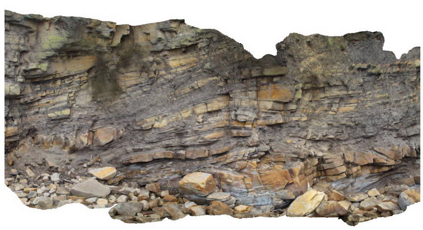
Prices4 Map
 |
20 |
03/13/2015 9:13 a.m. |
3D |
Normal faults disrupting Triassic sandstone and siltstone layers - detail view of Prices3. Prices Point, Tasman Peninsula, Tasmania. |
7.00 |
-43.03492200000 |
147.74760300000 |
0.500 |
normal fault, sandstone, siltstone, fluvial sediments, structure, sedimentology |
sandstone, siltstone |
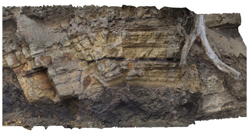
Prices5 Map
 |
20 |
03/13/2015 9:13 a.m. |
3D |
Cross bedded 'prograding' Triassic sandstone unit with clear erosional truncation. Prices Point, Tasman Peninsula, Tasmania. |
8.00 |
-43.03478900000 |
147.74734900000 |
0.500 |
cross bedding, sandstone, fluvial, sedimentology |
sandstone |
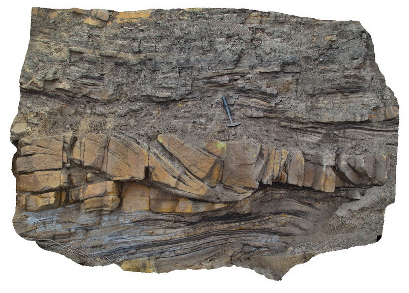
Prices6 Map
 |
20 |
03/13/2015 9:13 a.m. |
3D |
Thrust? Fault cross cutting Triassic carbonaceous siltstone and sandstone. Prices Point, Tasman Peninsula, Tasmania. |
10.00 |
-43.03390900000 |
147.74637700000 |
0.500 |
thrust fault, siltstone, sandstone, fluvial, structure |
siltstone, sandstone |
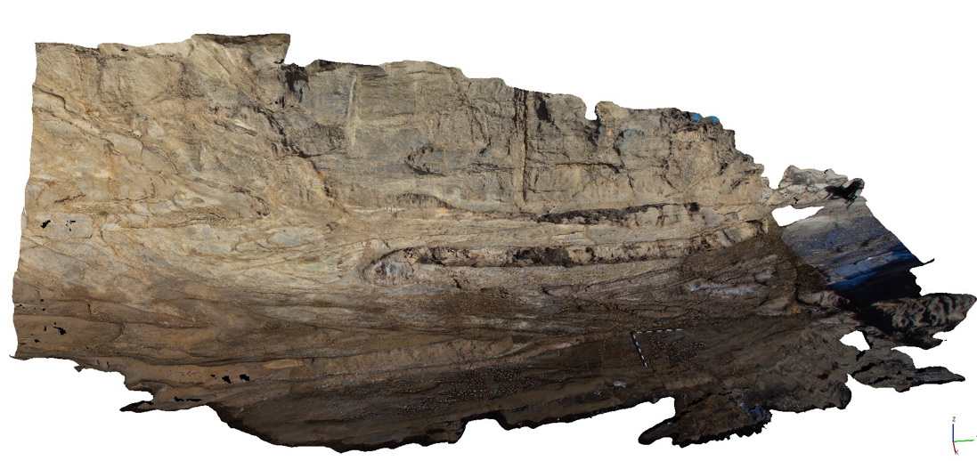
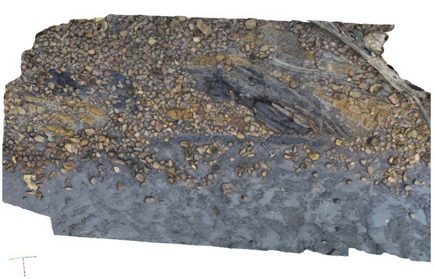
Prices7 Map
 |
20 |
03/13/2015 9:13 a.m. |
3D |
Cross beds and channels in Triassic fluvial sediments. Prices Point, Tasman Peninsula, Tasmania. |
10.00 |
-43.03379200000 |
147.74610800000 |
0.500 |
sandstone, cross beds, fluvial, channel, sedimentology |
sandstone |
Prices8 Map
 |
20 |
03/13/2015 9:13 a.m. |
3D |
Triassic fluvial/floodplain sediments. Prices Point, Tasman Peninsula, Tasmania. |
10.00 |
-43.03366100000 |
147.74592300000 |
0.500 |
fluvial, floodplain, sedimentology |
sandstone |
Prices9 Map
 |
20 |
03/13/2015 9:13 a.m. |
3D |
Cross bedded channel sandstone body in fine grained carbonaceous floodplain sediments. Prices Point, Tasman Peninsula, Tasmania. |
5.00 |
-43.03359100000 |
147.74572400000 |
0.500 |
channel, cross bed, fluvial, floodplain, sedimentology |
sandstone, siltstone |
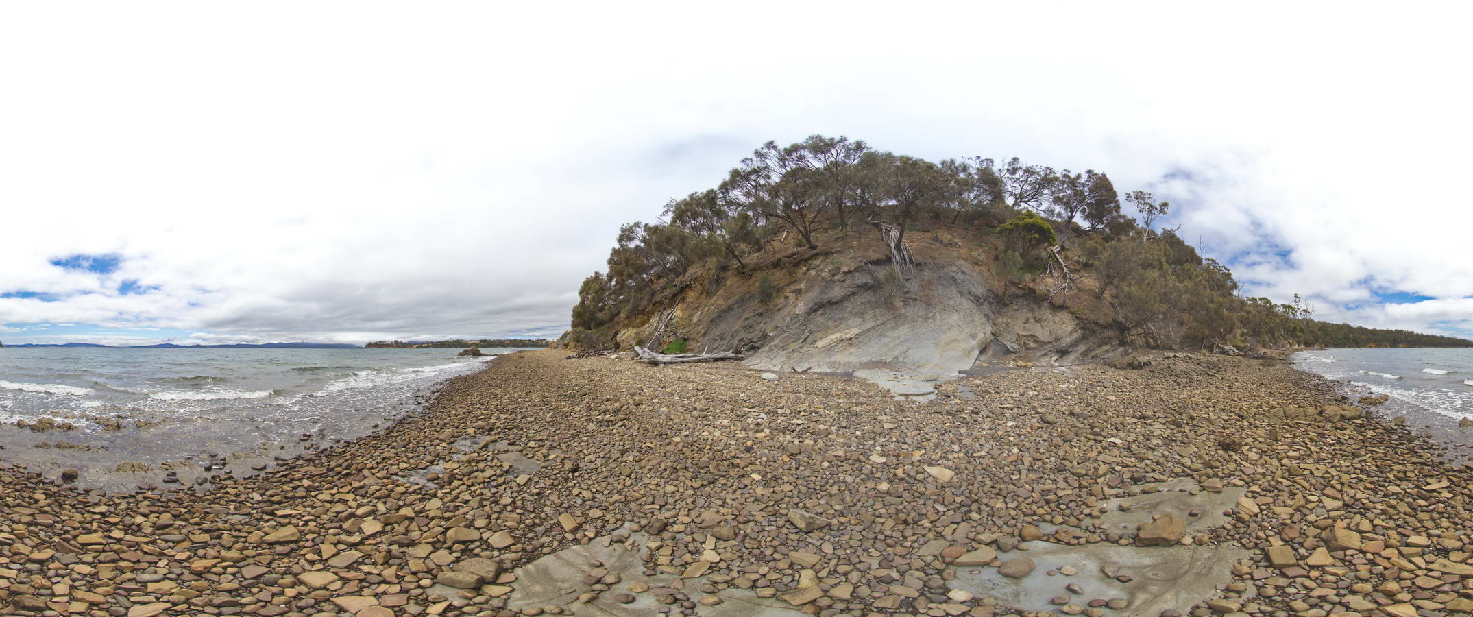
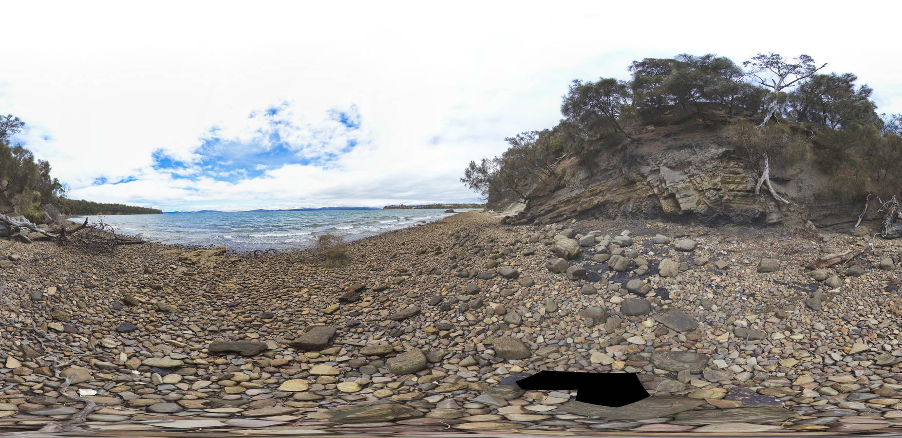
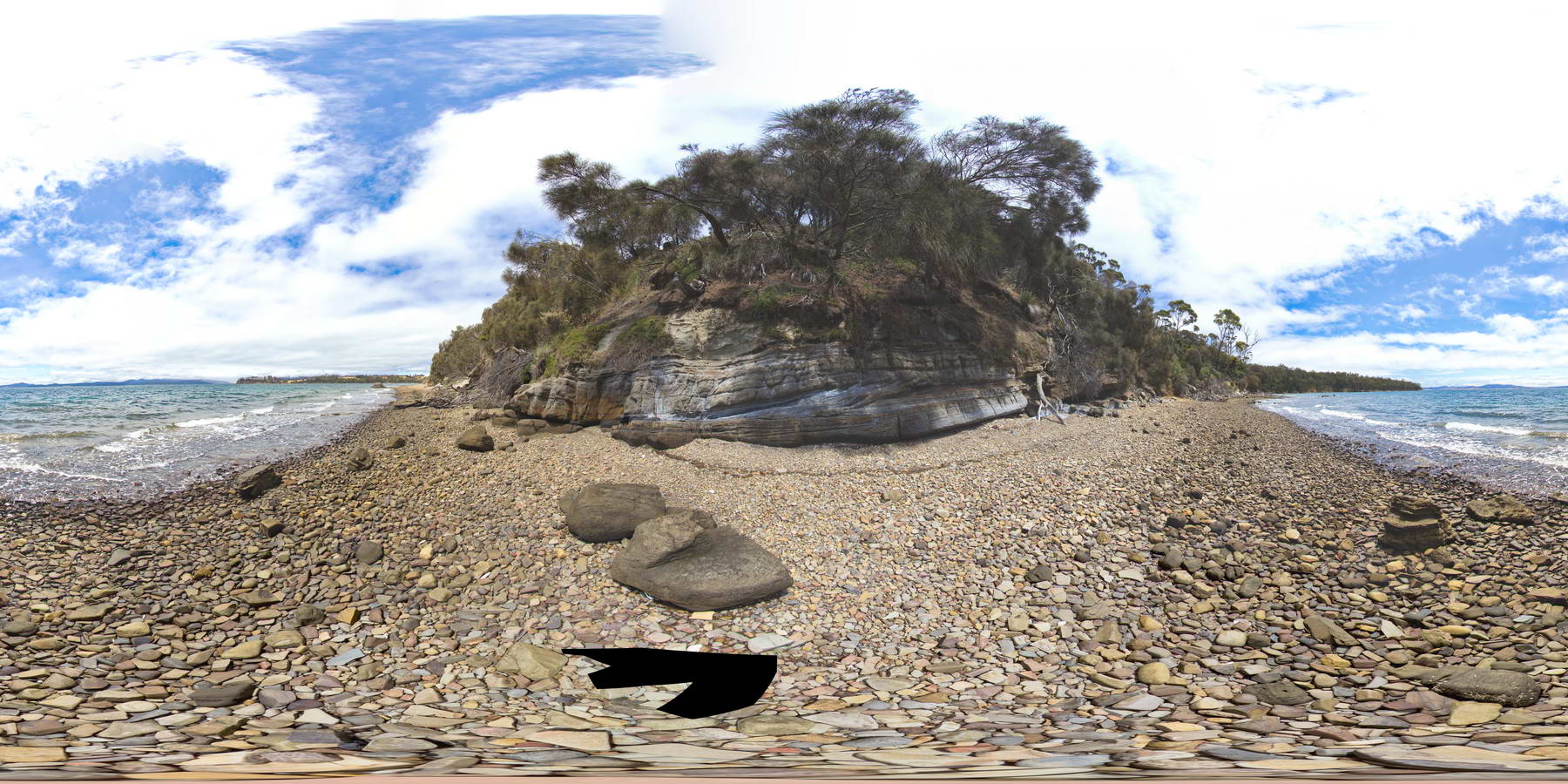
PricesFSP1 Map
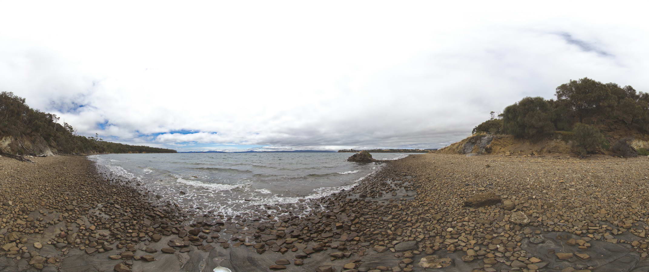 |
20 |
01/01/9999 midnight |
FSP |
view along beach, showing Triassic rocks in cliff and dolerite outcrop in water. Prices Point, Tasman Peninsula, Tasmania. |
500.00 |
-43.03506500000 |
147.74806700000 |
0.500 |
Triassic rocks in cliff, Jurassic dolerite |
siltstone, dolerite |
PricesFSP2 Map
 |
20 |
01/01/9999 midnight |
FSP |
view along beach, showing normal fault offsetting a contact between Triassic sandstone and siltstone. Prices Point, Tasman Peninsula, Tasmania. |
1000.00 |
-43.03500200000 |
147.74783500000 |
0.500 |
normal fault, geological contact, structure |
sandstone, siltstone |
PricesFSP3 Map
 |
20 |
01/01/9999 midnight |
FSP |
Normal faults disrupting Triassic sandstone and carbonaceous siltstone layers. Prices Point, Tasman Peninsula, Tasmania. |
500.00 |
-43.03491300000 |
147.74760800000 |
0.500 |
normal fault, fault, Triassic, sedimentology |
siltstone |
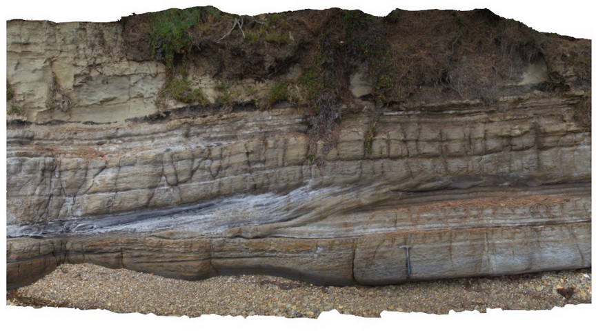
PricesFSP4 Map
 |
20 |
01/01/9999 midnight |
FSP |
view along beach of cliff with cross bedded 'prograding' Triassic sandstone unit with clear erosional truncation. Prices Point, Tasman Peninsula, Tasmania. |
500.00 |
-43.03478900000 |
147.74734900000 |
0.500 |
cross bedding, prograding, erosional truncation |
sandstone |
PricesFSP5 Map
 |
20 |
01/01/9999 midnight |
FSP |
view of contact in base of cliff between underlying carbonaceous siltstone and horizontal siltstone. Prices Point, Tasman Peninsula, Tasmania. |
250.00 |
-43.03404100000 |
147.74658500000 |
0.500 |
geological contact, sedimentology |
siltstone |