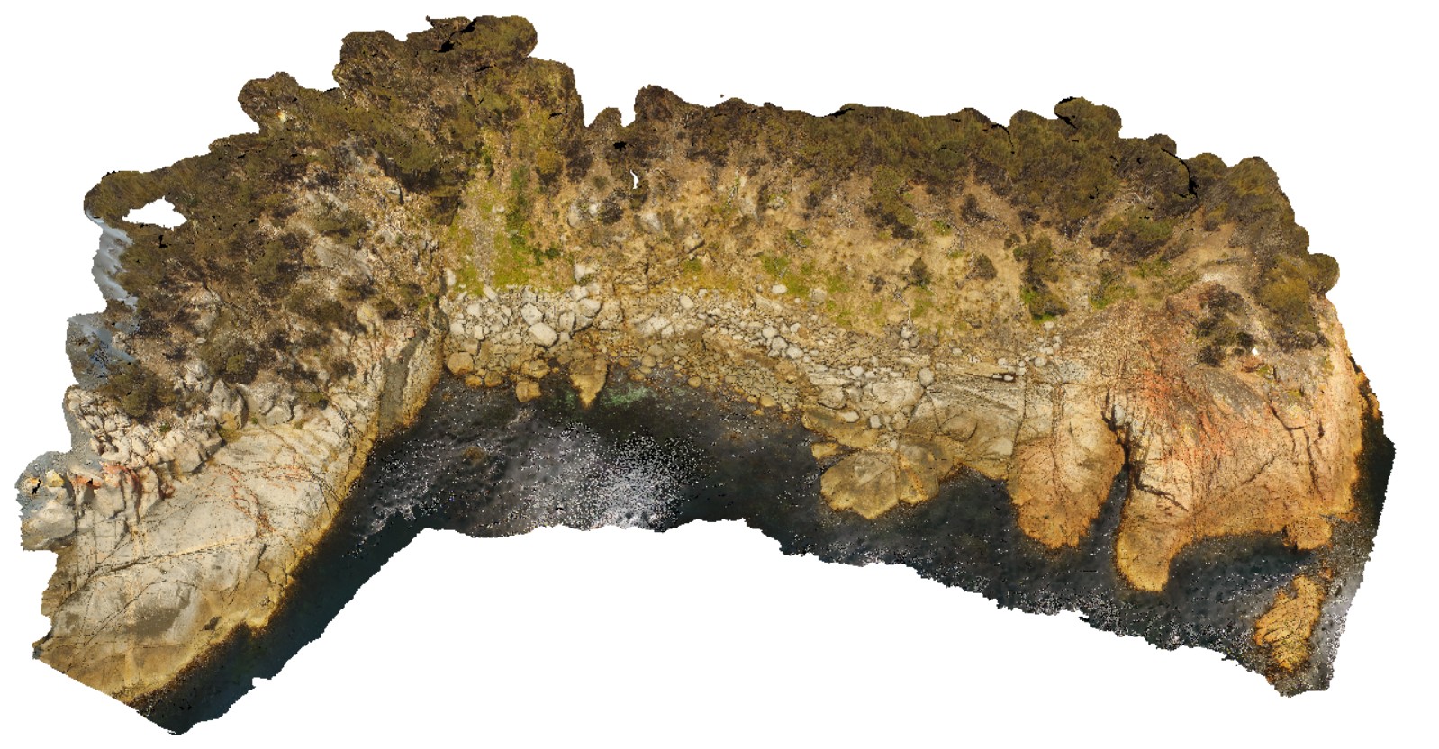
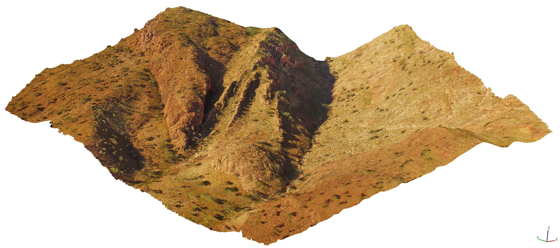
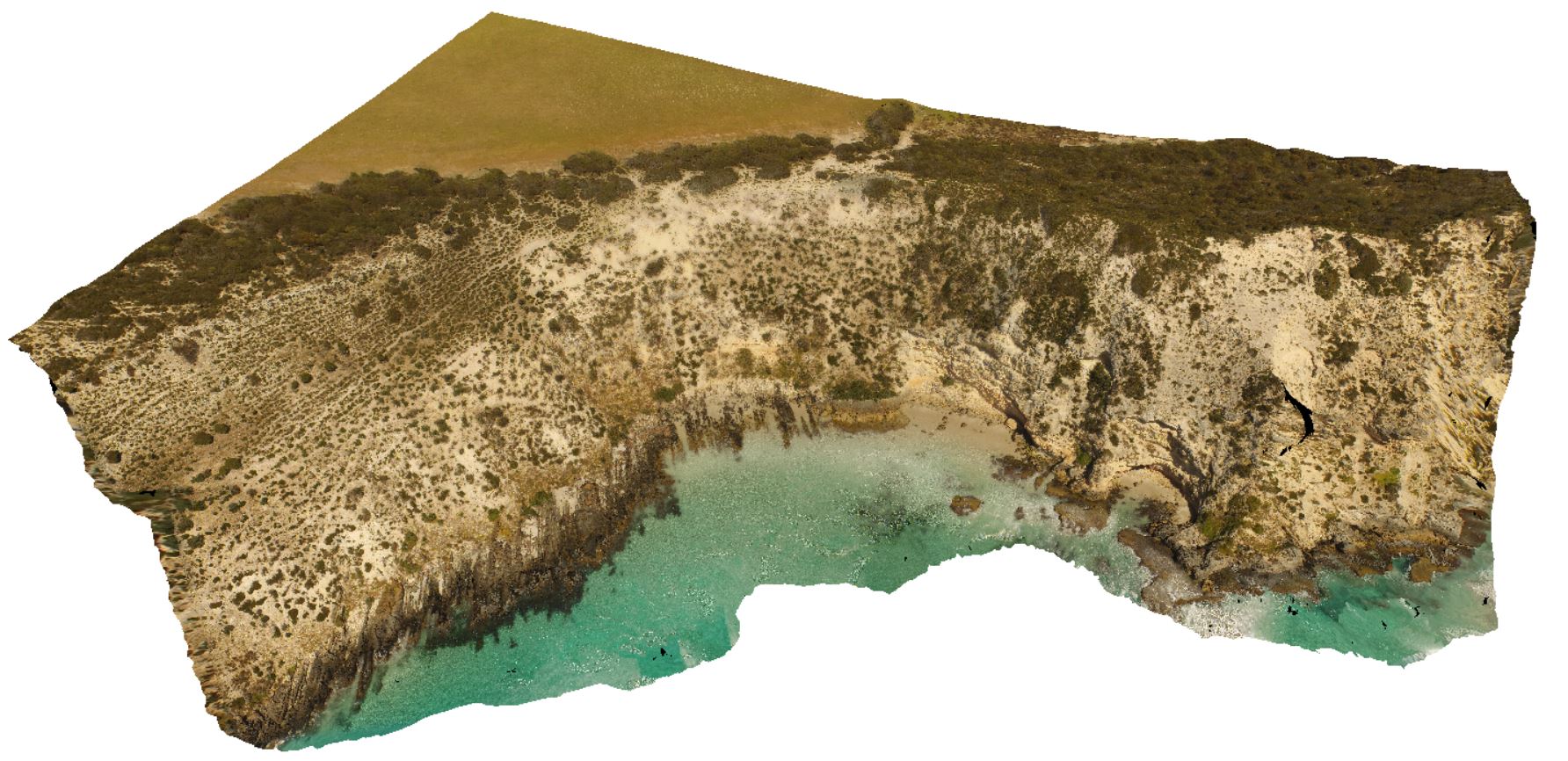
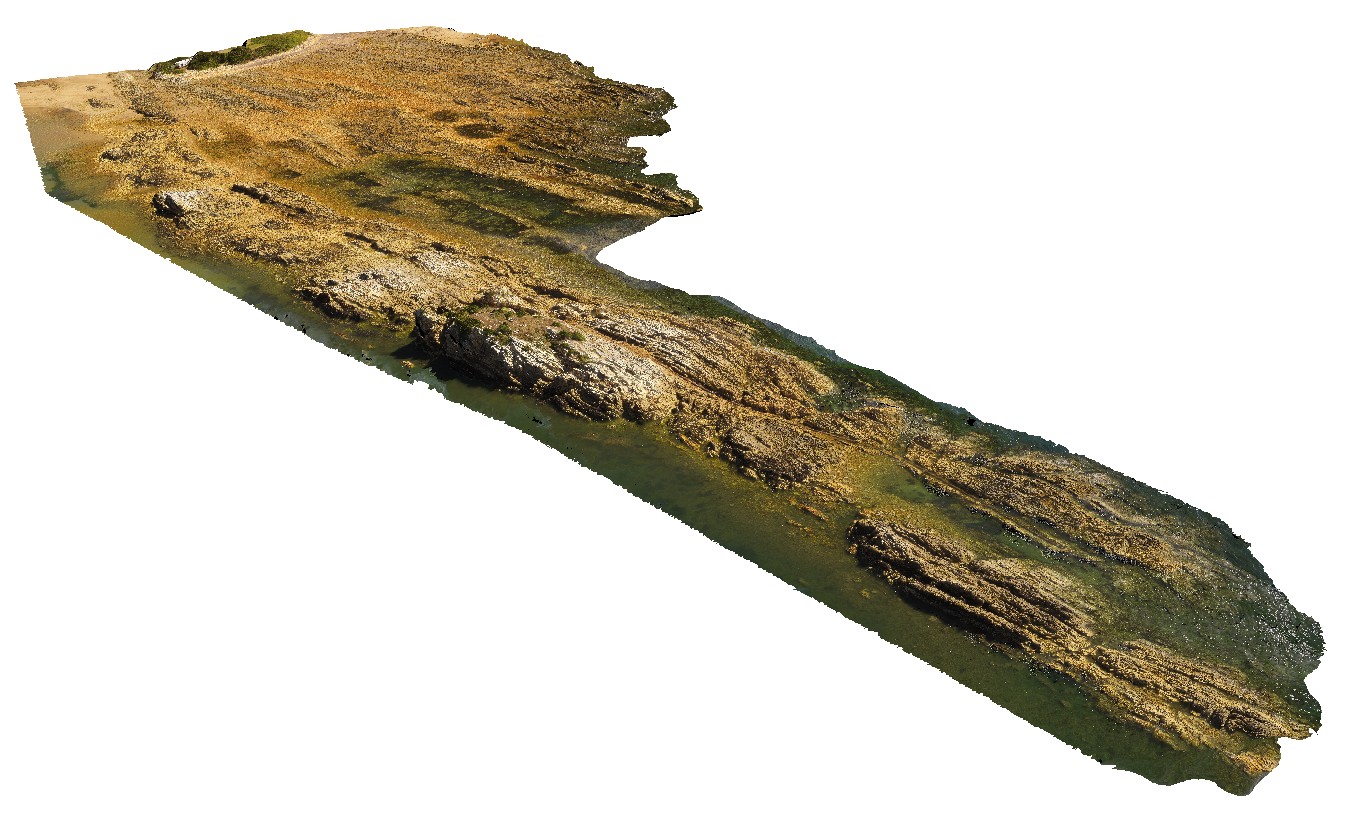
BluestoneUAV4 Map
 |
20 |
01/01/9999 midnight |
UAV |
aerial view of shoreline granodiorite with cross cutting mafic dykes at Bluestone Bay, Freycinet. Tasmania. |
200.00 |
-42.10347300000 |
148.33617400000 |
29.500 |
granodiorite, mafic dyke |
granodiorite |
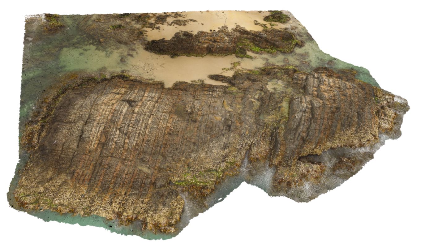
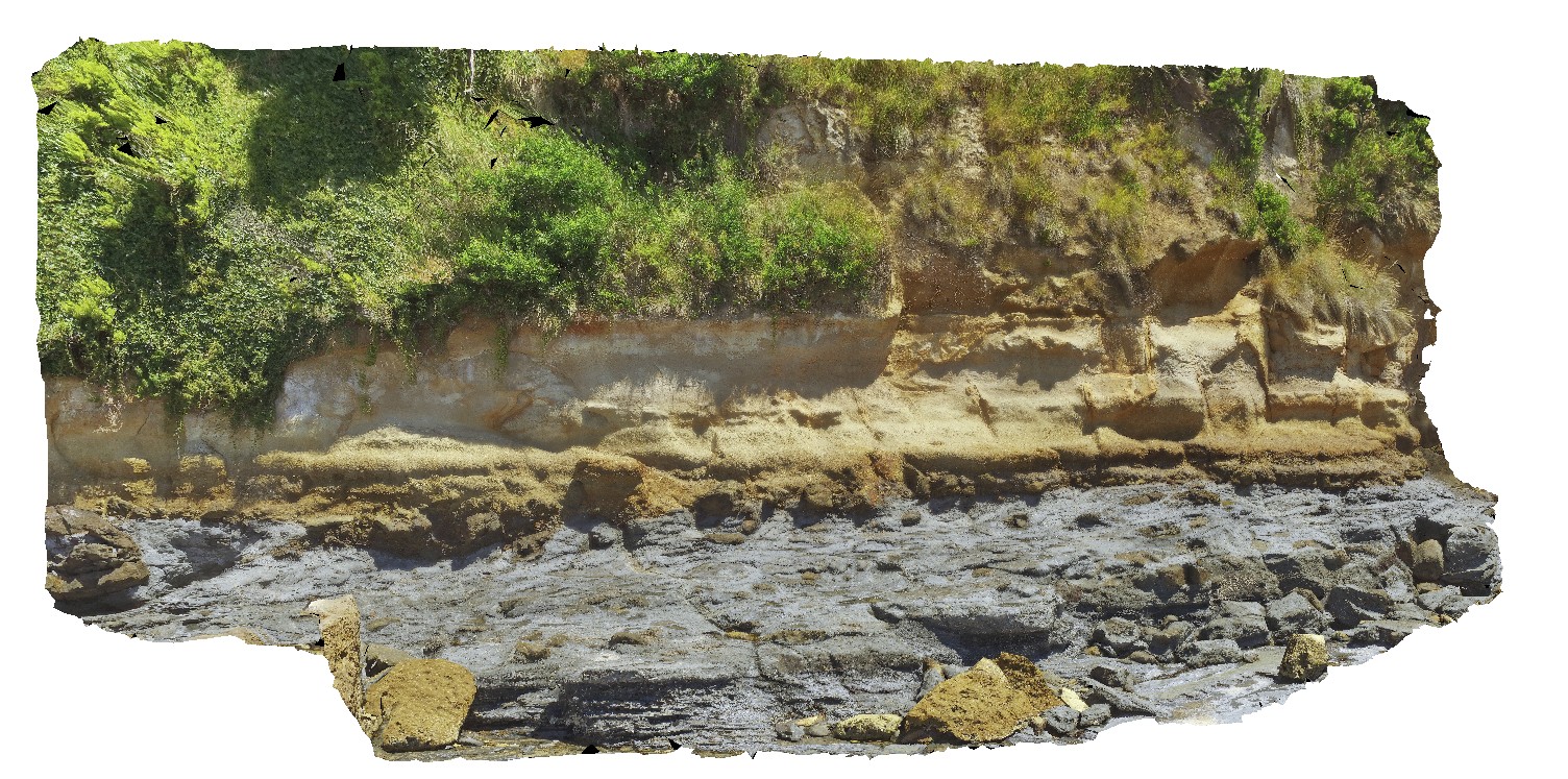
SulphurCreekUAV1 Map
 |
20 |
01/01/9999 midnight |
UAV |
aerial view of shore outcrop, showing region of folded metasediments in contact with altered basalts. Sulphur Creek, north Tas. |
232.00 |
-41.09104300000 |
146.02016600000 |
108.600 |
metasediments, basalt, fold, fault |
metasediments, basalt |
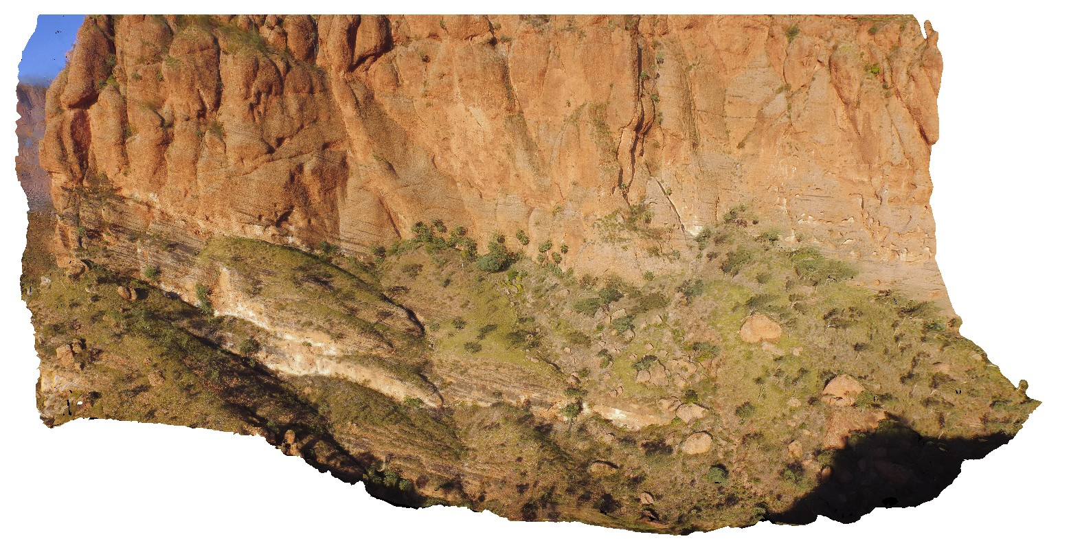
KakaduUAV2 Map
 |
20 |
01/01/9999 midnight |
UAV |
aerial view of small cliff exposure, showing gently dipping cross beds, truncated by planar bedded sandstone. Bardedjilidji Walk. Kakadu National Park. N.T. |
10.00 |
-12.43685000000 |
132.97076000000 |
-9999.000 |
cross bedding, sandstone, sedimentology |
sandstone |
KalbarriUAV1 Map
 |
0 |
05/20/2016 noon |
UAV |
aerial view of small creek and waterfall in the Tumblagooda Sandstone. Hawks Head Lookout, Kalbarri National Park. W.A. |
200.00 |
-27.79011200000 |
114.46939300000 |
-9999.000 |
Tumblagooda Sandstone, waterfall |
sandstone |
DixonRangeUAV1 Map
 |
0 |
06/14/2016 noon |
UAV |
aerial view of steep faults in metasediments. Road to Dixon Range, W.A. |
50.00 |
-17.17800000000 |
128.25186000000 |
-9999.000 |
steep fault, metasediments, structure |
metasediments |
DianasBasinUAV1 Map
 |
20 |
01/01/9999 midnight |
UAV |
aerial view of steeply dipping Mathinna Supergroup turbidite package. St Helens, Tasmania. |
77.40 |
-41.36620600000 |
148.30181600000 |
100.000 |
turbidite, steep dip, dip |
turbidite |
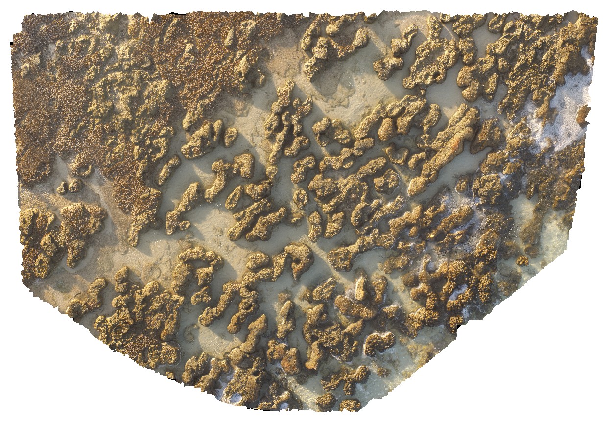
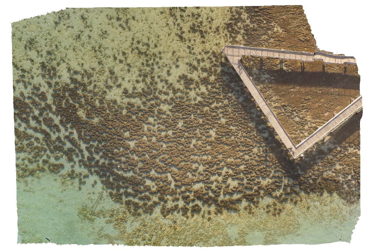
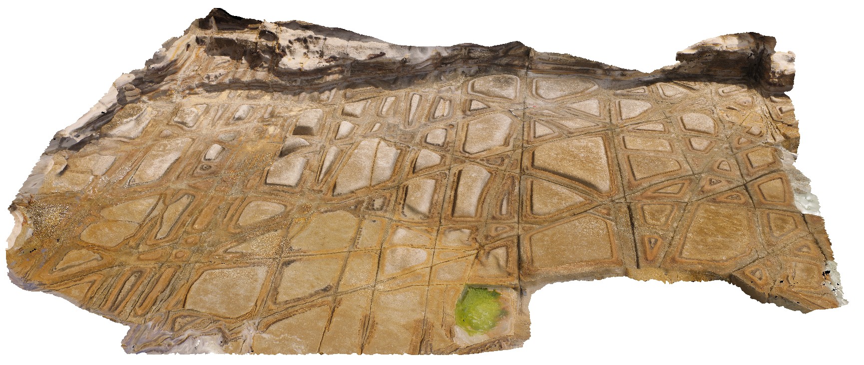
HamelinUAV3 Map
 |
0 |
05/23/2016 noon |
UAV |
aerial view of stromatolites and fine interstitial sediments. Hamelin Pool. Shark Bay, W.A. |
25.00 |
-26.40072100000 |
114.15898800000 |
-9999.000 |
tidal flat deposits, stromatolite |
tidal flat deposits |
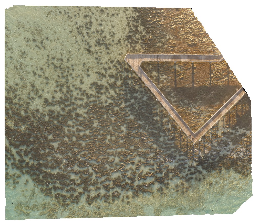
HamelinUAV2 Map
 |
0 |
05/23/2016 noon |
UAV |
aerial view of submerged stromatolite colony. Hamelin Pool. Shark Bay, W.A. |
100.00 |
-26.40027700000 |
114.15869900000 |
-9999.000 |
tidal flat deposits, stromatolite |
tidal flat deposits |
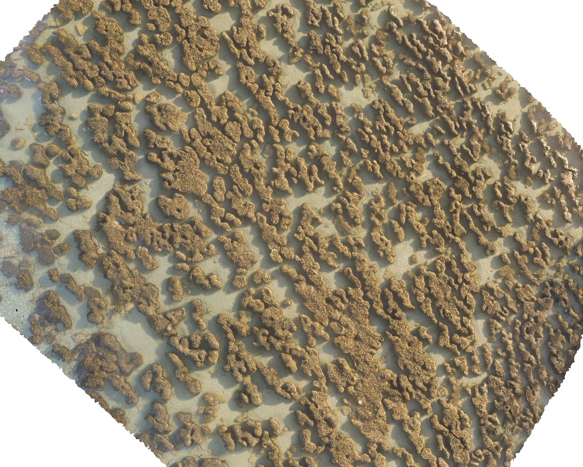
HamelinUAV1 Map
 |
0 |
05/23/2016 noon |
UAV |
aerial view of submerged stromatolite colony. Hamelin Pool. Shark Bay, W.A. |
50.00 |
-26.40043900000 |
114.15878700000 |
-9999.000 |
tidal flat deposits, stromatolite |
tidal flat deposits |
HamelinUAV5 Map
 |
0 |
05/23/2016 noon |
UAV |
aerial view of submerged stromatolites. Hamelin Pool. Shark Bay, W.A. |
50.00 |
-26.40031000000 |
114.15875100000 |
-9999.000 |
tidal flat deposits, stromatolite |
tidal flat deposits |
HamelinUAV6 Map
 |
0 |
05/23/2016 noon |
UAV |
aerial view of submerged stromatolites. Hamelin Pool. Shark Bay, W.A. |
100.00 |
-26.40043000000 |
114.15891500000 |
-9999.000 |
tidal flat deposits, stromatolite |
tidal flat deposits |
RHeadUAV4 Map
 |
20 |
01/01/9999 midnight |
UAV |
aerial view of tessellated pavement weathering pattern in Nobbys Tuff. Redhead, N.S.W. |
11.60 |
-33.00636200000 |
151.72970400000 |
4.000 |
weathering, tessellated pavement, jointing, Nobbys Tuff, Tuff |
tuff |
PtEllenUAV2 Map
 |
0 |
10/20/2015 3:47 p.m. |
UAV |
aerial view of the angular unconformity between the underlying Kanmantoo metasediments and the overlying Pleistocene sands. Point Ellen, Kangaroo Island. |
1000.00 |
-35.86015600000 |
137.73456900000 |
-9999.000 |
angular unconformity, metasediments, sandstone |
sediments, sandstone |
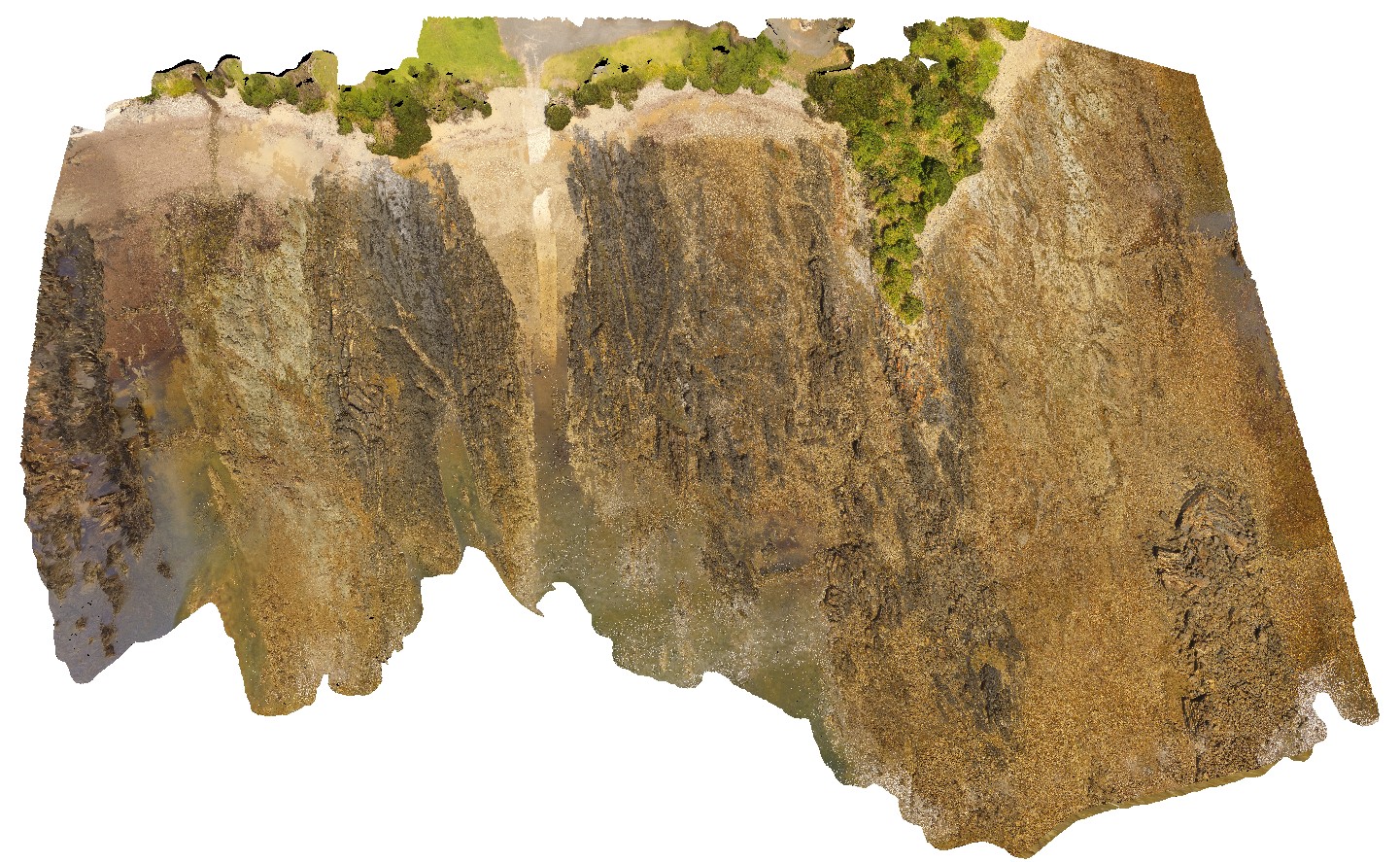
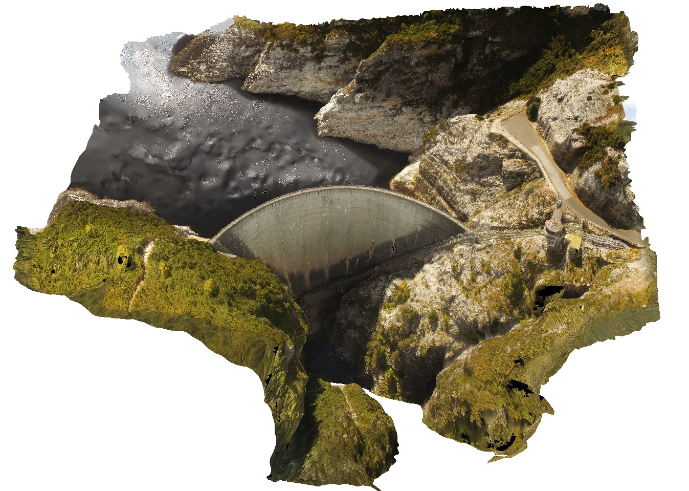
GordonDamUAV2 Map
 |
20 |
02/23/2016 9:14 a.m. |
UAV |
Aerial view of the Gordon Dam, showing folded quartzite and phyllite metasediments outcrop. Gordon Dam. Tasmania. |
200.00 |
-42.73044300000 |
145.97555560000 |
-9999.000 |
dam, quartzite, phyllite, structure |
quartzite |
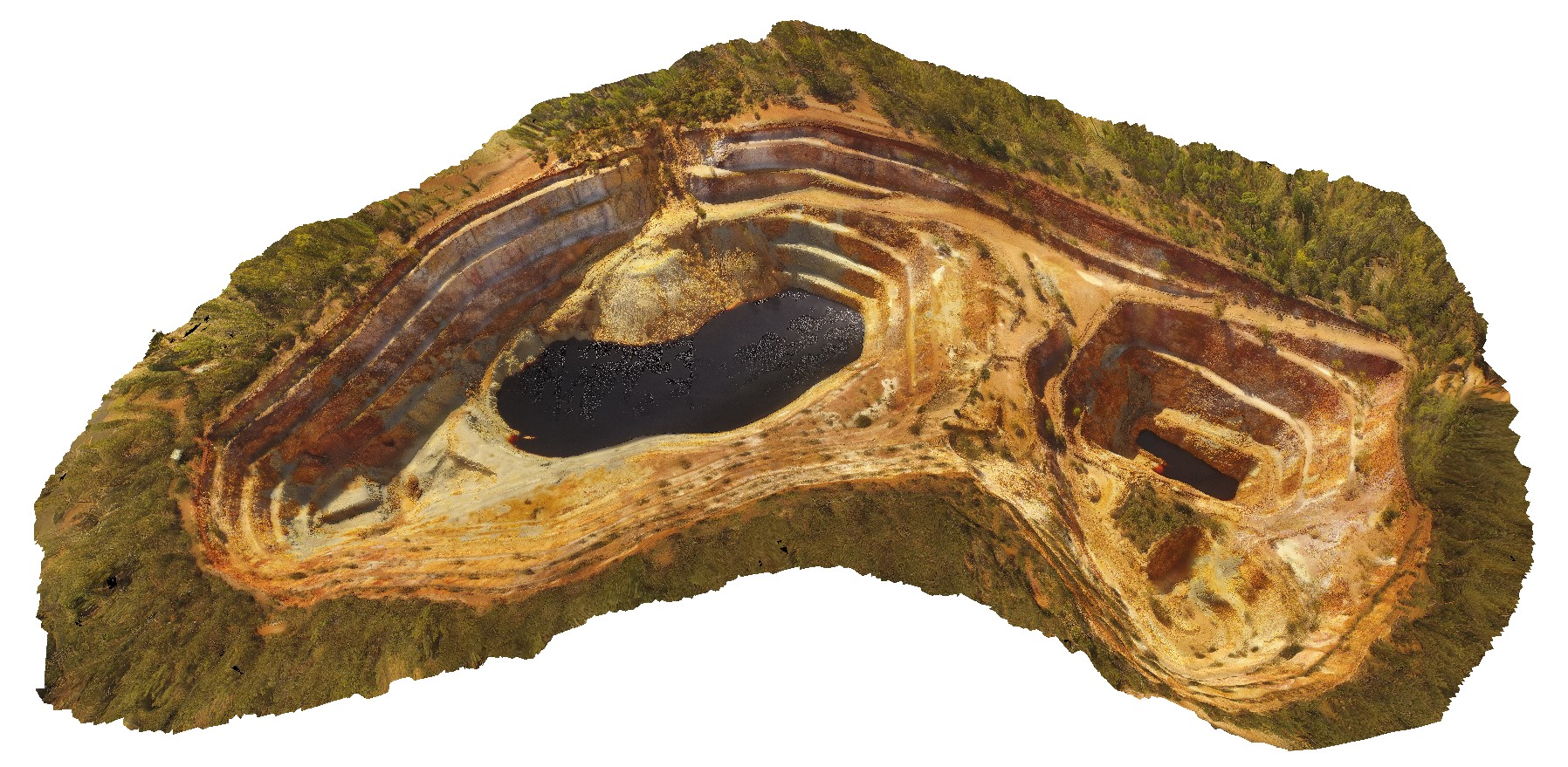
WTasUAV1 Map
 |
20 |
01/01/9999 midnight |
UAV |
aerial view of the Iron Blow open pit at My Lyell with view of the Lyell Schist and Owen Group. Gormanston, West Tasmania. |
0.00 |
-42.06835300000 |
145.59241300000 |
-9999.000 |
fault, contact, structure, Mount Lyell, Lyell Schist, Owen Group, conglomerate, Iron Blow Copper Mine |
schist, conglomerate |
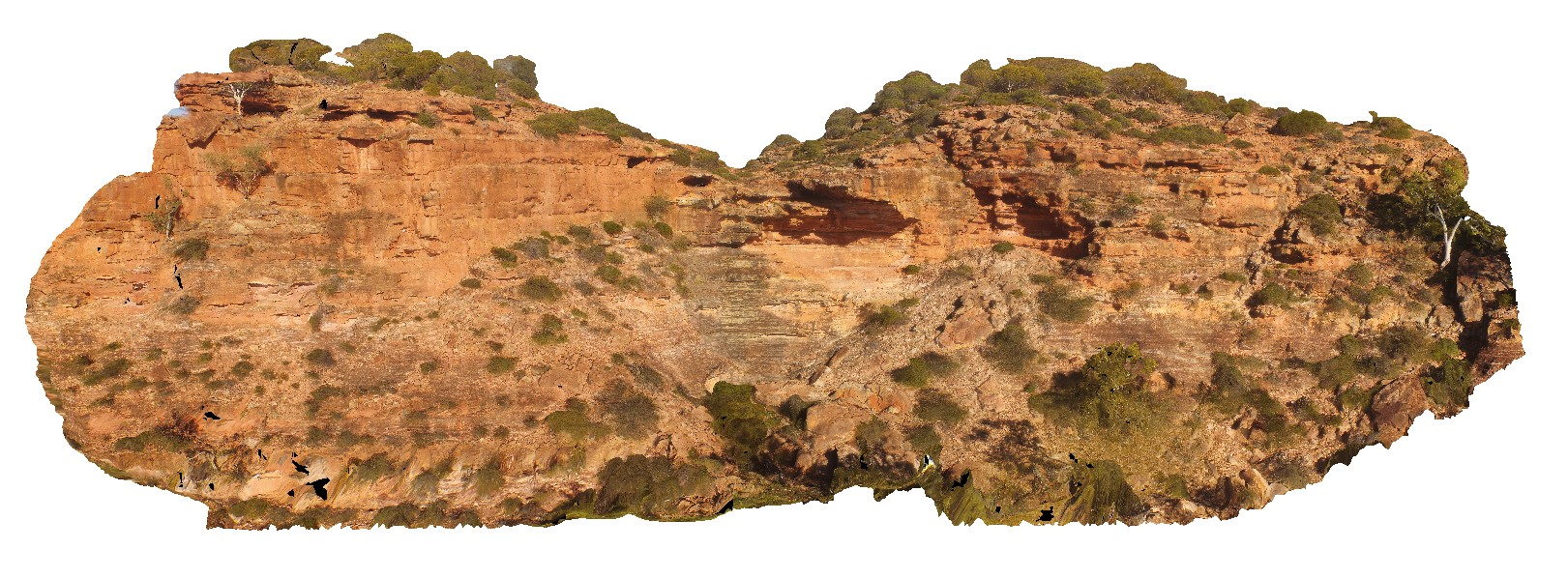
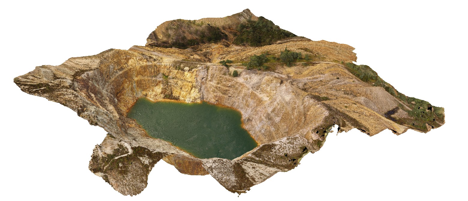
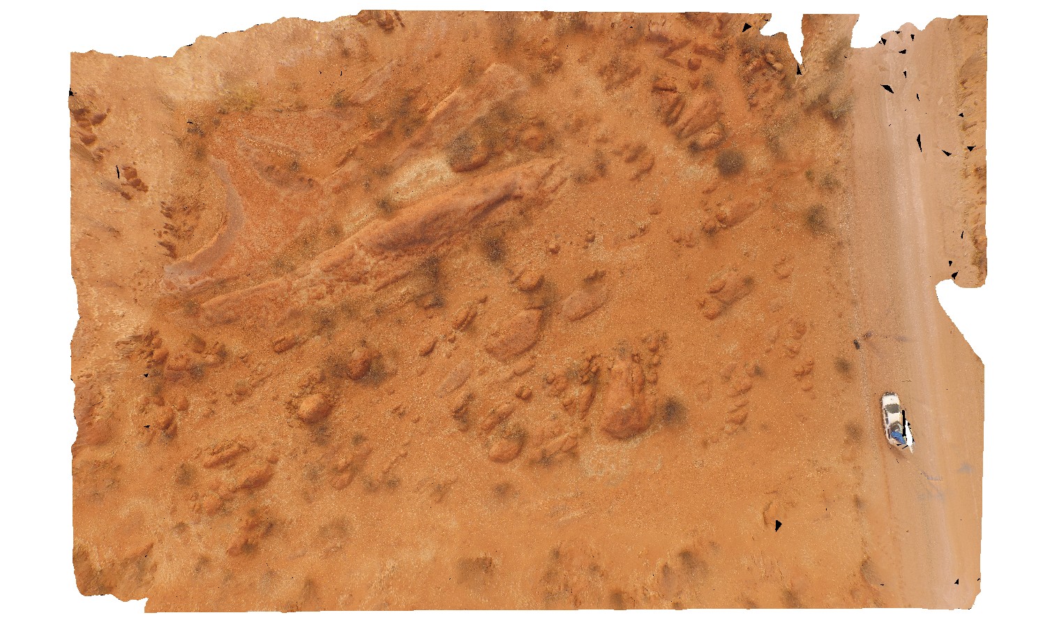
PeakHillUAV1 Map
 |
0 |
04/13/2016 12:52 p.m. |
UAV |
aerial view of the Peak Hill open pit, Peak Hill. N.S.W. |
486.00 |
-32.71978600000 |
148.19610200000 |
-9999.000 |
open pit, Peak Hill Gold Mine, mining, mine |
andesite |
ArkaroolaFSP3 Map
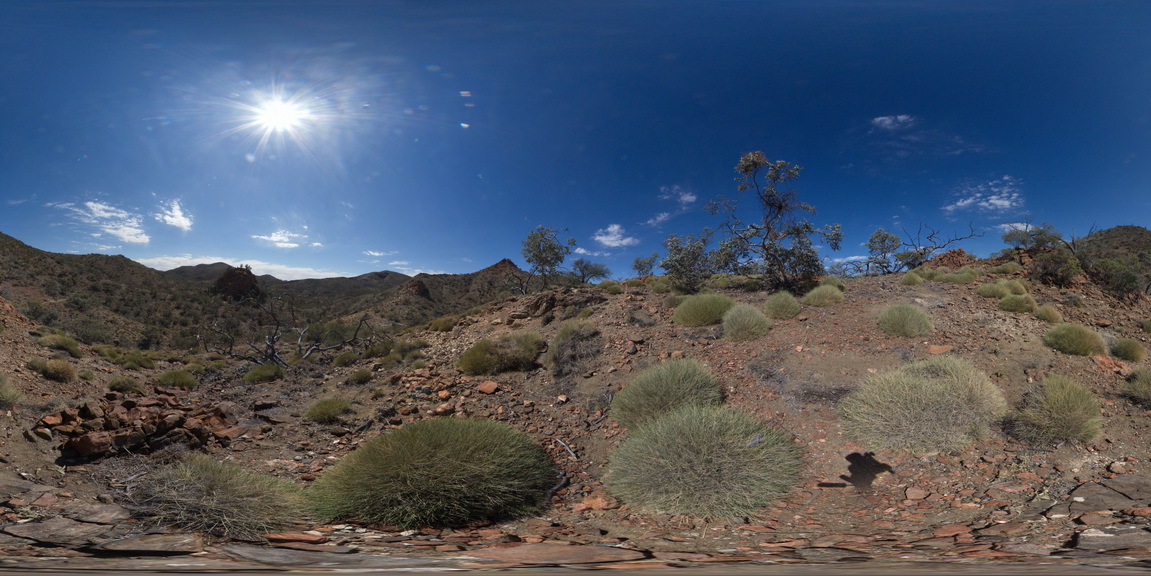 |
5 |
11/26/2015 2:08 p.m. |
FSP |
aerial view of the Pinnacles, pegmatitic intrusions and surrounding sediments, Arkaroola. Northern Flinders Ranges, S.A. |
0.00 |
-30.29877000000 |
139.30951000000 |
-9999.000 |
leucogranite |
granite |
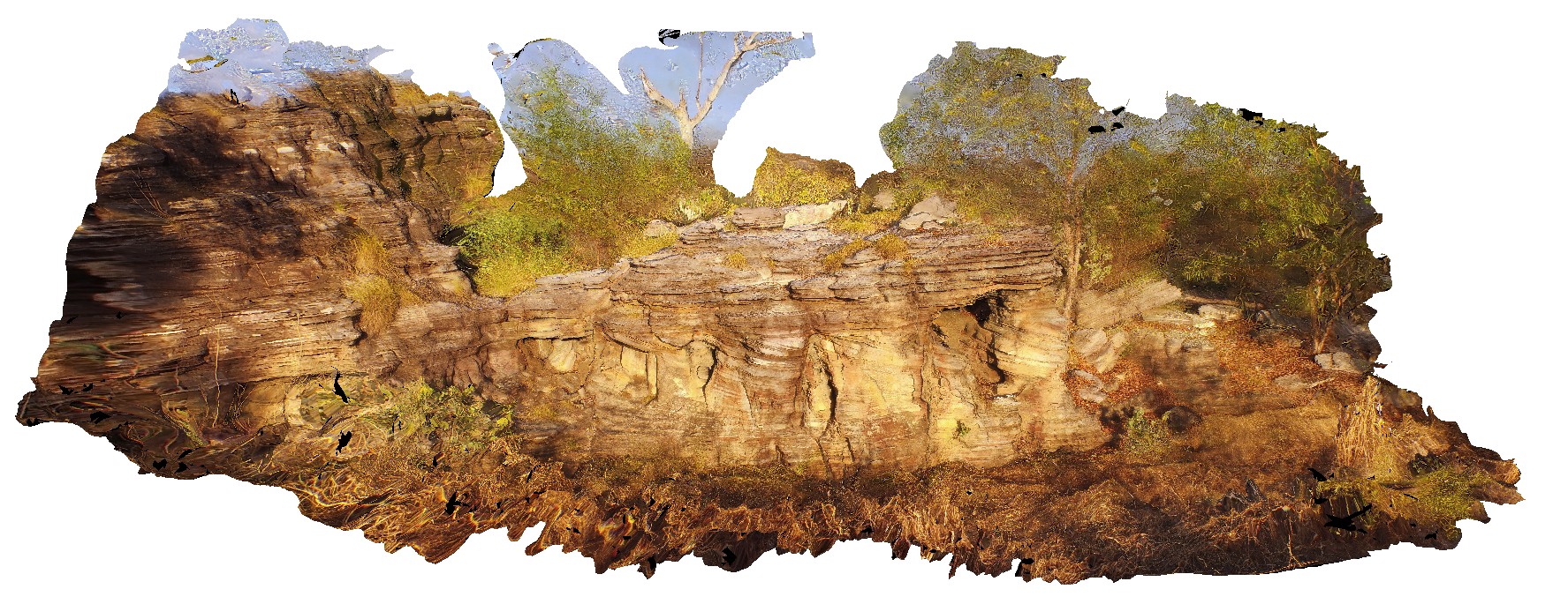
PurnululuFSP14 Map
 |
0 |
06/12/2016 noon |
FSP |
aerial view of the start of the Echidna Chasm trail, showing cliff of Glass Hill Sandstone. Osmand Range Lookout, Purnululu National Park, W.A. |
1000.00 |
-17.32185000000 |
128.41403000000 |
-9999.000 |
The Bungle Bungles, Sandstone, sedimentology, Purnululu National Park |
sandstone |
PurnululuUAV4 Map
 |
0 |
06/12/2016 noon |
UAV |
aerial view of the start of the Echidna Chasm trail, showing cliff of Glass Hill Sandstone. Purnululu National Park, W.A. |
50.00 |
-17.32394600000 |
128.41405700000 |
-9999.000 |
Glass Hill Sandstone, sandstone, Bungle Bungles |
sandstone |
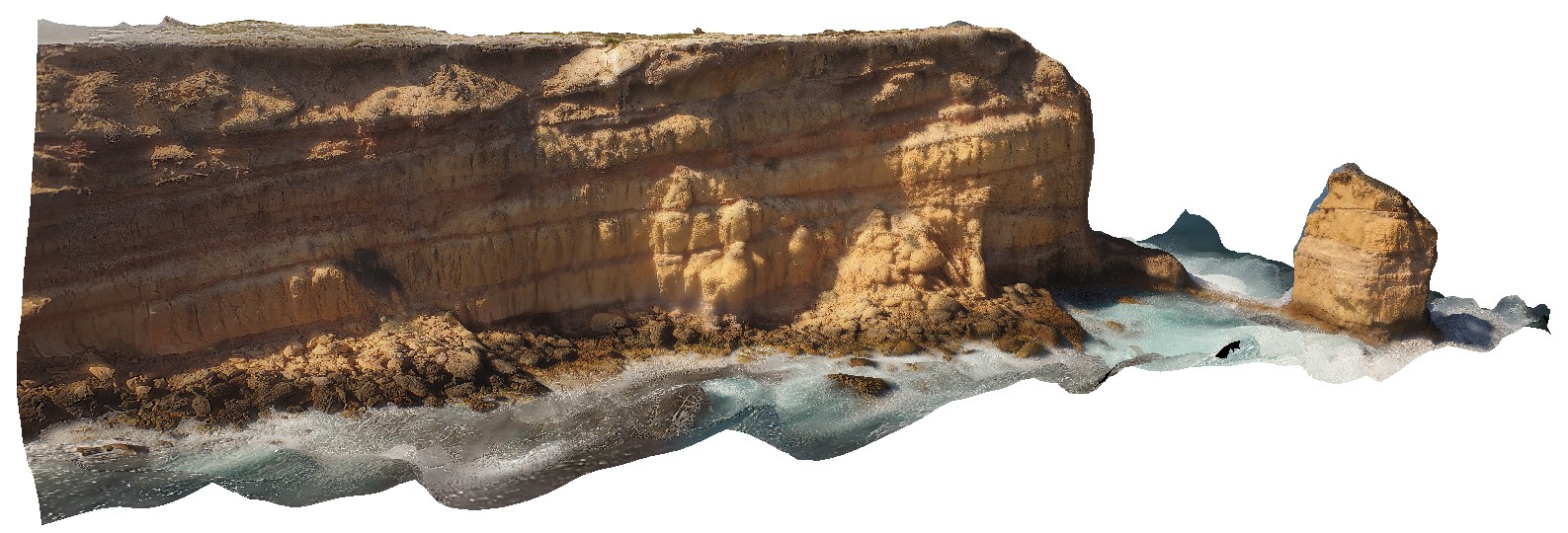
NTasUAV3 Map
 |
20 |
01/01/9999 midnight |
UAV |
aerial view of the unconformity at the base of Fossil Bluff, between the Permian and Tertiary units. Fossil Bluff Conservation Area, Wynyard. North Tasmania. |
50.00 |
-40.98138400000 |
145.73309700000 |
-9999.000 |
unconformity, geological contact, Fossil bluff |
sandstone, tillite |
YinnetharraUAV1 Map
 |
20 |
05/27/2016 noon |
UAV |
aerial view of typical outcrop of rounded granitic tors. North of Thirty Three River, Cobra-Dairy Creek Road, W.A. |
50.00 |
-24.51352090000 |
116.24685660000 |
-9999.000 |
granite, outcrop, granite tor |
granite |
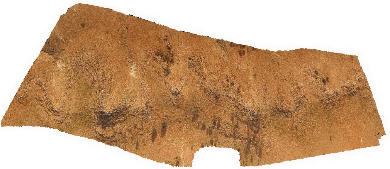
PicnicPtUAV1 Map
 |
20 |
01/01/9999 midnight |
UAV |
aerial view of Ulverstone metamorphics, showing folded bedding traces. Ulverstone Tasmania. |
641.00 |
-41.14010200000 |
146.16233400000 |
2.500 |
metasediments |
metasediments |
TaliaUAV1 Map
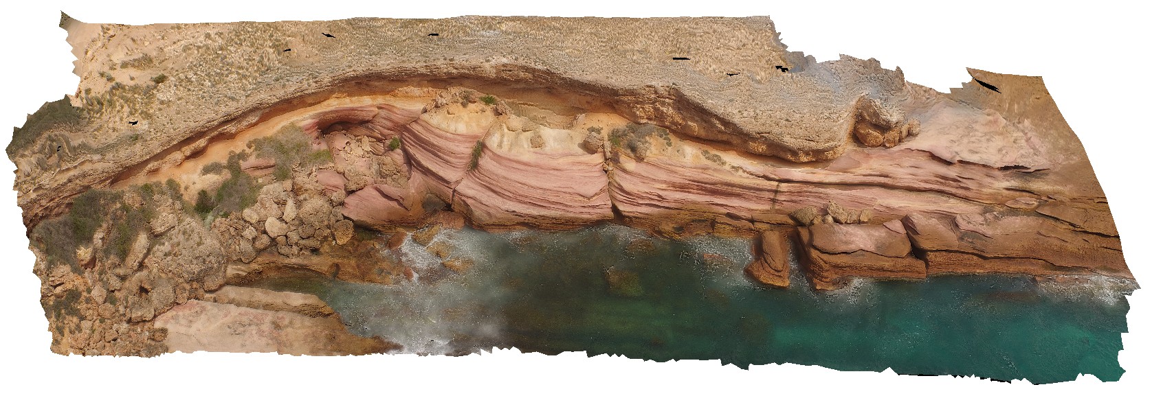 |
0 |
10/20/2015 4:52 p.m. |
UAV |
aerial view of unconformity between the Bridgewater Formation and the underlying Blue Range Beds, Near Talia Caves. Talia. |
50.00 |
-33.32410000000 |
134.78482000000 |
-9999.000 |
unconformity |
sandstone, sandstone |
DrummondUAV1 Map
 |
0 |
10/20/2015 4:39 p.m. |
UAV |
aerial view of unconformity between underlying granites and overlying calcarenite. Drummond Point. S.A. |
100.00 |
-34.01262600000 |
135.26615600000 |
-9999.000 |
calcarenite, unconformity |
calcarenite, granite |
OlaryUAV3 Map
 |
0 |
09/27/2015 6:50 p.m. |
UAV |
aerial view of 'Wiggly quartzite'. A folded quartzite unit at Weekaroo, Olary. S.A. |
100.00 |
-32.18229700000 |
139.95783400000 |
-9999.000 |
quartzite, fold, structure |
quartzite |