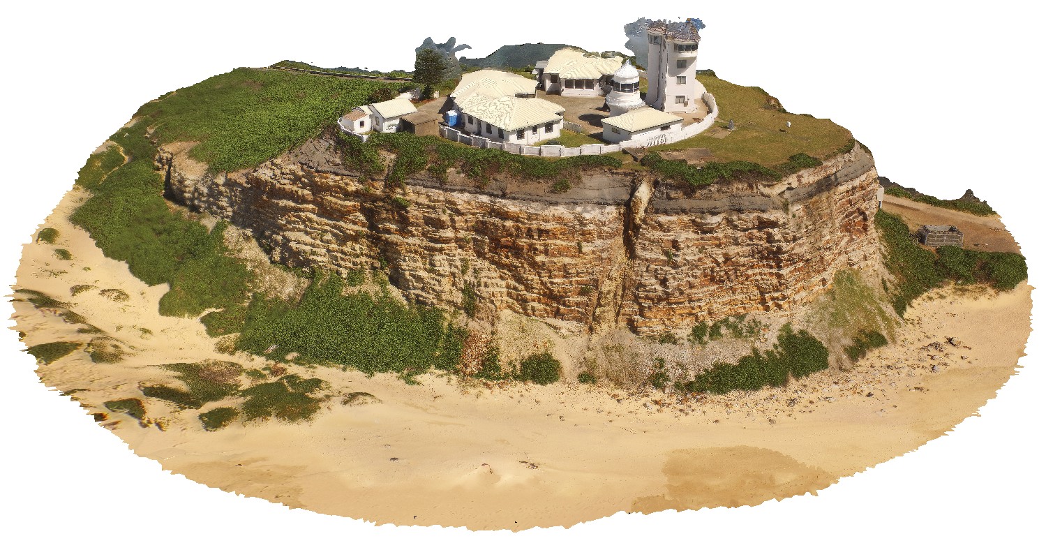
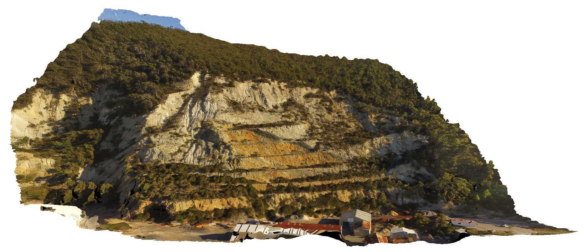
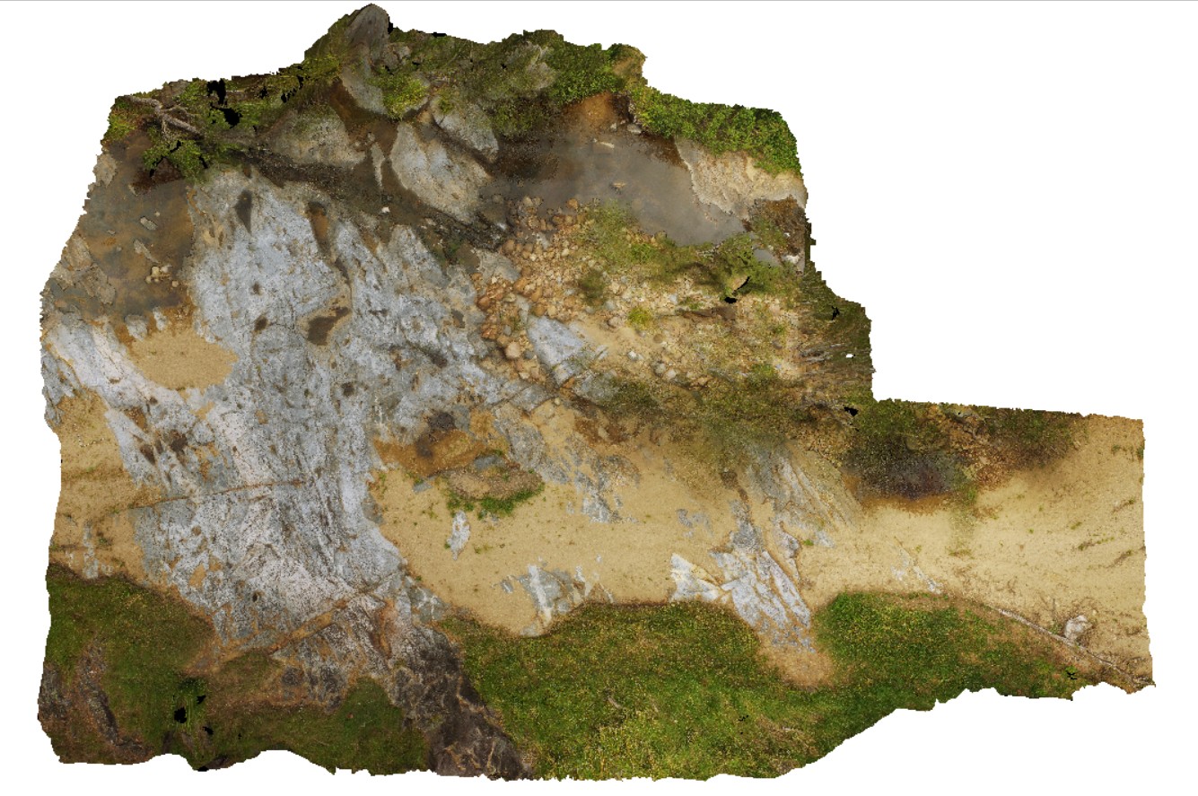
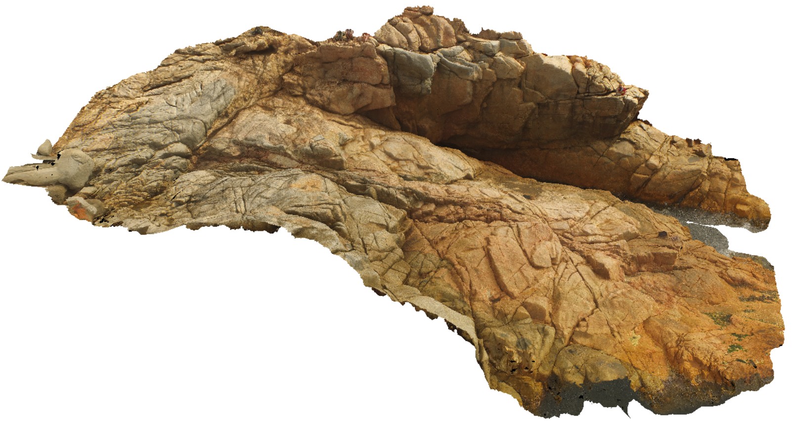
NewcastleUAV1 Map
 |
20 |
01/01/9999 midnight |
UAV |
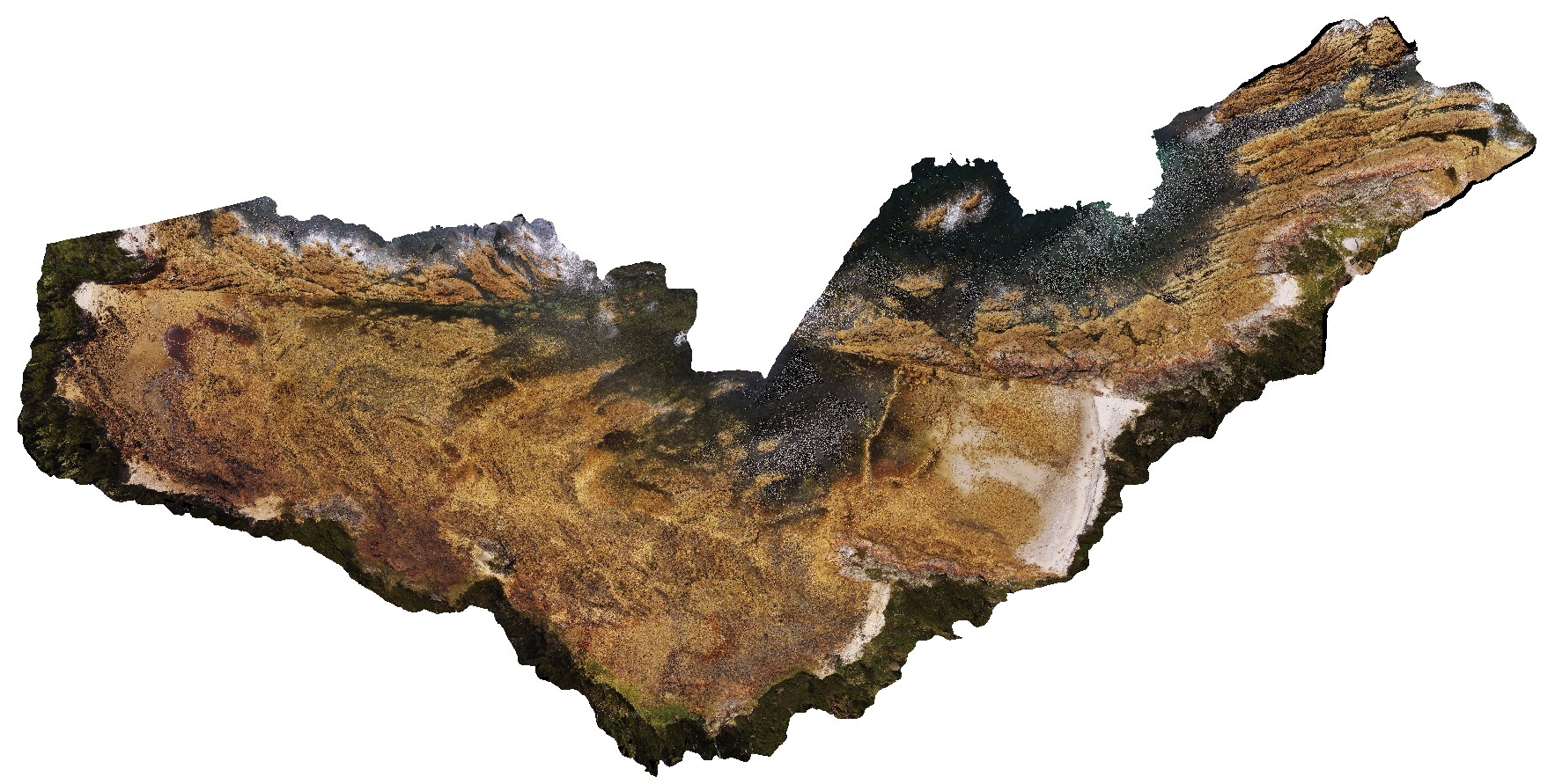
Nobbys headland with dyke and Nobbys Tuff in cliff face. Newcastle, N.S.W. |
500.00 |
-32.91871800000 |
151.79890100000 |
42.300 |
tuff, dyke, sedimentology |
tuff, igneous rock |
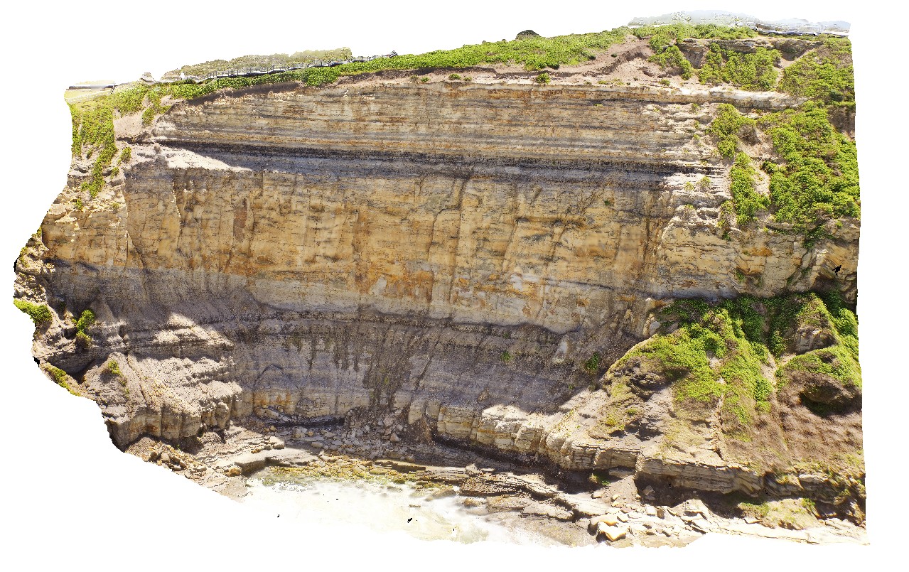
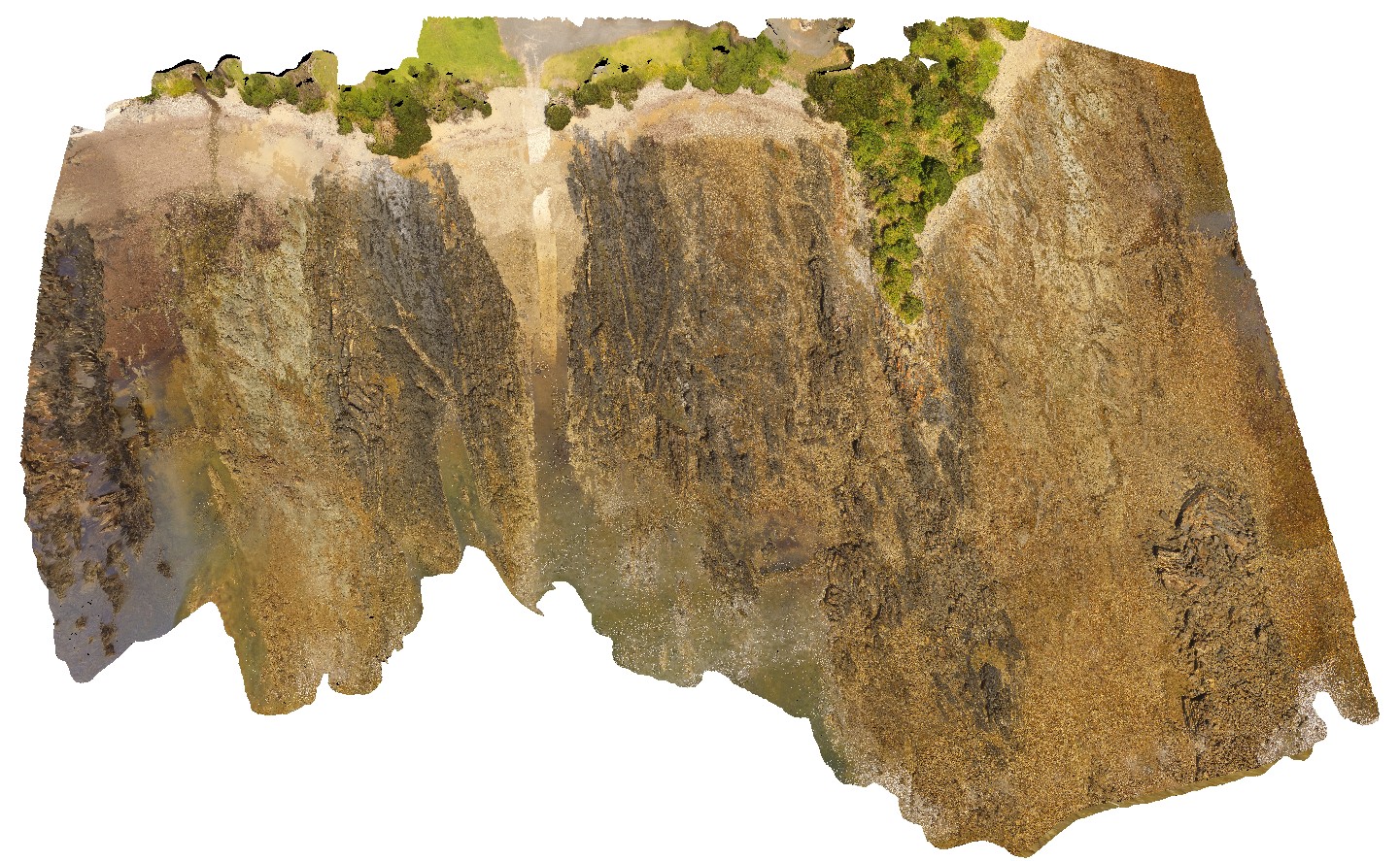
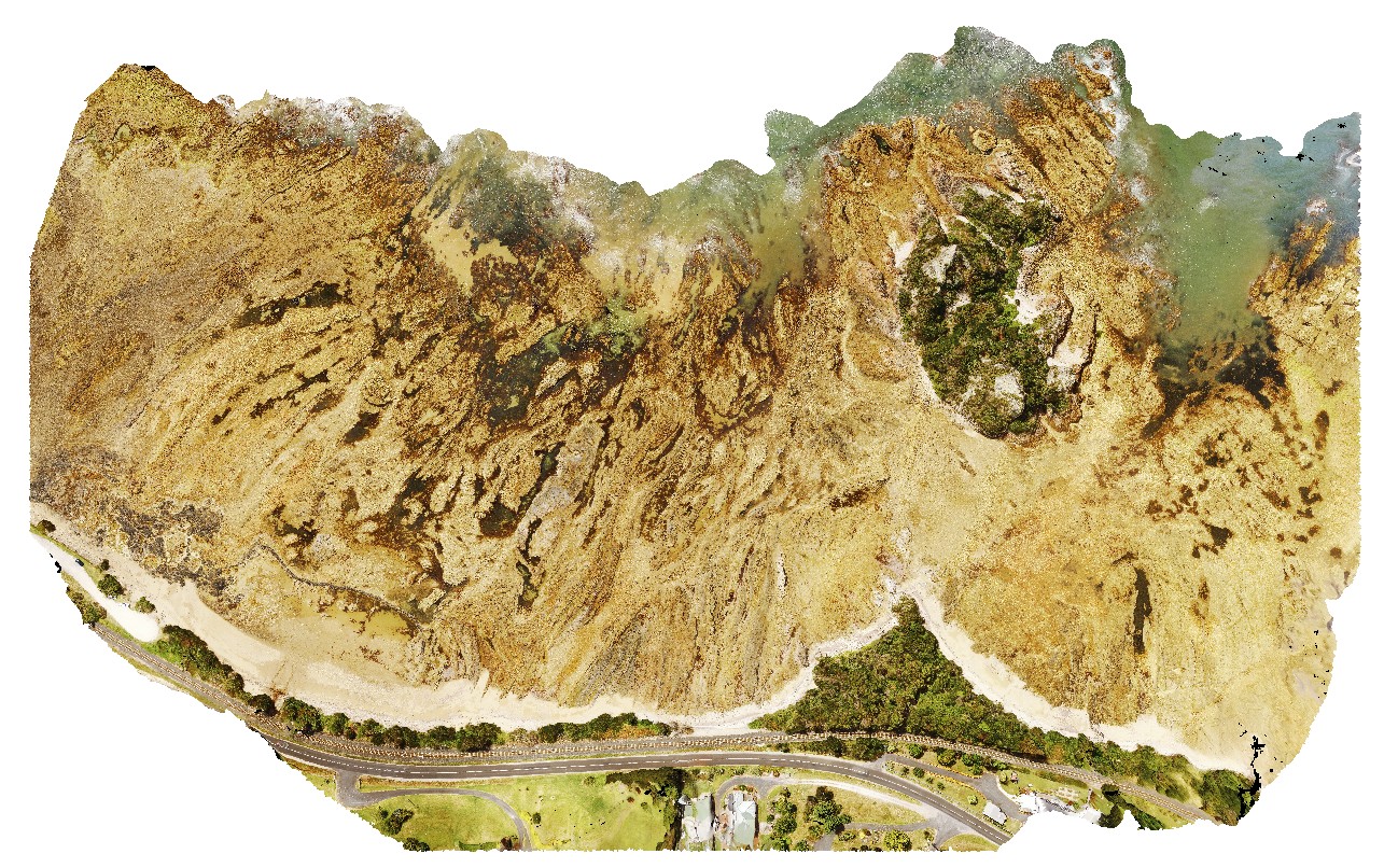
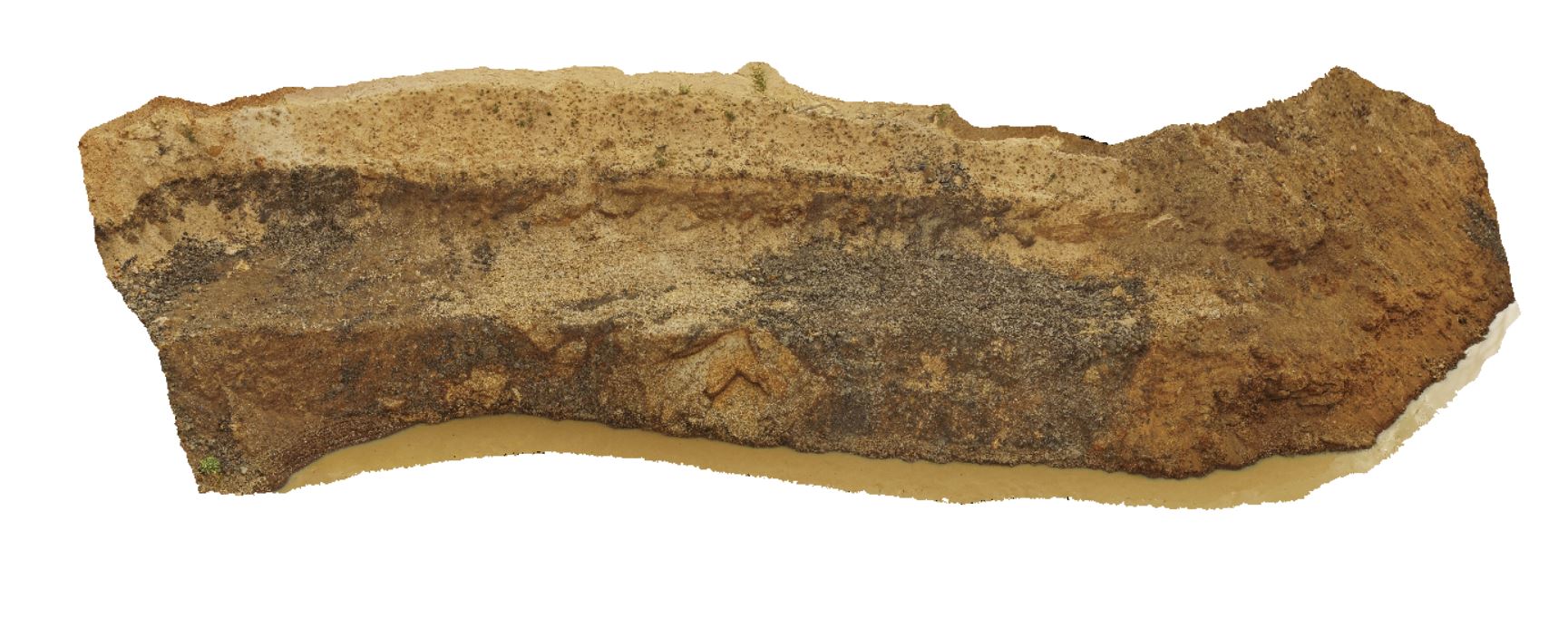
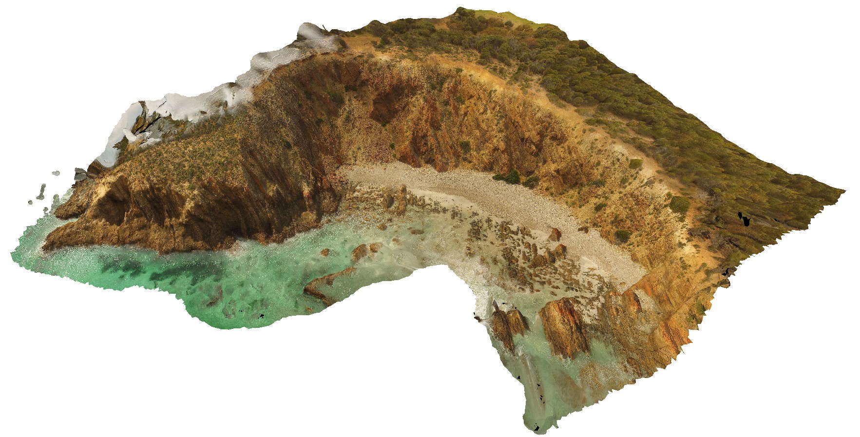
NewcastleUAV6 Map
 |
5 |
01/01/9999 midnight |
UAV |
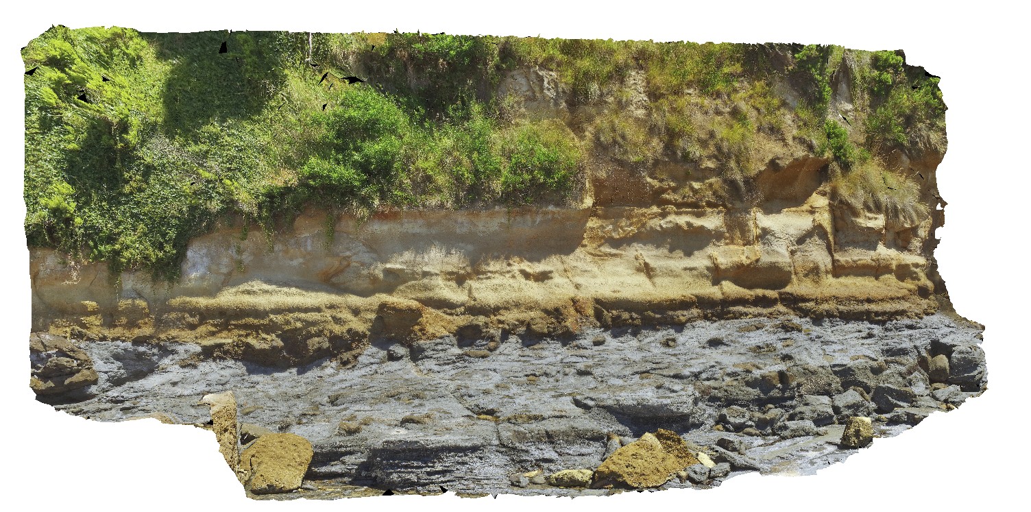
large cliff at Northern end of Bar / Susan Gilmore Beach, showing exposure of Yard coal seam, Dudley and Nobby sediments. Newcastle, N.S.W. |
70.00 |
-32.93887600000 |
151.77379900000 |
70.400 |
sedimentology, tuffaceous sandstone, coal measures |
tuffaceous sandstone |
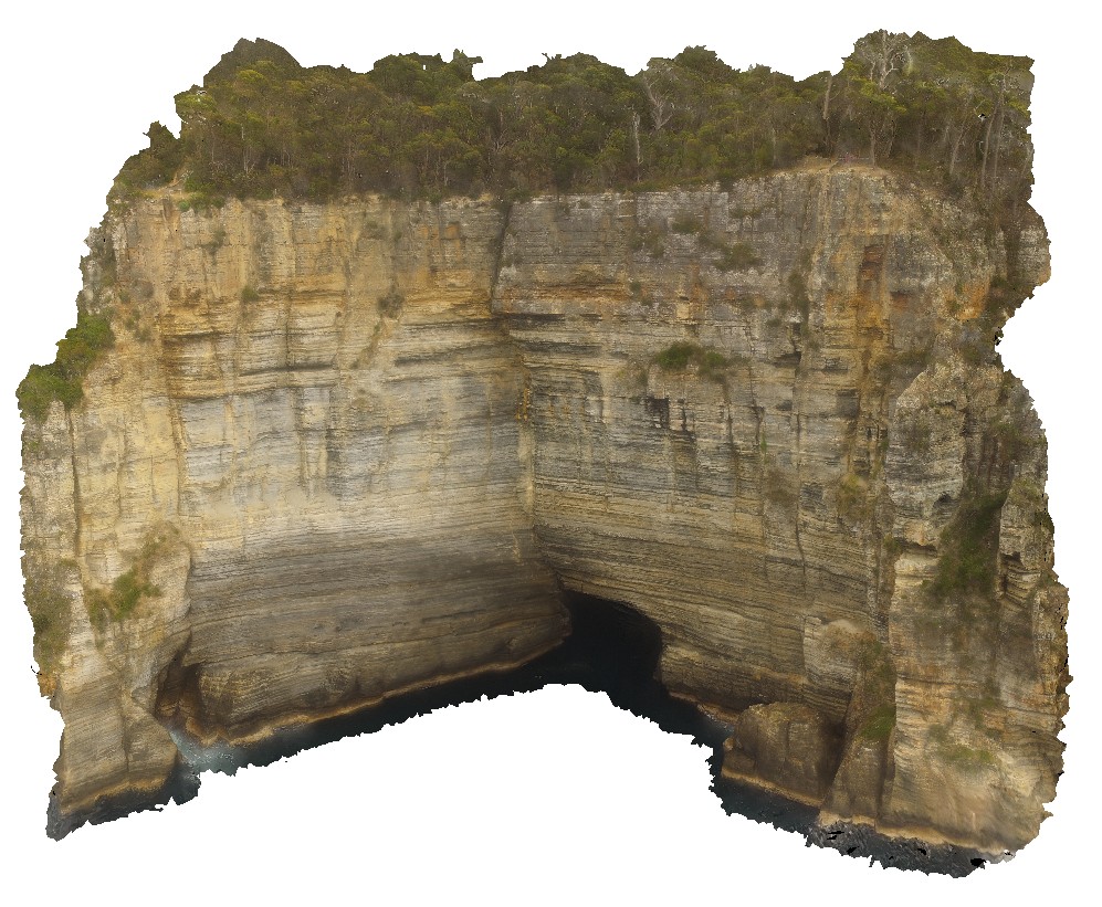
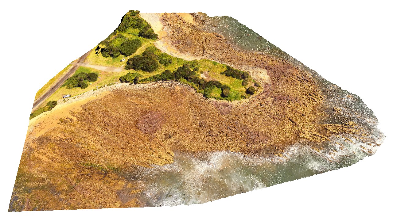
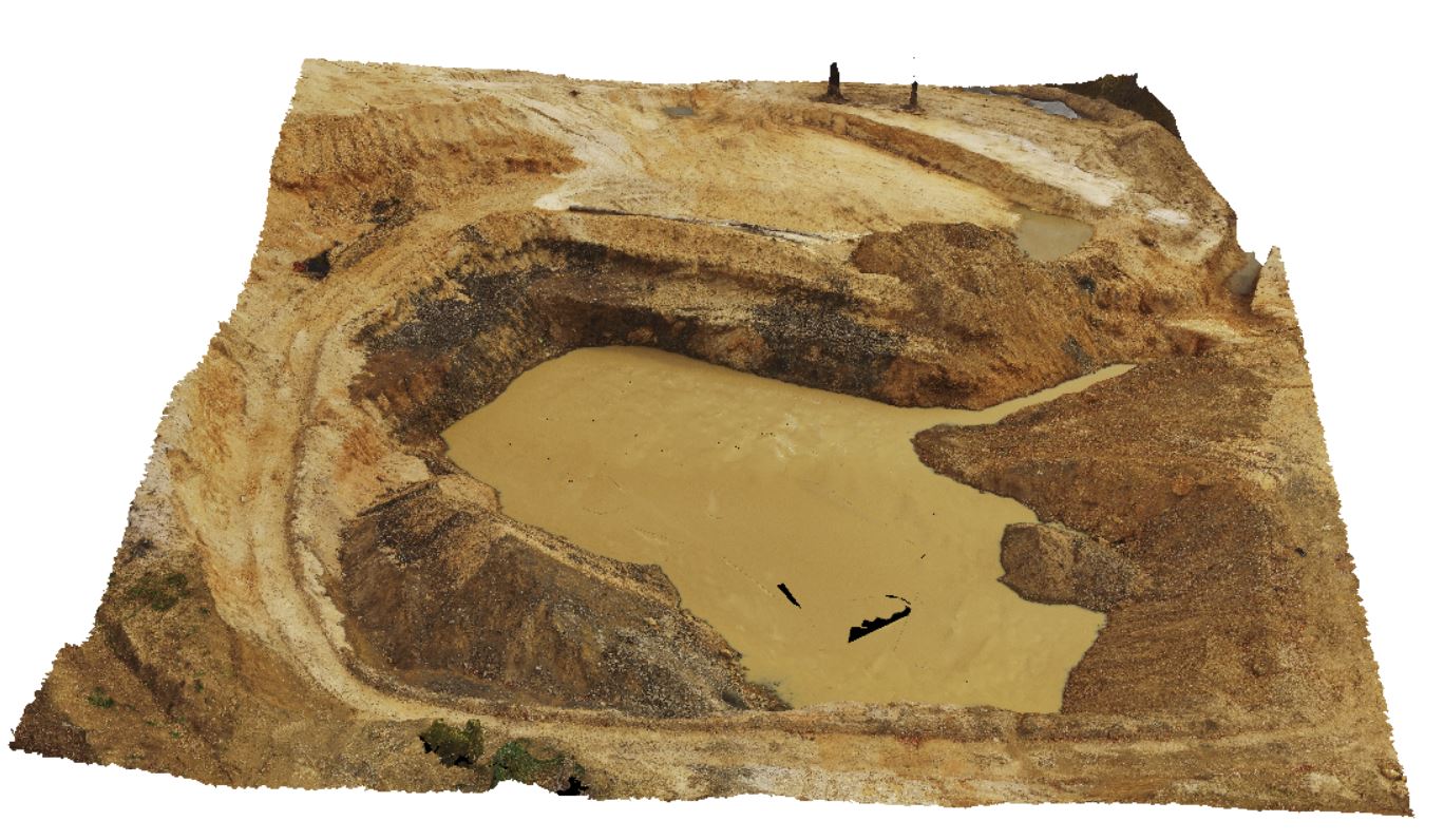
WaterfallbayUAV2 Map
 |
20 |
01/01/9999 midnight |
UAV |
extensive aerial view of 'clean' Permian sediment cliffs with sea cave. Waterfall Bay, Tasmania. |
140.00 |
-43.05807400000 |
147.94901500000 |
112.000 |
sea cave, Permian sediment, Parmeener Supergroup |
sediment |
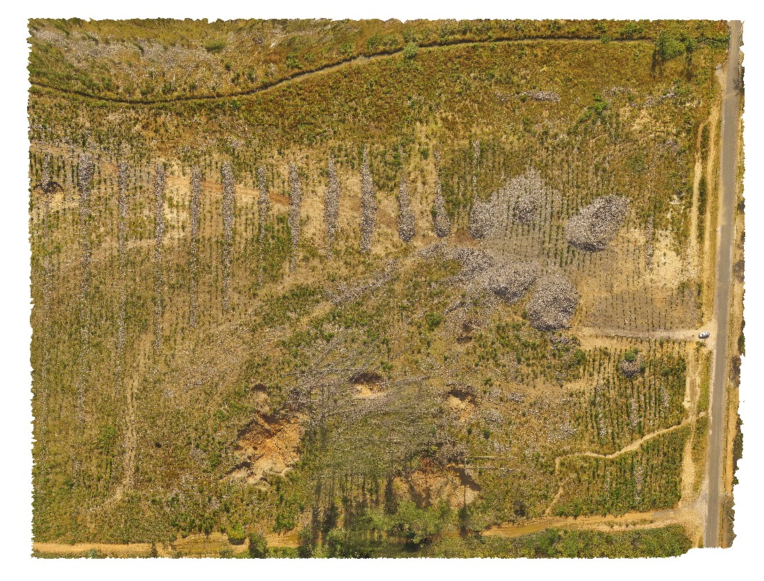
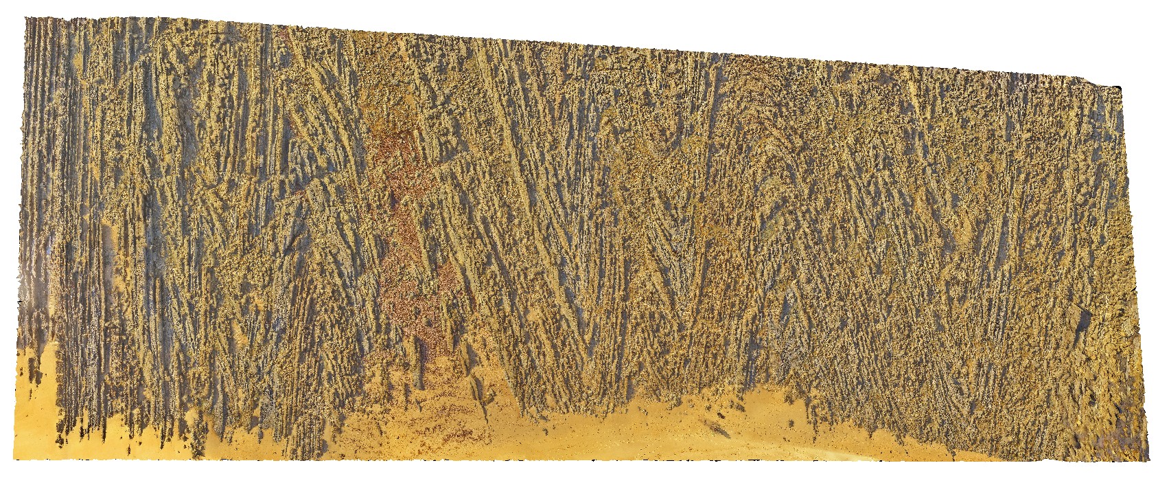
RailtonUAV1 Map
 |
20 |
01/01/9999 midnight |
UAV |
aerial view of logging coupe, showing sink holes in the 'Goliath Limestone' near the cement works, Dulverton Road, Railton. Northern Tasmania. |
480.00 |
-41.31009900000 |
146.40432500000 |
37.500 |
sink hole, logging coupe, Goliath Limestone |
limestone |
BurnieUAV1 Map
 |
20 |
01/01/9999 midnight |
UAV |
view of large quarry outcrop in quartzite? At the entrance to the township of Burnie. Burnie, north Tas. |
430.00 |
-41.06717200000 |
145.94652400000 |
70.000 |
quarry, quartzite |
quartzite |
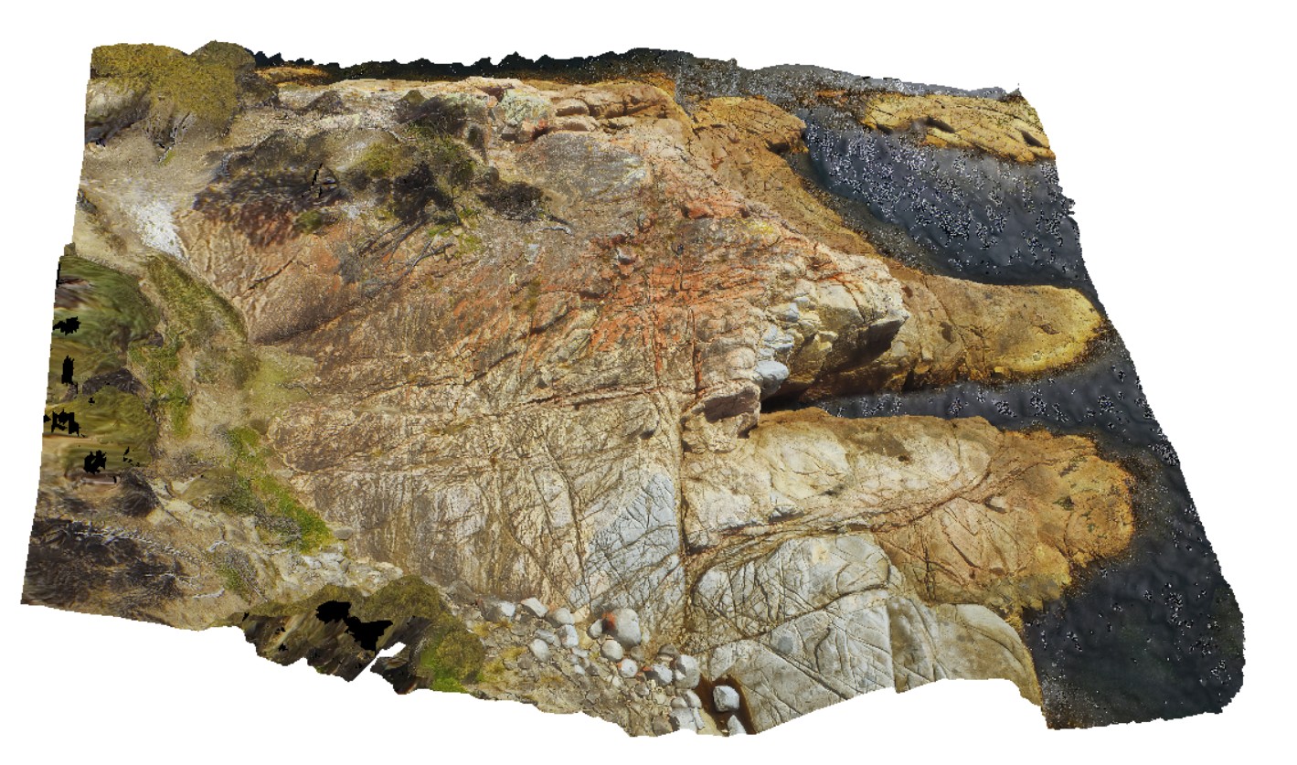
HallPointUAV1 Map
 |
20 |
01/01/9999 midnight |
UAV |
aerial view of folded and deformed Precambrian quartzites of the Rocky Cape Group. Hall Point, Sulphur Creek. Tasmania. |
335.00 |
-41.09298700000 |
146.02833200000 |
76.000 |
structure, Precambrian quartzite, fold |
quartzite |
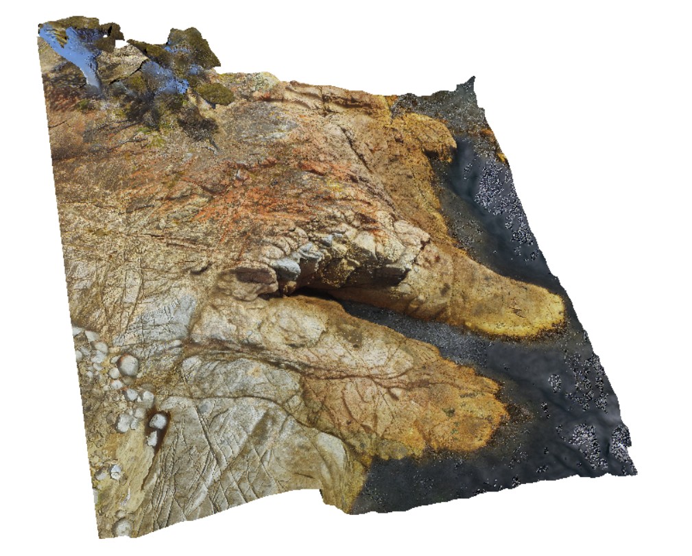
SulphurCreekUAV1 Map
 |
20 |
01/01/9999 midnight |
UAV |
aerial view of shore outcrop, showing region of folded metasediments in contact with altered basalts. Sulphur Creek, north Tas. |
232.00 |
-41.09104300000 |
146.02016600000 |
108.600 |
metasediments, basalt, fold, fault |
metasediments, basalt |
BluestoneUAV7 Map
 |
20 |
01/01/9999 midnight |
UAV |
detailed aerial view of granite / granodiorite contact. Bluestone Bay, Freycinet. Tasmania. |
57.00 |
-42.10328800000 |
148.33594000000 |
10.600 |
intrusive contact, igneous intrusion, Coles Bay Granite, Bluestone Bay Granodiorite |
granite, granodiorite |
BellthorpeUAV1 Map
 |
50 |
01/01/9999 midnight |
UAV |
Aerial view of granodiorite with multiple intrusive phases and metasediment xenoliths. Bellthorpe, QLD. |
100.00 |
-26.82770700000 |
152.62270000000 |
2.000 |
granodiorite, intrusive contact |
granodiorite |
GoatIslandUAV1 Map
 |
50 |
01/01/9999 midnight |
UAV |
aerial over view of folded metamorphic sediments of the Burnie Formation (Oonah Formation) and Ulverstone Metamorphics, which includes the Goat Island Conglomerate. Goat Island, Ulverstone. North Tasmania. |
680.00 |
-41.13575600000 |
146.13587000000 |
55.000 |
metasediments, Burnie Formation, Ulverstone Metamorphics, geological contact |
metasediments, metasediments |
PicnicPtUAV1 Map
 |
20 |
01/01/9999 midnight |
UAV |
aerial view of Ulverstone metamorphics, showing folded bedding traces. Ulverstone Tasmania. |
641.00 |
-41.14010200000 |
146.16233400000 |
2.500 |
metasediments |
metasediments |
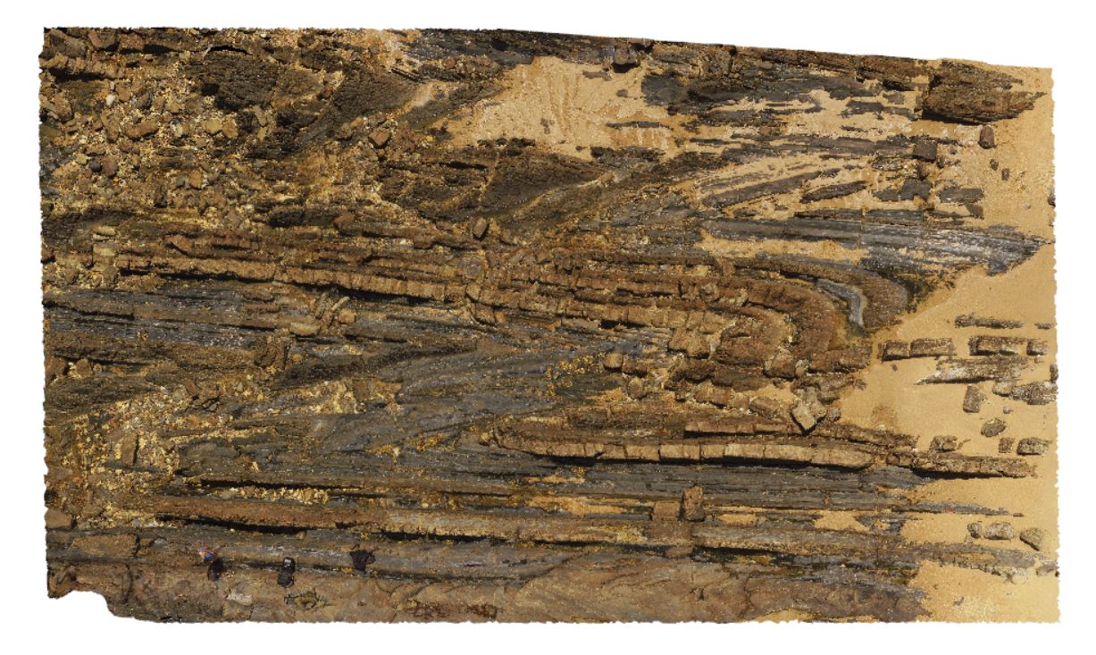
DianasBasinUAV1 Map
 |
20 |
01/01/9999 midnight |
UAV |
aerial view of steeply dipping Mathinna Supergroup turbidite package. St Helens, Tasmania. |
77.40 |
-41.36620600000 |
148.30181600000 |
100.000 |
turbidite, steep dip, dip |
turbidite |
HalfwayHillUAV2 Map
 |
20 |
01/01/9999 midnight |
UAV |
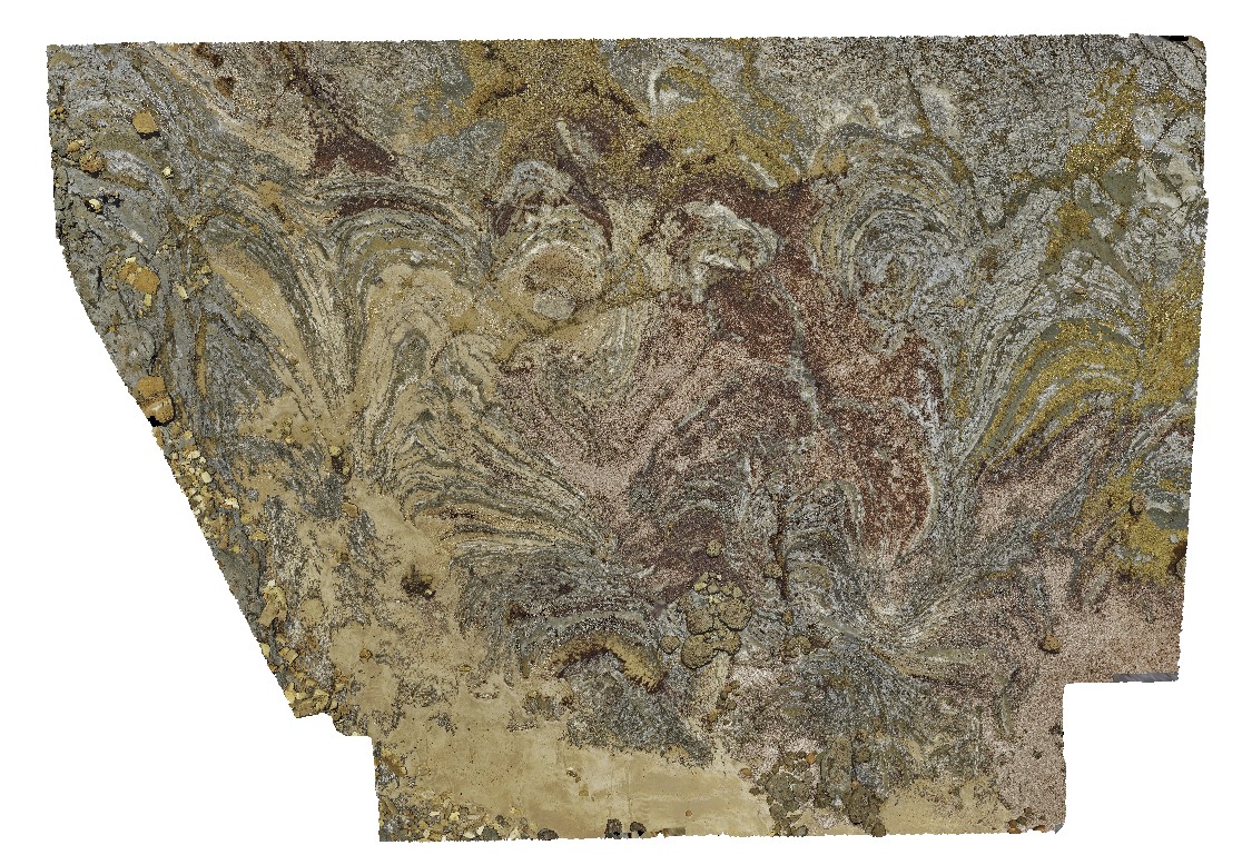
detail of diatreme, showing large granite clasts in basalt. Halfway Hill quarry, Tas. |
44.00 |
-41.23078400000 |
148.16087600000 |
-9999.000 |
diatreme, basalt, clasts |
basalt, granite |
HalfwayHillUAV1 Map
 |
20 |
01/01/9999 midnight |
UAV |
Tertiary basaltic diatreme in Devonian Granite. Halfway Hill quarry, Tas. |
100.00 |
-41.23063900000 |
148.16098600000 |
245.000 |
diatreme, Tertiary basalt, Devonian granite, intrusion |
granite, basalt |
BellinghamUAV3 Map
 |
20 |
01/01/9999 midnight |
UAV |
aerial overview of tightly folded parasitic folds in turbidites of the Retreat Formation. View is larger than the earlier UAV images. Bellingham, NE Tasmania. |
173.00 |
-41.00787600000 |
147.16153900000 |
20.000 |
parasitic folds, fold, structure, turbidite, sedimentology, tight fold |
turbidite |
BluestoneUAV8 Map
 |
20 |
01/01/9999 midnight |
UAV |
detailed aerial view of granite / granodiorite contact. Bluestone Bay, Freycinet. Tasmania. |
78.00 |
-42.10331200000 |
148.33529300000 |
29.300 |
intrusive contact, Coles Bay Granite, Bluestone Bay Granodiorite |
granite, granodiorite |
BluestoneUAV6 Map
 |
20 |
01/01/9999 midnight |
UAV |
detailed view of granite / granodiorite contact. Bluestone Bay, Freycinet. Tasmania. |
42.40 |
-42.10340100000 |
148.33612800000 |
9.500 |
granite, granodiorite, intrusive contact |
granite, granodiorite |
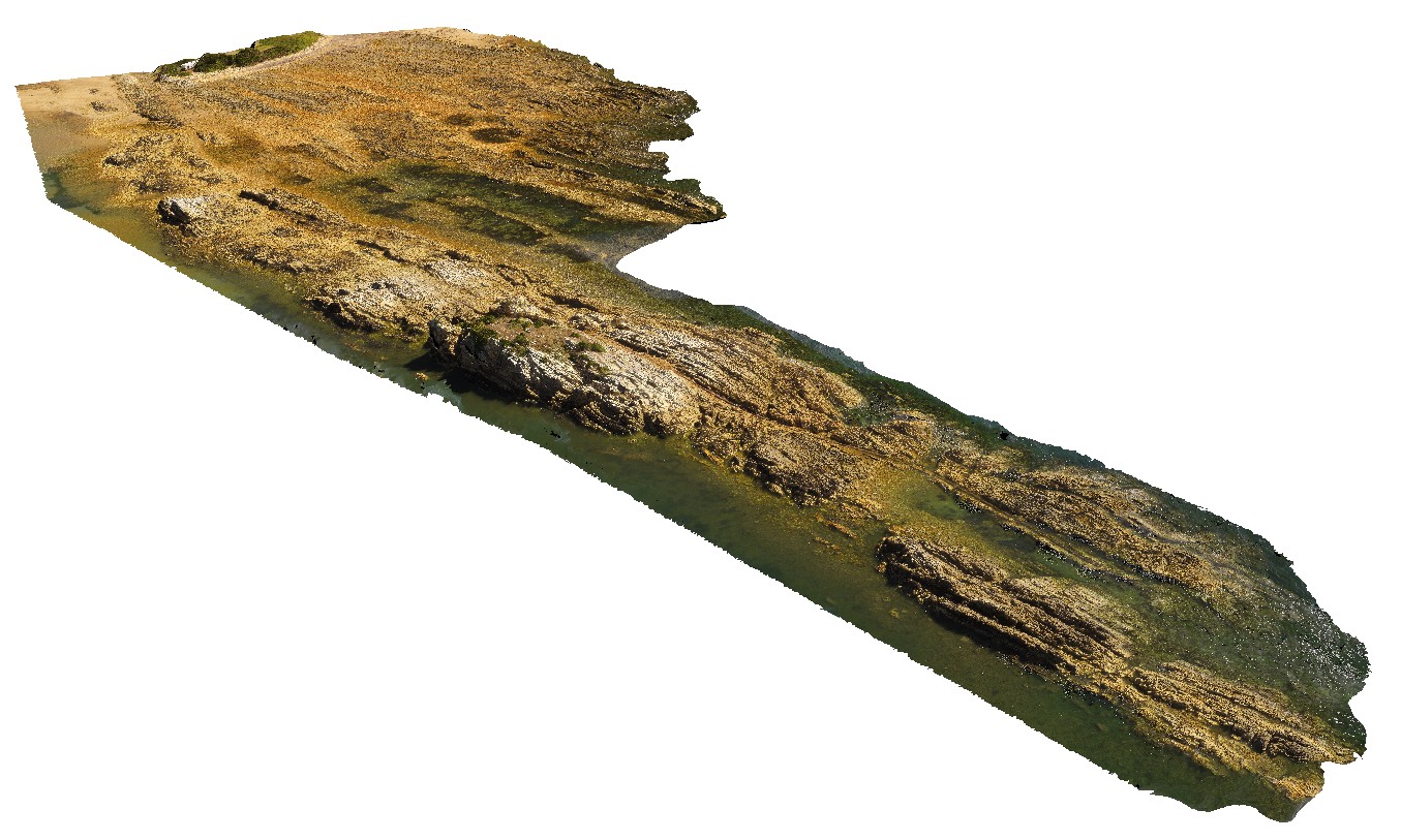
StokesUAV1 Map
 |
20 |
01/01/9999 midnight |
UAV |
aerial view of bedded sandstone, showing very open folding / kinks in steeply dipping beds. King George Bay, Kangaroo Island. |
200.00 |
-35.65456700000 |
137.11588900000 |
-9999.000 |
bedding, fold, kink fold, structure |
sandstone |
BellinghamUAV2 Map
 |
20 |
01/01/9999 midnight |
UAV |
a 20m above the ground aerial overview of parasitic folds in the folded turbidites of the Retreat Formation. Bellingham, NE Tasmania. |
200.00 |
-41.00787100000 |
147.16577100000 |
20.000 |
turbidite, fold, parasitic fold, structure |
turbidite |
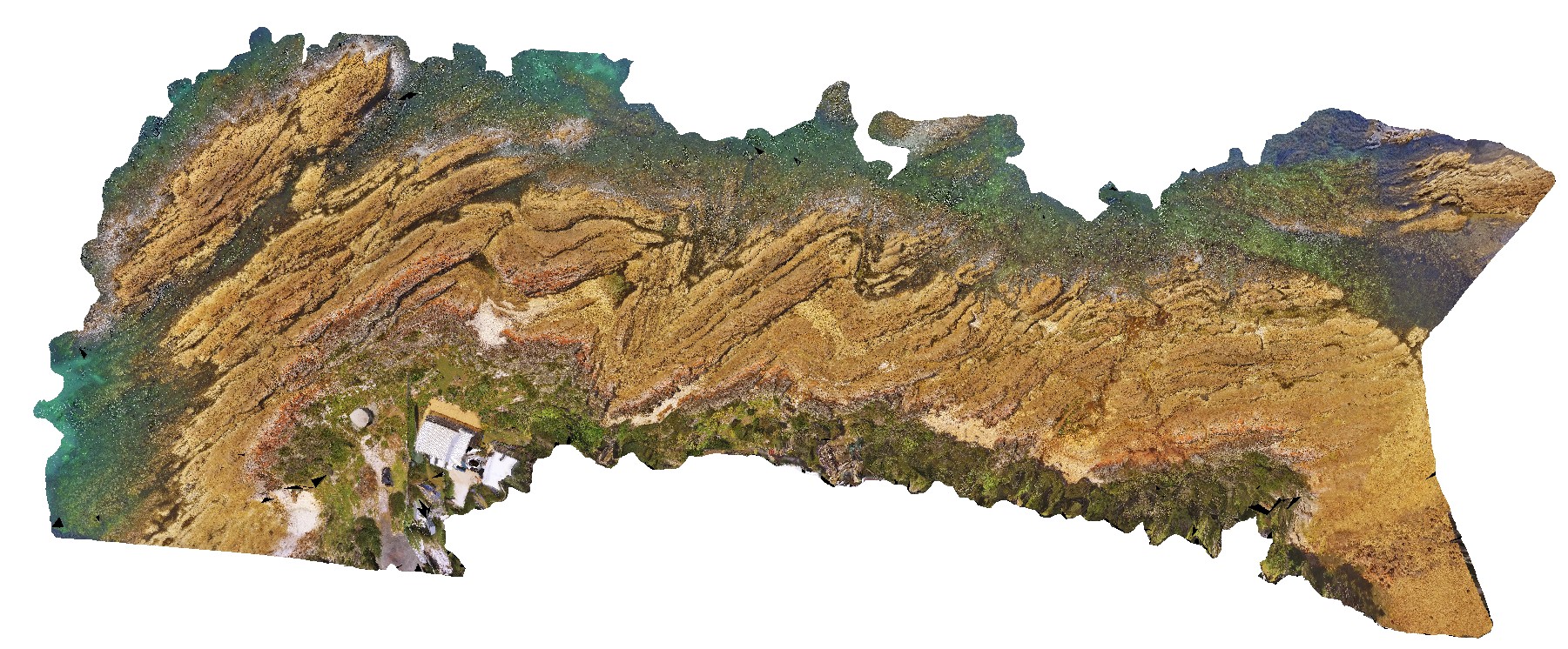
BellinghamUAV1 Map
 |
20 |
01/01/9999 midnight |
UAV |
aerial overview of folded and faulted, thick turbidite package at Bellingham, NE Tasmania. View taken from 60m above the ground. |
500.00 |
-41.00721400000 |
147.16257300000 |
186.700 |
structure, turbidite package, fold, fault |
turbidite |
NTasUAV4 Map
 |
20 |
01/01/9999 midnight |
UAV |
aerial view of Boat Harbour foreshore, showing macro-scale folding in moderately dipping rocks. Boat Harbour, north Tasmania. |
100.00 |
-40.92489400000 |
145.61249400000 |
-9999.000 |
fold, dip, structure |
quartzite |
NTasUAVFSP2 Map
 |
20 |
01/01/9999 midnight |
UAV |
aerial view of Boat Harbour foreshore, showing macro-scale folding in moderately dipping rocks. Boat Harbour, north Tasmania. |
0.00 |
-40.92531200000 |
145.61275600000 |
-9999.000 |
fold, structure, bedding |
quartzite |
NTasUAV5 Map
 |
20 |
01/01/9999 midnight |
UAV |
aerial view of Boat Harbour foreshore, showing macro-scale folding in moderately dipping rocks. Boat Harbour, north Tasmania. |
200.00 |
-40.92560000000 |
145.61093300000 |
-9999.000 |
fold, metamorphic rock |
quartzite |
NTasUAV3 Map
 |
20 |
01/01/9999 midnight |
UAV |
aerial view of the unconformity at the base of Fossil Bluff, between the Permian and Tertiary units. Fossil Bluff Conservation Area, Wynyard. North Tasmania. |
50.00 |
-40.98138400000 |
145.73309700000 |
-9999.000 |
unconformity, geological contact, Fossil bluff |
sandstone, tillite |
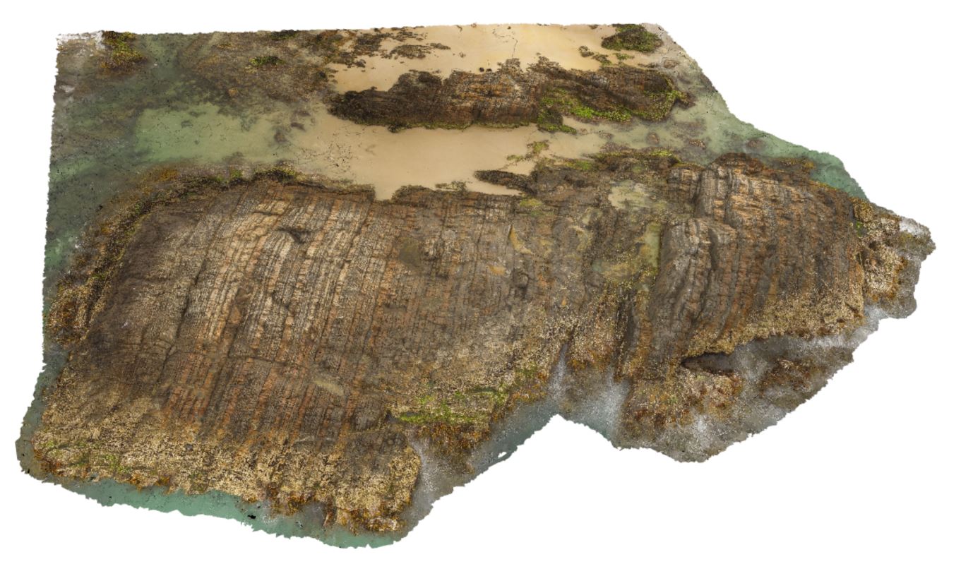
NTasUAV2 Map
 |
20 |
01/01/9999 midnight |
UAV |
Permian wave-cut platform east of Fossil Cliff, showing bedforms in Permian Layers. Fossil Bluff Conservation Area, Wynyard. North Tasmania. |
100.00 |
-40.98142000000 |
145.73314000000 |
-9999.000 |
wave-cut platform, Permian bedding |
sandstone |